
Where Flight Simulation Enthusiasts Gather from Around the World!
AVSIM Library - Search Results

| Category: Flight Simulator X - Scenery | |
| CYCD (2012) Version 3 for FS9, FSX and Prepar3D |

|
Images related to this file:
File Description:
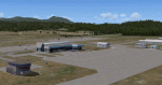
CYCD (2012) is an update to Ken Peter's CYCD Nanaimo-Collishaw Airport (Vancouver Island, British Columbia, Canada). The airport has recently completed a major runway
extension and installed an ILS for Rwy 16. The five flashing-red beacons that guide the way on a night approach to Rwy 34 are included. To the extent possible, this update
reuses Ken's custom buildings and objects (but you don't need to have Ken's version installed). As well, a selection of SAMM-generated static aircraft are scattered around the
aprons supplemented by a number of AI aircraft that do touch 'n gos from time to time. CYCD (2012) is compatible with ORBX FTX USA Canada Pacific Northwest and both versions
of Ultimate Terrain.
Generally, this new version is visually identical to its predecessor - even though quite different internally. As well, to the extent possible, it is compatible with
Prepar3Dv2. (v3.03 fixes a vehicle texture issue in 3.02)
| Filename: | CYCD_2012_Version_3_for_FS9_FSX_and_Prepar3D.zip |
| License: | Freeware |
| Added: | 22nd June 2014, 17:18:09 |
| Downloads: | 3,988 |
| Author: | Don Grovestine |
| Size: | 64 MB |
| Category: Flight Simulator X - Gauges | |
| Flypad Gauge |
|
Images related to this file:
File Description:

This gauge has been developed on Win7 for FSX Flight Simulator SP2 or SP1.It should also work with Acceleration, but this is not guaranteed by the author. The gauge is a little extra addon based on the design of a smart phone and provides 9 different displays which are different from all of the standard gauge displays on a regular aircraft panel. It is mainly helpful for the user flying small propeller aircraft, and old timer aircraft. However, the displays are as well attractive for sim pilots flying modern jet aircraft. Use it as if you just grabbed to your smart phone during a flight and check on the status of your aircraft,
or how the terrain awareness situation looks like, how the AI traffic on the radar is, while you proceed with your flight plan. Enjoy the new design of a simple aircraft attitude display during an ILS approach. For credits look at the pdf documentation inside the zip file. By Dietmar Loleit
| Filename: | Flypad_Gauge.zip |
| License: | Freeware |
| Added: | 6th June 2014, 20:59:12 |
| Downloads: | 396 |
| Author: | Dietmar Loleit |
| Size: | 3.82 MB |
| Category: Flight Simulator 2004 - Scenery | |
| Hawk Logging, for Holger Sandmann's scenery |
|
Images related to this file:
File Description:
This is a logging camp, on Admiral Island at the northern end of Chatham Strait in southern Alaska, around 30 miles south of Juneau. It is marked on the chart of the area; if you are chartless then there is a section of the chart included here. This scenery is designed specifically for use in the Tongass Fjord scenery (or Glacier, or Misty? I don't remember now which area it is in!) and probably does not work with just Ultimate Terrain; I haven't tried it. The camp has an identifying code so it will show up on a gps as PELC but there is no interaction with atc as there are no designated water runways; PELC on the GPS just acts as a waypoint. There will be further posts for use with Tongass Fjords, Misty Fjords, and Glacier Bay, and I still find these scenery areas by Holger and his crew the most satisfying in FS9.
| Filename: | Hawk_Logging_for_Holger_Sandmanns_scenery.zip |
| License: | Freeware, limited distribution |
| Added: | 8th November 2014, 22:42:24 |
| Downloads: | 317 |
| Author: | Roger Wensley |
| Size: | 12.37 MB |
| Category: Flight Simulator 2004 - Scenery | |
| Bumba Airport (FZFU/BMB) |
|
File Description:
Scenery for Bumba airport (FZFU/BMB), namely a small airport located in the North part of the Democratic Republic of Congo (DRC), Mondala Province, serving the small town of Bumba located near the Congo river. Bumba is an ideal reference point for VFR flights along the Congo river in that region, as well as around that part of the DRC forest. The scenery contains two parts: the landclass, that defines the terrain at and around the airport, and the airport scenery, which contains the runway, the aprons, and the 3D objects. In comparison with the default FS2004 scenery, this contains brand new runway and aprons, drawn using custom textures that should give a more realistic feeling of the airstrip, and the landclass has been modified in order to represent faithfully the real landscape around the airport. The Static Object Library of RWY12 is necessary in order to properly display the 3D objects: it can be found easily in the AVSIM library.
| Filename: | Bumba_Airport_FZFUBMB.zip |
| License: | Freeware |
| Added: | 30th April 2020, 18:31:15 |
| Downloads: | 160 |
| Author: | Marco Ruggieri |
| Size: | 7.52 MB |
| Category: Flight Simulator X - Scenery | |
| Aeropuertos de Isla San Andrés y de Isla Providencia (SKSP & SKPV), Colombia. |
|
File Description:
The delivery includes TWO airports: 1- Gustavo Rojas Pinilla (SKSP) on San Andrés Island, 2- El Embrujo (SKPV) on Providencia Island; both belonging to Colombia (Caribbean Area).
The delivery includes conditioning of the runways and taxiing of the airport facilities using original objects from the FSX Acceleration Pack.
The height of the terrain of the islands was also conditioned, and various objects that force you to take a low-altitude plane or helicopter ride for observation and discovery.
In Providencia you can try a landing approaching by the sea very close to the tropical forest (includes app positions to use gps in flight planner); In the same way, dare to take off on Route 35 without running into the treetops, trusting in your ability.
In San Andrés there will be many tourists on the runway headwaters taking photos of your aircraft arriving or departing from the airport !! They are waiting for you!
| Filename: | Aeropuertos_de_Isla_San_Andrs_y_de_Isla_Providenci.zip |
| License: | Freeware |
| Added: | 8th January 2021, 23:31:13 |
| Downloads: | 873 |
| Author: | Cristóbal Laje Ros |
| Size: | 23.63 MB |
| Category: Flight Simulator 2002 - Scenery | |
| Alaska Bush Scenery: Stony River Bend & Old Stony |
|
File Description:
Here's your big chance to take-off and land using a curved airstrip. Stony River Bend is located just west of Merrill Pass, very close to Tom Fica's cabin at Two Lakes (part of his 'Merrill Pass' scenery add-on). The bumpy dirt runway - becoming slightly overgrown and prone to waterlogging - is marked out with wooden posts (lit at night) and presents a unique challenge: one that I haven't really sorted out just yet! There's a small settlement just up a log-lined trail from the airfield with a gravel service track connecting with a basic NDB/DME facility to help out with night or low visibility approaches. Although Stony River Bend is fictional, it has been based loosely on a real life runway at Elk City in Idaho. Three miles downstream is another simple backwoods strip called Old Stony - the narrow gravel runway here is conventional, but it's probably in an even worse state of repair. Designed for use with Eddie Denney's FS2002 mesh of Alaska, but the scenery is usable without it.
| Filename: | Alaska_Bush_Scenery_Stony_River_Bend__Old_Stony.zip |
| License: | Freeware, limited distribution |
| Added: | 31st March 2003, 13:09:28 |
| Downloads: | 1,873 |
| Author: | James Belk |
| Size: | 2.04 MB |
| Category: Flight Simulator X - Scenery | |
| NZOP- Opotiki Aerodrome (VectorLandClass, New Zealand) |
|
Images related to this file:
File Description:
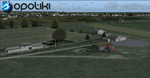
Opotiki aerodrome (ICAO: NZOP) is a small airstrip outside the township of of Opotiki, the gateway to the beautiful East coast of the North Island of New Zealand. Opotiki itself sits at the confluence of the Waioeka and Otara rivers and is surrounded by dairy farmland and Kiwifruit orchards with large areas of native bush to the south and east.
This scenery accompanies Tim Barnes'�� series of other small Bay of Plenty aerodromes (Whakatane,
Galatea, Waihi Beach) for use with VectorLandClass- It features custom modelled and textured buildings, large coverage of beautiful 0.5m aerial photography (fully auto-genned and including seasonal and night variations) and extensive use of high quality objects from the free VLC library. Installation of the library V1.1+ is required for this scenery to work properly and can be downloaded from the VectorLandClass website (www.vectorlandclass.co.nz)
This release, although not requiring it, works best with VectorLandClass topographic mesh and landclass addon covering all 268676 square kilometers of New Zealand. If you'��re not a VLC customer, you'��ll notice when the photoreal coverage runs out!
| Filename: | NZOP_Opotiki_Aerodrome_VectorLandClass_New_Zealand.zip |
| License: | Freeware, limited distribution |
| Added: | 21st February 2013, 13:52:47 |
| Downloads: | 969 |
| Author: | Tim Barnes |
| Size: | 146.68 MB |
| Category: Flight Simulator X - AFCAD Files | |
| PAOT - Wien Meml - Kotzebue, Alaska |
|
Images related to this file:
File Description:
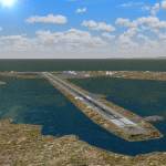
This AFCAD of the airport Wien Meml - Kotzebue (PAOT), Alaska, fixes some issues for Scenery Solution's UTX Alaska users who want to use mesh and texture resolutions better than 38 m and 1 m, respectively. Unfortunately this discloses some additional problems with lagoons surrounding runway 09/27. Some of the ponds had been elevated over apron level, the fence Microsoft had drawn around the airport ran through (elevated) water and so on. Runway 27 has no direct connection to the mainland like it is realized by UTX and furthermore a lot of water polygons (including the lagoons) had 'forgotten' shore line vectors. Included corrections are: fixed main waterpolygons around the airport (according to Google Maps), fixed airport layout, including aprons, GA parking, additional airport buildings (default FSX objects), fixed Runway designators (now 09/27 resp. 18/36 instead of 08/26 and 17/37, Nov. 2013), added shoreline vectors (compatible to UTX textures) and some more.
Again, THIS AFCAD IS INTENDED FOR USERS OF UTX ALASKA ONLY and will likely look horrible in other environments as it partially amends missing features only.
| Filename: | PAOT__Wien_Meml__Kotzebue_Alaska.zip |
| License: | Freeware, limited distribution |
| Added: | 3rd February 2014, 14:30:10 |
| Downloads: | 410 |
| Author: | Axel Birsul |
| Size: | 1.09 MB |
| Category: Flight Simulator X - Scenery | |
| Hawaiian Airports Part 2 |
|
Images related to this file:
File Description:
Hawaiian Airports Part 2
This scenery features the airports at PHJR John Rodgers Field, PHBK Barking Sands, NPS Ford Island and PHNG Kaneohe Bay. All runways, aprons, taxiways and buildings have been repositioned to their correct locations, and include custom textures based on photographs of the real airports. The scenery features many animated objects including people, aircraft, animals, waves, cars, trucks and many more. Full night textures with light maps are included.
All the scenery files have been sub-divided so they can be switched on or off according to user preference. It has been designed for, and tested in DX9 and FSXA only. The airports include sloped flattens so they can also be used with high density mesh. These airports have long runways and can easily cater for the 'heavies', PHJR now acts as a backup to the main airort at PHNL Honolulu. Runway 04 at PHNG is a real challenge, and requires a 90 degree turn under the mountains.
Please enjoy, and I hope you like my scenery as much as I enjoyed building it.
| Filename: | Hawaiian_Airports_Part_2.zip |
| License: | Freeware, limited distribution |
| Added: | 27th January 2015, 09:03:22 |
| Downloads: | 8,343 |
| Author: | George Keogh |
| Size: | 152.19 MB |
| Category: Flight Simulator X - Miscellaneous Files | |
| US & Canadian Coast Guard AI Boat Traffic V1 |
|
Images related to this file:
File Description:
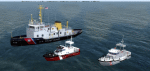
This is a paint and traffic file addition to go along with Henrik Nielsen's Global AI Ship Traffic.
These files have been tested to operate properly in FSX and P3Dv3. The textures are in .dds format for FSX and P3D.
The routes have been made with the consideration of using ORBX Vector, ORBX NA landclass and Pilots 2008 mesh products.
9 of the US Coast Guard's Bay Class icebreaker tugs are represented.
21 Canadian Coast Guard 47 foot motor life boats from the Quebec\Atlantic sectors and the British Columbia sector, along with 13 motor life boats of the US Coast Guard First District (New England) are represented.
4 ship traffic files allow all vessels to appear in the scenery.
Hendrik Nielsen's USCG Bay Class model and Jean-Pierre Fillion's Motor Life Boat model are included. Both Hendrik Nielsen and Jean-Pierre Fillion have given permission to include their ship/boat models with the project and I thank them greatly.
Four ship traffic files allow all vessels to appear in the scenery.
Please see the 'ReadMe' file first.
| Filename: | US__Canadian_Coast_Guard_AI__Boat_Traffic_V1.zip |
| License: | Freeware |
| Added: | 12th February 2019, 22:27:55 |
| Downloads: | 925 |
| Author: | Joe Bowers |
| Size: | 11.07 MB |


© 2001-2026 AVSIM Online
All Rights Reserved
Privacy Policy |