
Where Flight Simulation Enthusiasts Gather from Around the World!
AVSIM Library - Search Results

| Category: Flight Simulator 2004 - Scenery | |
| Airstrips of Eastern France |

|
Images related to this file:
File Description:
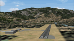
Next in my ongoing "Airstrips of Western Europe" project for FS2004, herewith about 100 sceneries of small, mostly default airfields in the eastern section of France, each enhanced with taxiways, parking spaces and aprons as appropriate, to further facilitate the generation of lightweight AI traffic in the area without overloading the more major airfields. When combined with the French airstrips from my previous uploads, the majority of the default small French airstrips in FS2004 will be able to generate AI traffic, should you so wish, as well as putting a little basic detail into the countryside.
Again, there's no photo-realism here, just a selection of basic 'generic' buildings, more or less accurately sized and placed to reflect the airfield layout as seen on on-line satellite imagery and aerial photography. These buildings have minimal effect on frame-rates, so are ideal for this kind of job. The airfields are aligned as well as possible with the roads etc. in UT Europe and the Genesis Europe mesh, but should mostly be fine in a default installation or other configuration.
| Filename: | Airstrips_of_Eastern_France.zip |
| License: | Freeware |
| Added: | 25th September 2024, 13:37:50 |
| Downloads: | 150 |
| Author: | Chris Eve |
| Size: | 2.83 MB |
| Category: Flight Simulator 2004 - Scenery | |
| Bethel: Yukon Area |
|
Images related to this file:
File Description:
This presumes you have already installed Bethel PABE, Bethel Local Airfields, and Bethel St Mary's. In the Yukon River area of Alaska to the north of Bethel and to the south around the equally wide (but shorter) Kuskowim River there are small villages, served by flights from both Bethel PABE and St Mary's PASM. These villages are dependent upon fishing for survival, and in this flat and very wet terrain are equally dependent upon the gravel runways that link them to the outside world. There are no surfaced roads, and the rivers and their tributaries wind into the distance and are impractical delivery routes except from nearby places. In an area 300 miles by 200 miles most places cannot be described as "nearby". This post is of the small villages, including those previously posted; I had missed on picking up some terrain conflicts between nighttime grass and town textures. They are corrected here and included along with new airfields. Bethel and St Mary's are also reposted to include the further enlargement of parking for the increased number of small AI aircraft. These smaller airfields vary in quality; some have runway signage but most do not, and while some have two or even three hangars/garages/terminal buildings on the apron there are others who have none at all. The 39 small airfields included here are as listed:
Akiak AKI, Akiakchak Z13, Alakanuk AUK, Anvik PANV, Atmautluak 4A2, Cape Romanzof PACZ, Chefornak PACK, Chevak VAK, Eek EEK, Emmonak PAEM, Goodnews GNU, Grayling KGX, Holy Cross HCA, Hooper Bay PAHP, Kako 9AK2, Kalskag KLG, Kasigluk Z09, Kipnuk PAKI, Kongiganak PADY, Kotlik KOT, Kwethluk KWT, Kwigillingok A85, Marshall MLL, Mountain Village MOU, Napakiak WNA, Napaskiak PKA, Newtok PAEW, Nightmute IGT, Nunapichuk 16A, Pilot Station 0AK, Quinhagak PAQH, Russian Mission RSH, Scammon Bay SCM, Shageluk SHX, Sheldon Point SXP, Toksook Bay OOK, Tuluksak TLT, Tuntutuliak A61, Tununak 4KA.
I am currently going through the airfields again to check if further modifications are required, and I am also adding a few new ones. As I am going to be updating my computer I am posting now, complete or not, and I will post an update later of further additions.
| Filename: | Bethel_Yukon_Area.zip |
| License: | Freeware, limited distribution |
| Added: | 3rd May 2019, 17:20:53 |
| Downloads: | 170 |
| Author: | Roger Wensley |
| Size: | 6.3 MB |
| Category: Flight Simulator X - AFCAD Files | |
| Somerset Airport (KSMQ), NJ |
|
File Description:
Located 03 miles N of Somerville, New Jersey on 210 acres of land, Somerset is a public airport with one asphalt and two grass runways, the longest of which is 2733' in length. The turf runways have no hard surfaces and you will be landing on terrain so have your mesh set as high as possible - both runways are still selectable in the ATC window for landing/takeoff announcements. AI aircraft will not use them. The helipad is a start location in front of the main terminal if a parking location is not wanted to begin helicopter flights. Parking is divvied up into three categories - GA_SMALL spots will accommodate aircraft with wingspans no greater than 40 feet. GA_MEDIUM spots will accommodate aircraft with wingspans no greater than 60 feet. GA_LARGE spots are named to identify locations suitable for starting in a glider if you wish to do so. They can also accommodate aircraft with wingspans no greater than 60 feet. In addition to tie downs, there are 13 hangars open for parking in various locations - they can be identified by GA_DOCK. Only the N Parking hangar can accommodate aircraft with wingspans no greater than 60 feet - all other hangers are suitable only for aircraft with wingspans no greater than 40 feet. Several of the hangars have attendants - look beside the doors for the NAV2 frequency to set for opening them. AI aircraft will only spawn on the north tarmac/hangars (largely to prevent AI traffic crossing the runway on taxi). All objects and static aircraft in the immediate vicinity of parking and taxiways have collision disabled. If your aircraft has a wingspan greater than 40 feet it is NOT recommended that you taxi down the middle taxiway leading to the main tarmac from N Parking as you will not clear the hangars - go either via the NW taxiway past the grass tie downs (NW Parking) or around East to the next taxi way on the other side of the east hangars (E Parking) which has more wing clearance. Fuel is available on both tarmacs north and south of the runway by stopping on the asphalt in front of the tanks/pump.
Scenery constructed with use of satellite images/streetview/aerial photos - the author has not been there in person.
This scenery is meant to be used in conjunction with MegaScenery Earth New York 005. It is not required, but apron use is minimized to allow satellite scenery to show through as much as possible, and objects are placed based on the MSE textures - lack of it may make scenery look out of place.
| Filename: | Somerset_Airport_KSMQ_NJ.zip |
| License: | Freeware |
| Added: | 27th September 2011, 01:15:53 |
| Downloads: | 306 |
| Author: | Drew Sikora |
| Size: | 1.47 MB |
| Category: Flight Simulator X - Scenery | |
| St. Helena, Ascension, and Tristan da Cunha Islands |
|
Images related to this file:
File Description:
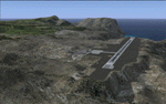
This project was begun to add the new airport (FHSH) to St. Helena Island and eventually was expanded to include a complete remake of Ascension Island (FHAW) and Tristan da Cunha (with an optional airport FHTC) and Gough Island with the actual weather station heliport (FHGH). Tested in both the default FSX/Acceleration and with FTX Global/Vector, accurate coastlines, lakes, road data, and SRTMGL1 (30m) mesh, as well as corrected landclass are provided based on the latest available satellite imagery. Flight plans are provided for the proposed commercial service to St. Helena, and some additional GA and military flights to the island are added as well.
The FSX St. Helena (FHSH) airport was created by aligning master plans for the airport with current satellite data and by studying many of the pictures that have been posted as the airport has taken shape. The official opening of the real airport on May 21, 2016, has been pushed back for more field tests due to challenging crosswinds. The Ascension Island (FHAW) airport was updated after I realized that Ascension could receive commercial service as a result of the new St. Helena airport. The entire airfield is redesigned to allow the volcanic terrain to display properly. The airbase, towns, BBC Atlantic relay station, and numerous satellite dishes, radomes, and wind turbines now appear in their real-world locations. Since I was already in the region, I added the Tristan da Cunha Islands (including Inaccessible, Nightingale and Gough Islands) and the Gough Island weather station maintained by the South African National Antarctic Programme. I also added an optional airport (and flight plans) to Tristan da Cunha (FHTC), which can be easily enabled/disabled. The FHTC airport is placed on the only part of the island that appears to be free of people or farmland, and the area is just long enough to accommodate a pared-down version of the St. Helena airport.
Updates were created or rebuilt in a manner which carefully aligns airport data with current satellite imagery. Scenery was created using Airport Design Editor X v1.67.5684, SBuilderX 3.13, and the FSX Object Placement Tool. Scenery objects were added and modified from stock FSX scenery to resemble as closely as possible the actual airports. The animated flag model is by Dietmar Loleit, the FSX apron lights included are from the set created by Jim Dhaenens, and the animated wind turbines and radomes are from the freeware package by Ray Porter.
| Filename: | St_Helena_Ascension_and_Tristan_da_Cunha_Islands.zip |
| License: | Freeware |
| Added: | 1st May 2016, 11:23:05 |
| Downloads: | 6,079 |
| Author: | Carlyle Sharpe |
| Size: | 10.52 MB |
| Category: Flight Simulator 2004 - Scenery | |
| CYYN Swift Current Municipal Airport |
|
File Description:
Swift Current Municipal airport is situated approximately 8 km east of the City of Swift Current. It is one of those tiny airports where the default flightsim scenery has no resemblance to the real world airport. CYYN was constructed using GMAX and represents the airport as it was in the Summer of 2007. It includes nearly all the buildings at the airport, runway signs, the addition of fencing, and a rotating beacon. CYYN also includes a landclass file to better represent the terrain around the airport, at least as far as the limits of the default landscape will allow. The airport has a long history, being built in 1937, as one of the hundred-mile airports on the Trans Canada airway. It was greatly expanded as an RCAF / RAF station during world war II. Many of the wartime structures still exist but many are in poor shape. Two of the original three runways remain in service. The airfield is often used by 15 Wing aircraft of CFB Moose Jaw to practice approaches.
| Filename: | CYYN_Swift_Current_Municipal_Airport.zip |
| License: | Freeware |
| Added: | 30th August 2008, 03:25:36 |
| Downloads: | 1,345 |
| Author: | Gregory Putz |
| Size: | 5.28 MB |
| Category: Flight Simulator 2004 - Scenery | |
| Baton Rouge,La. ( KBTR v2 ) |
|
File Description:
FS2004 KBTR Baton Rouge,La. v2.0
This is an updated version from my old EZ Mega KBTR version 1.0
This Scenery is optimized for use with Ultimate Terrain USA,but should work OK with default land scenery.
This package features a lot of objects around the city of Baton Rouge, such as an accurate rendition of the 473foot tall State capital Building, Cortana mall,Seigen Village Mall,strip malls,banks,restaurants,gas stations,Chemical plants,River Barge Traffic,USS Kidd Destroyer,the two casino boats,the Marriott Hotel off College drive,Louisiana State Police headquarters with its own AFCAD and Helo pads and lots of other stuff.This version does not feature my custom built terminal and hangers,that will come in version 3.
The Airport AFCAD has been once again reworked as well to reflect the newly lengthened Rwy 22R-4L and other stuff.
This has been my test bed for the upcoming version 3 release which will be released by Christmas hopefully.
In the meantime,enjoy this new version equipped with familiar landmarks.
As Always...Enjoy!!!
| Filename: | Baton_RougeLa__KBTR_v2_.zip |
| License: | Freeware |
| Added: | 11th October 2008, 02:15:38 |
| Downloads: | 2,868 |
| Author: | Joe DeGregorio |
| Size: | 13.04 MB |
| Category: Flight Simulator 2004 - Scenery | |
| Sioux Lookout CYXL in northwest Ontario Canada |
|
File Description:
Sioux Lookout is a small town of some 5,000 folks in northwest Ontario, towards the Manitoba border, and a regional centre for surrounding villages. The airfield is some two miles east of the town. It originally had two runways but the smaller was abandoned recently as part of a planned long term improvement of the field, leaving just 34/16 with its 5,300 feeet of asphalt. Both Wasaya and Bearskin fly to Sioux Lookout; on the field there are two maintenance companies, Eagle and Allen, and hangers for the Ministry of Health, Bearskin Airlines, Wasaya, and the Nishnawbe Aski Police Service (NAPS). I think there is now another company too, but I have no information on them so I pretended this was two years ago. As well as the airfield scenery there is also a landclass file an "AFCAD" file for your AI aircraft. You should also download and install Northwest Ontario Airports by Eric O'Link, and preferably also have Ultimate Terrain; I have not tested this without UT and there is a small lake nearby.
| Filename: | Sioux_Lookout_CYXL_in_northwest_Ontario_Canada.zip |
| License: | Freeware |
| Added: | 26th November 2008, 13:08:04 |
| Downloads: | 853 |
| Author: | Roger Wensley |
| Size: | 2.66 MB |
| Category: Flight Simulator 2004 - Scenery | |
| St. Kitts International Airport (Bradshaw), Caribbean |
|
File Description:
This scenery depicts the Robert L. Bradshaw International airport on the Island of St. Kitts in the Caribbean. It contains the modern new terminal, along with the distinctive green glass tower, and outer buildings. It is a small airport which is located in a valley between two mountain ranges near the southern end of the Island. The scenery has been updated to work in FS2004 by changing the location slightly, removing the hills which are no longer necessary, since FS has now done a great job with the new terrain. The tarmac area is now more representational of the airport, since the scenery tarmacs now override the default FS tarmacs, taxiways, and lines. The airport now has a cleaner layout, and the taxiway extending to the runway end now fits in perfectly. More trees have been added to prevent the stark look of the old scenery. This airport needs an afcad, since there are some A1 aircraft which park in the middle of the taxiway. This scenery will not work in FS2002.
| Filename: | St_Kitts_International_Airport_Bradshaw_Caribbean.zip |
| License: | Freeware |
| Added: | 23rd August 2003, 15:27:31 |
| Downloads: | 4,299 |
| Author: | Bill Melichar |
| Size: | 3.57 MB |
| Category: X-Plane - Original Aircraft | |
| A1 Spec. SL-1 |
|
File Description:
The Sealiner 1 A1 Special is a small amphibian jet, capable of landing both on land and water as well as other tough terrain, This iarcraft boasts 6 compact low bypass jet engines, The plane also has a nice and simple cockpit design, so simple this is a perfect plane for any first time pilot. Not only is it fast and user friendly but it is safe with a huge chute on it, it can slow this plane down to landing speed in seconds. Unlike the VTOL aircraft I built before this plane is much smaller and this is reflected in the amount of payload it can carry, but there is a good reason for this. This airplane was designed to service small islands (mainly in the south pacific) where before a boat would have had to been taken if one decided to leave, so with the SL-1 them and 20 other people can fly commerical airline style almost anywhere! In the future look for another engine to be added.
| Filename: | A1_Spec_SL1.zip |
| License: | Freeware, limited distribution |
| Added: | 25th April 2004, 01:57:41 |
| Downloads: | 568 |
| Author: | Sam Hoy |
| Size: | 48.1 KB |
| Category: Flight Simulator X - Scenery | |
| Thomas Hudner AFB |
|
File Description:
Thomas Hudner AFB is a fictitious Air Force Base located at Henderson Island, a member of the Pitcairn Islands in the Pacific. Located in a sheltered bay on the east side of the island, the airport features a 7500' x 120' paved runway, several hangars, barracks, and a fire dept. This airport also features a Delta V rocket and launch pad, a container ship being unloaded offshore by hovercrafts, and a small military ship. The default FSX scenery at this island has been completely replaced with custom scenery and terrain based on satellite photos.
This scenery requires the FSX Acceleration expansion pack for all of the objects to show up properly. Also, for some reason, Ground Environment X causes the sand textures to show up as rain forest. This is purely a visual quirk and the airport will still work, but it is up to you. This airport is not designed for FS2004, but you may try it at your own risk. Special thanks to Ashton Lawson for his invaluable help on this project.
| Filename: | Thomas_Hudner_AFB.zip |
| License: | Freeware, limited distribution |
| Added: | 31st January 2009, 01:29:20 |
| Downloads: | 541 |
| Author: | Daniel Otto |
| Size: | 1.57 MB |


© 2001-2026 AVSIM Online
All Rights Reserved
Privacy Policy |