
Where Flight Simulation Enthusiasts Gather from Around the World!
AVSIM Library - Search Results

| Category: Flight Simulator X - Flight Plans | |
| OB-53 Minneapolis Minnesota |

|
Images related to this file:
File Description:
FSX Flight Plan for OB-53 Minneapolis Minnesota IFR high speed low altitude military training route. This is the eleventh in a series of flight plans I have uploaded. This route goes through mostly flat and rolling terrain in Minnesota, North Dakota and South Dakota. This route has three different sets of targets. These are great routes for B-52, F-111, B-1B, B-2 A6, A4, Vulcan and any fighter or bomber enthusiasts. Of course you can fly the route with any aircraft of your choice. Included in this package are two spectacular gauges by Karol Chlebowski for TFR flying and Pave Tack which includes many advanced features for bombing, navigation and reconnaissance. These two gauges will greatly enhance your ability to fly these challenging routes and are a great companion of the flight plans. Another option to download Version 2.1 of my mini panel which has all this functionality and more.
| Filename: | OB53_Minneapolis_Minnesota.zip |
| License: | Freeware |
| Added: | 11th July 2011, 00:27:26 |
| Downloads: | 173 |
| Author: | Bill McClellan |
| Size: | 1.13 MB |
| Category: Flight Simulator X - Flight Plans | |
| OB-97 Fayetteville Arkansas |
|
Images related to this file:
File Description:
FSX Flight Plan for OB-97 Fayetteville Arkansas IFR high speed low altitude military training route. This is the eleventh in a series of flight plans I have uploaded. This route goes through mostly flat and rolling terrain in Arkansas, Texas, Oklahoma and Kansas. This route has two different sets of targets. These are great routes for B-52, F-111, B-1B, B-2 A6, A4, Vulcan and any fighter or bomber enthusiasts. Of course you can fly the route with any aircraft of your choice. Included in this package are two spectacular gauges by Karol Chlebowski for TFR flying and Pave Tack which includes many advanced features for bombing, navigation and reconnaissance. These two gauges will greatly enhance your ability to fly these challenging routes and are a great companion of the flight plans. Another option to download Version 2.1 of my mini panel which has all this functionality and more.
| Filename: | OB97_Fayetteville_Arkansas.zip |
| License: | Freeware, limited distribution |
| Added: | 11th July 2011, 04:47:54 |
| Downloads: | 167 |
| Author: | Bill McClellan |
| Size: | 1.03 MB |
| Category: Flight Simulator X - Flight Plans | |
| OB-98 Rapid City South Dakota |
|
Images related to this file:
File Description:
FSX Flight Plan for OB-98 Rapid City South Dakota IFR high speed low altitude military training route. This is the Twelfth in a series of flight plans I have uploaded. This route goes through both mountainous and flat and rolling terrain in South Dakota, Nebraska, Wyoming and Montana. This route has two different sets of targets. These are great routes for B-52, F-111, B-1B, B-2 A6, A4, Vulcan and any fighter or bomber enthusiasts. Of course you can fly the route with any aircraft of your choice. Included in this package are two spectacular gauges by Karol Chlebowski for TFR flying and Pave Tack which includes many advanced features for bombing, navigation and reconnaissance. These two gauges will greatly enhance your ability to fly these challenging routes and are a great companion of the flight plans. Another option to download Version 2.1 of my mini panel which has all this functionality and more.
| Filename: | OB98_Rapid_City_South_Dakota.zip |
| License: | Freeware, limited distribution |
| Added: | 12th July 2011, 02:26:18 |
| Downloads: | 169 |
| Author: | Bill McClellan |
| Size: | 942.19 KB |
| Category: Flight Simulator X - Flight Plans | |
| OB-96 Fort Worth Texas |
|
Images related to this file:
File Description:
FSX Flight Plan for OB-96 Fort Worth Texas IFR high speed low altitude military training route. This is the fifteenth in a series of flight plans I have uploaded. This route goes through mostly flat and rolling terrain in Texas, Oklahoma and Louisiana. This route has two different sets of targets. These are great routes for B-52, F-111, B-1B, B-2 A6, A4, Vulcan and any fighter or bomber enthusiasts. Of course you can fly the route with any aircraft of your choice. Included in this package are two spectacular gauges by Karol Chlebowski for TFR flying and Pave Tack which includes many advanced features for bombing, navigation and reconnaissance. These two gauges will greatly enhance your ability to fly these challenging routes and are a great companion of the flight plans. Another option to download Version 2.1 of my mini panel which has all this functionality and more.
| Filename: | OB96_Fort_Worth_Texas.zip |
| License: | Freeware, limited distribution |
| Added: | 13th July 2011, 02:35:57 |
| Downloads: | 187 |
| Author: | Bill McClellan |
| Size: | 1.07 MB |
| Category: Flight Simulator X - Scenery | |
| LFAW - Villerupt-Errouville |
|
Images related to this file:
File Description:
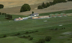
This scenery represents the field of Villerupt-Errouville LFAW where the flying club is based "Nord Lorraine" located in the north of the department 54 a few kilometers from Belgium and Luxembourg borders and the model aircraft club. The buildings have been modeled in GMAX, static devices are also present. Finally the autogen was placed on the same perimeter as the slab photo realistic.
********************************
Cette scene represente le terrain de Villerupt-Errouville LFAW qui est base l'aeroclub Nord Lorraine situe dans le nord du departement 54 a quelques kilometres de la Belgique et du Luxembourg ainsi qu'un club d'aeromodelisme et parachutisme.
L'ensemble des batiments ont ete modelises sous GMAX, des appareils statiques sont egalement presents.
Une dalle photo realiste a ete inseree mais je vous conseille de continuer le sol photo avec des logiciels comme fsEarthTile.
Enfin de l'autogen a ete place sur le meme perimetre que la dalle photo realiste.
| Filename: | LFAW__VilleruptErrouville.zip |
| License: | Freeware, limited distribution |
| Added: | 3rd January 2012, 11:24:06 |
| Downloads: | 1,862 |
| Author: | Alexandre Remy FAF010 |
| Size: | 17.72 MB |
| Category: Flight Simulator 2004 - Scenery | |
| Yellowknife Floats CEN9 - Northwest Territories, Canada |
|
Images related to this file:
File Description:
Yellowknife float base is on the shore of Yellowknife Bay, which is on the north side of Great Slave Lake. The float base is on two sides of Latham Island and the promontory that reaches out to it, which is where the town of Yellowknife was originally founded, and float planes land either in Back Bay (to the west) or in East Bay (guess where?). Where the south end of the island meets the promontory there are two inlets and two companies; Air Tindi in the eastern part and North Airways in the western. These two companies have bespoke buildings. I have used other buildings from other sceneries to model the "feel" of the original Yellowknife and the docks along the shore. One thing I could not do, and that was to recreate at its correct height "the rock", which is the raised centre of the promontory; FS9 resisted terrain readjustments beyond a certain point.
| Filename: | Yellowknife_Floats_CEN9__Northwest_Territories_Can.zip |
| License: | Freeware, limited distribution |
| Added: | 1st February 2012, 23:53:17 |
| Downloads: | 920 |
| Author: | Roger Wensley |
| Size: | 12.38 MB |
| Category: Flight Simulator 2004 - Scenery | |
| CWBH - Bernard Harbour - Nunavut, Canada |
|
Images related to this file:
File Description:
Bernard Harbour was a DEW line "iStation" (a small station with a staff of 5 or 7 people) on the nothern mainland coast 75 miles north of Kugluktuk, and 45 miles west of Lady Franklin Point. It closed in 1963. The slowly deteriorating buildings are still there, along with a fallen radio communications mast. The runway is also still there and has 3,040 feet of gravel, aligned 122T/302T. There is now no runway lighting, no signage, no windsock, and the bushes growing amid the gravel are winning, though slowly. In 1991 a North Warning System (NWS) automated station was established 3 miles to the southwest and there is a second smaller runway there (1,450 feet) along with a helicopter pad. A road joins the two sites for when diesel resupply is undertaken from a ship in the summer, and the zigzag route is (in reality) dictated by the numerous ponds that are too small to be picked up by Ultimate Terrain.
| Filename: | CWBH__Bernard_Harbour__Nunavut_Canada.zip |
| License: | Freeware, limited distribution |
| Added: | 11th November 2012, 01:24:20 |
| Downloads: | 258 |
| Author: | Roger Wensley |
| Size: | 1.49 MB |
| Category: Flight Simulator 2004 - Scenery | |
| VFR of Lario, Area C3 - Como lake, Italy |
|
Images related to this file:
File Description:
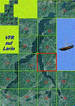
This is the twelfth scenery of the "VFR of Lario" project, made with
photorealistic terrain (multiseason & night) and with some 3D GMax realistic objects.
This scenery covers approximately an area of 7.5x6 kmt, from Limonta (NW) to the northern Grigna mountain (NE), from Onno (SW) to southern Grigna mountain (SE); some of specific buildings are included, as the small church and Museum of Cycling (Ghisallo), villa at pier (Limonta) and interruption of the freeway overpass (Mandello del Lario ... waiting for the next B3 scenery); are included five NLC piers (Limonta, Onno, Vassena, Lierna and Mandello del Lario) and two small motorboat (Ninfea and Giglio) of the NLC navigation; there are also included six sections of the freeway SS36 with its overpasses and tunnels. Some other minor boats and docks are placed alongside the lake coast.
Check video available here: http://youtu.be/q9I5B6oF4ZY
| Filename: | VFR_of_Lario_Area_C3__Como_lake_Italy.zip |
| License: | Freeware |
| Added: | 30th April 2013, 23:20:59 |
| Downloads: | 829 |
| Author: | Aldo Della Vedova, Daniele Lanfranchi, Gian Mario Verga |
| Size: | 22.95 MB |
| Category: Flight Simulator 2004 - AI Aircraft | |
| Forca Aerea Portuguesa Fiat/Aeritalia G.91 |
|
Images related to this file:
File Description:

Forca Aerea Portuguesa Fiat/Aeritalia G.91. I present a comprehensive AI traffic model package for this backbone of close air support in Europe during the Cold War years. The G.91 was built to suit a requirement for a NATO-compatible aircraft for close air support and light strike roles, able to operate from terrain as primitive as a flat grassy meadow (I found photos during research that support this). Going into production in 1961, this aircraft was manufactured for 19 years and served three European air forces for 35 years. The G.91 saw extensive combat service in Africa while operated by the Portuguese Air Force.
An original 7-LOD model brings this historic aircraft to the flightsim world. This package represents the G.91 in the service of the Forca Aerea Portuguesa ; with a total of 10 models and 56 repaints. Aircraft models covered are the G.91R3, G.91R4, and G.91T3. Aircraft, textures, and flight dynamics by Michael Pearson.
| Filename: | Forca_Aerea_Portuguesa_FiatAeritalia_G91.zip |
| License: | Freeware |
| Added: | 7th October 2013, 22:35:02 |
| Downloads: | 497 |
| Author: | Michael Pearson |
| Size: | 14.88 MB |
| Category: Flight Simulator 2004 - AI Aircraft | |
| Luftwaffe Fiat/Aeritalia G.91 |
|
Images related to this file:
File Description:

Luftwaffe Fiat/Aeritalia G.91. I present a comprehensive AI traffic model package for this backbone of close air support in Europe during the Cold War years. The G.91 was built to suit a requirement for a NATO-compatible aircraft for close air support and light strike roles, able to operate from terrain as primitive as a flat grassy meadow (I found photos during research that support this). Going into production in 1961, this aircraft was manufactured for 19 years and served three European air forces for 35 years. The G.91 saw extensive combat service in Africa while operated by the Portuguese Air Force.
An original 7-LOD model brings this historic aircraft to the flightsim world. This package represents the G.91 in the service of the Luftwaffe; with a total of 10 models and 86 repaints. Aircraft models covered are the G.91R3, G.91R4, and G.91T3. Aircraft, textures, and flight dynamics by Michael Pearson.
| Filename: | Luftwaffe_FiatAeritalia_G91.zip |
| License: | Freeware |
| Added: | 7th October 2013, 22:35:54 |
| Downloads: | 604 |
| Author: | Michael Pearson |
| Size: | 21.16 MB |


© 2001-2026 AVSIM Online
All Rights Reserved
Privacy Policy |