
Where Flight Simulation Enthusiasts Gather from Around the World!
AVSIM Library - Search Results

| Category: Flight Simulator X - Gauges | |
| FLTInfo V2 |

|
Images related to this file:
File Description:
This gauge has been developed for FSX Flight Simulator SP2 or SP1. It should also work with Acceleration, but this is not guaranteed by the author.
The gauge provides flight information for the pilot regarding the destination airport in terms of frequencies, runway conditions, altitude, bearing and distance, and basic information about the flight plan like current travelled miles and a estimated calculation about the Top Of Descent (TOD ) decision point.
This Version 2 includes 3 additional information pages for the runway layouts of the destination and the departure airport, and a page which provides graphical information about the terrain level relative to the aircraft on the selected flight plan.
For more information and installation instructions see the documentation inside the zip file.
| Filename: | FLTInfo_V2.zip |
| License: | Freeware, limited distribution |
| Added: | 12th October 2012, 18:05:11 |
| Downloads: | 1,553 |
| Author: | Dietmar Loleit |
| Size: | 853.38 KB |
| Category: Flight Simulator 2004 - Scenery | |
| VFR of Lario, Area C1 - Como lake, Italy |
|
Images related to this file:
File Description:
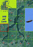
This is the third scenery of the "VFR of Lario" project, with photorealistic terrain and some 3D GMax realistic objects.
Information: this third scenery covers approximately an area of 7.5x6 kmt, from Pellio Intelvi/Ramponio (NW) to Colonno (NE), and from Almanno/Vesbio (SW) to Cavagnola locality (SE) and includes some details (GMax) of Argegno town, as NLC pier, some Holtel and Restaurants, the SS. Trinity church, some bridges and walls on Telo torrent and the cableway Argegno-Pigra (animated); it is also enclosed the unique small museum of financial police and smuggling, on Erbonne.
Contents: GMax objects as above and other buidings, minor piers and boats together with autogen buildings and trees are fully spreaded on the scenery.
| Filename: | VFR_of_Lario_Area_C1__Como_lake_Italy.zip |
| License: | Freeware |
| Added: | 16th February 2012, 00:17:59 |
| Downloads: | 1,776 |
| Author: | Aldo Della Vedova, Daniele Lanfranchi, Gian Mario Verga e Diego Caligiuri |
| Size: | 12.98 MB |
| Category: Flight Simulator X - Scenery | |
| F45 - North Palm Beach County General Aviation Airport - West Palm Beach, Florida (USA) |
|
Images related to this file:
File Description:
North Palm Beach County Airport, located northwest of West Palm Beach, Florida, was opened in 1994 as a designated reliever for KPBI. All of the buildings have been custom modeled in accordance with information available on the internet including Microsoft Bing birdseye views. The airport layout and landclass changes are in accordance with Google Earth imagery.
If you have Jim Dhaenens' lightobj.bgl installed, apron lighting will be included, and if you have KB_static_aircraft_FSX installed (available at www.kb-sim.com/screens_static_aircraft.html), additional parked aircraft will be visible.
The layout of scenery is optimized for use with Ultimate Terrain X-USA. There is no FAA airport diagram for this airport, but a taxiway diagram provided by the local Airport Authority is included in this package.
| Filename: | F45__North_Palm_Beach_County_General_Aviation_Airp.zip |
| License: | Freeware |
| Added: | 22nd August 2013, 20:48:03 |
| Downloads: | 1,152 |
| Author: | Art Poole |
| Size: | 1.27 MB |
| Category: Flight Simulator 2004 - Scenery | |
| AVL gliders airport - Alzate Brianza, Italy |
|
Images related to this file:
File Description:

"free version" of the same airport for gliders, that will be included inside the A2 scenery of "VFR on Lario" project. It is made for the use on FS9 standard, without any addition of photo-realistic terrain and/or specific extra meshes. It requests the use of "dva51" free library and the "TreePlanter" use.
This scenery represents the AVL airport, dedicated to Giancarlo Maestri, and seat of the homonymous Lariano Glider Aeroclub and related gliding school. It is situated inland SE Como, between the Alserio and Montorfano small lakes, in the municipality of Verzago. It has an asphalt runway of 1890x50 feet, ground communication frequency 123.50; ICAO code: LILB (Alzate Brianza).
Video available here: https://youtu.be/huKdtYar_uQ
| Filename: | AVL_gliders_airport__Alzate_Brianza_Italy.zip |
| License: | Freeware |
| Added: | 30th September 2013, 23:34:42 |
| Downloads: | 566 |
| Author: | Aldo Della Vedova, Daniele Lanfranchi, Gian Mario Verga |
| Size: | 5.84 MB |
| Category: Flight Simulator X - Scenery | |
| CZBB - Boundary Bay, BC, Canada (2011) Version 2 |
|
Images related to this file:
File Description:
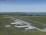
CZBB (2011) portrays the Boundary Bay (British Columbia, Canada) Airport (CZBB) - Canada's fifth-busiest airport by number of operations - and surrounding area as it appeared in mid-2011. Every significant structure on the airfield (50+) is included - all modeled with GMax and painted with hand-drawn textures. CZBB (2011) is compatible with ORBX FTX USA Canada Pacific Northwest, Ultimate Terrain and Vancouver+. A selection of SAMM-generated static aircraft are scattered around the aprons supplemented by a number of AI aircraft that do touch 'n gos from time to time.
Aside from the new custom approach and airfield lighting, generally, this new version is visually identical to its predecessor - even though quite different internally. As well, to the extent possible, it is compatible with Prepar3Dv2.
| Filename: | CZBB__Boundary_Bay_BC_Canada_2011_Version_2.zip |
| License: | Freeware, limited distribution |
| Added: | 20th June 2014, 05:10:24 |
| Downloads: | 3,488 |
| Author: | Don Grovestine |
| Size: | 73.9 MB |
| Category: Flight Simulator X - Scenery | |
| UTFN - Namangan, Uzbekistan |
|
Images related to this file:
File Description:
This is fictional scenery for Namangan (UTFN), Uzbekistan, designed for FSX.
I created this scenery to be more representative of the real life airport. I accomplished this by making modifications to the stock airport, using Google Satellite images and pictures for guidance. Also pictures of the terminal when they are available.
Here is what to look for in this scenery package:
- Added a custom made terminal as depicted in actual airport pictures.
- Added apron and taxiways as depicted in the actual airport pictures.
- Added a couple of hangers and SU-35 aircraft parked on the apron.
- Added a fire station and Control Tower.
- Flattened the terrain on the runway because part of the it was underground.
- Deleted a few trees on both approaches.
| Filename: | UTFN__Namangan_Uzbekistan.zip |
| License: | Freeware |
| Added: | 28th May 2014, 10:56:00 |
| Downloads: | 553 |
| Author: | Ed Bleck |
| Size: | 1.14 MB |
| Category: Prepar3D V1-4 - AI Flight Plans | |
| Druk Air 1998 AI Flightplans |
|
File Description:
Druk Air was the only scheduled carrier in Bhutan in 1998, operating a pair of Bae-146s across the region. The carrier is well known for being based out of the infamous Paro airport, which requires a demanding approach across mountainous terrain. However, due to the equipment Druk Air had at the time, the airline routed most flights via DMK, and the aircraft spend as much time(or more) in Bangkok as they do home in Pero! Michael Pearson's FMAI Bae-146-100 repaint may be found on Avsim as: "fmai_bae1461_drk.zip" Flightplans by Chasen Richardson. Part of the 1998 Flight Simulator Project. Follow us on Facebook at facebook.com/flightsim98 and on instagram as @bayviationsim. For more Retro AI, check out the forums at: http://retroai.proboards.com/
| Filename: | Druk_Air_1998_AI_Flightplans.zip |
| License: | Freeware, limited distribution |
| Added: | 28th November 2019, 17:32:06 |
| Downloads: | 65 |
| Author: | Chasen Richardson\Bayviation |
| Size: | 594.89 KB |
| Category: Flight Simulator X - Scenery | |
| LGSM Samos International Airport, Greece |
|
Images related to this file:
File Description:
LGSM Samos International Airport, Greece.
The island of Samos lies in the Eastern Aegean and is a very popular tourist destination for flights from Berlin, Munich, Gatwick, Oslo, Copenhagen, Rome and many others. It is widely regarded as the most dangerous airport in Greece, mountainous terrain requires a sharp right hand turn onto runway 09 and landings are invariably subject to strong turbulence.
The airport has been designed to sit on the excellent photoreal scenery by Dimitris Ntaskas, which is available here on Avsim and called 'samos_305814.zip'. It also uses many objects from my lgkf_kefallinia.zip scenery also available here at Avsim. The scenery has been designed for and tested with DX9 and FSXA only, if used with the default terrain many objects will be misplaced.
The scenery features a very detailed airport, repositioned according to satellite imagery and is based on real photographs. Full night lighting is included with washed lighting of the apron and carparks. The nearby town of Pythagorio has been modelled and includes some local landmarks. I have included many autogen style buildings based on photographs of Samos and also autogen trees native to the region.
The airport includes many animations, including olive trees, flags, people, windsocks, birds, road traffic and waves. Local Air traffic between the neighbouring islands of Chios, Mykonos, Kos and Rhodes is included, as is a panoramic view from inside the new tower. All the files have been sub-divided and can be switched on or off according to user preference.
Full installation instructions, settings, hints and tips can be found in the readme file. Please enjoy and I hope you like my scenery as much as I enjoyed building it.
| Filename: | LGSM_Samos_International_Airport_Greece.zip |
| License: | Freeware, limited distribution |
| Added: | 27th February 2013, 02:45:01 |
| Downloads: | 23,199 |
| Author: | George Keogh |
| Size: | 47.62 MB |
| Category: Flight Simulator 2004 - Scenery | |
| Invermere CAA8 in British Columbia, Canada |
|
Images related to this file:
File Description:
This airfield is in the Columbia Mountains (which are part of the Rockies) on the border between BC and Alberta. Invermere is in the same valley as Golden, 65 miles south and midway between Golden and Cranbrook. The town is at the northern end of Lake Windermere, on the western side, with a population of around 3,400. The main touristic feature of Invermere appears to be the provision of a wide choice of golf courses. These are included in the scenery, as are some of the surrounding commercial buildings including a nearby hotel and retail units. Invermere CAA8 is half a mile northeast of the lake, and is home to the non-profit Canadian Rockies Soaring Club that trains pilots during the summer months. The Invermere Soaring Centre, a separate organisation, provides glider towing services and rides for the general public. During the summer the airfield can only be described as busy, with gliders taking advantage of the terrain for ridge soaring. The AI here includes gliders that will take off and then circle around north of the field. The take off is not a realistic glider style launch, and the wind should be from the north; these gliders do not taxi and then turn around at the far end of a runway too well. Once again, like Golden, there is no runway or taxiway lighting, so daylight use only. There are GA visitors to CAA8 between the gliders, presumably carrying golfers and clubs. Due to the surrounding terrain AI aircraft might impact high ground before landing and then just show up on their parking spot.
| Filename: | Invermere_CAA8_in_British_Columbia_Canada.zip |
| License: | Freeware, limited distribution |
| Added: | 16th October 2018, 02:11:34 |
| Downloads: | 168 |
| Author: | Roger Wensley |
| Size: | 6.11 MB |
| Category: Flight Simulator 2004 - AFCAD Files | |
| Fiji Airstrips |
|
File Description:
Afcads and exclude files for 11 airstrips in Fiji that Microsoft omitted from FS9. Made primarily with Ultimate Traffic users in mind, to give full traffic in the Fiji Islands (aircraft assigments permitting!).
The Afcads add runways, aprons and parking spots; the exclude files get rid of the autogen trees. Airstrips built using current data from Australian Defense Force En Route Supplements, so runway locations, dimensions, alignments and elevations are fairly accurate. But aprons and parking spots are entirely fictional! And no airport buildings included!
Tested only with default scenery plus fijifix.zip by Jim Keir (available at avsim) to correct elevation errors in default mesh at Moala.
Includes NFNB Levuka/Bureta, NFCI Cicia, NFKD Kandavu/Namalata, NFNO Koro Is, NFNK Lakeba, NFNH Laucala, NFFO Malololailai, NFMA Mana Is, NFMO Moala, NFNS Savusavu and NFVB Vanuabalavu.
| Filename: | Fiji_Airstrips.zip |
| License: | Freeware |
| Added: | 4th December 2004, 05:17:19 |
| Downloads: | 1,613 |
| Author: | Adrian Wright |
| Size: | 14.82 KB |


© 2001-2026 AVSIM Online
All Rights Reserved
Privacy Policy |