
Where Flight Simulation Enthusiasts Gather from Around the World!
AVSIM Library - Search Results

| Category: Flight Simulator X - Scenery | |
| Victoria, Canada including US Southern Gulf Islands and San Juan Islands - Part 1 of 2 |

|
Images related to this file:
File Description:
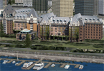
FSX-only version of Victoria, Canada area scenery including the Southern Gulf Islands and the San Juan Islands of the US. Includes automated installer and configurator by Scot Fraser.
Features:
-accurate shorelines, lakes and streams;
-landclass;
-FSX multi-LOD mesh with 10m maximum resolution;
-complete road network with moving traffic;
-railroads;
-utility corridors;
-marinas and ferry terminals;
-many static boats, including a custom model of the Canada Coast Guard ship Sir Wilfred Laurier;
-detailed models of major buildings and the Ogden Point Terminal;
-many bridges;
-nearly 300 marine lights; and corrected antennae locations.
Facilities include Don Grovestine's famous CYYJ (Victoria International Airport); 12 other Canadian land-based airports: Butler Field, Duncan (CAM3), Gaines, Hastings, Hudson Island, James Island, Thomas, Village Bay, Raven Field (CML2), Saltspring, Sidney Island, Whiskey Point; 20 US airports Blakely (38WA), Burden (61WA), Center Island (79WA), Clam Harbor (WA35), Crane Island, Decatur Shores (WN07), Decatur-Jones (WA18), Waldronaire (90WA), Orcas Island (KORS), Friday Harbour (KFHR), Lopez Island (S31), Pile Point, Roche Harbor (WA09), Shaw Island, Stuart Island Airpark (7WA5), Stuart Island West (2WA3), Wilding (6WA5), Windsock (4WA4); 12 floatplane facilities: Bedwell (CAB3), Fisherman's Bay (WA81), Friday Harbor (W33), Ganges (CAX6), Maple Bay, Mayne (CAW7), Port Washington (CAP8), Roche Harbor (W39), Rosario (W49), Shawnigan Lake (CAV8), Victoria Harbour (CYWH), Victoria International (CAP5) and Westsound, Orcas (WA83) - many with AI traffic; 9 heliports: Ganges (CAL7), Mayne (CBF5), Camel Point (CBF7), Jubilee (CBK8), Victoria General (CBW7) Madrona Bay (CBW9), Shoal Point (CBZ7), Mount Belcher (CMBH).
AI models include the DHC-2 floatplane in local liveries, a cruise ship model (by Mitsuya Hamaguchi) and two repaints, pilot boat, and small boats (by Larry Silsbee).
Ultimate Terrain X compatible (not required). Users of Vancouver+ for FSX will also get additional cruise ship traffic and additional floatplane and helicopter traffic. Full documentation. By Don Grovestine, Jon Patch and Holger Sandmann. Many other contributors: see documentation. Part 1 of 2 - you also need file vicenh7b.zip
| Filename: | Victoria_Canada_including_US_Southern_Gulf_Islands.zip |
| License: | Check within download |
| Added: | 29th January 2010, 21:23:17 |
| Downloads: | 23,162 |
| Author: | Don Grovestine, Jon Patch and Holger Sandmann |
| Size: | 56.8 MB |
| Category: Fly! II - Scenery | |
| Globe Tile D199159 gxx.trn Files |
|
File Description:
This Fly!2 upload contains four edited gxx.trn files which flatten the bodies of water in globe tile D199159. This globe tile, which includes Pittsburgh (KPIT lies just outside the border) is south of its companion globe tile D199160, whose gxx.trn files I uploaded previously. The edited gxx.trn files flatten the Allegheny R., Ohio R. and all streams flowing from the Pittsburg area. Special attention was paid to the Kiskiminetas R. and Conemaugh R. and river cuts thru ridges west of Johnstown. Terrain elev. just West of JST and East of KAGC were also adjusted for more pleasing effects.
Important: the globe tile was rendered with options set for subdivideDensity=8 and subdivideTolerance=500. Border areas were not edited to avoid compatibility problems with bordering globe tiles.
| Filename: | Globe_Tile_D199159_gxxtrn_Files.zip |
| License: | Freeware |
| Added: | 2nd September 2002, 17:07:13 |
| Downloads: | 175 |
| Author: | Mark Steinmetz |
| Size: | 223.59 KB |
| Category: Flight Simulator 2004 - Scenery | |
| Southern California Oilrigs v2.0 |
|
File Description:
This is a revised version of my previous rendition of the Oil Rigs off the Southern California Coastline. This file acurately represents the positions of ALL of the Oilrigs extending from Lompoc to Newport Beach, California. Also included are 4 lighthouses not placed in the FS2004 Default Scenery located from Morro Bay - Point Conception, California. * * REQUIRES RWY 12 * * This add-on was created with Runway 12 add-on, so you must have this add-on installed, or at least the scenery BGL and Texture files installed in your Addon Scenery\Static Objects Library folder for the scenery to work. In addition, the scenery was created while using Ultimate Terrain USA, so default FS2004 Scenery users may have some scenery items in slightly different places.
| Filename: | Southern_California_Oilrigs_v20.zip |
| License: | Freeware |
| Added: | 24th September 2005, 18:43:11 |
| Downloads: | 1,328 |
| Author: | Brian C. Selb |
| Size: | 63.56 KB |
| Category: Flight Simulator 2004 - Utilities | |
| TexPand2 |
|
File Description:
With the proliferation of Flight Simulator add-ons which modify scenery texture files, it may occasionally be necessary to restore files originally installed by FS2004. “TexPand2” can be useful when you have a texture file problem and you wish a solution less drastic than re-installing the entire Flight Simulator package. Use this utility if you wish to install an add-on which requires the original files to be present, or if you wish to remove any texture, water, cloud, or night lighting add-on such as NuRoads©, Ultimate Terrain©, BirdsEyeView©, Flight Environment©, Silver Wings, or add-ons which have no “UNINSTALL” feature. READ INSTRUCTIONS BEFORE USING! Requires FS2004 original install disks. Freeware By Frank Bergson
| Filename: | TexPand2.zip |
| License: | Freeware |
| Added: | 10th December 2005, 23:14:49 |
| Downloads: | 1,933 |
| Author: | Frank Bergson |
| Size: | 729.4 KB |
| Category: Flight Simulator 2004 - Scenery | |
| Pinal Airpark KMZJ |
|
File Description:
FS2004 Scenery - Pinal Airpark (IATA: MZJ, ICAO: KMZJ) is an airport located in Pinal County, seven miles (11 km) northwest of the central business district (CBD) of Marana, a city in Pima County, Arizona, USA. Its main purpose is to act as a "boneyard" for aircraft. Old airplanes are stored there with the hope that the dry desert climate will prevent rust and other forms of corrosion in case the aircraft is pressed into service in the future. Even so, many aircraft which are brought there wind up being scrapped. Nearby Davis-Monthan Air Force Base provides the same service to the U.S. military. Compatible with both FS default and Ultimate Terrain. EZ Scenery Libraries required. Some included. by JOhn B. Loney, Jr.
| Filename: | Pinal_Airpark_KMZJ.zip |
| License: | Freeware, limited distribution |
| Added: | 16th March 2008, 05:46:41 |
| Downloads: | 1,622 |
| Author: | John B. Loney, Jr. |
| Size: | 7.14 MB |
| Category: Flight Simulator 2004 - Scenery | |
| CYMJ 15 Wing Moose Jaw |
|
File Description:
CYMJ Moose Jaw is a Canadian Forces Base and headquarters for 15 Wing. This military airfield is situated approximately four miles south of the City of Moose Jaw. The airbase is home to the NATO Flying Training in Canada Program (CT-155 Hawk and CT-156 Harvard II aircraft) and 431 Air Demonstration (Snowbird) Squadron (CT-114 Tutor). This scenery was constructed using GMAX and represents the airport as it was in 2007 / 2008. It includes nearly all the buildings at the airport, taxiway and runway signs, as well as radar and radio transmission structures infield. CYMJ also includes a landclass file to better represent the terrain around the airport, at least as far as the limits of the default landscape will allow.
| Filename: | CYMJ_15_Wing_Moose_Jaw.zip |
| License: | Freeware |
| Added: | 5th May 2008, 01:09:35 |
| Downloads: | 3,086 |
| Author: | Gregory Putz |
| Size: | 4.45 MB |
| Category: Flight Simulator 2004 - Scenery | |
| Cavanaugh Bay 66S Idaho Airport |
|
File Description:
Priest Lake in Idaho is described by their Chamber of Commerce as "...a magnificent 23,000 acre azure lake nestled beneath the majestic Selkirk Mountains — without question, one of the most beautiful wilderness areas you’ll ever see." Cavanaugh Bay is a grass strip right on the lake, with lodges (there's one right next to the end of the runway), campgrounds and boat/plane docks nearby. I think I was able to make a fair approximation of the real thing, based on Google Earth. If you're flying something that floats, choosing RWY S or RWY E from the FS9 airport menu will park you conveniently at a floatplane dock. This scenery was designed for use with Ultimate Terrain USA and has not been tested with the default FS9 scenery.
| Filename: | Cavanaugh_Bay_66S_Idaho_Airport.zip |
| License: | Freeware |
| Added: | 14th July 2008, 13:38:40 |
| Downloads: | 608 |
| Author: | Sidney Schwartz |
| Size: | 654.43 KB |
| Category: Flight Simulator X - Scenery | |
| channel ships |
|
File Description:
Ships, loads of ships in the English Channel (excusee: Pas de Calais)
About 60 ships (apart from ai ships)
When flying over the Channel, pilots say that an emergency landing here would certainly mean a crash into a ship; there are that many ships about.
You'll see Cargo ships, containerships, super tankers. Cruisliners are symbolic for the ferries sailing to and from Calais / Dover and Dunkirk.
Corrected for use with Ultimate terrain Europe
To be able to see this scenery I had to make a fake airport and named it LF00 (read: LF zero-zero)
There's a tower position as well, midways the channel with a height of 100 mtr. I haven’t tested it, it's not visible either.LF00 is visible in your GPS. Have fun.
| Filename: | channel_ships.zip |
| License: | Freeware, limited distribution |
| Added: | 12th January 2009, 13:00:36 |
| Downloads: | 3,771 |
| Author: | Joost Visser / ade1.37 |
| Size: | 134.43 KB |
| Category: Flight Simulator 2004 - Scenery | |
| Norfolk Trees pt2 |
|
File Description:
This pack will place trees into the scenery for Norfolk UK for FS9. It is designed to be compliant with VFR Photographic Scenery, VFR Terrain part 1 and the UK2000 scenery. The scenery has been created using GianP's agen_x trees and Tree Planter by George Davison.
Part Two covers the area in an arc approximately 10 miles to the west and south of Norwich and is contiguous with part one.
If you have parts one and two installed you will now have tree cover for over 240 square miles of Norfolk comprising of more than 250,000 trees, the large majority of which have been �¢����hand planted�¢����
| Filename: | Norfolk_Trees_pt2.zip |
| License: | Freeware |
| Added: | 5th May 2010, 22:09:32 |
| Downloads: | 351 |
| Author: | Norman Dean |
| Size: | 1.15 MB |
| Category: Flight Simulator X - AFCAD Files | |
| Long Beach Municipal (KLGB) |
|
File Description:
Features:
- "spring street" flight schools and private terminal added.
- jetBlue, Horizen, Alaska,and other gates added from Google Earth positions.
- Vehicals, AI aircraft, grave yard aircraft, and many other static joys throughout the airport!
- "Runup" aircraft near runway 34R.
- Accurate roads including arrivals and departures
- Boeing C-17 facility (no aircraft C17 there)
- updated taxi ways and heliports
- Airport Service vehical roads updates and made with help from Google Earth.
- Accurated fence, jetblast fence, and boarders of airport.
- Cargo terminals added for UPS and DHL
- Private (gulfstream and other private) jet spots added.
- Flight Schools such as Long Beach Flight Academy (one I go to!!!) accurately made.
- New taxi ways and terrain
- MANY MANY More items you just need to see to believe!!!
| Filename: | Long_Beach_Municipal_KLGB.zip |
| License: | Freeware |
| Added: | 4th December 2011, 00:11:52 |
| Downloads: | 618 |
| Author: | Rohan Patel |
| Size: | 671.78 KB |


© 2001-2026 AVSIM Online
All Rights Reserved
Privacy Policy |