
Where Flight Simulation Enthusiasts Gather from Around the World!
AVSIM Library - Search Results

| Category: Flight Simulator 2004 - Scenery | |
| Watson Lake CYQH and CEJ9 in the Yukon Territories, Canada |

|
Images related to this file:
File Description:
Watson Lake is at 2,200 feet asl on the east side of the Rockies, in the Yukon Territories. The town is less than five miles north of the border with BC and is built around Wye Lake, just a few miles southeast of the much larger Watson Lake. Whitehorse is some 200 miles to the west, and Fort Nelson 220 miles to the east. The airport was built during WW2 and there remains one surviving original hangar, along with later additions. Unusually, the town of Watson Lake came into being because of the airport's existence, though with the closure of one mine that the airport used to serve and the serial closure of another (closed four times?) both the airport and the town (population 500) are in a downward spiral. The airport is 5 miles to the west of the town. There were two runways, but one is now closed and the remaining one is 08-26, 5,500 feet and 150 feet wide. There are two aprons, the northern one being half-used by CL 415 fire-fighting planes (included in the AI, along with Central Mountain Air). All the buildings for CYQH are modeled specifically, but the CJE9 shed is a guess.
| Filename: | Watson_Lake_CYQH_and_CEJ9_in_the_Yukon_Territories.zip |
| License: | Freeware, limited distribution |
| Added: | 14th July 2014, 21:38:57 |
| Downloads: | 446 |
| Author: | Roger Wensley |
| Size: | 17.6 MB |
| Category: Flight Simulator X - Scenery | |
| Crosswind Runways for California Central Coast Scenery for FSX with CCFSXMSG.ZIP or CCFSXMS.ZIP Installed |
|
Images related to this file:
File Description:
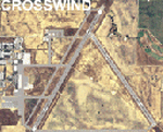
This scenery contains several revised files for my previously uploaded California Central Coast sceneries CCFSXMSG.ZIP and CCFSXMS.ZIP. These are the versions of my CCC scenery for FSX with MegaScenery Earth. The "G" version also requires Genesis Terrain Mesh but is the most complete version. Included here are revised AFCAD files for the major airports in those sceneries which will add interesting crosswind capability to C80, PRB, SBP, SMX and SBA airports. Additionaly, revised AFCAD and associated files for IZA, LPC, L52 and VBG are included. In some cases ground traffic has been added, a few glitches repaired and minor improvements effected. The crosswind AFCAD's for the 5 airports with tangential or crossing runways were revised using the technique developed by Jim Vile and executed by Airport Design Editor (ADEX). This procedure will unavoidably bolix up the ATIS runway advisories at the 3 tower controlled airports with ATIS (SBA, SBP and SMX) but will make all of the runways useable for AI traffic depending on wind conditions. This is not a problem at C80 and PRB since they are uncontrolled fields and have no ATIS available. Therefore, I've included revised AFCADs for SBA, SBP and SMX that do not have crosswind provisions that can be substituted if desired.
| Filename: | Crosswind_Runways_for_California_Central_Coast_Sce.zip |
| License: | Freeware |
| Added: | 7th January 2010, 22:05:25 |
| Downloads: | 515 |
| Author: | Al Wheeler |
| Size: | 194.42 KB |
| Category: Prepar3D V5 - AI Aircraft | |
| McDonnell Douglas DC-8 for AI Traffic (DWAI Models) |
|
Images related to this file:
File Description:

McDonnell Douglas DC-8 for AI Traffic (DWAI Models). This is the P3Dv4.5/5.2 conversion of Dee Waldron's entire DC-8 family of models for AI traffic, with permission kindly given by Dee Waldron. These models are intended as a stop-gap measure until a new DC-8 family specifically modeled for the 64-bit sims comes along, and I may have something to do with that this fall. This package has all seven of Dee's original models, and includes DC-8-12, DC-8-52, DC-8-61, DC-8-62 (two different model versions), and DC-8-63. I have also added in a small collection of the paints I have done over the years. Five main aircraft variants with a total of six models and 61 repaints are included here. This is only meant to get the AI DC-8 into the 64-bit sims, and I pretty much did straight conversions without too many upgrades. However, these aircraft, with special instructions included, are compatible with all prior paints available in the usual places. Original aircraft by Dee Waldron et. al, MCX and RADiator utilites by Arno Gerretsen, P3Dv4/5 conversion and all release repaints by Michael Pearson.
| Filename: | McDonnell_Douglas_DC8_for_AI_Traffic_DWAI_Models.zip |
| License: | Freeware, limited distribution |
| Added: | 5th September 2021, 16:55:35 |
| Downloads: | 260 |
| Author: | Michael Pearson |
| Size: | 20.64 MB |
| Category: Flight Simulator X - Scenery | |
| Iguassu Falls - Save The Planet |
|
Images related to this file:
File Description:
The Iguassu Falls, Itaipu Hydroelectric Power Plant, Foz do Iguassu City and Land Class Package for FSX
Save The Planet is my version of the Iguassu Falls, Itaipu Dam, bridges and landclass scenery for FSX.
Differently from my other version for MSFS 2004, I created a mesh of 5 meter resolution for Iguassu Falls area
to give me some idea how I could proceed. So, I decided to use on this addon
an image background avaliable at server (VirtualEarthSatellite). Thanks Microsoft.
Non-Airport Scenery - ICAO (SBFI). coming soon at www.Terra-Brasilis.org
Portuguese: Cataratas do Iguassu,
Spanish: Cataratas del Iguazu are waterfalls of the Iguassu River located on the border of the Brazilian state of Parana (in the Southern
Region) and the Argentinian Province of Misiones.
The Falls are shared between the Iguazu National Park (Argentina) and Iguacu
National Park (Brazil). The parks were designated UNESCO World Heritage Sites.
The Itaipu Hydroelectric Power Plant is located in the Parana River, in the stretch of the frontier between Brazil and Paraguay, 14 km north of the Friendship Bridge.
The area of the project extends from Foz do Iguassu, in Brazil, and Ciudad del Este, in Paraguay, in the south, up to Guaira (Brazil) and the Guaira Falls (Paraguay), in the north.
Enjoy FSX Iguassu Falls Scenery!
| Filename: | Iguassu_Falls__Save_The_Planet.zip |
| License: | Freeware |
| Added: | 9th December 2010, 01:57:00 |
| Downloads: | 2,852 |
| Author: | Cicero Costa |
| Size: | 31.71 MB |
| Category: Flight Simulator X - Gauges | |
| Advanced Radar System (ARS) |
|
Images related to this file:
File Description:
This Advanced Radar System (ARS) Version 1.0 displays AI traffic of FSX in a range of
5, 10, 20, and 40 miles.The ARS contains an AI tracking function, which allows you
to follow a selected AI automatically in terms of course and speed. In this mode
the ARS is coupled with the autopilot of your aircraft. The ARS feeds the
autopilot with the AI heading and speed data. The tracking mode can be
switched on or off.
An air fuel gauge is included in the ARS package also, which allows you to
perform an air re-fuel procedure for your aircraft. A air refueling can be done
from each AI aircraft if you have decided to use it as your tanker. The decision
will be done via a select function from the ARS panel and in addition via a
dedicated activation on the air fuel panel.For installation, look at the ARS_DOC folder.
(the folder is now included in the zip !!!!!!!!!! It was not in the previous upload. Sorry!)
COPYRIGHTS
This gauge is freeware. All rights are reserved and no part of the package may
be duplicated or distributed without the expressed, written permission of the
author.
CREDIT goes to: Bob Familton for his review of the documentation and testing
for SP1 FSX.
| Filename: | Advanced_Radar_System_ARS.zip |
| License: | Freeware |
| Added: | 2nd February 2011, 20:33:29 |
| Downloads: | 2,886 |
| Author: | Dietmar Loleit |
| Size: | 1.05 MB |
| Category: Prepar3D V5 - Scenery | |
| VOMM_P3Dv5 |
|
File Description:
Chennai International Airport (IATA: MAA, ICAO: VOMM) is an international airport serving the city of Chennai, Tamil Nadu, India, and its metropolitan area. It is located in Tirusulam, 21 km (13 mi) from the city centre. Chennai International Airport is the third busiest in international traffic and cargo capacity in the country behind New Delhi and Mumbai.[4][5] It is also 49th busiest airport in Asia making it one of the four major airports in India under the top 50 list.[6] The airport is served by the airport metro station of the Chennai Metro and the Tirusulam railway station of the Chennai Suburban Railway system. To cope with the passenger traffic, two new terminals, namely, T2 and one satellite terminal, are under construction to handle 40 million passengers per year.[7] Once completed, it will be India's first airport to have a satellite terminal. The new satellite terminal will be connected through a four way underground walkalator for passenger movement across different terminals.[8] Still, the Tirusulam airport complex is expected to reach saturation by 2035, with a peak capacity of 40 million passengers, and a proposal for a new greenfield airport in Chennai is underway for decades. Once the new airport is commissioned, both the airports will be functional.
| Filename: | VOMM_P3Dv5.zip |
| License: | Freeware |
| Added: | 20th October 2020, 23:18:27 |
| Downloads: | 1,399 |
| Author: | Abhishek Banerjee |
| Size: | 14.68 MB |
| Category: Flight Simulator X - Gauges | |
| V-One Gauge for Boeing 707-300 Complete |
|
Images related to this file:
File Description:
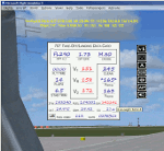
This gauge is specifically written for Captain Sim B707-300 and variants.
List of features: [New Items/Features]
Twenty-Two call-outs sounds integrated into gauge [15 new call-outs].
Take-off V-Speeds calculated for Flaps 14 with temperature and altitude adjustments.
[Take-off speed bugs automatically set for: V1, VR, V2].
[Flaps-up maneuvering speed (clean speed) bug set after flaps-up].
Optimum altitude and optimum EPR (EPR calc for M.80) are continually calculated.
Gross Weight overage will display in 'red' text. Tooltip indicates overweight value (LB/KG).
Take-off trim calculated for current gross weight.
Display units can be toggled between LB and KG (default LB).
Outside Air Temperature can be toggle between Fahrenheit and Celsius.
Resettable fuel use.
Resettable flight timer.
[Selectable Vref landing configurations, Vref40 (default) or Vref50].
[Approach / landing speed bugs automatically set for: Vref, Vref + 5, Vref + 10].
ZFW, Fuel, CG, Gross Weight and Barometric Pressure MSL (QNH) displayed.
['Barometer Set' call-out occurs when pressing keyboard letter 'B' (V-One gauge must be open)].
[Decision Height adjustment now on Data Card in hidden click-spot located on upper right corner].
[Now installation to a single location will work for all variants].
| Filename: | VOne_Gauge_for_Boeing_707300_Complete.zip |
| License: | Freeware, limited distribution |
| Added: | 3rd February 2013, 00:11:24 |
| Downloads: | 2,453 |
| Author: | Paul Tally |
| Size: | 3.14 MB |
| Category: Flight Simulator 2004 - Scenery Design | |
| Global Aviiation Forestyr Services - Outpost #01 - |
|
File Description:
Global Aviation Firebase Operations - Outpost #01 - Stevensville, Montana.
Global Air Foresty Services (G.A.F.S.) is a subsidiary of the Global Aviation Network Corporation located just a few miles North/North East of Corporate Head Quarters near KFCA - Glacier Park International.
Global Aviation Fire Supersion Services,in fictional partnership with the U.S.F.S. provides both AIR & HELO Attack & Supression Services throught the state of Montana. The services are primarly limited to Fire Attack/Supression, but might include other services; Such as: Medivac, Medical Transportation Services (limited services), Search and Rescue, Deep or High Mountain Rescue, Natural Disaster Support & Relief.
Partnership and Mutial Aid agreements with neighboring states, and Canada have allowed extended operatonial options, as well extending many other roles they could be called upon from time to time.
For current versions or updates please check: http://www.globalaviationnetwork.org - Schedualed Base Releases will be posted soon, who knows- got any suggestions? for a great location? your selection could be picked! Outpost #1 is one of the 29 more Outpost/Bases to come- scattered thought the Whole state of Montana! For schedualed FREE releases keep watch and checks
| Filename: | Global_Aviiation_Forestyr_Services___Outpost_01_.zip |
| License: | Check within download |
| Added: | 22nd May 2007, 02:55:03 |
| Downloads: | 699 |
| Author: | Tobey "-Mort-" Ford |
| Size: | 17.22 MB |
| Category: Flight Simulator 2004 - Aircraft Repaints, Textures and Modifications | |
| DARDANELAIR Beechcraft B1900 Fleet |
|
File Description:
This is the fleet of DARDANELAIR VIRTUAL airlines Beechcraft B1900. You must have PMDG B1900D to use these repaints. There are fourteen B1900 in the fleet of airlines. The names of airplanes get their names from the places of Çanakkale (except some). B1900 is the main and the most important aircraft of the fleet. DARDANELAIR pilots fly with B1900 in special events or fly-inns. DARDANELAIR VIRTUAL is the first regional virtual airlines of the Republic of TURKEY. DARDANEL is the ancient name of ÇANAKKALE. It was founded on 1 March 2007. DARDANELAIR VIRTUAL is a group of independent virtual pilots. The aims of airline are to help the development of virtual aviation community (especially in Turkey), to educate new virtual pilots, to give opportunities to the virtual pilots in order to improve themselves and to share new information about aviation among all people who fall in love with aviation. You can visit our main web page and forum by using www.dardanelairva.com and www.dardanelairva.com/forum/ links.
| Filename: | DARDANELAIR_Beechcraft_B1900_Fleet.zip |
| License: | Freeware |
| Added: | 31st July 2007, 11:45:15 |
| Downloads: | 360 |
| Author: | Serkan SAYINER |
| Size: | 48.05 MB |
| Category: Flight Simulator X - Flight Plans | |
| When The Land Trembles |
|
File Description:
At 8:46 A.M. a 6.2 in the Richter Scale Earthquake hit the western mountains of Guatemala, Central America.
Two Flight Routes have been set up by the Civil Defence and SAR authorities. They use
two airports to reconnoiter their respective areas. It has been reported that two mines
in the western Pine Mountains have been heavely hit and in Mine 1( Socrates Fer Coal Ltd ) there are some
wounded miners which must be picked up. Mine 2 (Ductil Ltd.Mine No.33) has been totally abandoned and
must be looked at for important documentation pertaining to security (?)
You can choose RED FLIGHT, where you will use a good transport aircraft, since you must pick up
the wounded and others---- or BLUE FLIGHT which is a " reconnaissance" flight out to a lake area and access
the damage as well as land and bring radio communications equipment to the communities.
Either way, this is dangerous stuff-----are your wits ready for such flying tasks?????----By the way, Dr. Lalita
Mazsis is counting on you to fly her safely....OH Boy!!!!!!!!------
| Filename: | When_The_Land_Trembles.zip |
| License: | Freeware, limited distribution |
| Added: | 19th October 2007, 21:11:11 |
| Downloads: | 675 |
| Author: | Gera Godoy C |
| Size: | 449.4 KB |


© 2001-2026 AVSIM Online
All Rights Reserved
Privacy Policy |