
Where Flight Simulation Enthusiasts Gather from Around the World!
AVSIM Library - Search Results

| Category: Flight Simulator X - Scenery | |
| USCG Air Station Kodiak Alaska PADQ Scenery Package with AI Aircraft |

|
Images related to this file:
File Description:
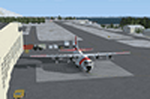
Thanks to Airport Design Editor(ADE), Military AI Works (MAIW) scenery and aircraft, along with AI Flight Planner3 (AIFP3), I did my best to re-create USCG Air Station Kodiak for FSX. Creating this airport scenery was my first BIG (for me) project in ADE, but thanks to MAIW and their Global Scenery Library Objects, I think I've succeed in re-creating the airbase. You'll need to go to MAIW's website and download the "Global Scenery" package for any of this to work for you, so I've copied that website link below (in STEP 1). I also painted Kodiak markings onto all the MAIW AI Aircraft for added realism.
And just for fun, I placed a USCG Cutter and a "fishing boat in distress" (complete with green smoke) out in the harbor as a "Practice Recue Scenario". The Cutter has a "hard deck" to land on and I've also illuminated both it and the Fishing boat for DUSK and NIGHT practice.
| Filename: | USCG_Air_Station_Kodiak_Alaska_PADQ_Scenery_Packag.zip |
| License: | Freeware |
| Added: | 31st January 2021, 06:43:03 |
| Downloads: | 1,010 |
| Author: | Daniel W Gregory |
| Size: | 25.65 MB |
| Category: Flight Simulator X - Scenery | |
| Iguassu Falls - Save The Planet |
|
Images related to this file:
File Description:
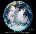
The Iguassu Falls, Itaipu Hydroelectric Power Plant, Foz do Iguassu City and Land Class Package for FSX
Save The Planet is my version of the Iguassu Falls, Itaipu Dam, bridges and landclass scenery for FSX.
Differently from my other version for MSFS 2004, I created a mesh of 5 meter resolution for Iguassu Falls area
to give me some idea how I could proceed. So, I decided to use on this addon
an image background avaliable at server (VirtualEarthSatellite). Thanks Microsoft.
Non-Airport Scenery - ICAO (SBFI). coming soon at www.Terra-Brasilis.org
Portuguese: Cataratas do Iguassu,
Spanish: Cataratas del Iguazu are waterfalls of the Iguassu River located on the border of the Brazilian state of Parana (in the Southern
Region) and the Argentinian Province of Misiones.
The Falls are shared between the Iguazu National Park (Argentina) and Iguacu
National Park (Brazil). The parks were designated UNESCO World Heritage Sites.
The Itaipu Hydroelectric Power Plant is located in the Parana River, in the stretch of the frontier between Brazil and Paraguay, 14 km north of the Friendship Bridge.
The area of the project extends from Foz do Iguassu, in Brazil, and Ciudad del Este, in Paraguay, in the south, up to Guaira (Brazil) and the Guaira Falls (Paraguay), in the north.
Enjoy FSX Iguassu Falls Scenery!
| Filename: | Iguassu_Falls__Save_The_Planet.zip |
| License: | Freeware |
| Added: | 9th December 2010, 01:57:00 |
| Downloads: | 2,849 |
| Author: | Cicero Costa |
| Size: | 31.71 MB |
| Category: Flight Simulator 2004 - Scenery | |
| CYHD - Dryden Regional - Ontario, Canada * Updated v2 * |
|
Images related to this file:
File Description:
This greatly modifies my previous (2009) post of Dryden; this version has bespoke buildings and is stand-alone and does not require you to have the previous post. There will also be follow-up posts of Sioux Lookout and Geraldton. Dryden is in northern Ontario, 110 miles east of the Manitoba border, 40 miles west of Sioux Lookout, and with the US border 90 miles to the south. The town is on the northern shore of Wabigoon Lake and has a population of around 7,800. The main business is pulp and paper, along with agriculture, tourism, and mining. The airport is 5 miles northeast of the town.
Dryden Regional has 6,000' of asphalt which in FS9 is aligned 11-29. The second runway is compacted sand 2,000' long and aligned 05-23. There are two aprons, the western being for the terminal building and some ga parking, and the eastern larger and used in the summer for parking fire fighting planes, along with maintenance hangarage and accomodation etc. The Ontario Fire Service planes were included with my original Geraldton post and are included here again; they fly back and forth and keep Dryden busy along with several Bearskin Airlines and Perimeter Aviation flights.
| Filename: | CYHD__Dryden_Regional__Ontario_Canada___Updated_v2.zip |
| License: | Freeware, limited distribution |
| Added: | 16th March 2013, 09:59:52 |
| Downloads: | 595 |
| Author: | Roger Wensley |
| Size: | 26.99 MB |
| Category: Flight Simulator 2004 - Scenery | |
| Watson Lake CYQH and CEJ9 in the Yukon Territories, Canada |
|
Images related to this file:
File Description:
Watson Lake is at 2,200 feet asl on the east side of the Rockies, in the Yukon Territories. The town is less than five miles north of the border with BC and is built around Wye Lake, just a few miles southeast of the much larger Watson Lake. Whitehorse is some 200 miles to the west, and Fort Nelson 220 miles to the east. The airport was built during WW2 and there remains one surviving original hangar, along with later additions. Unusually, the town of Watson Lake came into being because of the airport's existence, though with the closure of one mine that the airport used to serve and the serial closure of another (closed four times?) both the airport and the town (population 500) are in a downward spiral. The airport is 5 miles to the west of the town. There were two runways, but one is now closed and the remaining one is 08-26, 5,500 feet and 150 feet wide. There are two aprons, the northern one being half-used by CL 415 fire-fighting planes (included in the AI, along with Central Mountain Air). All the buildings for CYQH are modeled specifically, but the CJE9 shed is a guess.
| Filename: | Watson_Lake_CYQH_and_CEJ9_in_the_Yukon_Territories.zip |
| License: | Freeware, limited distribution |
| Added: | 14th July 2014, 21:38:57 |
| Downloads: | 443 |
| Author: | Roger Wensley |
| Size: | 17.6 MB |
| Category: Flight Simulator X - Original Aircraft | |
| ARX-5X Coyote, Version 2.1 |
|
Images related to this file:
File Description:

The ARX-5X (Concept 5) is a single-seat unlimited category aerobatic aircraft built around the 495c.i. 600hp Trace-Orenda OE600 V-8 aircraft engine and designed specifically for freestyle airshow type aerobatics.
Version 2 has a totally new airfile and flight dynamics - the plane can easily handle compulsory competition maneuvers as well as more advanced gyroscopic maneuvers such as lomcovaks and tumbles.
The ARX-5X cruises around 200kts, with a never-exceed speed of 240kts. This FSX native model contains animations, reflections, environment mapping, spec mapping and a full dynamic virutal cockpit. Although it is not a real aircraft it does have several real-world components such as the Chelton Fligh Systems EAU (engine airdata unit) display, and a Hartzell "scimitar" swept blade propeller.
This release is not a quick & dirty update simply "ported" into FSX, it is a full FSX rebuild by the original authors, compiled with XtoMDL and conforming the FSX SDK using dds textures and new modeling techniques for the best overall end-user performance. Includes 2 configs, 7 models, and 20 schemes with a custom smoke system and night time pyrotechnic effects. Aircraft, effects, and panel by Jason L. Terry and Mike VIvaldi. Aditional Skins by Brady Duros and Joshua B. Nyhus.
| Filename: | ARX5X_Coyote_Version_21.zip |
| License: | Freeware |
| Added: | 21st September 2012, 12:42:46 |
| Downloads: | 1,206 |
| Author: | Jason L. Terry, Mike Vivaldi, Josh Nyhus, Brady Duros |
| Size: | 41.04 MB |
| Category: Flight Simulator 2004 - Scenery | |
| Komakuk Beach & Storm Hills DEW sites in Yukon and Northwest Territories, Canada |
|
Images related to this file:
File Description:
These are DEW line sites in northern mainland Canada, to the west of Tuktoyaktuk.
Komakuk Beach CWKB is not included in FS9 and is in the Yukon, only 20 miles from the Alaska border. It is, as the name suggests, close to the sea, and the gravel runway 3,600' by 125' has its western end almost on the beach.
There is no lighting and no signage and the airfield is officially listed as closed, but in fact is used during the annual maintenance and refuelling of the automated NWS (North Warning Station) close by and for any unscheduled servicing. This replaced the previous much older DEW station that was manned year round and had a lot more buildings.
Storm Hills CWSH is in the Northwest Territories, 43 miles south-southwest of Tuktoyaktuk, up on higher land at 810 feet ASL. The NWS (there was no previous DEW station at this site) is serviced by helicopter from Tuktoyaktuk and has a gravel landing pad on the north side of the station. It will show on a gps and it is 5 miles west of the distinctively shaped and large Parsons Lake. This too was not in FS9.
| Filename: | Komakuk_Beach__Storm_Hills_DEW_sites_in_Yukon_and_.zip |
| License: | Freeware, limited distribution |
| Added: | 16th July 2012, 18:56:09 |
| Downloads: | 306 |
| Author: | Roger Wensley |
| Size: | 1.68 MB |
| Category: Flight Simulator 2002 - Scenery | |
| Redding Municipal Airport.. Redding, CA |
|
File Description:
KRDD(Redding Municipal Airport) is located in the beautiful city of Redding Ca. Redding is a city located in Shasta County 150 mile's north of Sacramento on Interstate-5. Redding is known as a gateway for recreation for those visiting this Northern Ca. city, Lake Shasta and Mt Lassen are just a short drive out of town. As a former resident of Redding I drove past KRDD on a daily basis,on a couple of occasion's I had the opportunity to attend the annual Redding Airshow. The airshow play's host to many of aviations finest stunt pilot's as well as one of many military jet flying team's, the USN Blue Angels have been guest of the airshow many time's. The airshow still runs to this day. KRDD is also a destination city for several major and regional air carriers, HorizonAir and United Skywest are among them. This scenery I have done as a tribute to the many mile's I have put on driving past it as well as an opportunity to give it some dignity amongst the many airports in MSFS2002. This is also my first airport project I have released. My hope is that it adds to your FS2002 experience.
| Filename: | Redding_Municipal_Airport_Redding_CA.zip |
| License: | Freeware |
| Added: | 22nd November 2002, 04:37:21 |
| Downloads: | 621 |
| Author: | Randall R Smith |
| Size: | 557.2 KB |
| Category: Flight Simulator 2002 - Scenery | |
| Redding Muni - Redding Ca. KRDD |
|
File Description:
KRDD(Redding Municipal Airport) is located in the beautiful city of Redding Ca. Redding is a city located in Shasta County 150 mile's north of Sacramento on Interstate-5. Redding is known as a gateway for recreation for those visiting this Northern Ca. city, Lake Shasta and Mt Lassen are just a short drive out of town.
As a former resident of Redding I drove past KRDD on a daily basis,on a couple of occasion's I had the opportunity to attend the annual Redding Airshow. The airshow play's host to many of aviations finest stunt pilot's as well as one of many military jet flying team's, the USN Blue Angels have been guest of the airshow many time's. The airshow still runs to this day. KRDD is also a destination city for several major and regional air carriers, HorizonAir and United Skywest are among them.
This scenery I have done as a tribute to the many mile's I have put on driving past it as well as an opportunity to give it some dignity amongst the many airports in MSFS2002. This is also my first airport project I have released.
My hope is that it adds to your FS2002 experience.
| Filename: | Redding_Muni__Redding_Ca_KRDD.zip |
| License: | Freeware |
| Added: | 12th February 2003, 22:43:12 |
| Downloads: | 726 |
| Author: | Randall R Smith |
| Size: | 557.2 KB |
| Category: X-Plane - Miscellaneous Files | |
| Thrust SSC |
|
File Description:
Thrust SCC (speed of sound car) X-Plane � 6.40
Originally developed for x-plane 5, now updated to 6.40. The whole idea of this vehicle is to break the sound barrier without taking off. In 1997 the British in a Richard Noble car driven by Andy Green set a new unlimited Land Speed Record and officially broke the sound barrier on land for the first time with a record speed of 763.035 (Mach 1.0175). Two runs were made. The first was 759.333 MPH, at Mach 1.015. The all-important backup run was made within the hour, at 766.609 MPH, which is Mach 1.020. A goal that many among us had thought unattainable has been reached. And now, if you want to set a new world unlimited land speed record, you're going to have to break the sound barrier first. For more on the LSR see my web page �. http://members.rogers.com/appster�.. This is a take off of the British car that did the job with the help of 2 F4 Phantom jet engines. Find a flat piece of land and this car can do as much as mach 1.4 or 1.6. The trick is to get stopped before you run out of real estate.
| Filename: | Thrust_SSC.zip |
| License: | Freeware, limited distribution |
| Added: | 24th January 2003, 03:13:15 |
| Downloads: | 260 |
| Author: | Robert L. App |
| Size: | 262.48 KB |
| Category: Flight Simulator 2004 - AFCAD Files | |
| ***AFCAD SMOOTH for Major Airports! Vienna Schwechat ( LOWW / VIE )*** |
|
File Description:
AFCAD SMOOTH is a normal AFCAD File for Major Airports such as Frankfurt, London LHR
or Paris CDG but all the taxiways have been totally reworked in order to get the most smoothest
AI Traffic on ground you will ever have. To achive this all the new created taxiways have nothing
in common with the original one for an airport. The new taxiways have been created
in a way to allow the smoothest traffic on ground, without traffic jam, conflict alerts
and also without planes staying almost 5 minutes at one point due to heavy traffic and finnaly
disappear. All this has been resolved.
In addition to this the parking positions have been created in a very very orderly way
with as much positions as possible. The gates are almost the same as in reality only with minor changes.
I also added missing ILS to airports like LIMC (RWY 17R) This File is only recommended for virtual pilots
who can call a huge amount of AI Traffic their own and who prefer smooth traffic instead an accurate taxiway system
compared to the real airports one.
In addition I recommend you AI Seperation (available at avsim), one of the best freeware AI Traffic
Management Tools for traffic on ground and in the air as well.
| Filename: | AFCAD_SMOOTH_for_Major_Airports_Vienna_Schwechat__.zip |
| License: | Freeware |
| Added: | 2nd July 2008, 15:33:25 |
| Downloads: | 2,181 |
| Author: | Dave Sheffield |
| Size: | 11.39 KB |


© 2001-2026 AVSIM Online
All Rights Reserved
Privacy Policy |