
Where Flight Simulation Enthusiasts Gather from Around the World!
AVSIM Library - Search Results

| Category: Flight Simulator X - Gauges | |
| Advanced Radar System 4 (ARS4) |

|
Images related to this file:
File Description:
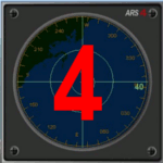
This gauge has been developed for FSX Flight Simulator SP1 or SP2. It
has also been tested with Microsoft Acceleration also, but compatibility is not guaranteed by the author.
This new Advanced Radar System (ARS 4) includes significant new features,
functions and displays for FSX AI traffic. The new key features are:
1)AI traffic display for air targets and boat/ship targets.
2)Auto landing on carrier if the carrier is part of the scenery MECOPS.
3)Allows switching between air target display and boat target display.
4) Provides for air and boat display to optionally insert airport and/or basic terrain display on the screen.
5)Different screen presentations for air and boat targets.
6)Simplified installation procedure.
7)The A2A re-fuel function remains the same as in the ARS2 version.
8)The auto tracking function remains the same as well as in the ARS2 version.
All displays for air, or boat/ship traffic, can be selected in a range of 5, 10, 20, and 40 miles.
For installation and additional information look at the ARS4 documentation inside the zip file. For copyrights and credits please look at the documentation for this gauge.
| Filename: | Advanced_Radar_System_4__ARS4.zip |
| License: | Freeware |
| Added: | 5th March 2013, 15:53:52 |
| Downloads: | 3,816 |
| Author: | Dietmar Loleit |
| Size: | 1.18 MB |
| Category: X-Plane - Aircraft Repaints, Textures and Modifications | |
| 'Breitling' Piper Tomahawk |
|
Images related to this file:
File Description:
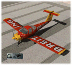
This is a livery-paint for the Piper Tomahawk (model for X-Plane made by AWALL86.) X-Plane 9 >>
Download the original model by AWALL86 here: http://forums.x-plane.org/index.php? app=downloads&showfile=11697
I deeply fell in love with this lovely bird,
Painting it has its limitations, nevertheless this was really a challenge, doing some almost impossible paint-things.
This skin depicts the original within the limitations of this model as far as I was able to do.
This set includes normalfiles with speculars for plane, interior and pilot.
It also includes a customised walnut-panel (for the 3D cockpit-panel only).
Doing research for this project, I met Charlotte Forrestier, the lovely Swiss lady-pilot.
How to make a nice looking woman from an ugly male pilot ?
Never ever expected to do that kind of job.
Well ..... please meet Charlotte !!!
Building-in this livery:
Unzip this upload to a temp. folder.
Copy the folder named Piper Tomahawk Breitling from this download into the LIVERIES-folder of
the airplane..
Copy the files named obj3.obj and obj3_NML.png into the main OBJECTS-folder.
Placing these two files here will have NO influence on the existing liveries.
They will only enhance the beauty of Charlotte Forrestier, our female pilot for the Breitling Tomahawk.
Have fun
Leen "Flybike" de Jager
http://www.flybike-paints.nl
| Filename: | Breitling_Piper_Tomahawk.zip |
| License: | Freeware, limited distribution |
| Added: | 25th June 2013, 16:26:33 |
| Downloads: | 126 |
| Author: | Leen "Flybike" de Jager |
| Size: | 12.03 MB |
| Category: Flight Simulator X - AFCAD Files | |
| Paramount Air Airport JY04 , NJ |
|
File Description:
Located 01 miles N of Green Creek, New Jersey on 20 acres of land, Paramount Air Airport is a private turf strip 2000' in length, although about 300' of it at the end of Runway 32 isn't in the best shape. The runway is 100' wide but closely hedged in by trees along both sides for the length of the runway. A hangar is past the end of Runway 14 but no services are offered for transient aircraft. Still, you can choose to start parked at the hangar if you wish. There is no hard surfaced runway so having your terrain mesh set as high as possible is recommended. No windsock is present, so know your weather (KWWD is very close by) and the airport is unlit so daytime VFR operations only are recommended.
Scenery constructed with use of satellite images/streetview/aerial photos - the author has not been there in person.
This scenery is meant to be used in conjunction with MegaScenery Earth New Jersey/Delaware 005. It is not required, but apron use is minimized to allow satellite scenery to show through as much as possible, and objects are placed based on the MSE textures - lack of it may make scenery look out of place.
| Filename: | Paramount_Air_Airport__JY04__NJ.zip |
| License: | Freeware |
| Added: | 20th April 2011, 16:42:48 |
| Downloads: | 179 |
| Author: | Drew Sikora |
| Size: | 418.37 KB |
| Category: Flight Simulator X - Original Aircraft | |
| ARX-5X Coyote, Version 2.1 |
|
Images related to this file:
File Description:
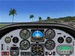
The ARX-5X (Concept 5) is a single-seat unlimited category aerobatic aircraft built around the 495c.i. 600hp Trace-Orenda OE600 V-8 aircraft engine and designed specifically for freestyle airshow type aerobatics.
Version 2 has a totally new airfile and flight dynamics - the plane can easily handle compulsory competition maneuvers as well as more advanced gyroscopic maneuvers such as lomcovaks and tumbles.
The ARX-5X cruises around 200kts, with a never-exceed speed of 240kts. This FSX native model contains animations, reflections, environment mapping, spec mapping and a full dynamic virutal cockpit. Although it is not a real aircraft it does have several real-world components such as the Chelton Fligh Systems EAU (engine airdata unit) display, and a Hartzell "scimitar" swept blade propeller.
This release is not a quick & dirty update simply "ported" into FSX, it is a full FSX rebuild by the original authors, compiled with XtoMDL and conforming the FSX SDK using dds textures and new modeling techniques for the best overall end-user performance. Includes 2 configs, 7 models, and 20 schemes with a custom smoke system and night time pyrotechnic effects. Aircraft, effects, and panel by Jason L. Terry and Mike VIvaldi. Aditional Skins by Brady Duros and Joshua B. Nyhus.
| Filename: | ARX5X_Coyote_Version_21.zip |
| License: | Freeware |
| Added: | 21st September 2012, 12:42:46 |
| Downloads: | 1,207 |
| Author: | Jason L. Terry, Mike Vivaldi, Josh Nyhus, Brady Duros |
| Size: | 41.04 MB |
| Category: Flight Simulator X - Scenery | |
| YTTI Troughton Island, Western Australia |
|
File Description:
YTTI Troughton Island - ShoreAir operates Troughton Island airstrip as an alternate to Mungalalu-Truscott. It has a 980m x 30m unsealed runway. Troughton Island sits 6 metres above sea level on a natural reef. Troughton is managed by two people who spend one month at a time on the island. During that time they are almost completely isolated from the outside world. Although they are isolated they are not alone; previous occupants of the island brought in quails and children's pythons that were once pets that escaped their cages during a cyclone. Now there is a healthy population of snakes living off the quails. Today Troughton Island is maintained as an emergency landing area for aircraft that are unable to reach Truscott. It also serves as a landing area if Truscott is inaccessible due to weather conditions. The Bureau of Meteorology has a weather station on Troughton island. Mungalalu-Truscott aerodrome supports all the FPSO (floating production storage and offloading facility) operations in the WA and NT waters of the Timor Sea, while the alternate aerodrome at Troughton Island is 20 nautical miles north of the main air route to Timor Sea facilities. REQUIRES Blencowe_LibraryKit.zip
REQUIRES blencowe_librarykit_309494.zip (Available HERE)
| Filename: | YTTI_Troughton_Island_Western_Australia.zip |
| License: | Freeware |
| Added: | 28th February 2013, 14:01:54 |
| Downloads: | 279 |
| Author: | Alan Blencowe |
| Size: | 2.37 MB |
| Category: Flight Simulator 2004 - Scenery | |
| Port McNeill CAT5 in British Columbia, Canada |
|
Images related to this file:
File Description:
Port McNeill is at the northern end of Vancouver Island, on the coast and around 20 miles east of Port Hardy. The town population is just over 2,000 and the main industry is logging, followed by sand and gravel quarrying and exporting for the construction industry. Tourism rates third.
The airport, a mile or so east of the town, provides a swift connection for nearby islands and the surrounding area to the rest of the west coast, and serves as the HQ main base for West Coast Helicopters. Their newly built large hangar and office accommodation is next to their older hangar to one side of the central public parking area, opposite the club house cum terminal and hangars. There are two runways: 06-24 which is asphalt, 2,400 feet long, and lit; and 11-29 of gravel, 3,650 feet long and also lit. There is some taxiway lighting, but not, for instance, for the connection between runways, which is in real life a ramp up to the gravel runway which is 15 feet higher. There are no regularly scheduled flights and traffic consists mainly of the West Coast helicopters, plus GA and irregular charters, the latter being mostly from Port Hardy.
| Filename: | Port_McNeill_CAT5_in_British_Columbia_Canada.zip |
| License: | Freeware, limited distribution |
| Added: | 18th November 2018, 05:49:13 |
| Downloads: | 138 |
| Author: | Roger Wensley |
| Size: | 13.29 MB |
| Category: Flight Simulator 2004 - Original Aircraft | |
| BAe 146-200 STA |
|
File Description:
A Military Airlift variant of the wellknow BAe-146-200 aircraft. Developed in the 1970's as a replacement for the RAF's strategic airlift capability, sadly the 146-STA never made it into production. This model features the distinctive re-fuel probe along the top of its fuselage , AIS components allowing cargo loading and the exclusive PUSHBACK feature. 2 texture sets are included depicting the protype aircraft, and a version in RNZAF livery. 8 variants are included for maximum flexibility for users, along with extensive check list information. The package is complete with the new 146 v3.0 Panel by Matthias Lieberecht. This new version now has complete working electric, hydraulic,fuel and pressurization systems to name a few. All are based on the real world
systems found in the 146 and have been realised with the help of real world BAe 146 and ARJ pilots. A fully working APU and GPU (not just dummies) is also realized together with a real battery lifetime of 20 minutes. A 100 page PDF manual which is necessary to handle all the functions is included. FS2002 panel config files are also included.
Model, textures and basic panel by Jon Murchison. 146 V3 panel by Matthias Lieberecht.
| Filename: | BAe_146200_STA.zip |
| License: | Freeware, limited distribution |
| Added: | 12th April 2004, 01:26:24 |
| Downloads: | 33,477 |
| Author: | Jon Murchison and Matthias Lieberecht. |
| Size: | 7.69 MB |
| Category: Flight Simulator 2002 - Miscellaneous Files | |
| Active Camera 2002 version 1.1 |
|
File Description:
Active Camera 2002. With this module you can enable additional views in Microsoft Flight Simulator 2002. Several new camera views are selectable from the FS2002 - Options menu. When activated this module replaces the original tower and virtual cockpit views of FS2002. Features: fly by, approach and spotter view, mouse driven spot plane view, allows mouse panning and zooming in the VC, walking in the cabin, walking outside of the aircraft (ambient sounds like steps, wind and aircraft stress sounds), head latency function, pre-stall buffeting effect, ground turbulence effect, ability to save and call up to 10 presets of views in the VC per aircraft for an unlimited number of aircraft. This version replaces Active Camera 2002 (AC2002.zip) uploaded to the AVSIM library on 20 June 2003. Some users encountered troubles to "handle" the spot plane view parameters, got a trembling image in Spot plane view and could not pan. To make things more simple we added : " Use mouse in spot view", a new option in the AC2002 menu that enables the Active Camera Spot Plane view. If "Use mouse in spot view" is unchecked, THE FS DEFAULT SPOT PLANE VIEW is active. Bug corrected : sometimes recycling views from 2D to 3D jumped over the virtual cockpit. Updated shortcut table.
| Filename: | Active_Camera_2002_version_11.zip |
| License: | Freeware, limited distribution |
| Added: | 24th June 2003, 00:35:57 |
| Downloads: | 34,402 |
| Author: | Guillaume Darier and Serge Baye |
| Size: | 1.77 MB |
| Category: Flight Simulator 2004 - Scenery | |
| Komakuk Beach & Storm Hills DEW sites in Yukon and Northwest Territories, Canada |
|
Images related to this file:
File Description:
These are DEW line sites in northern mainland Canada, to the west of Tuktoyaktuk.
Komakuk Beach CWKB is not included in FS9 and is in the Yukon, only 20 miles from the Alaska border. It is, as the name suggests, close to the sea, and the gravel runway 3,600' by 125' has its western end almost on the beach.
There is no lighting and no signage and the airfield is officially listed as closed, but in fact is used during the annual maintenance and refuelling of the automated NWS (North Warning Station) close by and for any unscheduled servicing. This replaced the previous much older DEW station that was manned year round and had a lot more buildings.
Storm Hills CWSH is in the Northwest Territories, 43 miles south-southwest of Tuktoyaktuk, up on higher land at 810 feet ASL. The NWS (there was no previous DEW station at this site) is serviced by helicopter from Tuktoyaktuk and has a gravel landing pad on the north side of the station. It will show on a gps and it is 5 miles west of the distinctively shaped and large Parsons Lake. This too was not in FS9.
| Filename: | Komakuk_Beach__Storm_Hills_DEW_sites_in_Yukon_and_.zip |
| License: | Freeware, limited distribution |
| Added: | 16th July 2012, 18:56:09 |
| Downloads: | 309 |
| Author: | Roger Wensley |
| Size: | 1.68 MB |
| Category: Flight Simulator 2004 - Scenery | |
| PAAT (ATU) - Attu - Alaska, USA |
|
Images related to this file:
File Description:
Attu is AT the western end of the Aleutian chain of islands in Alaska, around 40 miles west of Shemya. There was small village on Attu before the Japanese invasion in mid 1942, but the island is now uninhabited. The Coast Guard Loran navigation station remains in place, though it is no longer in operation and visitors to the island are now either tourists or wildlife experts conducting surveys of numbers of nesting birds, etc. The runway still usable is aligned 02-20 and 5,800 feet long; right hand circuits on 02 to stay away from rising ground to the west. The "terminal" building has lost its sign regarding the Horny Bird, removed in 2010 by one of the last of the station operators, but the building is still there, as are some sheds and shacks that lately were used for the uncomfortable accommodation of bird counters. FS9 has used an incorrect icao identification for Attu but correcting it now would make life complicated so ATU it is and shall remain. I have removed the default FS9 roads that came complete with streetlights and telephone poles and replaced and amended the layout with gravel roads to better resemble real life, though the island shape is at best approximate, as is usual in FS9.
| Filename: | PAAT_ATU__Attu__Alaska_USA.zip |
| License: | Freeware, limited distribution |
| Added: | 2nd March 2015, 20:58:09 |
| Downloads: | 283 |
| Author: | Roger Wensley |
| Size: | 3.27 MB |


© 2001-2026 AVSIM Online
All Rights Reserved
Privacy Policy |