
Where Flight Simulation Enthusiasts Gather from Around the World!
AVSIM Library - Search Results

| Category: Navigation and ATC - Navigation | |
| Caribbean World Aeronautical Chart Chunks for FSMap |

|
File Description:
Sectional chart chunks made from the August 2009 Sectional charts at the original scale, formatted in the WGS84 lat/long geographic coordinate system for the FSMap, moving map application for flight simulation use.
Coverage is the Bahamas, Cuba, Jamaica, Haiti, the Dominican and the Guadeloupe island areas.
The chart chunks are baseline 8bit tiffs with packbit compression applied that are 2750x2480 pixels at about 6.5mb each. Also, included is the FSMap fsm Calibration file for importing. The Caribbean jpegs that were previously uploaded, I lowered the gamma quite a bit due to WAC being too harsh to view on the display. With these tiffs I left them as is, because of the dimming feature in the FSMap gauge, one of the many great features the FSMap package has to offer.
| Filename: | Caribbean_World_Aeronautical_Chart_Chunks_for_FSMa.zip |
| License: | Freeware |
| Added: | 19th March 2010, 01:16:53 |
| Downloads: | 780 |
| Author: | David Myers |
| Size: | 84.36 MB |
| Category: Flight Simulator X - Scenery | |
| RNAS Anthorn / HMS Nuthatch 1950's - Cumbria, UK |
|
File Description:
This scenery is a representation of RNAS Anthorn (HMS Nuthatch) after runway and taxiway upgrades completed in 1948. It is not 100% accurate and no claim is being made that it is.
The scenery was made using ADE and is intended for use in FSX along with Horizon GenX VFR scenery but should work ok in Basic FSX.
This is the third version and is an update of "rnas_anthorn__1950s.zip". The second version was incomplete when i uploaded it (apologies).
Changes are fairly minor and are limited to textures and a few building additions. ZipDive! for Images...
Requires "RAF Buildings" by Ted Andrews - "MBC Studios Object Library for FSX" - "UKVFR Add ons scenery". Also requires Heli Traffic 2009" for Helo AI to be displayed but not necessary for scenery to display.
| Filename: | RNAS_Anthorn__HMS_Nuthatch_1950s__Cumbria_UK.zip |
| License: | Freeware |
| Added: | 8th April 2015, 22:02:28 |
| Downloads: | 465 |
| Author: | Mark John Byers |
| Size: | 174.74 MB |
| Category: Flight Simulator 2002 - Scenery | |
| Add on for the Microsoft EAA Air Venture Scenery Package |
|
File Description:
The new EAA Airventure scenery that Microsoft released is a spectacular add on for FS 2002 but I felt it needed a little more "Eye Candy". I have added in new taxiways (the new photorealistic ones looked lousey from the ground) and a small represntation of the aircraft found on display. Also microsoft neglected a large part of Airventure... the Sea Plane base southeast of the field on Lake Winnabago. I have enhanced this area with static float planes, 2 docks and a small cabin. For those users with Lago Scenery Enhancer, more detail has been added including people in various places around the scenery and more trees at the seaplane base. I have also included an AFCAD file that will allow the AI Traffic to follow the taxiways and added several new parking areas.
| Filename: | Add_on_for_the_Microsoft_EAA_Air_Venture_Scenery_P.zip |
| License: | Freeware, limited distribution |
| Added: | 25th July 2002, 18:27:26 |
| Downloads: | 3,300 |
| Author: | Brian Gladden |
| Size: | 1.69 MB |
| Category: Flight Simulator 2004 - Scenery | |
| Replacement Overcast Water Texture |
|
File Description:
The default milky "white/green" texture is highly unrealistic in very grey overcast conditions such as we often find here in Europe. The replacement texture will change this to a more convincing "blue/grey" cast. Version 2 has a darker blue/grey than my version 1 and presents a more realistic colour and in particular it's much improved in "dark overcast" conditions. Version 2 also offers better transitions from "overcast" conditions to "clear" conditions. It should be understood the default "milky green - overcast water texture" colour is dependant on the display settings. The replacement texture supplied will only work on DX9 compliant video cards. You must be able to move the "Water Effects" slider all the way to the right! If not then don't install them as you won't be able to see them!
| Filename: | Replacement_Overcast_Water_Texture.zip |
| License: | Freeware |
| Added: | 22nd December 2003, 21:08:19 |
| Downloads: | 1,055 |
| Author: | Peter Wilding |
| Size: | 668.32 KB |
| Category: Flight Simulator X - Gauges | |
| Event Logger v2 |
|
File Description:
This is version 2 of a diagnostic gauge, targeted primarily at gauge and panel authors. It writes all Key_Events issued in FSX or FS9 to a log file, thus allowing the detection of repeating Key_Events which interfere with normal panel operation. It will not identify the gauge issuing the repeating Key_Events, but by identifying the Key_Events themselves, it should make the gauge issuing them somewhat easier to locate. If you have a panel which does not allow the selection of a second engine or exit, or which exhibits improper autopilot operation, this gauge may help you discover why. Updates include a displayed count of the number of Key_Events issued by the sim, along with a tooltip display of the most recently issued Key_Event. Code signed for use in FSX.
| Filename: | Event_Logger_v2.zip |
| License: | Freeware |
| Added: | 27th December 2006, 20:46:07 |
| Downloads: | 862 |
| Author: | Doug Dawson |
| Size: | 50.02 KB |
| Category: Flight Simulator 2004 - Flight Plans | |
| World Capital Tour |
|
File Description:
On this tour you will nearly visit all capitals in the world except for the capital or the country has no airport like Monaco.
The tour starts at Falklands and ends in New Zealand via South America, the Carribean, Central America, North America, Europe, Africa, Asia and Australia/Oceania. The tour is designed as a sightseeing tour, means the maximum distance is about 600 nm and you will fly at altitudes between 7000ft and 16000ft. Only at the Anden and Himalaya region the altitude will be higher.
The tour has approximately 290 legs and the total distance is 95400 nm.
The package includes the PLN files for all legs. Additionally there's an Excel-Sheet which you can use as a logbook and KLM files so you can display the tour on Google Earth.
| Filename: | World_Capital_Tour.zip |
| License: | Freeware |
| Added: | 5th January 2008, 22:10:59 |
| Downloads: | 1,426 |
| Author: | Wolfgang Schroeder |
| Size: | 1.41 MB |
| Category: Prepar3D V1-4 - Aircraft Repaints, Textures and Modifications | |
| Just Flight Avro Vulcan B. Mk2 XL426 (G-VJET) V2.0 |
|
Images related to this file:
File Description:
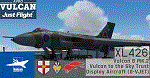
This is a repaint of the Justflight Vulcan as XL426 painted her current colors and owned by Vulcan Restoration Trust irl, a tone of Olive Drab Green and Grey Camo.
And with different tail emblems of both 617 and 9 Squadron, and the Vulcan Display Flight logo on the crew access door.
This livery is a more improved version of the stock XL426 Camo Livery that came with the base model. A
nd it matches with the real Vulcan XL426. This Requires the Just Flight's AVRO Vulcan B MK.2 Base Pack,
It is a must if you want to install this livery. Follow the instructions in the Readme txt file.
If you have any questions/comments or any problems while installing these livery/s, feel free to contact me on [email protected]
| Filename: | Just_Flight_Avro_Vulcan_B_Mk2_XL426_GVJET_V20.zip |
| License: | Freeware, limited distribution |
| Added: | 1st June 2020, 18:35:43 |
| Downloads: | 96 |
| Author: | Carl Lyndon F. Nepomuceno |
| Size: | 71.35 MB |
| Category: Flight Simulator 2004 - Scenery | |
| LIME Bergamo Orio al Serio 2021 |
|
Images related to this file:
File Description:
Bergamo Orio al Serio airport scenery for FS2004 users. In particular, attention was paid throughout the airport surface (taxiway, taxi signs, parking and runway) using satellite photos and the latest existing documentation from ENAV website to make the airport comply with the current situation. This is a revised and corrected version of the scenery replacing the previous (2017) one.
For proper display of all the objects included in this scenery it is
needed to have previously installed the following libraries:
EZ Scenery Library by David Grindele [ez_1.zip] (https://www.flightsim.com)
Rwy12 lib1, lib2, lib3 (http://flyawaysimulation.com/)
Lights SS V2 [lights_ss_v2.zip by Sidney Schwartz] (AVSIM Library)
FS2004/FSX MG Ezi Static Scenery Library 1 [mg__scenery_lib_obs_col_1.zip by Mark Griggs] (https://www.flightsim.com)
Small Airstrip Objects SS V1+ [small_airstrip_objects_ss_v1+.zip by Sidney Schwartz] (AVSIM Library)
| Filename: | LIME_Bergamo_Orio_al_Serio_2021.zip |
| License: | Freeware, limited distribution |
| Added: | 15th April 2021, 19:26:24 |
| Downloads: | 903 |
| Author: | Andrea Nardi |
| Size: | 22.96 MB |
| Category: Flight Simulator 2004 - Panels | |
| Golovin N93 and Solomon AK26 in Alaska |
|
Images related to this file:
File Description:
Golovin is a coastal fishing village 70 miles east of Nome and around 20 miles west of Elim, with a population of under 200. The village is a check point on the Iditarod race and the name originates from a Russian admiral in the far distant past. The airfield has a gravel runway which is over 4,000 feet long; the older runway amid the village housing is still visible but not usable. The majority of flights to and from the airfield originate in Nome, but there are also others to and from nearby fields such as Elim, Unalakleet, Shaktoolik, and Koyuk. The AI includes a daily ERA flight. Most flights to villages of this size are in fact not "scheduled", but are "air taxi" being used by three or four villagers to go supermarket shopping in a larger neighbouring town, which in this case is Nome. In many cases the numbers of flights to and from a village in a year average out to one a day. There is a further scenery included here, which is Solomon AK26. Solomon is around 40 miles west of Golovin and from 1898 was suppporting a gold mining operation on the Fish and Niukluk rivers further inland at Council. Solomon, and the airfield which obviously came later, gradually faded from use in competition with Nome, leaving almost nothing behind at Solomon by the 1980's except a gravel runway and the nearby Solomon roadhouse. There are other buildings near the airfield which appear to be new and in good condition, but their function is unknown to me. The Solomon terrain modifications and grass deletion bgl's did not function until loaded in a "Top" folder; this is unusual, and may be required only in my FS9 setup or in all situations. I have no way of knowing as I can only design for my situation. A note here about my scenery making. This is post number 503 and there will not be many more to follow this as I am almost at the end of the photos I either took or found for scenery purposes. There is a limit to what can be located online and I have already been making use of the little there is; eg Unalakleet. Post 520 is unlikely. So, if you are near an airport (preferably Canadian or Alaskan) and have a camera..... Let me know.
| Filename: | Golovin_N93_and_Solomon_AK26_in_Alaska.zip |
| License: | Freeware, limited distribution |
| Added: | 5th August 2019, 16:19:07 |
| Downloads: | 83 |
| Author: | Roger Wensley |
| Size: | 4.23 MB |
| Category: Prepar3D V1-4 - Utilities | |
| Flightplan Visualizer 1.8 |
|
Images related to this file:
File Description:
Flightplan Visualizer (FV) version 1.8.0. Copyright 2018 by Pelle F. S. Liljendal ([email protected]), all rights reserved.
FV comes with 300 Commercial-, and +380 BizJet AI pre-imported flightplans which the creators of those flightplans have gracefully allowed me to include with the installer, however you are able to import additional (AI) flightplans if you want to. Once imported these (AI) flightplans can be visualized on a map-view, and the user will be able to search accross all these. Hence you can use the program as inspiration as to which routes to fly. E.g. you can search across all imported flightplans to find all flights in an A321 flying into/out from LDDU, or simply to look for all flights in a Boeing 747-8F.
Simply run the included installer to install the software. The program will be installed into "C:\Program Files (x86)\Flightplan Visualizer" and all datafiles will be installed into: "C:\Users\[UserName]\AppData\Roaming\FlightplanVisualizer". The program comes with a full manual explaining everything, and a 2 page quick manual to get you started. The first 3 times you run the program the quick manual will automatically open. Lacking a “proper forum†I have - for now - setup a Facebook group for support. This group is called “Flightplan Visualizerâ€, and you can seek membership via this link: https://www.facebook.com/groups/FlightplanVisualizer/
If you are installing this version on top of a version prior to 1.7 the program will start slower than ususal and display a lot of warnings. This is because it fileformat of the pre-imported flightplans was changed between version 1.6 and 1.7, so starting version 1.8 it will update all flightplans (and in the progress it will display all those warnings). The next time you start FV you will no longer see this warnings as all flightplans will have become updated.
Pelle
| Filename: | Flightplan_Visualizer_18.zip |
| License: | Freeware, limited distribution |
| Added: | 16th December 2018, 01:30:27 |
| Downloads: | 330 |
| Author: | Pelle Liljendal |
| Size: | 24.48 MB |


© 2001-2026 AVSIM Online
All Rights Reserved
Privacy Policy |