
Where Flight Simulation Enthusiasts Gather from Around the World!
AVSIM Library - Search Results

| Category: Flight Simulator 2004 - AFCAD Files | |
| FlyTampa Dubai (OMDB) v2.1 |

|
Images related to this file:
File Description:
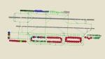
This high quality file is for the FS2004 Dubai scenery by FlyTampa. Features all gates in use, all coded for airlines that serve the airport. A total of 154 parking spots (T1, T2, T3, T4, Cargo, Overflow, VIP, EK Engineering) can be found at this airport and all will be used during busy periods, such as late at night! A full cargo area is also included, featuring correctly coded stands. North of the runways can be found Terminal 2, Fedex Cargo, DHL Cargo, UPS Cargo and GA ramps, plus an overflow area for the south cargo ramp. An extensive GA area (including Dubai Royal wing / VIP) can be found to the east of the airport, near Emirates engineering. This file replaces the one I released in 2005 (5687 downloads). Enjoy!!
| Filename: | FlyTampa_Dubai_OMDB_v21.zip |
| License: | Freeware |
| Added: | 28th December 2010, 03:35:28 |
| Downloads: | 5,569 |
| Author: | Lee Brompton |
| Size: | 2.18 MB |
| Category: Flight Simulator X - AFCAD Files | |
| KHSV Huntsville-Intl Airport with FAA 2008 Changes |
|
File Description:
This FSX AFCAD is the modified default airport KHSV-Huntsville Intl Airport located at Huntsville, Alabama. The AFCAD was modified using ADE v1.37 to include changes as per the FAA chart dated July 2008. The changes include a new control tower near the center of the East runway and a new taxi way "L" added to enable large cargo aircraft to taxi to U.S. Customs parking and take off using the extended runway 18R-36L. The origional control tower is still at the real airport.
Many thanks to Jon Masterson for his instructions of how to remove trees from texture squares which the new taxi way "L" now crosses. Additional information is included in the AFCAD's readme.txt Zip file.
This AFCAD has not been tested in Flight Simulator 2004.
| Filename: | KHSV_HuntsvilleIntl_Airport_with_FAA_2008_Changes.zip |
| License: | Freeware |
| Added: | 20th January 2009, 13:40:51 |
| Downloads: | 541 |
| Author: | Leroy Mears |
| Size: | 30.95 KB |
| Category: Flight Simulator 2004 - AFCAD Files | |
| MATVA Pacific |
|
File Description:
Afcad2 files for more of the Pacific airfields used by ourselves. These Afcads are designed for FS2004 default airfields only. While most of them add more gates etc to the default airfields some of them are required to allow AI aircraft to operate from/to them as there are no landing facilities. Airfields included are Nauru (ANAU), Vanuatu airfields Bauerfield (NVVV), White Grass (NVVW), Sangafa (NVSE) and Santo Pekoa (NVSS). New Caledonian Group, Tontouta (NWWW), Ounaham (NWWL), La Roche Aero (NWWR), Ouloup (NWWV) and Moue (NWWE). I have also included Maroochydore Airfield (YBMC). I haven't made any changes to the airfield but I have moved the ATIS frequency as FS9 has it sharing/colliding with Brisbane ATC making it difficult to contact/answer Brisbane. Especially when approaching from the East.
| Filename: | MATVA_Pacific.zip |
| License: | Freeware |
| Added: | 13th October 2005, 23:00:30 |
| Downloads: | 2,010 |
| Author: | Louie Maclennan MATVA |
| Size: | 20.6 KB |
| Category: Flight Simulator X - Scenery | |
| RAF Spanhoe - Northamptonshire, England |
|
File Description:
RAF Spanhoe (also known as Harringworth or Wakerley) (ICAO X3SE) is a former World War II airfield in Northamptonshire, England. The airfield is located approximately 4 miles (6.4 km) east of Uppingham; about 80 miles (130 km) north-northwest of London
Opened in 1943, it was used by both the Royal Air Force and United States Army Air Forces. During the war it was used primarily as a transport airfield,
it was closed in late 1945 after the WWII.
Today, much of the airfield has been returned to agriculture, however; the remains of some of the runways can be seen from the air and a part of the old peri track is used by various privately owned light aircraft which are housed at the old airfield. Source: Wikipedia
| Filename: | RAF_Spanhoe__Northamptonshire_England.zip |
| License: | Freeware |
| Added: | 7th March 2016, 21:40:28 |
| Downloads: | 222 |
| Author: | Terry Boissel |
| Size: | 2.36 MB |
| Category: Flight Simulator X - Scenery | |
| X3LR - RAF Langar - Langar, Nottinghamshire, England |
|
File Description:
RAF Langar (ICAO X3LR) is a former Royal Air Force station located near the village of Langar, Nottinghamshire, England. The airfield is located approximately 6 miles (9.7 km) east-southeast of Radcliffe on Trent and about 100 miles (160 km) north-northwest of London, England.
Opened in 1942 during World War II, it was used by both the Royal Air Force and United States Army Air Forces. During the war it was used primarily as troop carrier transport airfield. After the war it was provided to the Royal Canadian Air Force which used it as an operational base until 1963.
Today the airfield is the location for the British Parachute Schools, who use the original control tower for their headquarters. The former Avro industrial complex is used by private industry.
| Filename: | X3LR__RAF_Langar__Langar_Nottinghamshire_England.zip |
| License: | Freeware |
| Added: | 19th March 2016, 12:18:06 |
| Downloads: | 229 |
| Author: | Terry Boissel |
| Size: | 1.88 MB |
| Category: Flight Simulator 2004 - Scenery | |
| KLVK - Livermore Municipal Airport - California, USA |
|
Images related to this file:
File Description:
FS9 Scenery - Livermore Municipal Airport (IATA: LVK, ICAO: KLVK) is in Livermore, California, USA, east of San Francisco Bay. The airport is three miles northwest of the downtown area. Near the 650-acre airport are the Water Reclamation Plant and the Las Positas Golf Course. There are two parallel asphalt runways. The main lighted runway is 5,250 ft long and the second runway, unlighted, built in 1985, is 2,700 ft long is used mainly for training. Besides the 2,400 sq ft Terminal building, built in 1969, there are nearly 400 aircraft storage hangar units as well as a corporate-style hangar building containing 20,000 sq ft of space along with an aircraft storage shelter. About 600 aircraft are based on Livermore Airport. For your flying pleasure by John B. Loney, Jr.
| Filename: | KLVK__Livermore_Municipal_Airport____California_USA.zip |
| License: | Freeware, limited distribution |
| Added: | 17th July 2015, 17:11:29 |
| Downloads: | 262 |
| Author: | John B. Loney, Jr. |
| Size: | 11.46 MB |
| Category: Flight Simulator X - Scenery | |
| KLVK - Livermore Municipal Airport - California, USA |
|
Images related to this file:
File Description:
FSX Scenery - Livermore Municipal Airport (IATA: LVK, ICAO: KLVK) is in Livermore, California, USA, east of San Francisco Bay. The airport is three miles northwest of the downtown area. Near the 650-acre airport are the Water Reclamation Plant and the Las Positas Golf Course. There are two parallel asphalt runways. The main lighted runway is 5,250 ft long and the second runway, unlighted, built in 1985, is 2,700 ft long is used mainly for training. Besides the 2,400 sq ft Terminal building, built in 1969, there are nearly 400 aircraft storage hangar units as well as a corporate-style hangar building containing 20,000 sq ft of space along with an aircraft storage shelter. About 600 aircraft are based on Livermore Airport. For your flying pleasure by John B. Loney, Jr.
| Filename: | KLVK__Livermore_Municipal_Airport____California_US.zip |
| License: | Freeware, limited distribution |
| Added: | 17th July 2015, 17:12:03 |
| Downloads: | 365 |
| Author: | John B. Loney, Jr. |
| Size: | 10.81 MB |
| Category: Flight Simulator 2004 - Scenery | |
| Terrace CYXT in British Columbia, Canada - REVISED |
|
Images related to this file:
File Description:
This version includes the correct Piper Cub texture, unreported by all but one downloader (why?).
Terrace is fifteen miles east and inland from Prince Rupert, which is 500 miles north of Vancouver up the BC coast. It is at the point in the mountains where two fjords meet, one coming from Prince Rupert and the other from Kitimat. The airport is a couple of miles south of the town and on the south side of the Skeene River. There are two runways, and the main one is a recently-extended 7,500 feet long and lighted 33/15. The second is 5,373 feet of unlit 03/21. The apron has been enlarged to be able to accommodate a Boeing 737 so I have parked an Air Canada jet there, but the pics show the planes that do fly to Terrace, and these are Air Canada and Hawk Air Dash 8-300's. The original aircraft and the textures are down-loadable and and can be used for AI.
| Filename: | Terrace_CYXT_in_British_Columbia_Canada__REVISED.zip |
| License: | Freeware, limited distribution |
| Added: | 21st February 2010, 16:25:38 |
| Downloads: | 1,112 |
| Author: | Roger Wensley |
| Size: | 3.39 MB |
| Category: Prepar3D V1-4 - AI Flight Plans | |
| Nigeria Airways 1998 AI Flightplans |
|
File Description:
Unfortunately, between the early 1990s and 1998, Nigeria Airways had drastically reduced it's European network, ending service to places like London and Amsterdam and disposing of most of the A310s and DC-10s. Flights to Dubai were now on a charter basis, with the DC-10 only doing a LOS-KAN-JED route once per week. The DC-10 also did maintenance in MIA, so I included a ferry flight there but it usually sits in Lagos unused. A single PW-powered A310-200 and a DC-10-30 were doing the longhaul flights while the A310s and several 737-200s were flying around Africa. There were 3 A310s stored; 2 in Lagos and one impounded in BRU(to become a cafe in 12/99) with none in flying conditions. I have them sitting idle in LOS as in real life, but since they were not in flying condition, they only do a touch and go landing once per week in the middle of the night. I will give them proper parking spots when I do the LOS ADEX eventually, but delete them if you wish. Flightplans by Chasen Richardson. Repaints are in the Avsim library, filenames included. Part of the 1998 Flight Simulator Project. Follow us on Facebook at facebook.com/flightsim98 and on instagram as @bayviationsim. For more Retro AI, check out the forums at: http://retroai.proboards.com/
| Filename: | Nigeria_Airways_1998_AI_Flightplans.zip |
| License: | Freeware, limited distribution |
| Added: | 20th December 2019, 02:48:48 |
| Downloads: | 54 |
| Author: | Chasen Richardson\Bayviation |
| Size: | 672.64 KB |
| Category: Flight Simulator 2004 - Scenery | |
| Nenana Municipal Airport PANN in Alaska |
|
Images related to this file:
File Description:
Nenana is a village on the river of the same name around 40 miles west of Fairbanks, which is the second largest urban area in Alaska after Anchorage. Nenana, as a result of this proximity, is served by road and railway and unlike other Alaskan villages is not reliant on air cargo for necessities. The current population is just under 400, which is way down from its peak of 5,000 in the 1920's when gold was being mined and the railroad being built. Nenana's main claim to fame is as the starting point for the 1925 mushing delivery to Nome of the serum to combat an outbreak of diphtheria. Any Nenana Municipal Airport history is difficult to find, even the date of construction. It has two runways 3L-21R and 3R-21L, the first being asphalt and just under 5,000 feet with PAPI at both ends, the second grass and 1,800 feet. Both are lit. It also has a further water runway similarly aligned and 3,000 feet long. Maintenance is available and there is also fuel at the end of the northern apron, close to the crashed and stripped DC4 that sits among other unwanted items that are too large to make it worth the cost of moving them off the site. There are no regular scheduled flights to the airport, with air taxi or owner operated being in the majority. The scenery, in addition to the terrain, town, bridges, and airport items also modifies the terrain in an area further south where FS9 depicted as a city an Air Force base that is mainly concerned with radar and communications and in fact has very few buildings. The AI includes some Beavers on floats that were used in previous BC scenery with the kind permission of FSAddon. As I have already posted them I have not included them again here. The float plane AI uses the same radio frequency as the land based planes, but they fly to PANX and not to PANN as FS9 has problems with getting floats and wheels separated. Or maybe I just haven't worked out how to cope with FS9. A note here about my scenery making. There will not be many more to follow this as I am almost at the end of the photos I either took or found for scenery purposes, plus I expect to move on from FS9 at some point during next year.
| Filename: | Nenana_Municipal_Airport_PANN_in_Alaska.zip |
| License: | Freeware, limited distribution |
| Added: | 2nd December 2019, 18:12:42 |
| Downloads: | 155 |
| Author: | Roger Wensley |
| Size: | 7.36 MB |


© 2001-2026 AVSIM Online
All Rights Reserved
Privacy Policy |