
Where Flight Simulation Enthusiasts Gather from Around the World!
AVSIM Library - Search Results

| Category: Flight Simulator 2004 - Scenery | |
| Valdez Pioneer Field PAVD in Alaska |

|
Images related to this file:
File Description:
Pioneer Field is in Valdez Alaska, between the mountains to the north and the water of Valdez Arm to the south. It used to cater for a lot of the work for the Alaskan pipline and the nearby terminal and in the middle 1970's it was a very busy place. That is not the case now, and the tower is no longer manned though there is still an average of 35 flights a day and there are 30 planes (and helicopters) based at the field. There are three really odd hangars at the western end of the apron, with each of them having 6 "T" hangars which have been joined in a circle; this is the only place I have ever seen this. The recently resurfaced runway is 6,500 feet of 150 feet wide asphalt aligned 6/24 at 121 feet asl. There is also a wide and heavy duty asphalt and gravel surrounding runoff and base, probably because of drainage problems with water from the mountains. Fuel (both JetA and 100LL) is available from ERA Helicopters at the eastern end of the apron. All of the buildings on the field have been modelled specifically for this scenery, plus the nearby accomodation blocks. The AI flights are for the twice-daily ERA/Alaska Air flights using a Bombardier Dash 8-200.
| Filename: | Valdez_Pioneer_Field_PAVD_in_Alaska.zip |
| License: | Freeware, limited distribution |
| Added: | 21st January 2011, 03:29:51 |
| Downloads: | 1,199 |
| Author: | Roger Wensley |
| Size: | 3.97 MB |
| Category: Flight Simulator X - Gauges | |
| Advanced Radar System 4 (ARS4) |
|
Images related to this file:
File Description:
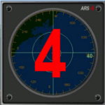
This gauge has been developed for FSX Flight Simulator SP1 or SP2. It
has also been tested with Microsoft Acceleration also, but compatibility is not guaranteed by the author.
This new Advanced Radar System (ARS 4) includes significant new features,
functions and displays for FSX AI traffic. The new key features are:
1)AI traffic display for air targets and boat/ship targets.
2)Auto landing on carrier if the carrier is part of the scenery MECOPS.
3)Allows switching between air target display and boat target display.
4) Provides for air and boat display to optionally insert airport and/or basic terrain display on the screen.
5)Different screen presentations for air and boat targets.
6)Simplified installation procedure.
7)The A2A re-fuel function remains the same as in the ARS2 version.
8)The auto tracking function remains the same as well as in the ARS2 version.
All displays for air, or boat/ship traffic, can be selected in a range of 5, 10, 20, and 40 miles.
For installation and additional information look at the ARS4 documentation inside the zip file. For copyrights and credits please look at the documentation for this gauge.
| Filename: | Advanced_Radar_System_4__ARS4.zip |
| License: | Freeware |
| Added: | 5th March 2013, 15:53:52 |
| Downloads: | 3,811 |
| Author: | Dietmar Loleit |
| Size: | 1.18 MB |
| Category: Flight Simulator X - Scenery | |
| CYCD - Nanaimo |
|
File Description:
Nanaimo is one of the greatest city situated on the east side of Vancouver Island, only 20mn Hop from/to YVR - Vancouver Intl and less than 10mn from Victoria,The capital.
Enjoy your stop in Nanaimo while soaring this beautifull island!
Nanaimo has as well a harbour to welcome all seaplane that I will develop in a near future so stay tuned!! :)
I have placed a larger terminal as it is today, all maintenance hangar located north and south, Both closed taxiway,the large oval parking lot and of course, the tower control that FSX completely forgot! :0
The push back truck is on auto for the two left side parking spot.(the nearest to the tower)
Nanaimo only offers an NDB for the Rwy 16.
Hope this will make your stop-over more Fun!
Airport already available:
-CZBB Boundary Bay
| Filename: | CYCD__Nanaimo.zip |
| License: | Freeware |
| Added: | 7th March 2009, 12:46:30 |
| Downloads: | 2,537 |
| Author: | Daniel Louvet |
| Size: | 1.29 MB |
| Category: Flight Simulator X - Scenery | |
| LFMA - Aix les Milles |
|
File Description:
Welcome to Aix Les Milles Airport.
Situated in the south coast of France, only few miles North East of Marignane (Marseille Provence - LFML). This is a great option for all G.A aircrafts to visit as well as Helicopters/Medical with their own base and it's even large enough to welcome the famous Alphajets from the "Patrouille de France".:)
The airport is used by those who wants to spend a great week end in the very well known city called Aix En provence and discover the beauty of Provence.
I have enhanced the entire airport with all buildings, proper taxi marking of aprons, taxisigns, Glider area/parking lot, Heli area including the medical one, replaced the tower at its own place, a military parking for the Alpha jets (Novembre West apron) and added...the LFMA VFR chart!!!
Enjoy!
| Filename: | LFMA__Aix_les_Milles.zip |
| License: | Freeware |
| Added: | 1st May 2009, 00:14:01 |
| Downloads: | 1,974 |
| Author: | Daniel Louvet |
| Size: | 1.29 MB |
| Category: Flight Simulator X - Scenery | |
| YWGM - White Gum Farm, Nedling Hills, Western Australia |
|
File Description:
YWGM White Gum Farm - Situated in the Needling Hills, approximately 120Km's from Perth and south east of York Brooklands, White Gum farm
was originally used for general farming and has also been active in outdoor tourist adventures and Farm stay accommodation. From August 2006 White Gum Farm Aviation with close links to SKY SPORTS has now formed, W.A's latest Microlight training facility is now open for business. White Gum Farm peaks at 380 meters above sea level. The Needling hills or (Neetling old name) comes from the Aboriginal meaning "The place of the wild dogs". White Gum Farm Aviation now boasts one of the most up to date Microlight training facilities in the West. Requires Blencowe_LibraryKit.zip
REQUIRES blencowe_librarykit_309494.zip (Available HERE)
| Filename: | YWGM__White_Gum_Farm_Nedling_Hills_Western_Austral.zip |
| License: | Freeware |
| Added: | 28th February 2013, 16:56:56 |
| Downloads: | 260 |
| Author: | Alan Blencowe |
| Size: | 6.81 MB |
| Category: Flight Simulator X - Scenery | |
| JZZ - Koliganek Airport - Alaska, USA |
|
Images related to this file:
File Description:
Koliganek Airport (IATA: KGK, ICAO: PAJZ, FAA LID: JZZ) is a state-owned, public-use airport located one nautical mile (1.85 km) east of the central business district of Koliganek,in the Dillingham Census Area of the U.S. state of Alaska. Scheduled airline service to Dillingham Airport is provided by Peninsula Airways (PenAir).The airport opened in 1997.
Increased length of runway 9/27 from 3,000 feet to 3,300 feet.Added runway 17/35 (3,300 feet and 75 feet wide). Changes were based on 2011 construction plans.
Created with Airport Design Editor 9x by ScruffyDuck Software using current FAA documentation and Google Earth measurements, this package offers a replacement for FSX's stock airport. All these enhancements are as close to the real airport as I can get with stock library objects and custom buildings.
| Filename: | JZZ__Koliganek_Airport__Alaska_USA.zip |
| License: | Freeware |
| Added: | 25th December 2014, 01:15:29 |
| Downloads: | 597 |
| Author: | Wayne Roberts |
| Size: | 214.91 KB |
| Category: Prepar3D V1-4 - Scenery | |
| ZMNA Nalayh Air Base |
|
Images related to this file:
File Description:
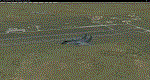
ZMNA Nalayh/Nalaikh AB is a former Russian airport in Mongolia and is now used by the Mongolian Air Force.
About 35 km South East of the Mongolian capital Ulaanbaatar.
At the base there is very little air traffic, mainly Mil-Mi8 helicopters.
This is because the Mongolian Air Force has relatively few aircraft/Helicopter (11 on 2022-01-01).
Nalayh AB leaves a dilapidated impression.
I made this scenery because I don't live far from the base myself.
As every flightsimmer knows, it is not nice to land on a naked airport.
That's why I added all kinds of things to make Nalayh AB a bit more lively,
I've added various parts that don't really belong there.
The runway, taxiways, controltower HAS Shelters and most of the hangars and buildings are real.
If you don't like this, just delete this scenery.
| Filename: | ZMNA_Nalayh_Air_Base.zip |
| License: | Freeware |
| Added: | 11th June 2022, 22:10:11 |
| Downloads: | 65 |
| Author: | Peter ZIEGLER |
| Size: | 30.45 MB |
| Category: X-Plane - Original Aircraft | |
| A1 Spec. SL-1 |
|
File Description:
The Sealiner 1 A1 Special is a small amphibian jet, capable of landing both on land and water as well as other tough terrain, This iarcraft boasts 6 compact low bypass jet engines, The plane also has a nice and simple cockpit design, so simple this is a perfect plane for any first time pilot. Not only is it fast and user friendly but it is safe with a huge chute on it, it can slow this plane down to landing speed in seconds. Unlike the VTOL aircraft I built before this plane is much smaller and this is reflected in the amount of payload it can carry, but there is a good reason for this. This airplane was designed to service small islands (mainly in the south pacific) where before a boat would have had to been taken if one decided to leave, so with the SL-1 them and 20 other people can fly commerical airline style almost anywhere! In the future look for another engine to be added.
| Filename: | A1_Spec_SL1.zip |
| License: | Freeware, limited distribution |
| Added: | 25th April 2004, 01:57:41 |
| Downloads: | 568 |
| Author: | Sam Hoy |
| Size: | 48.1 KB |
| Category: Flight Simulator 2004 - Scenery | |
| Talkeetna Village AK44 in Alaska, REVISED |
|
Images related to this file:
File Description:
The town of Talkeetna is around 75 miles north of Anchorage in Alaska, on the east shore of the Susitna River where the Susitna, Talkeetna, and Chulitna rivers join. The town is where Don Sheldon started Talkeetna Air Services. His story is told in "Wager With The Wind" by James Greinar and is well worth reading for the descriptions of mountain flying. There are two airfields at Talkeetna, PATK with its long asphalt runway and Talkeetna Village AK44 in the town. This is AK44; measuring the space left for the runway between the river bank in the south and the curve in the road that marks the north end of the field there is just enough space for the 900 feet of runway that is described in the book. The result is a step back in time to 1973, when the second hangar was built. Neither hangar has survived to today.
| Filename: | Talkeetna_Village_AK44_in_Alaska_REVISED.zip |
| License: | Freeware, limited distribution |
| Added: | 18th April 2010, 09:52:26 |
| Downloads: | 871 |
| Author: | Roger Wensley |
| Size: | 3.47 MB |
| Category: Flight Simulator X - AFCAD Files | |
| KHSV Huntsville-Intl Airport with FAA 2008 Changes |
|
File Description:
This FSX AFCAD is the modified default airport KHSV-Huntsville Intl Airport located at Huntsville, Alabama. The AFCAD was modified using ADE v1.37 to include changes as per the FAA chart dated July 2008. The changes include a new control tower near the center of the East runway and a new taxi way "L" added to enable large cargo aircraft to taxi to U.S. Customs parking and take off using the extended runway 18R-36L. The origional control tower is still at the real airport.
Many thanks to Jon Masterson for his instructions of how to remove trees from texture squares which the new taxi way "L" now crosses. Additional information is included in the AFCAD's readme.txt Zip file.
This AFCAD has not been tested in Flight Simulator 2004.
| Filename: | KHSV_HuntsvilleIntl_Airport_with_FAA_2008_Changes.zip |
| License: | Freeware |
| Added: | 20th January 2009, 13:40:51 |
| Downloads: | 541 |
| Author: | Leroy Mears |
| Size: | 30.95 KB |


© 2001-2026 AVSIM Online
All Rights Reserved
Privacy Policy |