
Where Flight Simulation Enthusiasts Gather from Around the World!
AVSIM Library - Search Results

| Category: Flight Simulator 2004 - Scenery | |
| Colville Lake CEB3 in Northwest Territories Canada |

|
Images related to this file:
File Description:
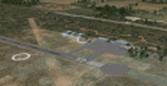
Colville Lake is a small village of around 150 Dene, located to the northwest of the Great Bear Lake and east of the Mackenzie River, 120 miles north of Norman Wells. The village and the airfield are next to each other and to the lake shore. I recently discovered which of the standard terminal buildings had been used there and this, along with information I already had, enabled me to now make the scenery, which is based on an approximate 2010 date. The gravel runway is lit and around 2,800 feet long, aligned 10-28. North Wright Air serves the village from it's headquarters at Norman Wells with daily flights by de Havilland Twin Otters, or "twotters" as they were quickly named among the northern Canadian airline personnel when they were first produced. The approximate time of this scenery is 2010. While testing this scenery I discovered that Tulita (previously called Fort Norman) which is another Mackenzie River airfield to the south of Norman Wells, needs to be reposted due to a terrain fault. If you find an error here then email me please, and note that my email address has been changed to rogwens at Gmail dot com.
| Filename: | Colville_Lake_CEB3_in_Northwest_Territories_Canada.zip |
| License: | Freeware, limited distribution |
| Added: | 31st July 2021, 18:23:48 |
| Downloads: | 70 |
| Author: | Roger Wensley |
| Size: | 4.51 MB |
| Category: Flight Simulator 2004 - Aircraft Repaints, Textures and Modifications | |
| United Arab Airlines DH Comet 4C SU-ALC |
|
File Description:
Misrair was renamed United Arab Airlines in December 1960 due to a planned almagamation of Egypt and Syria. The renamed airline was to reflect the fact it was to be the national airline of both coutries. The collapse of the plans meant the countries retained their own airlines. The UAA name was kept until 1971 when it was re-named Egyptair. This aircraft lasted from delivery to Misrair in June 1960 until 02 January 1971 when it crashed near Tripoli.Requires the DH 106 Comet 4C model by David Maltby
| Filename: | United_Arab_Airlines_DH_Comet_4C_SUALC.zip |
| License: | Freeware |
| Added: | 29th July 2005, 22:37:40 |
| Downloads: | 299 |
| Author: | Garry Russell |
| Size: | 1.14 MB |
| Category: Flight Simulator 2002 - Aircraft Repaints, Textures and Modifications | |
| EgyptAir Boeing 767-300ER |
|
File Description:
This aircraft was lost in the atlantic ocean shortly after take-off from New York to Cairo as MSR990 on October 31st 1999. This is my personal tribute to the 217 people who died on board this plane. RIP
Painted by: Ali Abou-Zeid www.simairline.net
| Filename: | EgyptAir_Boeing_767300ER.zip |
| License: | Freeware, limited distribution |
| Added: | 27th March 2003, 01:11:24 |
| Downloads: | 346 |
| Author: | Aircraft by: POSKY - Painted in EgyptAir Colours by: Ali Abou-Zeid (Egypt) |
| Size: | 1.94 MB |
| Category: Flight Simulator 2002 - Scenery | |
| Lyon - St Exupery |
|
File Description:
FS2002 Scenery Lyon - St Exupery Airport
Realistic freeware scenery for the main
Lyon's airport. Saint Exupery is one of
the biggest airport in France, located
in the south-east of the country.
| Filename: | Lyon__St_Exupery.zip |
| License: | Freeware |
| Added: | 26th July 2002, 15:38:25 |
| Downloads: | 3,505 |
| Author: | Yannick Mille |
| Size: | 1.23 MB |
| Category: Flight Simulator 2004 - Scenery | |
| Schänis (LSZX) for Suisse 2004 |
|
File Description:
Schänis (LSZX) is a small place far East of Switzerland. For gliders only. The scenery includes usual skins of Suisse 2004 : seasonal changes (texture, people, table,...), smoke effect. AFCAD file for FS2002.
| Filename: | Schnis_LSZX_for_Suisse_2004.zip |
| License: | Freeware |
| Added: | 22nd December 2003, 01:58:49 |
| Downloads: | 5,902 |
| Author: | Daniel Gauthier |
| Size: | 4.19 MB |
| Category: Flight Simulator 2004 - Aircraft Repaints, Textures and Modifications | |
| Gulfstream G-V G550 G-JCBC |
|
File Description:
Gulfstream G-V G550 JC BAMFORD EXCAVATORS LTD (JCB) This G550 is based at Nottingham East Midlands Airport. Model by Henry Tomkiewicz. A special thanks to Bryn Thompson for taking the screenshot.
| Filename: | Gulfstream_GV_G550_GJCBC.zip |
| License: | Freeware, limited distribution |
| Added: | 3rd May 2006, 01:29:17 |
| Downloads: | 1,336 |
| Author: | Ashley Flynn JBAI |
| Size: | 465.35 KB |
| Category: Flight Simulator 2002 - Scenery | |
| CFB (8 Wing) Trenton |
|
File Description:
CFB (8 Wing) Trenton
is located on the shores of Lake Ontario,
about 180 KM east of Toronto Canada. CFB
Trenton is the hub of air transport
operations for the Canadian Forces.
| Filename: | CFB_8_Wing_Trenton.zip |
| License: | Freeware, limited distribution |
| Added: | 14th July 2003, 04:50:45 |
| Downloads: | 1,511 |
| Author: | Vern Opperman |
| Size: | 1.23 MB |
| Category: Flight Simulator X - Scenery | |
| Robertson Airfield (FARS), South Africa |
|
Images related to this file:
File Description:
Robertson Airfield (FARS) is an unmanned municipal airport situated 1 km to the east of the Western Cape town of Robertson in South Africa. The facility is also used for sparts skydivers.
| Filename: | Robertson_Airfield_FARS_South_Africa.zip |
| License: | Freeware |
| Added: | 20th March 2014, 20:14:38 |
| Downloads: | 1,614 |
| Author: | Philip Schall, Aeroworx |
| Size: | 43.45 MB |
| Category: Flight Simulator X - AFCAD Files | |
| BGSF - Kangerlussaq Airport - Qeqqata, Greenland |
|
File Description:
BGSF is located at the head of Sondre Stromfjord, 90 NM Miles North East of the month of the Davis Strait. Greenland's permanent icecap is located approximately 15 NM to the east. The airport also known as Sondrestrom was originally an American airbase during WWII, but is now under civilian control. The airport has domestic air service as well as Airbus 330 service to Denmark with Air Greenland.
This scenery was designed to be used with the default FSX scenery.
| Filename: | BGSF__Kangerlussaq_Airport__Qeqqata_Greenland.zip |
| License: | Freeware |
| Added: | 20th June 2013, 02:01:43 |
| Downloads: | 1,685 |
| Author: | Bill Bridges |
| Size: | 9.46 KB |
| Category: Flight Simulator X - Gauges | |
| Multiple Moving Map Gauge |
|
Images related to this file:
File Description:
This Multiple Moving Map ( MMMap) provides a excellent and generic orientation and navigation gauge for any aircraft in FSX. The gauge will be implemented as a separate window in the panel.cfg ( for installation see pdf doc in this ZIP file).
The gauge allows the user to select different terrain presentations e.g. desert areas on the globe ( north of Africa for example ), or areas in the north of Europe/America .
In addition, the user can select a camera lookalike view. This is a dedicated view which allows the user to have a top view from the aircraft to the real FSX terrain.
Control buttons are available to insert into the map displays for airports, flight plans,VOR etc.. The gauge includes a commercial version ( MMMap_Com) and a military version (MMMap_mil). The difference is the gauge body only.
| Filename: | Multiple_Moving_Map_Gauge.zip |
| License: | Freeware |
| Added: | 18th December 2009, 23:34:50 |
| Downloads: | 2,509 |
| Author: | Dietmar Loleit |
| Size: | 2.36 MB |


© 2001-2026 AVSIM Online
All Rights Reserved
Privacy Policy |