
Where Flight Simulation Enthusiasts Gather from Around the World!
AVSIM Library - Search Results

| Category: Flight Simulator 2004 - Scenery Design | |
| Bomb Grates (Military Metal Pallets) |

|
File Description:
FS2004/FS2002 API macro--Bomb Grates in
quantities from 1 to 8 for scenery
designers. Vietnam Veterans will probably
recognize these steel pallets as they were
frequently used for everything from walkways
to foot wipers and even tent floors in the
often muddy or sandy terrain in most of the
base camps in Vietnam. By Al Simms
| Filename: | Bomb_Grates_Military_Metal_Pallets.zip |
| License: | Freeware |
| Added: | 21st May 2006, 02:00:19 |
| Downloads: | 451 |
| Author: | Albert E Simms Jr |
| Size: | 96.13 KB |
| Category: Flight Simulator X - Scenery | |
| Toronto City Centre 2 |
|
File Description:
This is a substitute version of Toronto City Centre Scenery which includes scenery for Toronto CYTZ airport for users of Ultimate Terrain X Canada. Includes airport runway-taxiway-parking changes per Google Earth imagery, and replacement of the "floating" airport generic buildings. This version excludes downtown Toronto building relocations which are already included in UTX Canada.
| Filename: | Toronto_City_Centre_2.zip |
| License: | Freeware |
| Added: | 11th November 2008, 11:11:10 |
| Downloads: | 3,360 |
| Author: | Art Poole |
| Size: | 150.61 KB |
| Category: Flight Simulator X - Scenery | |
| SVSZ - Santa Barbara del Zulia - Zulia State, Venezuela |
|
Images related to this file:
File Description:
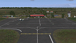
The "Miguel Urdaneta Fernandez" National Airport serves the cattle town of Santa Barbara del Zulia, located south of Lake Maracaibo in Zulia state. Serves air link between South Lake region and the capital of Zulia state, Maracaibo. Photo-terrain area improved with Autogen files. Only compatible with versions to FSX or P3Dv1v2v3.x. Also includes a friendly Auto-Install.
| Filename: | SVSZ__Santa_Barbara_del_Zulia__Zulia_State_Venezue.zip |
| License: | Freeware |
| Added: | 11th July 2016, 08:43:02 |
| Downloads: | 457 |
| Author: | David Maldonado |
| Size: | 58.41 MB |
| Category: Flight Simulator X - AFCAD Files | |
| FIMP- Mauritius International Airport - Update 2 |
|
File Description:
Updated AFCAD file for Mauritius International Airport by Max Kraus. With Max's permission this update to his excellent scenery corrects the ILS glide slope and the PAPI angle to 3.8 degrees as per charts. Included an optional "cvx" file to eliminate the cliff scenery near the runway. This will now ensure a safe altitude from terrain approach to rwy14.
| Filename: | FIMP_Mauritius_International_Airport__Update_2.zip |
| License: | Freeware |
| Added: | 1st September 2013, 08:30:54 |
| Downloads: | 8,442 |
| Author: | Johann van Rhyn |
| Size: | 10.93 KB |
| Category: Flight Simulator X - Scenery | |
| Carora Airport (SVCO) - Venezuela |
|
File Description:
Regional airport located in the city of Carora, the second city of the Lara state after Barquisimeto, in western Venezuela. With photo-terrain scenery from satellite imagery in Google Earth.
Not compatible with versions prior to FSX.
This scenery includes terminal building and hangars with realistic
textures from images obtained from Internet. Also includes a friendly Auto-Install.
| Filename: | Carora_Airport_SVCO__Venezuela.zip |
| License: | Freeware |
| Added: | 12th March 2012, 16:41:17 |
| Downloads: | 1,400 |
| Author: | David Maldonado |
| Size: | 80.7 MB |
| Category: Flight Simulator X - Scenery | |
| Canaima National Park - Venezuela |
|
Images related to this file:
File Description:
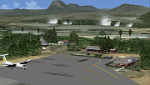
This package includes Canaima Airport-SVCN,
Angel Falls (created by Jean St-Cyr)
and camp Kavak-SVKV (new in FSX).
With photo-terrain scenery from satellite imagery
of Google Earth.
Not compatible with versions prior to FSX.
This scenery includes terminal building with realistic
textures from images obtained from Internet.
Also includes a friendly Auto-Install.
| Filename: | Canaima_National_Park__Venezuela.zip |
| License: | Freeware |
| Added: | 3rd September 2012, 02:05:52 |
| Downloads: | 2,730 |
| Author: | David Maldonado |
| Size: | 50.02 MB |
| Category: Flight Simulator X - Scenery | |
| Pudong Airport ZSPD |
|
File Description:
Pudong Airport, Shanghai, China. ZSPD is the new international airport for Shanghai, China supplementing ZSSS (Hongqiao). This is an enhanced ADE airport providing the new runway 17R/35L, Terminal 2, and cargo ramp. Some additional minor terrain mods are provided as well. This is a re-upload of my previous file, download ID 138750 which was lost.
| Filename: | Pudong_Airport_ZSPD.zip |
| License: | Freeware, limited distribution |
| Added: | 2nd June 2010, 01:54:42 |
| Downloads: | 3,915 |
| Author: | Scott Smart |
| Size: | 265.41 KB |
| Category: Flight Simulator X - Gauges | |
| Garmin 500 GPS Upgrade |
|
File Description:
Upgrade your FSX Garmin 500 GPS to display aircraft and terrain shadows. This file replaces the FSX fs9gps.cab file found in the Microsoft Games/gauges directory. Instructions impress on user to backup existing file. Tested thoroughly in FSX Acceleration only however the author of the upgrade instructions indicates that he has tested it for FSX SP2 also.
| Filename: | Garmin_500_GPS_Upgrade.zip |
| License: | Freeware |
| Added: | 14th July 2015, 11:49:20 |
| Downloads: | 1,744 |
| Author: | Simon Hitch |
| Size: | 292.3 KB |
| Category: Flight Simulator 2004 - Aircraft Repaints, Textures and Modifications | |
| United Arab Airlines DH Comet 4C SU-ALC |
|
File Description:
Misrair was renamed United Arab Airlines in December 1960 due to a planned almagamation of Egypt and Syria. The renamed airline was to reflect the fact it was to be the national airline of both coutries. The collapse of the plans meant the countries retained their own airlines. The UAA name was kept until 1971 when it was re-named Egyptair. This aircraft lasted from delivery to Misrair in June 1960 until 02 January 1971 when it crashed near Tripoli.Requires the DH 106 Comet 4C model by David Maltby
| Filename: | United_Arab_Airlines_DH_Comet_4C_SUALC.zip |
| License: | Freeware |
| Added: | 29th July 2005, 22:37:40 |
| Downloads: | 299 |
| Author: | Garry Russell |
| Size: | 1.14 MB |
| Category: Flight Simulator 2004 - Scenery | |
| Dease Lake CYDL 2010 v1.1 |
|
Images related to this file:
File Description:
Version 1.1 adds the three hazard beacons that define the boundaries of the night circuit, as depicted in the included chart. Many thanks to Lane Street for creating the beacons and giving us permission to include them in the scenery. This scenery is complete and does not require the previous verion. Dease Lake CYDL airport is located about 2 miles south of Dease Lake in stunningly beautiful northwest British Columbia. (The lake directly to the east of the airport is Allan Lake.) Scheduled passenger service to Smithers and Bob Quinn Lake is provided by Northern Thunderbird Air (http://ntair.ca/). CYDL also serves as a base for Pacific Western Helicopters (http://www.pwh.ca/). This version moves the airport slightly to its correct location. All aprons & taxiways have been redone and all default buildings replaced. The little terminal building is photo real. The missing town of Dease Lake and the missing lake south of Allan lake have been added. This scenery was designed for use with Ultimate Terrain and was not tested in the default scenery. It may or may not work in FSX. Previous version had 307 downloads.
| Filename: | Dease_Lake_CYDL_2010_v11.zip |
| License: | Freeware |
| Added: | 6th November 2010, 22:30:24 |
| Downloads: | 793 |
| Author: | Sidney Schwartz & Peter Ham |
| Size: | 1.8 MB |


© 2001-2026 AVSIM Online
All Rights Reserved
Privacy Policy |