
Where Flight Simulation Enthusiasts Gather from Around the World!
AVSIM Library - Search Results

| Category: Flight Simulator X - Aircraft Repaints, Textures and Modifications | |
| Consolidated PBY-5A (C-FCRR) |

|
Images related to this file:
File Description:

This folder contains a repaint for the Aerosoft PBY Catalina for FSX. It is shown here as C-FCRR, with Air France colors. Built by Boeing of Canada at Vancouver, it became RCAF Canso 9767 on March 4, 1943, and was allocated to Squadron 162, coded S, at Reykjavik, Iceland. In 1944, piloted by Flying Officers Thomas Charles Cooke and Eric Walter Wiskin, 9767 sank the German U-boat U-342 off the coast of Iceland on April 17. The amphibian was removed from the military service on April 1, 1946. The same year it was sold to Canadian Pacific Airlines, registered CF-CRR and assigned fleet number 233 (later 933), it was operated until 1959, thereafter by Northland Airlines (1960-1968), Midwest Airlines (1969-1970), and Ilford Riverton until 1973. The registration was changed to C-FCRR when Avalon Aviation acquired it as a water bomber in 1977, listed as Tanker number 791.
In 1995 the aircraft was bought by Powell Eorp. Of Parry Sound, Ontario, subsequently it was owned by the Canadian Air Legend. The French pilot Franklin Devaux bought C-FCRR in 1995 and converted it to a flying television studio, it was based at Le Bourget, Paris, France. During 1996 C-FCRR was the star of monthly French television programme Operation Okavango, while in September 1998 it was the eye catcher of the three-week Champs-Elysees (Paris) static air show. The following October the aircraft started an 8,078 mls (13,000 km) trip to Chile via Dakar (Senegal) and Natal (Brazil) to commemorate early Air France South Atlantic mail service, returning to France in June 1999. On January 19, 2002 the aircraft was stored at Orly Airport, Paris, and has not flown since. Its Canadian registration was cancelled on October 7, 2005. At present it seems to be registered as N9767, and in airworthy condition again. Here's a youtube movie on this aircraft: http://www.youtube.com/watch?v=s6jyzV8Gawc. Repaint by Jan Kees Blom, based on the repaint kit by Aerosoft.
| Filename: | Consolidated_PBY5A_CFCRR.zip |
| License: | Freeware |
| Added: | 13th July 2018, 20:34:21 |
| Downloads: | 151 |
| Author: | Jan Kees Blom |
| Size: | 9.83 MB |
| Category: Prepar3D V1-4 - Aircraft Repaints, Textures and Modifications | |
| North American P-51D 1st SF (5E-E) "Easy Does It" |
|
Images related to this file:
File Description:

This folder contains a repaint for the A2A WoP3 P-51D Mustang (with AccuSim), in the colors of P-51D-5-NA 44-13557 5E-E "Easy Does It" as flown by Lt Richard 'Spider' Smith of the 1st Scouting Force, 8th AF. Lt. Smith was a B-17 plot with the 303rd BG and had completed his tour of 35 missions in october 1944 when he was made an offer he could not refuse. As all pilots, he had been dreaming of flying a fighter and was disappointed when he was assigned to the bombers. He now was asked to join the newly formed scouting force, which used experienced bomber pilots to scout ahead of the bomber force flying Mustangs. After 6 hours in a T-6 and 10 hours in a P-51, 'Spider' (so called because of his physique, tall, with long thin limbs) flew his first missio in a P-51 on 6 december 1944 in an old 364th FG P-51D-5, which he named 'Easy Does It' after it's callsign E. The name 'Betty' on the canopy rail referred to his future wife back in the US, but also to a nurse he was dating in the UK. On his 26th mission, on 1 april 1945, flying lead to Leipzig, his engine caught fire on the return flight, and he had to bail out over Belgium. He broke his arm when he hit the tail on bailing out, but otherwise landed safely. He was sent home to the US and came back just before his 21st birthday, having flown 60 missions. HIs story can be read here: http://www.rccr1957.com/spider.pdf.
He did not crash with this aircraft though, this was damaged during a ground collision in the winter of 1944-45, was repaired and was now flying with the 487th FS/352nd FG as Maj. 'Wild Bill' Halton's 'Slender, Tender and Tall', where it finished the war. Repaint by Jan Kees Blom, based on the A2A paintkit.
| Filename: | North_American_P51D_1st_SF_5EE_Easy_Does_It.zip |
| License: | Freeware |
| Added: | 30th October 2018, 15:25:05 |
| Downloads: | 71 |
| Author: | Jan Kees Blom |
| Size: | 11.93 MB |
| Category: Flight Simulator 2004 - Scenery | |
| Tok Junction 6K8 in Alaska, USA |
|
Images related to this file:
File Description:
Tok Junction is a village, or small town, on the Alaska Highway some 180 miles east of Fairbanks and 60 miles west of the Alaska-Canada border. The town is spread over a wide area on the flat terrain and barely registers among the trees, and as such is not shown in FS9 except as a grid of roads as there is no town terrain texture like it used in FS9. The airfield is at the eastern end of the town and adjacent to the Alaska Highway and I have included some surrounding houses, workshops, shops, lodges, etc. The single runway is 3,000 feet of 50 feet wide asphalt aligned 07-25 and lit. There is a small airline based on the airfield called 40-Mile Air. Their hangar is red and the name written large and 100LL fuel is available beside it at all times. Jet A-1 is available by a telephoned pre-arangement. They are, I believe, no longer flying scheduled flights but they do still function as an air taxi and they have a contract to deliver mail to surrounding villages that are not served by all-weather roads. The airfield now has a new icao "PFTO" but in FS9 it remains as the original FAA LID, 6K8. The FS9 roads are not accurately placed, and the grass airfield background is not really appropriate as the reality is more like gravel mixed with earth; it is however difficult to replicate this with the available textures and still prevent bushes or trees appearing. But, in the winter and with snow on the ground it looks as it should. A note here about my scenery making. There will not be many more to follow this as I am almost at the end of the photos I either took or found for scenery purposes, plus I expect to move on from FS9 at some point during next year.
| Filename: | Tok_Junction_6K8_in_Alaska_USA.zip |
| License: | Freeware, limited distribution |
| Added: | 14th January 2020, 17:49:21 |
| Downloads: | 176 |
| Author: | Roger Wensley |
| Size: | 25.47 MB |
| Category: Prepar3D V1-4 - Utilities | |
| AIFlow SimConnect Utility for P3D v4 |
|
Images related to this file:
File Description:
AIFlow v1.1 is a simconnect utility designed to ease AI congestion and go-arounds at the airport the user is departing from and arriving at. AIFlow does this by enforcing spacing minimums between arriving AI aircraft resulting in more orderly arrival patterns. AIFlow also supports spacing spacing minimums between the AI aircraft and the USER’s aircraft when the user is flying (during all phases of the user's flight). For added realism, AIFlow adds landing effects (e.g., micro bank and pitch corrections that scale up during crosswind conditions) to the AI on short final approach. The user can also briefly squawk 1234 in their aircraft to temporarily suspend landings so that the user can find a slot to depart a busy runway. AIFlow is designed to compliment the default P3D AI program and thus is fully compatible with any AI-related program that is compatible with the default AI program (e.g., AIG, Ultimate Traffic Live, Radar Contact, etc.). AIFlow is targeted to Prepar3D version 4.5 or 5.0, specifically SimConnect Version 4.5.0.0 or later. AIFlow operates externally via simconnect and thus makes no changes to the P3D sim. NEW for v1.1: (1) detect and correct AI performing poor approaches (e.g., dive-bombing, descent into terrain) under control of the P3D AI engine, (2) user can specify minimum and maximum AI approach speeds in terminal area, (3) prevent AI from stopping on runway when user landing, (4) AI plane spotting mode only, (5) external database fallback in case simconnect fails to provide local airport data, (6) adjustable in-sim message level, (7) periodic read of .ini file to tweak parameters more easily, (8) AIFlow starts minimized. FIXES for v1.1 include: sequencing in heavy AI traffic would sometimes cause excessive go-arounds, going around AI would sometimes improperly hold, changing AI spacing from default value did not have any effect, sometimes user aircraft would get controlled, .ini file would sometimes get confused reading parameter values having whites spaces.
| Filename: | AIFlow_SimConnect_Utility_for_P3D_v4.zip |
| License: | Freeware |
| Added: | 3rd July 2020, 23:57:52 |
| Downloads: | 2,015 |
| Author: | Roland Foster |
| Size: | 1.18 MB |
| Category: Flight Simulator X - Scenery | |
| Carnes Farm |
|
Images related to this file:
File Description:
These are the files that I talked about in the Prepar3d forums. I created these objects for Fs9, then upgraded them to the scenery SDK for FSX. They were created 10 years ago in GMAX, and I have used them successfully ever since in Prepared 1.4 as well.
For some reason the individual farmhouse and other objects that I created are not showing up in Prepar3d version 2.0.
That's where you guys come in! These files are free to use in anyway you want as long as proper attribution is given, but, I would like you guys who have both Prepar3d 1.4 and 2.0 to try them out in both and report back to me as to whether you have the same problems that I do. That's your only fee. And I'd like you guys to give it a shot in both, or all four( I am not sure that they will work in FS9 anymore, but try it out. Unfortunately I can't recompile my FSX SDK Files back to FS9 if it doesn't work).
What's included:
1. Photo real scenery of Barbourville, 10 miles to the north west of stinking Creek where we live, and;
2. Photo real scenery of the farm area and stinking Creek, upon which I have placed my GMAX objects;
A. The farm house.Carnes Farm From the Bridge at 500 AGL.jpg
B. The barn, shed and the RV in back of the farmhouse.
C. A two-story long structure the top of which is an apartment but the bottom of which is a re-creation of Mama Carne's store, along with all the real wood floors shelves and original contents.. It is also o n Google earth in 3-D as it is here with further description .
... A little note on Gmax.. Mama Carne's store was one the first structures that I built in Gmax. It was just a box. Later, I added the true architectural features that you see including the steps and rails which took about as long to create as it would have to Saw and fit and hammer the real rails, risers and steps.
D. K-6, my little 2300 foot strip for runways 03 and 21. It has VOR - (117.55), ILS(110.1), and NDB(222).
E. Gerald Bingham's house, 1/4 mile up Warriors Path North from us.( mostly dirt road with gravel topping).
F. Dewitt Baptist Church.
Off property Knox county
G.Escoe's Store and Post Office complete with great prices for gas at the included pumps.
Escoes.jpg
H. Rex allen's killer corner...sheds and farm equipment on the sharpest bend on Stinking Creek...my son went off it with a flat tire, unscathed, but more than several have lost their lives on that curve... there may be several iterations of the sheds...just delete or rename the wrong ones...I was experimenting with ModelConverterX, Arno Gerretsen's wonderful model and object scenery tool.
I. sitting on top of the Barbourville Photo real scenery Barbourville PhotoReal over the shopping center.jpg is the Barbourville P3D Shopping Center2.jpg shopping center all the stores and all the storefronts ... it's on 25 E. as you head into Barbourville.
Recreated, is the entire shopping center with the now outmoded Wal-Mart sign. Probably my magnum opus.
note on the Gmax scenes.
All of the scenery was either directly measured and if not practical for a such a long measuring device, walked off, as in the Stinking Creek Bridge and shopping center. All of the objects were then photographed, in 360° where possible and saved as texture for inclusion in the Gmax model.
Enjoy!
...oh... how do you get there? Wellllll.... situate yourself at Middlesboro (1a6), and tune your Nav radio to K-69's VOR, 117.55, take off and climb to 3500 feet...grinnnnn
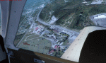
Welcome to Knox County Kentucky!
| Filename: | Carnes_Farm.zip |
| License: | Freeware |
| Added: | 2nd December 2013, 05:34:20 |
| Downloads: | 453 |
| Author: | Chas Honce |
| Size: | 91.13 MB |
| Category: Flight Simulator X - Scenery | |
| GB-0112 - RAF Bassingbourn - Cambridgeshire, England |
|
File Description:
RAF Bassingbourn is a former Royal Air Force station located in Cambridgeshire approximately 3 mi (5 km) north of Royston, Hertfordshire and 11 mi (18 km) south west of Cambridge, Cambridgeshire, England.
RAF Bassingbourn was constructed by John Laing & Son between 1937 and 1939 in the parishes of Wendy and Bassingbourn immediately to the west of the A14 (now the A1198) road. The site selected was low ground between several tributaries of the River Cam. The area had been long cleared of forest and tended to be swampy and unstable, and because the boggy ground produced a persistent mist over the large meadow the site was considered ideal for airfield camouflage.
During the Second World War it served first as an RAF station and then as a bomber airfield of the Eighth Air Force, of the United States Army Air Forces (USAAF). It remains the home of the Tower Museum Bassingbourn. From 19 August 1942 to 25 June 1945, Bassingbourn served as headquarters for the 1st Combat Bombardment Wing of the 1st Bomb Division. It was assigned USAAF designation Station 121.
The RAF resumed occupation of Bassingbourn on 26 June 1945, the airfield was officially returned on 10 July 1945. The station became one of the main airfields for long-range transport aircraft. In 1948 and 1949 Avro York, Avro Lancaster and Douglas Dakota aircraft from the base took part in the Berlin Airlift, a massive operation transporting essential commodities to the beleaguered city.
In February 1952, RAF Bassingbourn received its first allocation of English Electric Canberra bombers and became the first jet bomber operational conversion unit (OCU) in the world. Canberras operated from Bassingbourn for 17 years and one of the aircraft is on static display in the Barracks. From 1963 to 1969 the Joint School of Photographic Interpretation was also located there.
On 29 August 1969, the last RAF Commanding Officer, Sqn Ldr A.M. McGregor MBE, turned over the station to the British Army as Bassingbourn Barracks.
The barracks were established, on the site of the former RAF Bassingbourn airfield, in January 1970, as the new Depot for the Queen's Division. The depot was responsible for training recruits undergoing their 19-week basic training before joining a regular battalion; in 1993 the Barracks were re-designated the home of the "Army Training Regiment, Bassingbourn" and remained as such for nearly 20 years. Bassingbourn Barracks closed as an army training location in August 2012.
The site was reopened for training Libyan soldiers in 2014 but closed down the same year.
Since approximately 1970 the site has retained its RAF links by being the home of 2484 (Bassingbourn) Squadron Air Training Corps.
| Filename: | GB0112__RAF_Bassingbourn__Cambridgeshire_England.zip |
| License: | Freeware |
| Added: | 30th May 2016, 11:01:25 |
| Downloads: | 321 |
| Author: | Terry Boissel |
| Size: | 1.58 MB |
| Category: Flight Simulator X - Missions | |
| Discover FSX Flights (FMCH - FMCZ) 160 NM |
|
File Description:
Flight 12 (FMCH - FMCZ)
With all the many airports and various terrains on FSX, I have decided to contribute to the wonderful FSX flight community by providing pre-selected
Flight plans which i have created using pre-selected VOR's , NDB's and way points, with careful selection of realistic departure and arrival tracks.
Weather your flying commercial Jets, or props or cargo, I am sure there is something here for you..check it out (Just place the included PLN file in your
saved routes folder) and Load it from the FSX flight planner and it will show up on your aircraft GPS and Flight Managment display, Pilots are strongly
recommended to adhere to altitude and speed restrictions, as that will make the flight more comfortable for both pilots and passengers, and will allow for
the enjoyment of the scenery and flight. I have included a Paint version of the flight plan with notes. The route is designed to be as as realistic as
possible, so pilots and aircraft are expected to follow strict departure and arrival stations.
Included here is my first flight : (Prince Said Ibrahim international / Comoros islands (FMCH) - Pamandazi / mayotte (FMCZ) (169 - nm)
Recommended departure time (05:00 AM DAwn)
Recommended Aircraft CantuEMB120.zip by Mr.Eric Cantu availabe at Avsim.com
recommended Weather (fair on departure) (grey and rainy on arrival)
Recommended call sign (Yankee 1 Foxtrot)
Flight number 12
Flight Time 33 minutes
Situation orientation (Fictional) : A struggling Morani based aviation company makes its bucks on a single boeing 707 servicing mombasa,
as well as two Embraer120 servicing the adjacent islands and airports, Flight 12 is a twice a week flight to Pamandzi (160 nm South of Morani / 30 mins hop)
Due to the timing of the flight (4:45 AM), its infamous with the pilots and passangers who despise getting this flight,but work is work and life goes on.
The residents of Dzaoudzi (arrival airport)
always look forward for flight 12's arrival as it brings home relatives, friends, the once in a while tourists as well as mail and supplies.
Your the captain of this flight today , Flight 12 to Pamandzi is now boarding, please display your boarding slips at the door and walk directly to the
aircraft.Goodmorning captain, coffee?
| Filename: | Discover_FSX_Flights__FMCH__FMCZ__160_NM.zip |
| License: | Freeware |
| Added: | 24th September 2007, 13:06:33 |
| Downloads: | 3,498 |
| Author: | Ali Zied |
| Size: | 375.37 KB |
| Category: Flight Simulator X - Scenery | |
| Freeware Project Kobe X (RJBE) Japan |
|
Images related to this file:
File Description:
Freeware project KOBE X (RJBE) Japan. Contains fully detailed airport with custom ground polygons. Accurate 3d model and texture of all the building of the airport including the terminal, control tower, hangars, bridge and many more. Please note that this project was my initial experience in many fields of scenery design so take it as it is and enjoy flying in Japan. The design is never done but I think it was ready to be released. Still have some work to do with the animated jetways and night lighting for my next "payware" project (KSAN, San Diego Intl). It's going to be far better than this freeware.
You can download the world of ai installer and install the All Nippon Airways package and maybe the JAL too. The jetways are not animated but you can park a 747 in gate 1, a 767 in gate 5 and a 737 in gate 6 and be perfectly aligned with the jetway door.
Also I've not try this scenery in a less powerful computer than mine. I run a Windows 7, I7-950 @ 3.8 GHz and a GTX 570. So don't get mad if you're having bad performances :). With all sliders in the "display settings" set to max I've around 20 fps in the virtual cockpit of the level-d 767. You'll get a nicer airport with also the global texture resolution set to max, water effects set to High 2.x and traffic to ultra-high. Do not turn on Ground scenery shadows as it will make a shadow for the entire airport (ground poly).
I've some tutorial on my YouTube channel (n170toga) on how to make fsx sceneries if you are interested. Don't forget to subscribe there and have updates for the upcoming scenery. Please review this airport if you like as I will learn a lot for my next
project and it's only going to be better.
This scenery is a freeware and should be considered as a freeware. Arigato, Sagga Toure (Devinci), Devinci Design and Development (3De)
| Filename: | Freeware_Project_Kobe_X_RJBE_Japan.zip |
| License: | Freeware |
| Added: | 12th June 2011, 08:28:51 |
| Downloads: | 6,653 |
| Author: | Sagga Toure |
| Size: | 66.48 MB |
| Category: Flight Simulator X - Scenery | |
| Albany International Airport (KALB) Albany, New York |
|
Images related to this file:
File Description:
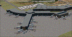
This airport was made using Airport Design Editor, Google Sketchup, and Instant Scenery 2. Albany International Airport, Is an airport located near Albany, New York. The airport has scheduled airline flights. Almost all of the buildings are custom made with photo textures to make it closer to real life. At the main terminal, I added more gates and put moving jetways. The gates have assigned parking codes. There is a parking lot next to the terminal full of cars. I put the airport access road in between the parking lot and the terminal. At the southwest ramp, I put hangars and some you can taxi inside of. If you choose to start off from the southwest DOCK gate, You will start off inside the Million Air Aviation FBO. I also put static aircraft on the ramp too. To the northwest, I put the New York Police hangar. You can start off inside this hangar by choosing the Northwest DOCK gate. Taxiing into or starting off inside a hangar will not cause a crash unless you touch the sides. To the Northeast, I put the cargo terminal with trucks. At the cargo section, I put three FedEx Cessna Caravans. I also put the control tower and the buildings. Tower views are from the roof of the control tower. To the southeast, I put small hangars and the Air National Guard Section with UH-60 helicopters. I extended runway 1/19 to the correct length of 8,500 feet. I also put red, blue, green, and purple Cessna 172s in different places around the airport. There will be more objects if your scenery complexity is set to normal (such as jetways, aircraft, and vehicles). This was all made based on Google Earth Imagery and Bing Maps. There are no night textures for the buildings. This will be added in a future version. An installer program is included to install the airport for you. There will be more versions of this that include night textures and static business jets. This is for Flight Simulator X only. By Tyler Lawrence.
| Filename: | Albany_International_Airport_KALB_Albany_New_York.zip |
| License: | Freeware |
| Added: | 2nd June 2012, 08:14:12 |
| Downloads: | 4,347 |
| Author: | Tyler Lawrence |
| Size: | 47.69 MB |
| Category: Flight Simulator X - Utilities | |
| FS2004/FSX Flight Analyzer, Logbook Utility V4.09 |
|
Images related to this file:
File Description:
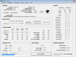
FS2004/FSX Flight Analyzer Utility V4.09
Flight Data Recorder - Logbook.
NOW WITH STATISTICS TOP 5 AIRPORTS, CITIES AND COUNTRIES.
Very easy to use, just make a flight plan in the simulator or in this utility.
What this program do:
- quickly change the settings of FSX/Fs2004, such as time, date, fuel, weight, traffic etc.
- start a failure sytem, such as gear, flaps, engine, etc.
- freeze the time, so you can fly in a for everlasting sunset.
- runway detecting system to see wich runways are in use.
- flight analyzing/data recording from departure to parking at the gate.
- When flight analysis is finished you can print a report, the report is automaticly saved as pdf File.
- graphical landingchart.
- record all your flights
- quickly look to your FSX display settings (only FSX) and change them even before the flight simulator is running.
- After a flight is finished FsQC saves your flight automaticly as 'FsQC last Flight', so you can continue the next day or hour.
Flight analysis start recording at the moment when you begin taxiing.
It gives you huge information such as:
- takeoff- and landing-weight.
- takeoff- and landing-roll in m. and ft.
- separate fuel consumption in taxi, climb, cruise and descent.
- maximum banking in flight.
- which speed you using the flaps and gear.
- when autopilot on or off.
- vertical speed on touchdown.
- reverser set after landing.
- wich speed you cancel reverser.
- bouncing at landing.
- graphical landingchart.
- and lots of more.
You can better look the example of the pdf document located in the 'Flight Reports' folder.
Logbook records:
- fuel consumption.
- payload.
- distance.
- number of different airports.
- flight hours.
- landings.
- flaps.
- speed.
- and lots of more.
- quickly show touchdown wind information in a picture.
- quickly show the graphical landing chart.
- Now with statistics: top 5 Countries, Cities and Airports
Requirements:
Computer with vista or higher and internet access.
Microsoft .net framework 4.6 or higher.(free download on microsft.com)
Flightsimulator FSX or 2004 and FSUIPC installed.
Note: requires paid activation for full use.
Register and you have 1 month free.
Program fully works without registration at airport Athens and Iraklion (Greece)
| Filename: | FS2004FSX_Flight_Analyzer_Logbook_Utility_V409.zip |
| License: | Shareware, time limited |
| Added: | 3rd March 2019, 00:20:37 |
| Downloads: | 250 |
| Author: | Evander Tholen |
| Size: | 3.35 MB |


© 2001-2026 AVSIM Online
All Rights Reserved
Privacy Policy |