
Where Flight Simulation Enthusiasts Gather from Around the World!
AVSIM Library - Search Results

| Category: Flight Simulator 2004 - Panels | |
| VFR/Landing View for "Level-D Simulations: The 767" |

|
File Description:
After a lot of hard work, and help and advice from 757/767 captains, I'm proud to release this small add-on for "Level-D Simulations: The 767"! This view has been verified by pilot's to be close to the "real-thing"! I have created two styles of these panels. One with the Radar-Altimeter tape (like AAL and Delta use on their 767-300s) and one without (like UAL). Both were made to work more seemlesly with PIC 767. Landing your 767 will never be the same again... Special thanks to "Jake" at www.airliners.net; without his input and photos, this panel would not exist.
DISCLAIMER: THESE FILES ARE THOROUGHLY TESTED. HOWEVER, THEY ARE TO BE USED AT YOUR OWN RISK!!!
Level-D is not responsible for any modifications to their product. Send an E-Mail to [email protected] with any comments or technical difficulties!
| Filename: | VFRLanding_View_for_LevelD_Simulations_The_767.zip |
| License: | Freeware, limited distribution |
| Added: | 18th October 2005, 10:22:05 |
| Downloads: | 5,292 |
| Author: | Philip A. Geddes |
| Size: | 863.24 KB |
| Category: Flight Simulator 2004 - Scenery | |
| OIBJ Jam/Tohid, Iran |
|
File Description:
Googly scenery for OIBJ Jam/Tohid - a small Iranian domestic airport for which
nothing more than a runway is provided in Flight Simulator 2004. These scenery
files add taxiways, aprons, buildings and other airport features so that you
and your "AI" traffic can land, taxi, park and take off in a realistic manner.
The airport is served about twice per week by Fokker jets of Iran Air.
The scenery does not purport to be ultra-accurate. Based on high-detail satellite
imagery from Google Earth, the layout is proportionally correct but the added
airport features, such as buildings, are built from default Microsoft objects
and add-on libraries so will not look like the real thing.
You are not obliged to download and install any additional scenery libraries,
but to enjoy this scenery in its entirety, you may wish to. It will work fine,
with or without.
| Filename: | OIBJ_JamTohid_Iran.zip |
| License: | Freeware |
| Added: | 8th July 2007, 21:19:39 |
| Downloads: | 1,020 |
| Author: | John Hinson |
| Size: | 80.11 KB |
| Category: Flight Simulator 2004 - Scenery | |
| HSMK Rumbek, Sudan |
|
File Description:
Googly scenery for HSMK Rumbek, a small airport serving the city of the same
name, capital of the Buhayrat (or Lakes) state in southern Sudan. The airport
is served daily by Beech 1900 aircraft operating for Delta Connection, a
Kenyan airline.
Flight Simulator 2004 has completely omitted this airport and this scenery
seeks to redress the situation so that you and your "AI" traffic can use the
airport.
The scenery does not purport to be ultra-accurate. Based on high quality
satellite imagery from Google Earth, the layout is proportionally correct but the
added airport features, such as buildings, are built from default Microsoft objects
and add-on libraries so will not look exactly like the real thing.
You are not obliged to download and install any additional scenery libraries,
but to enjoy this scenery in its entirety, you may wish to. It will work fine,
with or without.
| Filename: | HSMK_Rumbek_Sudan.zip |
| License: | Freeware |
| Added: | 19th April 2008, 20:33:09 |
| Downloads: | 754 |
| Author: | John Hinson |
| Size: | 78 KB |
| Category: Flight Simulator 2004 - Aircraft Repaints, Textures and Modifications | |
| Repaints and Panel Updates for YAK-18T |
|
File Description:
This package contains 2 different textures and a panel modification.
-1st repaint: RA44400, (I corrected some small issues from my previous upload)
this repaint is from a real Yak-18T. Check http://www.russianaeros.com/yak18Tproduct.htm.
-2nd repaint: N416RG, this is a new repaint from a Yak-18T flown by Ross Granley in aerobatic airshows in Canada and USA.
I have fixed the manifold pressure gauge, added a "post-it" with some useful flight data, and added sub panels to access some gauges/switches without leaving the VC.
You need the following files prior using these repaints and panel modification:
* Original Aircraft: yak-18t.zip (FlightSim) or yakovlev_yak-18t.zip (AVSIM) - from the original Design Team Alexey Yuzefov, George Sukhykh, Alexander Aphonin, Dmitry Shvetsov and Mike Maarse.
* 2.2 Yak-18T Update: yak18a22.zip - from Wolfram Beckert & Nick Schreger (MeatWater), who updated this great Freeware airplane.
| Filename: | Repaints_and_Panel_Updates_for_YAK18T.zip |
| License: | Freeware |
| Added: | 12th January 2008, 04:08:59 |
| Downloads: | 3,076 |
| Author: | Steffen Moessner |
| Size: | 11.82 MB |
| Category: Flight Simulator 2004 - Scenery | |
| Tillsonburg CNQ4 in Ontario Canada REPLACEMENT |
|
File Description:
This is a replacement (though complete in itself) for my original Tillsonburg post with the corrected office building included. Tillsonburg is a small town in southwest Ontario, mid way between Toronto, Buffalo, and Detroit. The airfield is some four miles north of the town. It was originally built by the RCAF as an emergency grass field to support flying training in WW2. It now has two grass runways, each 2,400 feet long, and another 4,000 feet long that is asphalt. There is a company that carries out painting and ulholstery work, a flight school, and of course the Canadian Harvard Aircraft Association, which is a volunteer organisation that does what the title suggests and takes care of Harvards, I think six of them plus a Tiger Moth, and something else. And when I was there two years ago and in the winter there was a licensed AME just starting up.
| Filename: | Tillsonburg_CNQ4_in_Ontario_Canada_REPLACEMENT.zip |
| License: | Freeware |
| Added: | 12th November 2008, 14:48:26 |
| Downloads: | 664 |
| Author: | Roger Wensley & Jim Turner |
| Size: | 1.43 MB |
| Category: Flight Simulator 2004 - Miscellaneous Files | |
| Sharkjet |
|
File Description:
Read the text
Many years have passed, but I finally led to the concept of primary sharkjet.
This device of fiction that I listed in the files ... miscelanous established with an initial shape
model in a framework for fs9.Logiciel addon that I love, a file from the famous
Mig 31 Firefox is the backbone of sharkjet but only its engine and some tests
dashboard. The aircraft made a remarkable flight over GMME sale in Morocco.
However, I promise improvements of textures and structures as long GMAX is to
compl�©tement.Vous control will be very kind to support me in the Moroccan property
Industrial and Commercial OMPIC, Casablanca Technopark. In order to complete the development of a
Small and medium enterprise in this context. Design & Games is currently its name
commercial.
Author: Hassan Doukkali
nickname "Shamsoone" from Avsim.
[email protected]
[email protected]
January 2010.
| Filename: | Sharkjet.zip |
| License: | Freeware, limited distribution |
| Added: | 23rd January 2010, 11:29:46 |
| Downloads: | 140 |
| Author: | Hassan Doukkali |
| Size: | 1.2 MB |
| Category: Flight Simulator 2004 - Scenery | |
| Snowden Farm CF39, in Ontario Canada |
|
Images related to this file:
File Description:
Another airfield close to Highway 11, further south towards Lake Simcoe. Snowden Farm is a bit over five miles south of Huntsville and east of of highway 11. The grass runway 12/30 is just over 2,000 feel long and sandwiched between Penfold Lake to the north, and on the south side a large pond with a creek that connects to the much larger Mary Lake to the east. There is a hangar and a shed at the eastern end of the runway. There is one airfield scenery file, and two landclass files to provide the grassed area and the large pond and creek. I presume that the pond was just a little too small to register with Ultimate Terrain. The scenery might work without Ultimate Terrain but I haven't tested it, and for sure without it Penfold Lake and probably Mary Lake won't appear.
| Filename: | Snowden_Farm_CF39_in_Ontario_Canada.zip |
| License: | Freeware, limited distribution |
| Added: | 5th February 2010, 03:51:07 |
| Downloads: | 296 |
| Author: | Roger Wensley |
| Size: | 837.43 KB |
| Category: Flight Simulator 2004 - Aircraft Repaints, Textures and Modifications | |
| Caledonian BAC One-Eleven 509 G-AWWX |
|
File Description:
Flagship Isle of Skye was the first of an order for three new BAC One-Eleven 509EW to be delivered in March/April 1969. The three aircraft, joined a year later by a fourth, spent only eighteen months as a small fleet before Caledonian became Britains second force airline overnight. In October 1970 Caledonian took control of the main operation of British United. Renamed Caledonian//BUA the four One-Elevens were joined by the ex BUA One-Eleven 200's and 500 machines supplimented by four VC 10's joining Caledonians fleet of Boeing 707's on long range routes. After a couple of years the airline took up the name British Caledonian. The original Caledonian One-Eleven fleet were sold off in the mid seventies, this one going to Dan Air in October 1975. Requires the BAC One-Eleven 500 model by David Maltby
| Filename: | Caledonian_BAC_OneEleven_509_GAWWX.zip |
| License: | Freeware |
| Added: | 4th December 2005, 03:37:51 |
| Downloads: | 484 |
| Author: | Garry Russell |
| Size: | 537.74 KB |
| Category: Flight Simulator 2004 - Scenery | |
| Dragon Peaks AFB, South Africa |
|
Images related to this file:
File Description:
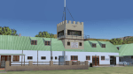
A Gmax representation of Dragon Peaks Air Force Base also referred to as CL van Wyngaard Airfield, South Africa with photoreal textures.
AFB Dragon Peaks is a small airfield nestled between the hills on the slopes of the Northern Drakensberg of South Africa. The airfield is situated only a few hundred meters from the Dragon Peaks Mountain resort as well as the home of the famous Drakensberg Boys Choir.
The grass runway is aligned 06/24 and 458m long and sits at an elevation of 3 986ft.
The scenery consists of 64 square kilometers of photoscenery with variants for all 4 seasons. Almost 1 100 hand placed autogen buildings and more than 32 000 (yes, thirty-two-thousand) hand placed autogen trees makes up the surrounding scenery. At the airfield itself you will find custom made Gmax models of the airfield buildings and structures with photoreal textures.
| Filename: | Dragon_Peaks_AFB_South_Africa.zip |
| License: | Freeware, limited distribution |
| Added: | 9th November 2017, 18:36:39 |
| Downloads: | 467 |
| Author: | kobus van wyk |
| Size: | 19.94 MB |
| Category: Flight Simulator X - Scenery | |
| ade scenery for LFLB v1.02 |
|
File Description:
ADE scenery for LFLB v1.02
New version corrects push back car sticking out through hangar door(sorry for that, didn’t see any pb car at all while checking)
Corrects ugly parking spots ( you should enter apron from north)
Small adjustment to birds flying at nw rwy (bigger area) extra car and stuff.
parking spot for light aircraft on the main apron (behind the md83)
scenery= 1 rearranged gates and parking spots (as seen on pictures)
2 birds SW and NW of the runway and high flying Eagles in the mountains left and right of the airport.
3 an NDB transmitter where the NDB is south of the runway.
4 rearranged buildings at the airport and some private planes on the parking's
5 An MD83 on the apron.
6 Overall: a more lively LFLB, Aix Les Bains in the French Alps
7 not much impact on frame rates.
| Filename: | ade_scenery_for_LFLB_v102.zip |
| License: | Freeware, limited distribution |
| Added: | 6th January 2009, 02:43:23 |
| Downloads: | 6,953 |
| Author: | Joost Visser / ADE |
| Size: | 611.76 KB |


© 2001-2026 AVSIM Online
All Rights Reserved
Privacy Policy |