
Where Flight Simulation Enthusiasts Gather from Around the World!
AVSIM Library - Search Results

| Category: Flight Simulator 2004 - Panels | |
| Douglas DC-3 MAAM-SIM Panel Modifications |

|
File Description:
Requires prior installation of the R4D-6/DC-3 package available from Mid-Atlantic Air Museum Simulations (MAAM-SIM) at www.maam.org. Will not work with the default FS2004 DC-3. These unofficial modifications, in two versions, of the panel supplied for the DC-3 in the MAAM-SIM package are uploaded with their permission. In both versions everything is consolidated on, or is accessible from, the Pilot's panel. Most features are accessible from the VC also. Version 1 replaces the Sperry autopilot with a Bendix autopilot and adds an HSI and RMI to the panel; Version 2 retains the Sperry but replaces the directional gyro with a more contemporary gyro with Heading bug. This panel also has an RMI and a conventional VOR1 gauge. Both panels have several other enhancements including standby radios.
| Filename: | Douglas_DC3_MAAMSIM_Panel_Modifications.zip |
| License: | Freeware |
| Added: | 10th July 2004, 04:54:24 |
| Downloads: | 9,688 |
| Author: | Mark Beaumont |
| Size: | 3.43 MB |
| Category: Flight Simulator 2004 - Aircraft Repaints, Textures and Modifications | |
| Caicos International Limited Douglas DC-4 |
|
Images related to this file:
File Description:

Textures for Jens B. Kristensen's excellent Douglas DC-4/C-54, repainted by Manfred Meyer.
This are textures only, You need to download and install DC4_V30.ZIP by J. B. Kristensen, use the cargo model with no radar nose!
These textures depict N529D (c/n 10748) of Caicos International Limited.
The aircraft was delivered in june 1945 as 42-72643 to the USAAF. After conversion to DC-4 in 1946 she went to China and flew for CNAC and CAT as XT-T-07 and XT-102. 1949 the plane came into US register as N4890V and served with several companies like Trans Ocean, Southwest, Riddle and Flying Tiger. 1960 she goes to Paraguayan Air Service as ZP-CBP and later in 1968 to SAM Colombia as HK-529. Bought by Florida Aircraft Leasing in 1970 and leased 1973 to 1975 to Caicos International Limited.
After then flew for Anglers Club and Southern Aero Trades, after all it believed destroyed in Colombia 1979.
| Filename: | Caicos_International_Limited_Douglas_DC4.zip |
| License: | Freeware |
| Added: | 16th November 2014, 21:00:43 |
| Downloads: | 120 |
| Author: | Manfred Meyer |
| Size: | 2.6 MB |
| Category: Flight Simulator 2004 - Miscellaneous Files | |
| Active ILS - EFHK (Helsinki - Vantaa Aerodrome) |
|
File Description:
As most know initiating the ILS at certain airports for AI Traffic is not a function at this time when using AFCAD2. If you add a new ILS runway to an airport such as EFHK (Helsinki - Vantaa 4L/22R) only the user aircraft can use this runway when visibility falls below 3 miles. ATC will no longer use this runway for AI Traffic because FS9 sees it as a visual runway. This will cause ATC to vector all your AI Traffic back to 4R/22L which is also a Terminal departure runway. This bgl file adds all NAVAIDS for making 4L/22R a Precision Instrument Runway by adding all the radar fixes for both the ILS approach portion and the missed approach procedures, altitudes and intersections as per current published plates. All AI Aircraft will now continue to use 4L/22R when Airport weather conditions are less than 3 miles.
*** FISD Finnish Scenery Designers and FS2004 Default Scenery AFCAD's included ***
| Filename: | Active_ILS__EFHK_Helsinki__Vantaa_Aerodrome.zip |
| License: | Freeware, limited distribution |
| Added: | 5th August 2004, 16:56:59 |
| Downloads: | 2,133 |
| Author: | Jim Vile |
| Size: | 27.25 KB |
| Category: Flight Simulator 2004 - Scenery | |
| High-resolution 76-m (LOD9) Terrain Mesh and Scenery Enhancements for the Southern Canadian Rockies |
|
File Description:
Not simply an add-on mesh, these files include many scenery enhancements for the southern Rockies of British Columbia and Alberta. Coverage extends from Cranbrook to Calgary, and Hinton to Edmonton (N48.9-53.4 W112.3-116.3). The mesh source data are 3-arcsec (~90-m) Shuttle Radar (SRTM) files, compiled at LOD9 (76-m) resolution. All lake elevations (!) have been adjusted to eliminate the problems with the default lake data and to better fit the new terrain mesh. In addition, the Transcanada Highway/Icefields Parkway corridor in Banff National Park, from Canmore to the Hwy 11 junction, has been completely re-made, with dozens of alpine lakes (including Lake Louise, Moraine Lake, and Lake O'Hara), accurate transportation network, and landclass/waterclass updates based on satellite imagery. Due to significant changes in FS2004 to vector layering and autogen features, the special scenery enhancements cannot be used with FS2002. However, terrain mesh, lake corrections and landclass replacements will work well in FS2002.
| Filename: | Highresolution_76m_LOD9_Terrain_Mesh_and_Scenery_E.zip |
| License: | Freeware, limited distribution |
| Added: | 29th October 2003, 03:01:22 |
| Downloads: | 15,468 |
| Author: | Holger Sandmann |
| Size: | 21.81 MB |
| Category: Flight Simulator 2004 - Panels | |
| Bristol Britannia |
|
File Description:
A highly detailed and comprehensive panel designed for Mike Stone's Bristol
Britannia aircraft. In addition to the standard instrumentation, includes cabin
announcements, traffic radar, fuel management etc.
Also requires a) FSUIPC (the latest version is always available at http://www.schiratti.com/dowson.html and is essential for the operation of some of the gauges in this panel), b) (optional) Flight Deck Sound Effects available here at AVSIM - fdsfxpnl.zip, and c) (optional) GPWS Altitude Call-Out Sounds available here at AVSIM - fpda_a330_callout.zip.
The manual is available in plain text format in this main download, or you can download an illustrated manual separately from the same download site in PDF format (britpanm.zip).
This is the result of over eighteen months of development and has been produced
specifically as a thankyou to all the people that have produced free add-ons that I have benefitted from.
I hope this enhances the pleasure of flying the only British-built long long-range turboprop airliner.
| Filename: | Bristol_Britannia.zip |
| License: | Freeware |
| Added: | 30th November 2004, 01:15:55 |
| Downloads: | 2,436 |
| Author: | John Hinson |
| Size: | 9.41 MB |
| Category: Flight Simulator 2004 - Gauges | |
| Delco Carousel IV-A Boeing 727 v2.51 |
|
File Description:
This download provides a dual INS mockup for all your Dreamfleet 727 v2 cockpits PLUS a TCAS and Transponder set that is fully compatible for online flying!
- all gauges are located where they would be in reality, that is on the overhead and next to the wx radar on the forward pedestal - as well in the virtual cockpit!
- package includes the excellent freeware IVSI embedded TCAS & Transponder by I.L. Hetherington in ALL non-EFIS variants, both 2D and virtual cockpit!
- package includes ilhtcaschange.gau by Jose Oliveira
- it is now possible to add gauges to the forward pedestal panel even in the virtual cockpit - FMS, GPS, you name it
This is version 2.51 includes
- a complete dual INS setup INCLUDING the new cardreader function to load and save INS Data (Waypoints)
- now compatible with the latest Simufly version 1.5 INS gauges
NOTE: the INS gauges are NOT included and need to be downloaded.
| Filename: | Delco_Carousel_IVA_Boeing_727_v251.zip |
| License: | Freeware |
| Added: | 9th July 2007, 13:40:39 |
| Downloads: | 4,140 |
| Author: | Nick Schreger (MeatWater) |
| Size: | 1.21 MB |
| Category: Flight Simulator 2004 - Scenery | |
| Wake Island (PWAK) |
|
Images related to this file:
File Description:

FS2004 photo scenery and AI package for Wake Island (PWAK) in the Pacific. Seemingly drifting in a strategic yet isolated position Wake Island-an atoll really-was one of the loneliest outposts of the United States. Originally a gas station for Pan Am's 'Clipper' flying boats, Wake was also a strategic air base during the Second World War. This continued with the Cold War as Wake became a centerpiece of the Pacific Radar Net against the Soviets.
With the thawing of Eastern Europe and the advent of more efficient jet aircraft Wake slowly drifted back to the quiet backwater it is again today, home to a handful of civilian caretakers and local wildlife. This scenery attempt to recapture Wake in the early 1980's when it still performed a semi-regular duty as gas station and pit stop. (This is a reload of the scenery due to the Hack attack - no changes to previous package)
| Filename: | Wake_Island_PWAK.zip |
| License: | Freeware, limited distribution |
| Added: | 15th May 2010, 08:57:58 |
| Downloads: | 4,935 |
| Author: | John Stinstrom |
| Size: | 4.75 MB |
| Category: Flight Simulator 2004 - Scenery | |
| "Himalayan Peaks" LOD10 Mesh, Volume 6 - Jammu and Kashmir |
|
Images related to this file:
File Description:
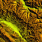
Highly detailed terrain mesh of the Jammu and Kashmir areas, N31-36 E76-78. The files in this package are based on Shuttle Radar (SRTM) Version 2 data but with many of the void areas, especially the most significant sections, filled with elevation data generated from topographic maps by Jonathan de Ferranti. While Jonathan's work is unrelated to flight simulation he kindly gave me permission to compile his data for use in FS. The result is a wonderful improvement in detail and accuracy over any existing mesh file, freeware or commercial, based on SRTM or DTED data alone.
Due to the large area of the Himalayas I've compiled the source data as two separate series: the "Himalayan Peaks" series covers prominent mountains and ranges in higher detail and locally overrides any existing LOD9 terrain mesh. In addition, a LOD9 "base mesh" series covering the entire Himalayas will be available for those who do not yet have an add-on terrain mesh of these beautiful mountains.
| Filename: | Himalayan_Peaks_LOD10_Mesh_Volume_6__Jammu_and_Kas.zip |
| License: | Freeware, limited distribution |
| Added: | 29th May 2010, 08:55:43 |
| Downloads: | 9,672 |
| Author: | Holger Sandmann, Jonathan de Ferranti |
| Size: | 52.19 MB |
| Category: Flight Simulator 2004 - Scenery | |
| "Himalayan Peaks" LOD10 Mesh, Volume 7 - K2 and Karakoram |
|
Images related to this file:
File Description:

Highly detailed terrain mesh of the Karakoram area, N35-37 E73-77. The files in this package are based on Shuttle Radar (SRTM) Version 2 data but with many of the void areas, especially the most significant sections, filled with elevation data generated from topographic maps by Jonathan de Ferranti. While Jonathan's work is unrelated to flight simulation he kindly gave me permission to compile his data for use in FS. The result is a wonderful improvement in detail and accuracy over any existing mesh file, freeware or commercial, based on SRTM or DTED data alone.
Due to the large area of the Himalayas I've compiled the source data as two separate series: the "Himalayan Peaks" series covers prominent mountains and ranges in higher detail and locally overrides any existing LOD9 terrain mesh. In addition, a LOD9 "base mesh" series covering the entire Himalayas will be available for those who do not yet have an add-on terrain mesh of these beautiful mountains.
| Filename: | Himalayan_Peaks_LOD10_Mesh_Volume_7__K2_and_Karako.zip |
| License: | Freeware, limited distribution |
| Added: | 30th May 2010, 09:56:27 |
| Downloads: | 9,485 |
| Author: | Holger Sandmann, Jonathan de Ferranti |
| Size: | 38.58 MB |
| Category: Flight Simulator 2004 - Scenery | |
| "Himalayan Peaks" LOD10 Mesh, Volume 4 - Annapurna |
|
Images related to this file:
File Description:

Highly detailed terrain mesh of the Annapurna area, N28-30 E83-85. The files in this package are based on Shuttle Radar (SRTM) Version 2 data but with many of the void areas, especially the most significant sections, filled with elevation data generated from topographic maps by Jonathan de Ferranti. While Jonathan's work is unrelated to flight simulation he kindly gave me permission to compile his data for use in FS. The result is a wonderful improvement in detail and accuracy over any existing mesh file, freeware or commercial, based on SRTM or DTED data alone.
Due to the large area of the Himalayas I've compiled the source data as two separate series: the "Himalayan Peaks" series covers prominent mountains and ranges in higher detail and locally overrides any existing LOD9 terrain mesh. In addition, a LOD9 "base mesh" series covering the entire Himalayas will be available for those who do not yet have an add-on terrain mesh of these beautiful mountains.
| Filename: | Himalayan_Peaks_LOD10_Mesh_Volume_4__Annapurna.zip |
| License: | Freeware, limited distribution |
| Added: | 29th May 2010, 08:59:29 |
| Downloads: | 10,467 |
| Author: | Holger Sandmann, Jonathan de Ferranti |
| Size: | 15.07 MB |


© 2001-2026 AVSIM Online
All Rights Reserved
Privacy Policy |