
Where Flight Simulation Enthusiasts Gather from Around the World!
AVSIM Library - Search Results

| Category: Flight Simulator 2004 - Scenery | |
| Aspen (KASE), Colorado, Photo-Scenery (FS9 & FSX) |

|
Images related to this file:
File Description:
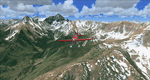
There sure is more than one reason to go to Aspen and this is sure another must-have of my Colorado sceneries. If you're coming IFR there's a couple of very demanding approach procedures. From a LOC/DME to several visual approaches there's everything your heart might desire. Due to the steep and high surrounding terrain these are quiet some hair raisers (see www.airnav.com/airport/KASE). If you're coming VFR then the traffic pattern altitude is 9.005 ft for light aircraft (vs. 9.505 for aircraft 12.500 lbs or more). Weather and wind permitting, RW15 is preferred for all landings (left pattern). RW33 has a right pattern and is preferred for all takeoffs. You even need a written permission to depart RW15. When departing VFR make a right turn to a heading of 360 degrees ASAP for noise abatement and hold this heading for at least 2 miles from the field. And don't forget to enjoy the impressive mountain scenery with two 14ers: Snowmass Mtn. and Castle Pk. to the southwest. This scenery brings you another 3.500 sq km of beautiful Colorado in 4.7m/pix quality. High resolution versions of this scenery for FS9 and FSX (much sharper, but larger and multiple downloads) are available at www.blueskyscenery.com/GNB_South2West2.html . The screenies are taken from the high-res versions, so expect this version to be slightly more blurry. YourDonation@Work: Dedicated to Mark, Markus and Yves.
| Filename: | Aspen_KASE_Colorado_PhotoScenery_FS9__FSX.zip |
| License: | Freeware, limited distribution |
| Added: | 30th January 2010, 17:04:55 |
| Downloads: | 3,585 |
| Author: | Gottfried Razek - blueskyscenery.com |
| Size: | 92.5 MB |
| Category: Flight Simulator 2004 - Scenery | |
| Lechfeld, v2 |
|
Images related to this file:
File Description:
This airbase, located about 35 NM in the west of Munich (Bavaria, South Germany),
is the homebase of JaBoG32 riding the Tornado PA200. The German flight check
department GMFS, using C-47 in the early days and thereafter Hawker-Siddeley 748
as well as HS-125 for periodic recalibration of the radar- and navigational
equipment at civil and military airfields, was also on the base till 1994.
After the final decision was made not to establish commercial air traffic although
it had been discussed for a long time period, I reworked the airbase completely.
Among other objects, 38 hardened shelters for combat aircraft have been emplaced.
The included AI-Package contains: Lockheed F-104E GAF, Panavia Tornado PA200 GAF,
Mikoyan MiG-29 GAF, Douglas C-47 GAF, Canberra B.20 GAF, Boeing E3A Nato, Boeing
KC-135 USAF and an aircraft.cfg for the MS Learjet 45.
Several F104's, Tornadoes and MiGs perform touch and goes in the local area,
a Nato E3A leaves IFR to Geilenkirchen (ETNG), an USAF KC-135 routes IFR to
Decimomannu (LIED), a Canberra B.20 (was used for high altitude validations) goes
IFR to Cologne (EDDK) high in the sky and a Learjet shoots IFR to Bremen (EDDW) per
attached flight plan.
Lago's FSE is required in order to see most of the emplaced buildings /objects.
Lets get ready to rumble, but keep in mind, don't argue with the flight checkers
if they are on duty.
| Filename: | Lechfeld_v2.zip |
| License: | Freeware |
| Added: | 12th April 2011, 13:26:46 |
| Downloads: | 1,422 |
| Author: | Klaus Jone |
| Size: | 5.43 MB |
| Category: Flight Simulator 2004 - Miscellaneous Files | |
| GoTo any Airport Version 4 |
|
File Description:
Go To Any Airport.- Now 4 Airports Included.
Always wanted to return to your favourite local Airport from anywhere in the world? simply - with no fuss? Look no Further.
Start at your Designated Airport, [in this case London Gatwick,Innsbruck,Dublin or Edinburgh in a 737], then Goto any Airport! - via the FS9 World menu and return to the Original Designated Airport - every time! - By Just turning the GPS/nav switch to GPS and Flight Director and autothrottle on whilst still on the ground.Click on the Autopilot and Nav Hold switch once above 1000ft - thats it !! . Set Weather as required and dont forget Altitude and Speed in autopilot and away you go. Use the FS9 ATC as You Travel, call into designated Airport when close and receive the curent ATIS and Runway approach in use.
HAVE FUN.
(This is different to the great circle direct routes that you can programme into the very good FS9 GPS - each and every time you start from a new airport).
As A bonus you can also use the designated flight files provided to take of and circle your Airport,using autopilot again with GPS/nav switch on gps setting and nav hold switch on. This is a good way to observe the airfield and your aircraft especially from tower view - set tower position using map window and pointing and dragging tower icon also set the tower altitude.Some Example flights worded "AJT Circuit of......." are also enclosed.- these particular flights can make good moving screen savers!
| Filename: | GoTo_any_Airport_Version_4.zip |
| License: | Freeware |
| Added: | 7th March 2004, 18:21:48 |
| Downloads: | 1,001 |
| Author: | Alan Trussell |
| Size: | 54.91 KB |
| Category: Flight Simulator 2004 - Flight Plans | |
| Military Base Tour - Pacific Rim |
|
File Description:
Military Base Tour – Pacific Rim (MFPR) contains 21 Flight Plans (.PLN) for flights to various military air bases along the Pacific Rim, across the Pacific to CONUS and ending at Andrews AFB/NAF where the Military Flights Series began. It is the continuation of Military Flight Plans (MF) (mf_flights.zip) published in Avsim on 29th March 2004, Military Flight Plans – Europe (MFE) (mfe_flights.zip) published in Avsim on 17th June 2004 and Military Base Tour – West Asia (MFWA) (mfwa_flights.zip) published in Avsim on 6th August 2004 and Military Base Tour – South Asia (MFSA) (mfsa_flights.zip) published in Avsim on 20th November 2004. There are a total of 128 flight plans in this Military Flight Series - Round the World Tour of Military Bases. (See Military Flights Master Itinerary– included in this .zip.) The itinerary contains a list of all the plans in the five uploaded files.) There are Briefing documents for each flight in Microsoft Word (.doc) and Text (.txt). The Flight Plans use the autopilot from takeoff to landing. The speed, altitude, weather, radios and various other controls are the pilot’s responsibility. Many landings are IFR and all are under the control of the autopilot. It is suggested that the pilot set up a separate Folder (“MFPR Flights” for example) and unzip this file there to store the .PLN and Briefing files. The .PLN can then be copied to the “Flight Simulator Files” and used to set up the flight and the Briefings printed and available for quick reference during the flight.
| Filename: | Military_Base_Tour__Pacific_Rim.zip |
| License: | Freeware |
| Added: | 9th April 2005, 04:39:05 |
| Downloads: | 1,382 |
| Author: | John Resch |
| Size: | 282.22 KB |
| Category: Flight Simulator 2004 - AI Aircraft | |
| AI Gliders |
|
File Description:
This packages is the result of my efforts to get AI-glider traffic into FS2004.
Included are:
-a fictional glider-airfield (my personal area51) somewhere at a quiet and flat place at Denmark. It's divided into two afcads AF2_A51A.bgl and AF2_A51B.bgl;
-an AI-version of the DUO DISCUS, tweaked in a way that it takes off from the airfield (afcad A51A), fly a pattern and land at the same airfield (afcad A51B). After 30 minutes the glider does the same trick from afcad B to afcad A. And so on every hour;
- an other AI-version of the DUO DISCUS, tweaked in a way that it will take off from afcad A, climb while circling and then keeps endlessly circling at an altitude of around 3000ft ASL in the surrounding of the airfield; A second glider of the same sort takes off from afcad B and also start circling endlessly.
- an traffic.bgl to make the above flights possible (and the source files for it).
You can use this package as an example to make your own AI-glider-airfields and AI-glider_trafficfiles. It is my intention to upload other AI-gliders in a short time.
Credits go to Wolfgang Piper for his excellent gliders which inspired me to start experimenting with AI-gliders and for giving me permission to rebuild his gliders to AI-versions.
For other examples of his excellent gliders, visit his site http://www.fsglider.de
Also credits go to Alan Kaiser for the stemme.air, which I used to make the AI-versions for the DUO DISCUS.
| Filename: | AI_Gliders.zip |
| License: | Freeware, limited distribution |
| Added: | 27th June 2005, 23:22:45 |
| Downloads: | 2,348 |
| Author: | Bert de Bruin |
| Size: | 1.82 MB |
| Category: Flight Simulator 2004 - Miscellaneous Files | |
| Map BMP Pack 1 |
|
Images related to this file:
File Description:
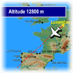
FeelThere Map! will display the track of your flight. In addition, a sequence of screens shows a variety of flight information such as elapsed and remaining time, distance, altitude, wind information, and temperature, this pack contains .bmp files for 220 airlines, incluiding airlines like Aeroflot, Aeromexico, Air Canada, Air China, Air Europa, Air France, Air New Zealand, Alitalia, All Nippon Airways, American Airlines, Asiana Airlines, Austrian Airlines, British Airways, Cathay Pacific Airways, China Eastern Airlines, China Southern Airlines, Delta Air Lines, EgyptAir, Finnair, Iberia, Japan Airlines, KLM, Korean Air, LAN, LOT, Lufthansa, Qantas, Royal Jordanian, S7 Airlines, Scandinavian Airlines, Singapore Airlines, South African Airways, Swiss International Airlines, TAM, TAP, Thai, Turkish Airlines, United Airlines and more, you need the FEELTHERE - MAP! to use these files.
**************************************
FeelThere Map! mostrara todo el trayecto de tu vuelo. Asi como tambien, una secuencia de pantallas que muestran informacion del vuelo como el tiempo transcurrido y el restante, la distancia, la altitud, informacion del viento y de la temperatura, este paquete contiene archivos .bmp para 220 aerolineas, entre ellas estan Aeroflot, Aeromexico, Air Canada, Air China, Air Europa, Air France, Air New Zealand, Alitalia, All Nippon Airways, American Airlines, Asiana Airlines, Austrian Airlines, British Airways, Cathay Pacific Airways, China Eastern Airlines, China Southern Airlines, Delta Air Lines, EgyptAir, Finnair, Iberia, Japan Airlines, KLM, Korean Air, LAN, LOT, Lufthansa, Qantas, Royal Jordanian, S7 Airlines, Scandinavian Airlines, Singapore Airlines, South African Airways, Swiss International Airlines, TAM, TAP, Thai, Turkish Airlines, United Airlines y muchas mas, necesitaras el FEELTHERE - MAP! para usar estos archivos.
| Filename: | Map_BMP_Pack_1.zip |
| License: | Freeware |
| Added: | 15th September 2011, 13:20:03 |
| Downloads: | 2,266 |
| Author: | Juan Rodriguez, AeroSimulaciones, FeelThere |
| Size: | 26.56 MB |
| Category: Flight Simulator 2004 - Scenery | |
| CZNL - Nelson - Nelson, British Columbia, Canada |
|
Images related to this file:
File Description:
Nelson is a town with a population of around 10,000, located 250 miles or so east of Vancouver on the southern shore of an east-west offshoot of Kootenay Lake. The surrounding landscape can be described as "steep" without fear of contradiction, and the diagram of arrival and departure routes (included here) shows that straight finals to either end of the runway are non-existant. The airport is right beside the water, with a single runway 3,100 feet long and 75 feet wide, aligned 04/22. The apron is at the western end. There are a number (3?) of helicopter companies based at the western end of the apron, and there is also a terminal building, though there are in fact no regular scheduled flights; there are occasional charters to cater for town events during the summer tourist season. There is no runway lighting, or taxiway or apron lights, so usage is effectively restricted to daylight hours (though not legally stated as such). All circuits are over the water and not the town, though even this means you climb quickly and dog-leg to follow the water until you have gained enough altitude to turn. Winter maintenance is limited. And if all this is not enough you are advised to "watch for wildlife on the rwy". The nature of the surrounding terrain makes AI hit-and-miss; mostly hit. AI Planes will taxi out and then take off, and provided you don't follow them until they fly into a mountain it will all appear normal. Planes that are arriving will appear by magic on their parking spots, as they have crashed before they arrive. To avoid repetitive unrealistic arrivals I have limited the AI to only 3 planes. The scenery includes some of the nearby buidings and landmarks, as shown in the screenshots.
| Filename: | CZNL__Nelson__Nelson_British_Columbia_Canada.zip |
| License: | Freeware, limited distribution |
| Added: | 7th June 2015, 10:23:49 |
| Downloads: | 426 |
| Author: | Roger Wensley |
| Size: | 17.84 MB |
| Category: Flight Simulator 2004 - Scenery | |
| Twin Lakes Airstrips in British Columbia Canada |
|
Images related to this file:
File Description:
There are three grass airstrips within sight of each other from the air at Twin Lakes in BC, which is between the close junction of Elkin Lake and Vedan Lake. The two lakes are similarly shaped and sized and in the same narrow valley between high ground that runs north-south; hence the name. Elkin is to the north, and Vedan is to the south. Twin Lakes CAG4 is on the strip of land between the two lakes and it is unclear to me who it belongs to etc. It is not in the Nav Canada copy that I have with me which is from 2010, and the online version does not cover grass strips. It is probably owned by whoever lives in the house next to the red hangar. The runway is 3,600 feet of grass aligned 14-32 at 3,945 feet ASL. Chaunigan Lake Lodge CF83 is over to the northwest from Twin Lakes by around 2 miles or so and as the name suggests it services the Lodge of that name, which is on the northeast corner of Chaunigan Lake. The runway is 2,600 feet of grass aligned 02-20 at 4,900 feet ASL. You might want to read about altitude power reductions for the take off. Elkin Creek Guest Ranch CBL9 is at the southern end of Vedan Lake and serves the ranch. This appears to be another high-budget operation and the runway is 3,670 feet of grass aligned 36-18 at 3,999 feet ASL. I have posted this as three separate airstrips, but I suggest that you add these to your "BC airfields" folder as previously suggested. Up to you. If you find a defect, email me. Ignore the post of Chilanko Lodge posted today. I requested Avsim to delete it but it seems they didn't read the email. It was originally posted as a correction for the original post of the three posted here.
| Filename: | Twin_Lakes_Airstrips_in_British_Columbia_Canada.zip |
| License: | Freeware, limited distribution |
| Added: | 21st November 2020, 23:29:09 |
| Downloads: | 126 |
| Author: | Roger Wensley |
| Size: | 25.39 MB |
| Category: Flight Simulator 2004 - Panels | |
| Super VC10 Panel Upgrade Part 3 |
|
File Description:
This panel upgrade for David Maltby's Super VC10 incorporates significant major changes. First the Super VC10 has now become a stand alone aircraft within the "DMFS Shared Files" file structure. This allows for many changes that distinguish the Super VC10 from the Standard. Some already present and some ongoing. The main panel is now in widescreen format i.e. "not stretched!" Many hundreds of other changes have also been made some unseen that make significant differences to the performance of the model. For example the Super has a fin tank now modelled along with correct fuel transfer and jettison procedures. The engines have been totally overhauled with new thrust curves so that their performance is as accurate as possible across the power spectrum. A consequence of this is that throttle control is now much more precise. Internal engine sounds have been completely revised and are as close as possible to the sound one would hear from the cockpit. There are in addition numerous new panels that are fully functional such the Oxygen panel. This means that cabin altitude and depressurisation are all potential factors and must be attended to. Though you do have an oxygen mask (so don it if necessary or face the consequences!). There is a tiller for ground manoeuvring. There are just too many changes and additions to list here but they are listed in the documentation. Another important addition is refuelling. Refuelling can only be done from an underwing point. To assist is a dedicated new fuel uplift spreadsheet which incorporates a facsimile of a real Super VC10 load sheet allowing you to change passenger loads etc. Everything is explained in the "Technical and Operational Procedures Manual" pdf file as well as the "VC10 FLYING MANUAL" pdf file which contains all the full checklists not cut down for sim use. With ongoing work the intention is that this will become a "study" simulation.
If you do not already have David Maltby's Super VC10 model then download it from here. http://www.dmflightsim.co.uk/vickers_vc10.htm
Follow his instructions and make sure everything is working as expected before downloading these updates.
| Filename: | Super_VC10_Panel_Upgrade_Part_3.zip |
| License: | Freeware |
| Added: | 18th August 2016, 03:57:13 |
| Downloads: | 416 |
| Author: | Nicholas Weber |
| Size: | 127.77 MB |
| Category: Flight Simulator 2004 - Panels | |
| Super VC10 Panel Upgrade Part 4 |
|
File Description:
This panel upgrade for David Maltby's Super VC10 incorporates significant major changes. First the Super VC10 has now become a stand alone aircraft within the "DMFS Shared Files" file structure. This allows for many changes that distinguish the Super VC10 from the Standard. Some already present and some ongoing. The main panel is now in widescreen format i.e. "not stretched!" Many hundreds of other changes have also been made some unseen that make significant differences to the performance of the model. For example the Super has a fin tank now modelled along with correct fuel transfer and jettison procedures. The engines have been totally overhauled with new thrust curves so that their performance is as accurate as possible across the power spectrum. A consequence of this is that throttle control is now much more precise. Internal engine sounds have been completely revised and are as close as possible to the sound one would hear from the cockpit. There are in addition numerous new panels that are fully functional such the Oxygen panel. This means that cabin altitude and depressurisation are all potential factors and must be attended to. Though you do have an oxygen mask (so don it if necessary or face the consequences!). There is a tiller for ground manoeuvring. There are just too many changes and additions to list here but they are listed in the documentation. Another important addition is refuelling. Refuelling can only be done from an underwing point. To assist is a dedicated new fuel uplift spreadsheet which incorporates a facsimile of a real Super VC10 load sheet allowing you to change passenger loads etc. Everything is explained in the "Technical and Operational Procedures Manual" pdf file as well as the "VC10 FLYING MANUAL" pdf file which contains all the full checklists not cut down for sim use. With ongoing work the intention is that this will become a "study" simulation.
If you do not already have David Maltby's Super VC10 model then download it from here. http://www.dmflightsim.co.uk/vickers_vc10.htm
Follow his instructions and make sure everything is working as expected before downloading these updates.
| Filename: | Super_VC10_Panel_Upgrade_Part_4.zip |
| License: | Freeware |
| Added: | 19th August 2016, 21:43:08 |
| Downloads: | 347 |
| Author: | Nicholas Weber |
| Size: | 152.39 MB |


© 2001-2026 AVSIM Online
All Rights Reserved
Privacy Policy |