
Where Flight Simulation Enthusiasts Gather from Around the World!
AVSIM Library - Search Results

| Category: Flight Simulator 2004 - AFCAD Files | |
| Birmingham International Airport, Birmingham, Alabama (KBHM) |

|
File Description:
An extremely accurate rendition of the KBHM airport with appropriate gate, cargo and general aviation parkin. I've decided to make it a habit to do airports that one doesn't really see much on FS. Everyone does 300 AFCADs of KORD and there's nothing wrong with that it's a great airport but I figured I didn't need to add another KORD or KLAX to the pile unless I'd be providing something the others lack and I can't seem to find it. So, again, I'll be continuing to do AFCADs I feel are lacking or unavailable or not done well. The BHM airport is definetely not a bustling international port of call and it only receives mainline service from a few carriers but it has a decent amount of traffic and I thought it would be good to represent the airport. Thankfully this time MS did a reasonably good job with terminal space and I was able to include every gate in the two concourses. The great BHM website made my job a breeze by indicating which airlines park at which specific gate(s). Every airline is exactly where they should be as is cargo. A ramp for you VFR general aviation buffs is also available. The only time you might notice some craziness is if you start your flight super early in the morning and you have traffic at 95% +. It seems MS doesn't really "turn" planes in a realistic manner so you end up having more planes parked at the gate in the early morning hours then would be there in real life if they adheared to real world turn around times. Nothing I can do about that. Hope you enjoy your virtual trips in and out of the Birmingham International Airport.
| Filename: | Birmingham_International_Airport_Birmingham_Alabam.zip |
| License: | Freeware |
| Added: | 29th June 2004, 19:31:34 |
| Downloads: | 2,317 |
| Author: | Jason Diaz |
| Size: | 137.07 KB |
| Category: Flight Simulator X - Scenery | |
| LFMQ - Le Castellet |
|
File Description:
Welcome to Le Castellet Airfield -
This airfield is situated few Nm east of Marseille Provence - LFML, in the south of France. On the 1,000 hectares of plateau he acquired between Marseille and Toulon, Paul Ricard, forever motivated by innovation and development, constructed in 1962 the largest
private airfield in the Provence-Alpes-Côte d’Azur region.
The landing strip at Le Castellet covered a distance of 1,000 metres and allowed for VFR (Visual Flight Rules) operation. Situated on a plateau at the time free of all economic development, it was above all a private airfield. In 1970, the construction
of the Paul Ricard Circuit nearby created an economic dynamic for the first time on Le Castellet plateau. In 1972, Paul Ricard invested in improvements to the runway, lengthening it from 1,000 to 1,750 metres, thus rendering it capable of
receiving business and private airplanes of up to 38 tonnes.
Over twenty years, Le Castellet Airport saw intense periods of activity due to business and private aviation, notably with the arrival of the first F1 French Grand Prix on the Paul Ricard Circuit in 1971, and more recently, with the creation of the Entreprise Zone at Signes, situated only a few kilometres from the airfield. Stop by for an amazing visit at the medieval village as well, situatued on top of a hill.
Nevertheless, from 1972 to 1999, no investment was made at the airfield. In May 1999, the company Excelis S.A. purchased the site (airfield and circuit) and refurbished and modernised the installations.
A truly amazing place to fly to - I have enhanced the entire apron as it is today, all marking correctly set, acces to runway and the Heli area for the "Eggbeater" fan :)
includes the hangar, building and other things around. Hope you'll enjoy your stay at "Le castellet"!
| Filename: | LFMQ__Le_Castellet.zip |
| License: | Freeware |
| Added: | 24th April 2009, 16:28:59 |
| Downloads: | 2,350 |
| Author: | Daniel Louvet |
| Size: | 986.65 KB |
| Category: Flight Simulator 2004 - Scenery | |
| Frozen Canadian & USA Rivers & Lakes Revision |
|
Images related to this file:
File Description:
This "freezes" all lakes and rivers for winter flying and means they can be landed on with skis or wheels; it is meant for low level flying rather than high level jet flights. This edition is complete in itself and now really covers all of Canada and parts of the USA along the border, including large parts of Michigan, Wisconsin, Minnesota, North Dakota, and Montana. It is reversible with an "untick" in the FS scenery library. The revision is the addition of frozen sea in the area of Baffin Island (where I and Sid & Pete have recently posted all of the Baffin Island airfields) as I missed this area last time. Sorry about that. I have spent some time making sure that the sea and the inlets along the coast in the south do not get frozen too, and also some of the lakes that are close to the coast and rarely get cold enough to freeze over. The Great Lakes do not usually totally freeze, but this is an either ON or OFF modification and partial freezing cannot be convincingly simulated, so I went for total ice. Along the north shore I went for the peak of the winter with sea ice all the way to the permanent polar cap; this is not totally realistic as there is usually a partially open lead along the coast, but as with the Great Lakes...... It will work without Ultimate Terrain, but as UT is what gets all the lakes and rivers there and in the right place (except in the far north) it is obviously much improved with UT. The pics show Rockcliffe in the winter with the frozen Ottawa River for real and in FS for comparison; without UT the river would not be in the right place.
| Filename: | Frozen_Canadian__USA_Rivers__Lakes_Revision.zip |
| License: | Freeware, limited distribution |
| Added: | 6th September 2011, 00:42:43 |
| Downloads: | 623 |
| Author: | Roger Wensley |
| Size: | 1.2 MB |
| Category: Flight Simulator 2004 - Scenery | |
| Lismore Regional Airport (YLIS) |
|
File Description:
A very attractive small airport approximately 130 nautical miles from Coffs Harbour and a slightly shorter distance to Grafton and Ballina. This makes a good stopover for hopping down the east coast of Australia. The airport handles around 7 flight a day from Sydney and is also a busy GA aiport. A new terminal is a major feature of the airport with a very modern design. This terminal was opened on Dec 9 2000 and replaces an older style building to be found in the general aviation area. The terminal is at the northern end of the aiport and the GA area the furthest south.
The size of the airport has allowed me to put in that extra detail which makes the terminal and surrounds very much "as in real life". Photographic textures are used throughout for the buildings, trees and shrubs. Thanks to the cooperation of the airport manager and Lismore Council, the owners of the airport, a very accurate model of the airport has been produced from over 250 photographs taken on site. AFCAD and Traffic Tools files are included to add extra AI traffic. For that reason and because of limited apron space few static planes have been used. In addition a landclass is included to make the airport ground texture resemble the real thing and also to widen the river and show the lake to the east of the airport..
The scenery concentrates on adding a realistic terminal to the airport and hangars which are as close as possible to the real thing. Many other details have been added all authentically Lismore.
Some night lighting is included including some very distinctive airport lights in the car park.
| Filename: | Lismore_Regional_Airport_YLIS.zip |
| License: | Freeware |
| Added: | 11th April 2004, 06:31:42 |
| Downloads: | 3,677 |
| Author: | John Ross |
| Size: | 4.21 MB |
| Category: Flight Simulator 2004 - Scenery | |
| Airstrips of North-West Europe |
|
Images related to this file:
File Description:
The sales blurb for FS2004 announced the inclusion of over 23,000 airfields ... unfortunately a significant number of those consisted of little or nothing more than a runway on a flatten with a rectangular background polygon.
To enable the addition of an amount of lightweight GA AI traffic, without overloading those airfields that were designed with parking spaces and taxi-ways, (and are probably already busy), I herewith include over 140 small sceneries, of mostly default airfields, from NW France, up the English Channel and the North Sea coast through Belgium, the Netherlands and NW Germany to Denmark, all with added taxiways and parking spots, aprons, generic buildings and background polygons as appropriate, to enable AI traffic to be generated without interrupting things at the more major airports.
A few of the French airfields are "new", not included originally with FS2004, and a couple have been updated to suit more recent developments :- for example, LFES "Scaer Guiscriff" is now LFES "Bretagne Atlantique", LFOR "Chartres Champhol" is now LFOR "Chartres Metropole", EHSE "Seppe" is now EHSE "Breda International" and EKVH "Vesthimmerlands" was previously EKVH "Aars".
There's no photo-realism here, just a selection of basic 'generic' buildings, more or less accurately sized and placed to reflect the airfield layout as seen on on-line satellite imagery and aerial photography. These buildings have minimal effect on frame-rates, so are ideal for this kind of job.
The airfields are aligned as well as possible with the roads etc. in UT Europe and the Genesis Europe mesh, but should mostly be fine in a default installation or other configuration.
Please read the rest of this "waffle" in the included text file ... it might save some confusion ;)
Enjoy :)
| Filename: | Airstrips_of_NorthWest_Europe.zip |
| License: | Freeware |
| Added: | 14th June 2024, 13:44:58 |
| Downloads: | 286 |
| Author: | Chris Eve |
| Size: | 9.95 MB |
| Category: Flight Simulator X - Gauges | |
| TCAS and Traffic Display Gauge V2.0 |
|
Images related to this file:
File Description:
This TCAS and Traffic Display Gauge Version 2.0 includes significant improvements from V1.0. It has been developed for the FSX Flight Simulator SP1/2 also. It should also work with Acceleration.The functionality for the TCAS part is based on general specs for commercial aircrafts. It does not provide in detail the function for a specific aircraft model. It is a generic gauge, and can be simple added to any aircraft as a standalone popup window.
In addition the gauge provides a AI traffic display in the ranges of 10,20, and 40 miles.Within this display mode, no TCAS rules are valid, which means all AI aircraft are displayed independent of any altitude or distance.
Improvements in V2.0 are: 1: Full TCAS and traffic display capability is provided even though your aircraft is on the ground. Only the trigger of the alarm/warn sound and the blinking lamp display willbe blocked. 2: An AI HDG pointer will be displayed. It shows in which direction the AI is moving. 3: A bearing pointer has been introduced. It allows the pilot to point to a specific AI.4: The AI additional text info display follows the structure of an ATC text.5:The AI additional text can be selected individually per AI with a mouse click.
6: Each AI display contains a ID index number (0 � 20).7: The design of the TCAS and Traffic Display Box has been updated.8: Increased the number of AIs displayed on the screen in display mode.
For installation and functional description look at the doc inside the ZIp.
CREDIT goes to :
Stefan Schneider for his support on special XML issues and TCAS functionality.
Bob Familton for his review of the documentation and testing for SP1 FSX.
Doug Dawson for his dsd-XML-sound interface in order to generate the sounds.
| Filename: | TCAS_and_Traffic_Display_Gauge_V20.zip |
| License: | Freeware |
| Added: | 25th October 2010, 13:37:36 |
| Downloads: | 3,757 |
| Author: | Dietmar Loleit |
| Size: | 981.32 KB |
| Category: Prepar3D V1-4 - Original Aircraft | |
| UV-4 V/STOL UAV (Experimental) |
|
Images related to this file:
File Description:
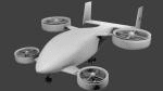
Created as a means to display the potential of a ducted fan rotorcraft powered by multiple electric motors. The system made its launch in 2015, since then advances and improvements have been completed to the airframe and power plant configurations. Delivering an efficient means of lift using smaller and therefore quieter propeller then traditional helicopters. The function of the ducted system serves as a mean of channeling pressure and vectoring thrust. Giving the UV-4 a unique control system and improved maneuverability. The design of a low speed "T-Tail" houses the function of yaw control with multiple rudders located on its vertical stabilizer, and elevators on its horizontal stabilizer. In addition the rear ducted systems may pivot up to less then sixty degrees forward and backwards to deliver the vector thrust where the aircraft needs it to be. The cargo bay may house up to four thousand pounds of deliverable payload. As its max gross take-off weight is designed to reach twelve thousand five hundred pounds. The electrical systems on the aircraft use a network of batteries, generators, and its two electrical motors. Proving five hundred horse power each, totaling an amount of one thousand horse power. An electrical charge then powers the mechanization used to spin the propeller to its desired rate per minute. Perhaps in the near future an additional system can be created to then generate electrical charges created by the spinning propeller of inside the duct back into the aircraft to then power systems or recharge the battery. We forward to providing this aircraft on Microsoft Flight Simulator X, Lockheed-Martin Prepar3d, and X-Plane 10 for download by the end of 2016. Aircraft by Rob Gomez & Kris Pyatt
| Filename: | UV4_VSTOL_UAV_Experimental.zip |
| License: | Commercial demo |
| Added: | 22nd January 2017, 04:10:41 |
| Downloads: | 186 |
| Author: | Rob Gomez & Kris Pyatt |
| Size: | 8.13 MB |
| Category: Flight Simulator 2004 - Scenery | |
| Ballina, New South Wales, Australia (YBNA) |
|
File Description:
A very attractive small airport approximately 120 nautical miles from Coffs Harbour and a slightly shorter distance to Grafton and Lismore. This makes a good stopover for hopping down the east coast of Australia. The airport handles around 11 flight a day from Sydney and is also a busy GA aiport. Airlines REX and Qantas link fly into Ballina. The size of the airport has allowed me to put in that extra detail which makes to terminal and surrounds very much "as in real life". Photographic textures are used throughout for the buildings and even the trees and shrubs are hand made macros from photographs at the airport. Thanks to the cooperation of Northern Airline Services - Mr Bruce Beesley the MD and Graeme from Ballina Council the relative position of all of the buildings are exactly to scale as shown on scale drawings of the airport. AFCAD and Traffic Tools files are included to add extra AI traffic. For that reason and because of limited apron space no static planes have been used. In addition a landclass is included to make the airport ground texture resemble the real thing and also to widen the river behind runway 24. The scenery concentrates on adding a realistic terminal to the airport and hangars which are as close as possible to the real thing. Many other details have been added all authentically Ballina. The default runway detail remain unchanged with the exception of VASI placement. Other than that the airport merges into the default scenery without the usual "green oasis" effect. Full night lighting is included plus a rather dubious attempt to model the inside of the terminal (strictly not to be taken too seriously)
| Filename: | Ballina_New_South_Wales_Australia_YBNA.zip |
| License: | Freeware |
| Added: | 25th January 2004, 19:16:25 |
| Downloads: | 5,912 |
| Author: | John Ross |
| Size: | 6.8 MB |
| Category: Flight Simulator X - Scenery | |
| US Navy Collection, with Flyable UAV |
|
Images related to this file:
File Description:

Unfortunately the Navy has cancelled or scaled down most fleet week celebrations around the nation. With this collection, you can stage your own!
Among the latest and hottest additions to the US Navy arsenal is the LCS. Two versions have been developed, the trimaran corvette by General Dynamics and Lockheed Martin's version, which promise to give a double black eye to Al Qaida, Somali pirates, or anyone else that opposes Freedom and Independence. Also are included in this package are the Arleigh-Burke class destroyer USS Fitzgerald, the Ticonderoga class cruiser Lake Champlain and two Oliver-Perry class frigates, FFG-58 Samuel B Roberts and FFG-60 Rodney M Davis. The centerpiece of the fleet is LHD-2 USS Essex and thanks to Arno's fantastic ModelConverterX, Essex is able to feature a highly detailed deck packed with 7 F-35b JSF, 6 MV-22 Osprey, 5 CH-53 and 2 Seahawks. Finally, SSN775 Texas, as part of the collection is available for patrol. All ships have landable decks, night lights and animation effects. Texas as a submarine is more of a boat, I believe, but it has navigation lights and wake effects.
I have also included another hot Navy addition, the RQ-8 fire Scout. There are two versions, a static RQ-8b lashed to the deck of Independence and an RQ-8c with the Flir Brite Star electro/optical turret which I have made flyable, largely for absence of deck space to place it as static.
Make no mistake that the Essex model is very resource intensive, with all it's polygons and what have you. The night lighting is stunning (imo) but seems to have an even heavier effect, you've been warned..
| Filename: | US_Navy_Collection_with_Flyable_UAV.zip |
| License: | Freeware, limited distribution |
| Added: | 19th October 2013, 20:27:36 |
| Downloads: | 1,292 |
| Author: | Rick Keller |
| Size: | 96.89 MB |
| Category: Flight Simulator 2004 - Scenery | |
| Bethel area airfields in southwest Alaska close to the Yukon River |
|
Images related to this file:
File Description:
This presumes you have already installed my post of Bethel PABE. In the Yukon River area of Alaska there are a lot of small villages close together, which is unusual for Alaska. Almost all of them are on the coast or a river bank, and the local economies depend on fishing. Some are larger than others and have a fish processing plant, such as in Emmonak. This is the largest such plant and it exports prepared fish by cargo planes which fly in on a daily basis, using an extended runway. This post includes airfields to the south and west of PABE, 17 of them; some of them already included and now modified. There will be more airfields to the north and northwest of Bethel in a future post. There are revisions to Bethel to include parking spaces for Yute Air (newly included here) and extra spaces for Ryan Air. Both of these flew Cessna 205 planes into the smaller village strips from Bethel (past tense as Yute Air recently went bankrupt). The northwest area is served both from Bethel and also from St Mary's PASM, which is in the northwest and at a more economical range to the local airfields (100 miles closer than Bethel). These smaller airfields have few airfield buildings or any other creature comforts; featuring heavily are a new standard blue garage building (sometimes not yet installed) and a small and old terminal shed (that has sometimes collapsed and been removed). Go to "http://vfrmap.com/" for free vfr maps of the area, There is a pic of the local chart area included here. The screenshots are a random sample. Kipnuk PAKI is the one that appears to have a second and long grass runway; what it actually has is the ground prepared for a new and long gravel runway but which hasn't been started yet as it has taken 10 years just to prepare the ground. I have no idea why.
| Filename: | Bethel_area_airfields_in_southwest_Alaska_close_to.zip |
| License: | Freeware, limited distribution |
| Added: | 16th April 2019, 22:47:47 |
| Downloads: | 155 |
| Author: | Roger Wensley |
| Size: | 5.93 MB |


© 2001-2026 AVSIM Online
All Rights Reserved
Privacy Policy |