
Where Flight Simulation Enthusiasts Gather from Around the World!
AVSIM Library - Search Results

| Category: Flight Simulator 2004 - AI Aircraft | |
| Tupolev Tu-22 Belaja (NATO-code 'Blinder') |

|
File Description:
Tupolev Tu-22 Belaja (NATO-code 'Blinder') for AI Traffic. This is an excellent addition to your retro military AI world, a classic Cold War medium bomber. A very mean, sleek design, but not always kind to its crews, with over 70 of roughly 350 production aircraft lost in accidents. This aircraft saw extensive combat in the 70s and 80s, in North Africa, the Middle East, and Southwest Asia. The Blinder also found work as a high-speed recce and electronic warfare platform. This is a complete aircraft package, with with two LOD6 model options and four serials (two -PD and two -RD) from the 341st TbAP (Heavy Bomber Regiment), home-based at Machluschi AB, Minsk; the regiment saw combat service in Afghanistan in the 1980s. This initial release only uses the RD model, but subsequent repaints will use both -R and -RD models. A multi-layer PSP paint kit is also included. Aircraft model by Sergey Bunevich, flight dynamics by Sergey Ivanov, Anglo-Russian diplomacy and Cyrillic spelling lessons by Rysiek Winauer, master textures, repaints, and paint kit by Michael Pearson.
| Filename: | Tupolev_Tu22_Belaja_NATOcode_Blinder.zip |
| License: | Freeware |
| Added: | 4th November 2008, 04:36:24 |
| Downloads: | 1,096 |
| Author: | Sergey Bunevich, Michael Pearson |
| Size: | 6.23 MB |
| Category: Flight Simulator 2004 - Scenery | |
| Ontario Small Fields in Canada: #7 Lucan CPS4 |
|
Images related to this file:
File Description:
This is the seventh in a series of small airfields in southern Ontario Canada, Lucan CPS4; plus revised AI and parking for #6 Nixon CNX8 to include a crop spray plane (the Grumman 164) which I have just identified from a photograph; plus a note re an addition required to the different crop spray aircraft (the AT802) config file so that it parks correctly at St Thomas CYQS.
Lucan is 15 miles north of London Ontario, and 20 miles southeast of Lake Huron. The airfield is the base for a small crop spraying business and has a grass runway of 3,100 feet aligned 09/27, and with lighting. The overhead cables that previously imposed a 550 feet threshold displacement on the runway 09 approach (up to and including 2010) have now been buried. The lighting is owner-controlled and cannot be turned on from the air. Fuel and oil is available. The crop spray plane is a Grumman G164A Ag-Cat, which was manufactured in the 1970's and remains in use with a lot of owner-operators.
| Filename: | Ontario_Small_Fields_in_Canada_7_Lucan_CPS4.zip |
| License: | Freeware, limited distribution |
| Added: | 27th October 2015, 15:16:58 |
| Downloads: | 168 |
| Author: | Roger Wensley |
| Size: | 4.59 MB |
| Category: Flight Simulator 2004 - Scenery | |
| Himalayas LOD9 Base Mesh, Volume 5 - Hindu Kush and Pamir |
|
Images related to this file:
File Description:
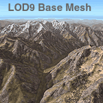
Detailed terrain mesh of the Hindu Kush and Pamir Ranges, N32-40 E70-76. The files in this package are based on Shuttle Radar (SRTM) Version 2 data but with many of the void areas, especially the most significant sections, filled with elevation data generated from topographic maps by Jonathan de Ferranti. While Jonathan's work is unrelated to flight simulation he kindly gave me permission to compile his data for use in FS. The result is a wonderful improvement in detail and accuracy over any existing mesh file, freeware or commercial, based on SRTM or DTED data alone.
Due to the large area of the Himalayas I've compiled the source data as two separate series: the "Himalayan Peaks" series covers prominent mountains and ranges in higher detail and locally overrides any existing LOD9 terrain mesh. In addition, the LOD9 "base mesh" series, with LOD8 and LOD7 "buffer" mesh files, covering the entire Himalayas, is meant for those who do not yet have an add-on terrain mesh of these beautiful mountains.
| Filename: | Himalayas_LOD9_Base_Mesh_Volume_5__Hindu_Kush_and_.zip |
| License: | Freeware, limited distribution |
| Added: | 29th May 2010, 08:57:29 |
| Downloads: | 7,607 |
| Author: | Holger Sandmann, Jonathan de Ferranti |
| Size: | 85.72 MB |
| Category: Flight Simulator 2004 - Scenery | |
| Himalayas LOD9 Base Mesh, Volume 4 - Kashmir and Jammu |
|
File Description:
Detailed terrain mesh of the Kashmir and Jammu Ranges, N30-39 E76-78. The files in this package are based on Shuttle Radar (SRTM) Version 2 data but with many of the void areas, especially the most significant sections, filled with elevation data generated from topographic maps by Jonathan de Ferranti. While Jonathan's work is unrelated to flight simulation he kindly gave me permission to compile his data for use in FS. The result is a wonderful improvement in detail and accuracy over any existing mesh file, freeware or commercial, based on SRTM or DTED data alone.
Due to the large area of the Himalayas I've compiled the source data as two separate series: the "Himalayan Peaks" series covers prominent mountains and ranges in higher detail and locally overrides any existing LOD9 terrain mesh. In addition, the LOD9 "base mesh" series, with LOD8 and LOD7 "buffer" mesh files, covering the entire Himalayas, is meant for those who do not yet have an add-on terrain mesh of these beautiful mountains.
| Filename: | Himalayas_LOD9_Base_Mesh_Volume_4__Kashmir_and_Jam.zip |
| License: | Freeware, limited distribution |
| Added: | 22nd February 2006, 20:32:50 |
| Downloads: | 7,505 |
| Author: | Holger Sandmann, Jonathan de Ferranti |
| Size: | 29.24 MB |
| Category: Flight Simulator 2004 - Scenery | |
| "Himalayan Peaks" LOD10 Mesh, Volume 8 - Tirich Mir and Pamir |
|
Images related to this file:
File Description:
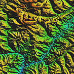
Highly detailed terrain mesh of the Tirich Mir and Pamir areas, N36-39 E71-74. The files in this package are based on Shuttle Radar (SRTM) Version 2 data but with many of the void areas, especially the most significant sections, filled with elevation data generated from topographic maps by Jonathan de Ferranti. While Jonathan's work is unrelated to flight simulation he kindly gave me permission to compile his data for use in FS. The result is a wonderful improvement in detail and accuracy over any existing mesh file, freeware or commercial, based on SRTM or DTED data alone.
Due to the large area of the Himalayas I've compiled the source data as two separate series: the "Himalayan Peaks" series covers prominent mountains and ranges in higher detail and locally overrides any existing LOD9 terrain mesh. In addition, a LOD9 "base mesh" series covering the entire Himalayas will be available for those who do not yet have an add-on terrain mesh of these beautiful mountains.
| Filename: | Himalayan_Peaks_LOD10_Mesh_Volume_8__Tirich_Mir_an.zip |
| License: | Freeware, limited distribution |
| Added: | 29th May 2010, 08:52:47 |
| Downloads: | 9,107 |
| Author: | Holger Sandmann, Jonathan de Ferranti |
| Size: | 47.94 MB |
| Category: Flight Simulator 2004 - AI Aircraft | |
| AI Spirit of Panalpina B744-8F Operated by Atlas Air |
|
Images related to this file:
File Description:

"Spirit of Panalpina" B744-8F Operated by Atlas Air.
Panalpina is a Swiss company, provider of forwarding and logistics services, specializing in intercontinental air and ocean freight and associated supply chain management solutions. In addition, Panalpina has a cooperating agreement with cargo airline Atlas Air Cargo, which in turn has one Boeing 747 named "Spirit of Panalpina".
Flightplans may be available on AVSIM or FlightSim.com.
This works for both FS9 and FSX. Tested in FSX.
Texture quality; FSX Native: DDS DXT5 with alpha. FS9 Native: BMP DXT3 with alpha.
FSX Light Fix included in the DDS night texture.
Included repaint is for the following model:
AIA_747_400F :: model.fge_no_refl
Model is available on AVSIM and FlightSim.com or on the author/developers site. (aia747fb.zip)
You need the basekit for this to work!!
Do make sure you copy the texture folder(s) in the respective folder.
Note: This is a AIA 742F GE / AIA 747-400F conversion for the 744F GE model, though the new Panalpina is actually a 744-8F heavy bird unfortunately there is no such model available thus the conversion.
Enjoy
| Filename: | AI_Spirit_of_Panalpina_B7448F_Operated_by_Atlas_Ai.zip |
| License: | Freeware, limited distribution |
| Added: | 25th June 2012, 05:18:23 |
| Downloads: | 812 |
| Author: | Stephan Faessler / ImpulseAI |
| Size: | 1.5 MB |
| Category: Flight Simulator 2004 - AFCAD Files | |
| Winnipeg Intl with Crosswind Runways |
|
File Description:
A high quality AFCAD2 file for Winnipeg Int'l airport, Manitoba, Canada. This file has been built from scratch using information from the internet. This AFCAD2 will extend the runways as follows - 07/25 is now 9000ft, 13/31 is now 9100ft and 18/36 is now 12000ft long. In addition, improvements have been made to runway lighting, VASI and approach lighting. Assigned parking is provided for all commercial airlines that serve YWG and also for the following companies - FedEx, UPS, Perimiter Aviation, Esso, Shell, Skyward Aviation and the Canadian Armed Forces. This airport also features extensive GA parking, Helicopter pads, Air Canada maintenance area, new taxiways and improved apron and taxiway night lighting. Using the crosswind runway technique, all 3 runways can also now be used simultaneously. There are 2 versions included here - (1) Concrete taxiways and runways, (2) Asphalt Taxiways and runways. This file is only for use with the addon scenery by Adam Bentley and David Madge (cywg_v101.zip) and has not been tested with the default airport.
| Filename: | Winnipeg_Intl_with_Crosswind_Runways.zip |
| License: | Freeware |
| Added: | 28th February 2005, 15:45:06 |
| Downloads: | 1,778 |
| Author: | Lee Brompton |
| Size: | 57 KB |
| Category: Flight Simulator 2004 - Scenery | |
| Himalayas LOD9 Base Mesh, Volume 1 - Southeastern Ranges |
|
Images related to this file:
File Description:
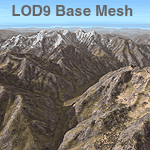
Detailed terrain mesh of the Southeastern Himalayan Ranges, N26-32 E90-98. The files in this package are based on Shuttle Radar (SRTM) Version 2 data but with many of the void areas, especially the most significant sections, filled with elevation data generated from topographic maps by Jonathan de Ferranti. While Jonathan's work is unrelated to flight simulation he kindly gave me permission to compile his data for use in FS. The result is a wonderful improvement in detail and accuracy over any existing mesh file, freeware or commercial, based on SRTM or DTED data alone.
Due to the large area of the Himalayas I've compiled the source data as two separate series: the "Himalayan Peaks" series covers prominent mountains and ranges in higher detail and locally overrides any existing LOD9 terrain mesh. In addition, a LOD9 "base mesh" series, with LOD8 and LOD7 "buffer" mesh files, covering the entire Himalayas, is meant for those who do not yet have an add-on terrain mesh of these beautiful mountains.
| Filename: | Himalayas_LOD9_Base_Mesh_Volume_1__Southeastern_Ra.zip |
| License: | Freeware, limited distribution |
| Added: | 29th May 2010, 09:01:26 |
| Downloads: | 10,301 |
| Author: | Holger Sandmann, Jonathan de Ferranti |
| Size: | 71.82 MB |
| Category: Flight Simulator 2004 - Scenery | |
| Himalayas LOD9 Base Mesh, Volume 2 - Southcentral Ranges |
|
Images related to this file:
File Description:
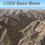
Detailed terrain mesh of the Southcentral Himalayan Ranges, N26-32 E82-90. The files in this package are based on Shuttle Radar (SRTM) Version 2 data but with many of the void areas, especially the most significant sections, filled with elevation data generated from topographic maps by Jonathan de Ferranti. While Jonathan's work is unrelated to flight simulation he kindly gave me permission to compile his data for use in FS. The result is a wonderful improvement in detail and accuracy over any existing mesh file, freeware or commercial, based on SRTM or DTED data alone.
Due to the large area of the Himalayas I've compiled the source data as two separate series: the "Himalayan Peaks" series covers prominent mountains and ranges in higher detail and locally overrides any existing LOD9 terrain mesh. In addition, a LOD9 "base mesh" series, with LOD8 and LOD7 "buffer" mesh files, covering the entire Himalayas, is meant for those who do not yet have an add-on terrain mesh of these beautiful mountains.
| Filename: | Himalayas_LOD9_Base_Mesh_Volume_2__Southcentral_Ra.zip |
| License: | Freeware, limited distribution |
| Added: | 29th May 2010, 09:05:56 |
| Downloads: | 9,451 |
| Author: | Holger Sandmann, Jonathan de Ferranti |
| Size: | 90.25 MB |
| Category: Flight Simulator X - Scenery | |
| 200 AI Ships and AI Ship Traffic V2 |
|
Images related to this file:
File Description:
This package contains more than 200 AI ships and AI ship traffic routes for the entire globe for FSX and P3Dv1 to P3Dv4. It is an addition to Global AI Ship Traffic V1 released in April 2016. This package also corrects four model files from Global AI Ship Traffic V1, so they also work in P3Dv4. This package includes cruise ships, ferries, container ships, bulk carriers, fishing boats, destroyers, frigates, aircraft carriers, patrol boats, yachts, oil rigs and much more… It also contain animated migrating whales thanks to Jean-Pierre Fillion. For full benefit download and install first Global AI Ship Traffic V1. Combining the two packages will give you a complete coverage of the world with AI Ship traffic and more than 850 ships in total. Several people have contributed with models, repaints, and sound files to this package including Jean-Pierre Fillion, Rick Keller, Lazarus Starkweather, Cxema, Erwin Welker,Sebastian Viale, Manfred Sielder, Knud Kristoffersen, Bernard Berju83, Didier Puentes, and Alberto Garcia JAGL04. Further a great thanks to all who have helped testing and providing images and drawings.
| Filename: | 200_AI_Ships_and_AI_Ship_Traffic_V2.zip |
| License: | Freeware |
| Added: | 18th June 2017, 19:37:02 |
| Downloads: | 13,953 |
| Author: | Henrik Nielsen |
| Size: | 233.21 MB |


© 2001-2026 AVSIM Online
All Rights Reserved
Privacy Policy |