
Where Flight Simulation Enthusiasts Gather from Around the World!
AVSIM Library - Search Results

| Category: Flight Simulator X - AFCAD Files | |
| Coombs Airport (7NJ7), NJ |

|
File Description:
Located 04 miles NE of Elmer, New Jersey, Coombs Airport is a private turf field 2000' in length wilth clear 20:1 approach and departure at each end of the runway. You'll find some surrounding buildings but they are all located several hundred yards from the runway. This is a good strip to keep in mind for emergencies if you're in the area. You will be landing on terrain so having your mesh complexity set as high as possible is recommended. This airport is not lit at night, daytime VFR operations only are suggested. There are no transient services offered.
Scenery constructed with use of satellite images/streetview/aerial photos - the author has not been there in person.
This scenery is meant to be used in conjunction with MegaScenery Earth New Jersey/Delaware 004. It is not required, but apron use is minimized to allow satellite scenery to show through as much as possible, and objects are placed based on the MSE textures - lack of it may make scenery look out of place.
| Filename: | Coombs_Airport_7NJ7_NJ.zip |
| License: | Freeware |
| Added: | 16th February 2011, 00:03:55 |
| Downloads: | 191 |
| Author: | Drew Sikora |
| Size: | 756.22 KB |
| Category: Flight Simulator X - AFCAD Files | |
| Rainbow's End Airport (JY39), NJ |
|
File Description:
Located 07 miles S of Salem, New Jersey on 20 acres of land, Rainbow's End Airport is a private turf strip 2200' in length. There are no services for transient aircraft and the airport is not lit at night, so daytime VFR operations only are recommended. If you have an aircraft with 40' or less of wingspan you can start at one of the parking spaces east or west of the runway by the hangars. Otherwise it is suggested you start on the runway. There is no hard surfaced runway so set your terrain mesh as high as possible.
Scenery constructed with use of satellite images/streetview/aerial photos - the author has not been there in person.
This scenery is meant to be used in conjunction with MegaScenery Earth New Jersey/Delaware 005 & New Jersey/Delaware 004. It is not required, but apron use is minimized to allow satellite scenery to show through as much as possible, and objects are placed based on the MSE textures - lack of it may make scenery look out of place.
| Filename: | Rainbows_End_Airport_JY39_NJ.zip |
| License: | Freeware |
| Added: | 12th May 2011, 00:58:29 |
| Downloads: | 173 |
| Author: | Drew Sikora |
| Size: | 626.46 KB |
| Category: Flight Simulator 2004 - Scenery | |
| Palermo Punta Raisi Area 2013 |
|
Images related to this file:
File Description:
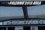
Dear Friends simmer, using the great objects bgl by mr Gianluca Giovannini, I tried to fill with autogen trees / buildings , the urban area near the international airport of Palermo "Falcone Borsellino". With the current integration of scenery i have created the town of Cinisi, Villagrazia di Carini, Torre Muzza and part of the smalls village near Airport.
Warning Very Important: the scenery "is not complete" and to get the best result YOU MUST INSTALL the following files:
-mesh by Pietro mauri (or SIMILAR mesh OF Sicily) (available HERE);
-install the wonderfull scenery LICJ by Francesco Salsano (available HERE);
-the "Palermo Vfr" by Fulvio Mazzokan (available HERE).
Most information inside the read me file. I hope you like this for your eternal fs 2004 and for your flights in Sicily. Best regards from Italy, Fabio Ferrari Castione della Presolana (bg).
| Filename: | Palermo_Punta_Raisi_Area_2013.zip |
| License: | Freeware, limited distribution |
| Added: | 20th February 2013, 21:57:36 |
| Downloads: | 2,711 |
| Author: | Fabio Ferrari |
| Size: | 4.72 MB |
| Category: Flight Simulator 2002 - AFCAD Files | |
| Cork Airport File 1.0 |
|
File Description:
This is the first file of a few files I will be releasing for Cork Airport Ireland {EICK} in FS2002. This is just a small, basic Afcad file to correct the parking at Cork airport. This Afcad file will make all the aircraft at Cork airport {including your aircraft}, park sideways against the building as in real life at Cork airport, instead of parking facing the building. All the starting points will also change to a sideways heading of 166. This will also change the gate numbers and will stop the atc using the term 'parking' all the time. It will change gate 1 to medium, gate 2 to heavy, gate 3 to small, gate 4 to medium {cargo}, parking 5 to ramp GA small, parking 6 to ramp GA small, and parking 7 to ramp GA small. All runways {17/35,07/25}, taxiways, traffic, and atc have been left alone. Parking and buildings are a mess at Cork airport in FS2002, therefore, the file is not perfect. I plan to release further traffic and scenery files for Cork airport in the future. This file requires AFCAD by Lee Swordy. Details of where to get it within download.
The progressive taxi instructions will also not change, neither will the pink line on the taxiways. The pink line will not turn sideways at the gates, but you must turn and park sideways at a heading of around 166 to park properly.
| Filename: | Cork_Airport_File_10.zip |
| License: | Check within download |
| Added: | 27th November 2002, 12:59:02 |
| Downloads: | 486 |
| Author: | Michael O'Sullivan |
| Size: | 200.19 KB |
| Category: Flight Simulator 2004 - Aircraft Repaints, Textures and Modifications | |
| Norwegian Long Haul "Roald Amundsen" Boeing 787-8 Dreamliner (EI-LNE) |
|
Images related to this file:
File Description:

Norwegian Air Shuttle operates "long-haul" flights to Asia and the United States through two fully owned subsidiaries, Norwegian Long Haul AS and Norwegian Air International Limited. The two subsidiaries operate Boeing 787 Dreamliners. Norwegian Long Haul is registered in Norway, and is managed by Norwegian Air Shuttle ASA from its head office at Fornebu. Norwegian Air International is registered in Ireland and has its head office in Dublin. Norwegian Long Haul does not operate any own routes, but instead its capacity is used to operate the routes of parent company Norwegian Air Shuttle to Asia and North America.
Norwegian livery painted on Tenkuu Developers Studio (TDS) Boeing 787-8 Rolls Royce model. The textures are saved in 32bit format for quality graphics. Textures are also characterized by HD (High Definition). Its features are idle-reverser animation, animated pack vents and pressurisation outflow valve, detailed textures, accurate paint, dynamic shine & effects, dynamic flexing wings that respond to turbulence, fully independent suspension, trim animation, gear steering, accurate flight dynamics, spoiler animation, reflective cockpit windows, improved wingflex code with input from several new parameters including ground spoilers, fuel load, and angle of attack, transparent navigation light lenses and many more. REPAINT TEXTURES ARE ALSO COMPATIBLE WITH THE FSX MODEL (needed).
Visit our Facebook page "Sky Level Textures" for news, updates and previews on my future repaint projects. Thanks for downloading & Happy flying. HD GAMING EXPERIENCE inside. https://www.facebook.com/SkyLevelTextures
| Filename: | Norwegian_Long_Haul_Roald_Amundsen_Boeing_7878_Dre.zip |
| License: | Freeware |
| Added: | 13th July 2014, 01:58:09 |
| Downloads: | 1,560 |
| Author: | Giacomo Tomasini | Sky Level Textures | Tenkuu Developers Studio (TDS) |
| Size: | 20.45 MB |
| Category: Flight Simulator X - AFCAD Files | |
| Winchelsea Airport (8NJ0), NJ |
|
File Description:
Located 01 miles W of Port Republic, New Jersey, Winchelsea Airport is a private turf strip. Pay very, very close attention to the published length of this grass runway: 980'. This is in addition to 50ft tree obstacles at either end of the runway. Double-check your aircraft's takeoff and landing distances before visiting this airfield!! A strong headwind is suggested for operations out of this location. Also take note the traffic patterns vary for each runway. There are no transient services offered and the airport is not lit at night so daytime VFR use only is suggested. There is no hard surface runway so set your terrain mesh slider as high as you can for the best effect of landing on terrain.
Scenery constructed with use of satellite images/streetview/aerial photos - the author has not been there in person.
This scenery is meant to be used in conjunction with MegaScenery Earth New Jersey/Delaware 003. It is not required, but apron use is minimized to allow satellite scenery to show through as much as possible, and objects are placed based on the MSE textures - lack of it may make scenery look out of place.
| Filename: | Winchelsea_Airport_8NJ0_NJ.zip |
| License: | Freeware |
| Added: | 24th March 2011, 19:28:46 |
| Downloads: | 162 |
| Author: | Drew Sikora |
| Size: | 396.23 KB |
| Category: Flight Simulator X - AFCAD Files | |
| Southern Cross Airport (C01), NJ |
|
File Description:
Located 03 miles SW of Williamstown, New Jersey on 18 acres of land, Southern Cross is a public turf airstrip with an ample 2400' runway. The runway is hard surfaced in order to allow for AI traffic to use this airport, however the end user must enable flights to arrive/depart from this airfield within their AI traffic program in order for AI to appear here. Tie down space is available north of Runway 09 and fuel is available at the tank next to the hangar. This airport is not lit at night so daytime VFR operations only are recommended. In addition to trees at the ends of both runways, power lines are strung up across there too.
Scenery constructed with use of satellite images/streetview/aerial photos - the author has not been there in person.
This scenery is meant to be used in conjunction with MegaScenery Earth New Jersey/Delaware 004. It is not required, but apron use is minimized to allow satellite scenery to show through as much as possible, and objects are placed based on the MSE textures - lack of it may make scenery look out of place.
| Filename: | Southern_Cross_Airport_C01_NJ.zip |
| License: | Freeware |
| Added: | 25th March 2011, 16:38:00 |
| Downloads: | 192 |
| Author: | Drew Sikora |
| Size: | 630.77 KB |
| Category: Flight Simulator X - AFCAD Files | |
| Stoe Creek Farm Airport (7NJ2), NJ |
|
File Description:
Located 01 miles S of Canton, New Jersey, Stoe Creek Farm is a private turf field 1725' in length. The runway is largely clear of obstructions although on approach for Runway 05 you will deal with 20-30' trees a few hundred feet back from the threshold and there are transmission towers along the approach corridor to Runway 23 you should watch out for. The runway does have edge lighting, although the windsock is not lit at night and daytime VFR is still recommended. There are no services for transient craft at this airfield. Since you will be landing on terrain, it is recommended that your mesh complexity is set as high as possible.
Scenery constructed with use of satellite images/streetview/aerial photos - the author has not been there in person.
This scenery is meant to be used in conjunction with MegaScenery Earth New Jersey/Delaware 004. It is not required, but apron use is minimized to allow satellite scenery to show through as much as possible, and objects are placed based on the MSE textures - lack of it may make scenery look out of place.
| Filename: | Stoe_Creek_Farm_Airport_7NJ2_NJ.zip |
| License: | Freeware |
| Added: | 14th February 2011, 18:32:24 |
| Downloads: | 163 |
| Author: | Drew Sikora |
| Size: | 700.91 KB |
| Category: Flight Simulator X - AFCAD Files | |
| Weiss Farm Airport (JY24), NJ |
|
File Description:
Located 02 miles W of Allamuchy, New Jersey on 264 acres of land, Weiss Farm Airport is a private turf strip 1800' in length. The published width is 50' but you really have closer to 100' to play with. There are no services offered to transient aircraft but you can start parked next to the barn if you wish to taxi out to the runway. No hard surfaced runway is used to have your terrain mesh set as high as possible the start of Runway 23 is a bit slanted and bumpy so you may want to aim long on your approach. The airport is unlit so daytime VFR operations only are recommended.
Scenery constructed with use of satellite images/streetview/aerial photos - the author has not been there in person. This scenery is meant to be used in conjunction with MegaScenery Earth New York 007. It is not required, but apron use is minimized to allow satellite scenery to show through as much as possible, and objects are placed based on the MSE textures - lack of it may make scenery look out of place.
| Filename: | Weiss_Farm_Airport_JY24_NJ.zip |
| License: | Freeware |
| Added: | 21st April 2011, 10:09:59 |
| Downloads: | 192 |
| Author: | Drew Sikora |
| Size: | 593.91 KB |
| Category: Flight Simulator X - Scenery | |
| LFMI - Istres/Le Tube |
|
File Description:
Welcome to Istres Air Base/BA 125.
Istres is an Air Base use by the French Air Force and is also a base for the helicopter squadron. It has a large repair and is a large training facility.
It's common to see the Alpha jet visiting the BA 125 during their training. Alpha Jet used by the Patrouille de France.
The Air base is large enough to accomodate all type of aircrafts and even up to the B747. It has 1 major Rwy 15/33 of 12303 Ft /3750 m.
I have included the 15C/33C grass rwy for use by ligth G.A aircraft and other Gliders. Put up on a nice landing and Hot dog will be waiting for you down there! ;)
I have developped all aprons, included the ILS rwy 15 and developped the Tower area, increased the amount of parking due to the space available.
Istres has a tremendous amount of parking spot. I have included the chart as well for VFR traffic.
2 Parallel Rwy to the active one, these are closed! do not mistake them with the grass one! ;)
Have fun!
| Filename: | LFMI__IstresLe_Tube.zip |
| License: | Freeware |
| Added: | 12th May 2009, 10:30:16 |
| Downloads: | 2,741 |
| Author: | Daniel Louvet |
| Size: | 4.13 MB |
© 2001-2026 AVSIM Online
All Rights Reserved
Privacy Policy |