
Where Flight Simulation Enthusiasts Gather from Around the World!
AVSIM Library - Search Results

| Category: Prepar3D V1-4 - Utilities | |
| FS Flight Builder - Update |

|
Images related to this file:
File Description:
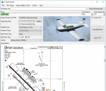
FS Flight Builder is a utility for general aviation flying that will build flight files for FSX, FSX Steam Edition, and Prepar3D based on waypoints and other data either entered manually or imported from SkyVector using the Plain Text Link functionality. Among other things, you can select your starting position, aircraft, and VFR or IFR flight plan.
One of the most interesting features of the application is that it will include a Briefing file, added to the aircraft's built-in kneedboard, that will include departure and destination airport information (runways, frequencies, weather, and charts) as well as navigation frequencies along the route.
Have you ever started up flight simulator and wondered “where do I want to go today� The new Destination Chooser functionality can help to solve that problem. The screen allows you to enter your departure airport and choose various parameters for your destination (like min and max distance, tower availability, ILS availability, runway length requirements, etc.).
| Filename: | FS_Flight_Builder__Update.zip |
| License: | Freeware |
| Added: | 30th July 2018, 18:12:05 |
| Downloads: | 303 |
| Author: | Tom Arduini |
| Size: | 27.99 MB |
| Category: Prepar3D V1-4 - Utilities | |
| P3D/FSX/FSXSE FS Flight Builder |
|
Images related to this file:
File Description:

Update to fix the auto-updater functionality
FS Flight Builder is a utility for general aviation flying that will build flight files for FSX, FSX Steam Edition, and Prepar3D based on waypoints and other data either entered manually or imported from SkyVector using the Plain Text Link information. Among other things, you can select your starting position, aircraft, and VFR or IFR flight plan.
One of the most interesting features of the application is that it will include a Briefing file, added to the aircraft's built-in kneedboard, that will include departure and destination airport information (runways, frequencies, weather, and charts) as well as navigation frequencies along the route.
Have you ever started up flight simulator and wondered “where do I want to go today� The new Destination Chooser functionality can help to solve that problem. The screen allows you to enter your departure airport and choose various parameters for your destination (like min and max distance, tower availability, ILS availability, runway length requirements, etc.).
| Filename: | P3DFSXFSXSE_FS_Flight_Builder.zip |
| License: | Freeware |
| Added: | 31st July 2018, 07:19:16 |
| Downloads: | 367 |
| Author: | Tom Arduini |
| Size: | 27.99 MB |
| Category: Prepar3D V1-4 - Scenery | |
| Malta Republic of Malta Europa N35.53.00 E14.30.00 |
|
File Description:
Malta N35.53.00 E14.30.00 officially the Republic of Malta and an archipelago located in the Mediterranean, in the
Malta Channel, 80 km from Sicily, 284 km from Tunisia and 333 km from Libya, including in the Italian geographical
region. With an extension of 315.6 km² it is one of the smallest and most densely populated states in the world. Its
capital is Valletta. The main island is characterized by a large number of towns that, together with the capital, form
a conurbation of 368 250 inhabitants. It was a Greek colony later a Roman and Arab colony, and English and only on 21
September 1964 it gained independence from Great Britain. The city of Valletta with its port, the city of Mdina
including the northern part of the Maltese archipelago with the island of Gozo and the Malta airport with its
infrastructures, was particularly taken care of. Within the downloaded package you will find readme files for
scenery installation. Good fly VFR. Pasquale Marrulli.
| Filename: | Malta___Republic_of_Malta_Europa_N355300_E143000.zip |
| License: | Freeware |
| Added: | 14th May 2018, 19:52:40 |
| Downloads: | 321 |
| Author: | Pasquale Marrulli |
| Size: | 3.7 MB |
| Category: Flight Simulator 2002 - Miscellaneous Files | |
| Albuquerque Sectional Chart |
|
File Description:
Fly eastbound from Phoenix and visit Area 51 and Roswell (where SETI was "born"), Alamogordo, White Sands National Monument, Trinity Site (where the Manhattan Project tested the first nuclear device), Albuquerque (the state´s capital city), Lincoln County (where Billy the Kid was shot), the Mescalero Reservation (great skiing at Sierra Blanca south of the White Mountain Wilderness Area) and Capitan, Birthplace of Smokey the Bear. Flying VFR in this kind of countryside isn´t easy, as there aren´t all that many landmarks to rely on. Maybe this chart is of some assistance to you. You may use it "as is" without any other software, but it will develop its full potential if used as moving map with SimSystem´s FSFlightMax or FSGarmin. It wouldn´t have been possible to offer this chart without Richard Harvey and his love to flightsimming, so please consider this file to be "donationware" and make a however small contribution to the Richard Harvey Endowed Scholarship.
| Filename: | Albuquerque_Sectional_Chart.zip |
| License: | Check within download |
| Added: | 29th March 2003, 04:15:12 |
| Downloads: | 2,137 |
| Author: | Uwe Rademacher |
| Size: | 15.09 MB |
| Category: Flight Simulator 2002 - Flight Plans | |
| 34RTWest |
|
File Description:
An FS2002 GPS flight Plan. The 34th in a series of Round the World flight plans for the FS2002 default scenery. Depart Guwahati runway 02, India and arrive 1 hour 04 minutes later at Paro (VQPR) runway 33, Bhutan. A quiet and gentle flight, at least for the first 14 minutes then on entering a deep valley to start a pass storming climb into the snow capped mountains the mood of the flight changes. A session of dodging through gaps in the peaks concludes with a ‘Dive Bomber” VFR finals into a airport surrounded by very high ground and with its runway in a deep pit in a valley bottom, brings the session to an end. Pilots who have so far enjoyed the brand of fun and nonsense I call flight planning, will not be disappointed with this flight. The flight briefing (Word and text) is for a B737-400, it contains climb, cruise, top of descent and fuel loading details, waypoint timings and destination details.
| Filename: | 34RTWest.zip |
| License: | Freeware |
| Added: | 7th July 2002, 19:09:58 |
| Downloads: | 1,055 |
| Author: | The Ancient Brit |
| Size: | 37.4 KB |
| Category: Flight Simulator 2004 - Miscellaneous Files | |
| GoTo Any Airport |
|
File Description:
GoTo Any Airport.
Inclued here Heathrow and London Luton. Always wanted to return to your favourite local Airport from anywhere in the world? simply - with no fuss? Look no Further.
Start at these Designated Airports,then Goto any Airport! - via the FS9 World menu and return to the Original Airport - every time! - By Just turning the GPS/nav switch to GPS and Flight Director and autothrottle on whilst still on the ground.Click on the Autopilot, IAS, ALT and Nav Hold switches once above 1000ft - thats it !! . Set Weather and Altitude as required and Speed in autopilot and away you go. Use the FS9 ATC as You Travel, call into Airport when close and receive the curent ATIS and Runway approach in use.
The added circuit flights are on Autopilot and allow you to observe the airport befor landing.They make good moving screen savers - but make sure you have plenty of fuel!compatible with UK2000 Airports & VFR scenery for UK.
| Filename: | GoTo_Any_Airport.zip |
| License: | Freeware |
| Added: | 19th June 2004, 07:12:30 |
| Downloads: | 690 |
| Author: | Alan Trussell |
| Size: | 38.37 KB |
| Category: Flight Simulator 2004 - Scenery | |
| Lost Horn Ranch |
|
File Description:
This is Lost Horn Ranch (FA80) a small farm strip located in South Florida near Ochopee. The location is well placed to reach the west and Gulf coasts and not too far from the Keys. The strip exists in the default FS9. This scenery is fiction and tries to depict a small farm strip in the 1930s. The inspiration to make this was Golden Wings 3 (developed by Bill and Lynn Lyons and the Golden Wings Gang). Hopefully everything looks more or less in keeping with the period prior to WWII. If something stands out then let me know and I will do something about it. The scenery is a work in progress. I plan to add to it over the coming months including some outlying buildings etc and maybe another farm strip or two. I have in mind to create enough visual reference points across Florida so that pilots may fly VFR using them. In the meantime please accept my apologies for any rough edges.
| Filename: | Lost_Horn_Ranch.zip |
| License: | Freeware, limited distribution |
| Added: | 5th September 2005, 16:57:22 |
| Downloads: | 1,254 |
| Author: | Jon Masterson |
| Size: | 2.98 MB |
| Category: Flight Simulator X - AFCAD Files | |
| Air-List-Ads Airport (JY07), NJ |
|
File Description:
This is a small turf strip 1500x70 feet located near the border of NJ and PA in the northwestern part of the state. It's not officially listed so I don't have any more data than that. No services of any kind are available. Trees are summer ONLY. If you fly VFR around the area, this will at least prevent you from seeing a random-looking grass strip over some trees and half a neighborhood. Runway headings are 11/29
Scenery constructed with use of satellite images/streetview, the author has not been there in person.
This scenery is meant to be used in conjunction with MegaScenery Earth New York 007. It is not required, but apron use is minimized to allow satellite scenery to show through as much as possible, and objects are placed based on the MSE textures - lack of it may make scenery look out of place.
| Filename: | AirListAds_Airport_JY07_NJ.zip |
| License: | Freeware |
| Added: | 16th October 2010, 08:57:57 |
| Downloads: | 182 |
| Author: | Drew Sikora |
| Size: | 283.7 KB |
| Category: Flight Simulator X - AFCAD Files | |
| Malone Airport (NJ61), NJ |
|
File Description:
Located 02 miles E of Frenchtown, New Jersey on 45 acres of land, Malone is a private airport with two turf strips, the longest of which is 2400' in length. There are no services offered, although there is room next to the existing planes to park if you wish - collisions are disabled with the aircraft. Both runways have their hard surfaces removed so turn your mesh settings as high as possible. Both runways slope down from the hangar/house area. Airport is unlit and daytime VFR operations only are recommended.
Scenery constructed with use of satellite images/streetview/aerial photos - the author has not been there in person.
This scenery is meant to be used in conjunction with MegaScenery Earth New York 007. It is not required, but apron use is minimized to allow satellite scenery to show through as much as possible, and objects are placed based on the MSE textures - lack of it may make scenery look out of place.
| Filename: | Malone_Airport_NJ61_NJ.zip |
| License: | Freeware |
| Added: | 20th September 2011, 13:57:18 |
| Downloads: | 284 |
| Author: | Drew Sikora |
| Size: | 958.34 KB |
| Category: Flight Simulator X - Flight Plans | |
| Rocky Mountain Airport Tour |
|
File Description:
Rocky Mountain Airport Tour:
A very hard flight plan in common GA Aircraft. I flew this with a Carenado B58. VFR Flight with wild swings in Altitudes. Maintain 16000 (One Six Thousand) feet for most of the flight to and from the airports. You will have to fly around mountains on approaches with steep short field finals. GPS flight plan is just a guide. You will have to follow the mountain passes from some airports in order to attain sufficient altitude (in some cases). Don't wimp out! Max load your plane.
Country: USA
State: Cololorado
Start: KDRO (Make sure you start from a parking spot)
End: KHDN
Most difficult: Taking off at Buckhorn Ranch (8000+ feet ALT, 4000 FT Runway)
Toughest area between airports:
KASE to KEGE
Time to compleat: about 3 hours
Good Luck.
Questions Contact me at AVSIM
Avsim ID: hawkDsl
To Install: Copy "Rocky Mountain Airport Tour.pln" and paste it into you FSX flight plan file
Win7 : userfiles/my document/Flight Simulator X Files
| Filename: | Rocky_Mountain_Airport_Tour.zip |
| License: | Freeware |
| Added: | 21st July 2012, 13:26:52 |
| Downloads: | 473 |
| Author: | Henry Oeser |
| Size: | 1.94 KB |
© 2001-2026 AVSIM Online
All Rights Reserved
Privacy Policy |