
Where Flight Simulation Enthusiasts Gather from Around the World!
AVSIM Library - Search Results

| Category: Orbiter - Miscellaneous Files | |
| Complete Apollo 16 pack for Nassp v3.0 |

|
File Description:
This is a COMBINED Descartes Landing site and Descartes Enhancement Pack for the new NASSP (v3.0) and the new ORBITER (021202). It also includes Vinka's updated (for 021202) Generic Spacecraft DLL Module so that the "independent" Lunar EVA implementation would work. It also includes YesRushGen's Apollo 16 scenarios which depict the Apollo 16 mission in various stages during the mission.
Everything found in Descartes Landing Site and DEP add-ons are included, along with a new Lunar Rover that has both the CMDR and LMP on board when pressing "V" after the NASSP EVA key is pressed. However, due to an inexplicable bug, I decided not to include the detailed SIMBAY EVA astronaut mesh, because Orbiter kept on crashing whenever I perform EVA on BOTH the LM and the CSM.
Furthermore, although the LM now sports the bronze-like coloring of the J-Mission Advanced LMs (from inside the SIVB booster until separation of ascent stage), I had to remove the enhancements like the hanging MESA and the LRV from the Descent Stage because it caused inexplicable Orbiter crashes too. But I hope you like the new LM color which is now consistent during the course of the entire mission (in the DEP add-on, it was still aluminum/grey when docked to the CSM and only turned bronze when undocked).
Finally, I added a NAV/ADF beacon to the landing site, so that if you press SHIFT-C and tune to 109.10, then press SHIFT-L, your landing display will show your position with respect to the landing site, provided you are within 500 kilometers.
| Filename: | Complete_Apollo_16_pack_for_Nassp__v30.zip |
| License: | Freeware |
| Added: | 17th December 2002, 13:26:13 |
| Downloads: | 5,645 |
| Author: | Rodion M. Herrera |
| Size: | 7 MB |
| Category: Orbiter - Miscellaneous Files | |
| Edwards AFB Upgrade 1.1 |
|
File Description:
This upgrade replaces Edwards Air Force Base upgrade 1.0. This is an upgrade to, and requires, Slat's Edwards AFB add-on.
Included in this release:
• Five new high-definition surface tiles (for a total of eleven!), covering the area around Rogers Dry Lake, the main base and the north and south bases, including the town of Boron, CA.
• Edwards AFB ILS and VOR frequencies
• Several main flightline hangars
• Edwards tower camera view
• Mesh resolution increased 800%!
• Scenarios to fly several previously-released X-planes at Edwards AFB
• Support for X-33 VentureStar; placement of the VentureStar base in the correct place, just north of Haystack Butte.
Scenarios are included for the following aircraft, all tested/flown at the real Edwards AFB:
• X-15 rocketplane and B-52 dropship
• SR-71 "Blackbird"
• SR-71 with drone
• X-34 lifting body and Lockheed L-1011 Stargazer dropship
• X-36 thrust vector prototype
• X-38 Crew Recovery Vehicle
• X-33 VentureStar
• Shuttle Training Aircraft
(STA control surfaces patch)
• Space Shuttle Enterprise
| Filename: | Edwards_AFB_Upgrade_11.zip |
| License: | Freeware |
| Added: | 18th November 2003, 16:32:31 |
| Downloads: | 4,492 |
| Author: | John Wilson |
| Size: | 2.81 MB |
| Category: Flight Simulator 2004 - Scenery | |
| Airstrips of Scandinavia and the Baltic States |
|
Images related to this file:
File Description:
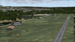
Effectively an extension of my "Airstrips of Western Europe" project for FS2004, around 140 sceneries of small airfields in Scandinavia and the Baltic states, each enhanced with buildings, taxiways, parking spaces and aprons as appropriate, to further facilitate the generation of lightweight AI traffic in the area, without overloading the more major airfields.
Given the available comprehensive coverage of both Norway and Finland by other authors, and much of Denmark by myself in my earlier "Airstrips of North-West Europe" upload, this selection comprises mostly small Swedish and Baltic State airfields.
Unfortunately, due to the very nature of much of the area, some of these airstrips are just that, a grass/dirt runway on a flattened/mown area in the landscape with just an associated building or two. Nevertheless, they do perform the required function of providing sources for AI traffic. The very existence of those airstrips not included in FS2004 is referred to in various on-line databases.
Again, there's no photo-realism here, just a selection of basic 'generic' buildings, more or less accurately sized and placed to reflect the airfield layout as seen on on-line satellite imagery and aerial photography. These buildings have minimal effect on frame-rates, so are ideal for this kind of job. The airfields are aligned as well as possible with the roads etc. in UT Europe (where applicable) and the Genesis Europe mesh, but should mostly be fine in a default installation or other configuration.
Please read the rest of this "blurb" in the included text file. There may be some details of note or interest.
| Filename: | Airstrips_of_Scandinavia_and_the_Baltic_States.zip |
| License: | Freeware |
| Added: | 11th November 2024, 17:25:16 |
| Downloads: | 109 |
| Author: | Chris Eve |
| Size: | 2.52 MB |
| Category: Flight Simulator 2004 - Scenery | |
| Fort Simpson Island CET4 - Northwest Territories, Canada |
|
Images related to this file:
File Description:
Fort Simpson Island is the fifth in a series of airfields that follow (approximately) in a southward direction the Mackenzie River. At the far northern end of the river there is Tuktoyaktuk, then Inuvik, Fort McPherson, Fort Good Hope, Deline, and then Wrigley, all posted. Fort Simpson Island is at 405 feet asl and on the west bank of the the Mackenzie, around 110 miles south of Wrigley at the junction of the Mackenzie and the Liard rivers. The town of Fort Simpson is on an island, and has a population of 1,250 or so folks. The Hudson Bay trading post was established here in 1822. The airport is right next to the town, and has 3,000 feet of gravel runway, though with a displaced threshold of 1,000 feet at each end (unmarked, on gravel) this is effectively 2,000 feet for landing. The Canada Flight Supplement lists the runway as being 100 feet wide; the gravel is definitely far less and the 100 refers to the width in the winter when you are landing on snow and don't care if there is gravel or grass underneath. There are no scheduled flights as these go to the nearby Fort Simpson CYFS. There is a mandatory radio frequency which is for both CYFS and CET4 and in this case I have set the "tower" to "manned" so you will report position and obey instructions. Runway 13 has right hand circuits. I have modified the Ultimate Terrain route for the Mackenzie Highway so that it remains on the west side of the river and does not wander randomly from one side to the other north of Fort Simpson.
| Filename: | Fort_Simpson_Island_CET4__Northwest_Territories_Ca.zip |
| License: | Freeware, limited distribution |
| Added: | 6th July 2014, 02:56:05 |
| Downloads: | 208 |
| Author: | Roger Wensley |
| Size: | 2.46 MB |
| Category: Flight Simulator 2004 - Scenery | |
| Sproat Lake CAA9 on Vancouver Island in British Columbia, Canada |
|
Images related to this file:
File Description:
Sproat Lake is in the middle of southern Vancouver Island, 6 miles west of the town of Port Alberni and 30 miles directly south of Comox Valley Airport. It is some 14 miles long and around the eastern shores has a large number of houses with docks and boats. Plus, in the offshoot called Upper Sproat Lake, it has the Sproat Lake Tankerbase CAA9, home to two rather large Martin Mars firefighting planes. Their history is interesting, and their capacity for carrying water for dousing forest fires during the summer months has kept them in use since their construction in the 1940's. They have finally been retired from fighting fires in 2013, having been first retired from military service in 1958. This scenery is made for use with Ultimate Terrain; there was another version made several years ago which either predated or ignored UT. This scenery is for the month when a Mars was being repainted before retiring to a museum as a military plane, date unkown but perhaps 2013? If it is a time when there were three in existance then it is sometime in the 1960's; take your pick. Because of hills adjacent to the lake the landing of the AI Mars may or may not take place, depending on wind direction and whether or not it flies into rock before landing. Take off and departure seem to be more reliable than landing on a daily basis. The Mars flies to Vancouver Harbour, but only in theory; it does not land and park as there is no parking available for such a large aircraft. The AI follows in the second post.
| Filename: | Sproat_Lake_CAA9_on_Vancouver_Island_in_British_Co.zip |
| License: | Freeware, limited distribution |
| Added: | 11th December 2016, 06:44:50 |
| Downloads: | 261 |
| Author: | Roger Wensley |
| Size: | 14.88 MB |
| Category: Flight Simulator 2004 - Scenery | |
| Golden CYGE in British Columbia, Canada |
|
Images related to this file:
File Description:
This airfield is in one of the north-south valleys in the Columbia Mountains (which are part of the Rockies) on the border between BC and Alberta. The town of Golden (population just under 4,000) grew along with the Canadian Pacific Railway and the logging industry, both of which are still the mainstays of the town. Tourism is a more recent development along with the Kicking Horse Mountain Resort, which is only 3 miles to the west of the town. There are occasional flights into CYGE related to the richer echelon of tourist groups for Kicking Horse, particularly at the weekends; three actual such flights are included in the AI. Golden CYGE is immediately to the west of the town beside the Columbia River, with the 4,500 feet of asphalt runway aligned 14-32; right hand circuits for 32. There are no runway lights or landing aids, and no taxiway lights, so this airfield is for daylight use only. There is a helicopter company based on the field (Alpine) and a volunteer search and rescue group, a skydiving operation at the northern end, plus an active club with a long open hangar with a club room. A friendly airfield. The AI helicopter was included in my post of Alma CYTF. The Beaver will not show up unless you have the Aerosoft Beaver installed. I found the other planes without a problem on flightsim or avsim. Due to the surrounding terrain AI aircraft will usually impact high ground before landing and then just show up on their parking spots. A northern wind improves but does not totally solve this.
| Filename: | Golden_CYGE_in_British_Columbia_Canada.zip |
| License: | Freeware, limited distribution |
| Added: | 29th September 2018, 19:26:13 |
| Downloads: | 156 |
| Author: | Roger Wensley |
| Size: | 12.2 MB |
| Category: Flight Simulator 2004 - Scenery | |
| Bryce Canyon National Park (KBCE), Utah, Photo-Scenery |
|
Images related to this file:
File Description:
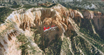
Bryce Canyon National Park (KBCE), Utah, Photo-Scenery (FS9 & FSX)
Despite its name, Bryce Canyon is not actually a canyon that was formed by a river, but rather a giant natural cliff shaped through erosion by wind, water, and ice. Bryce is distinctive due to its geological formations, delicate and colorful pinnacles called hoodoos that are up to 200ft high. The bizarre forms and red, orange and white colors of the rocks provide spectacular views. Unfortunately the hoodoos are too small for the elevation mesh in flight simulator. But you can enjoy the colors and shape of the cliffs. The cliffs in main region of the park, just south of the airport are partly covered
by snow. But on the southern and western part of the plateau you can enjoy them free of snow. Bryce Canyon is named after the Mormon pioneer Ebenezer Bryce who settled in this area in the 1850s. It was designated as a national park in 1928.
Bryce Canyon Airport (KBCE) just handles small aircraft on a daily basis. But is was actually built to handle larger aircraft in case of emergency. And so on Oct.6th 2000 an American Airlines MD-82 from Denver to Los Angeles made a successful emergency landing after reporting smoke in the cockpit and a loss of cabin pressure.
High resolution versions of this scenery for FS9 and FSX (much sharper, but larger and multiple downloads)are available at www.blueskyscenery.com/CNY_South2West4.html . The screenies are taken from the high-res versions, so expect this version to be slightly more blurry. Thanks to Joop Mak for providing a custom AFCADs that correct airport layouts so that they align with the photo-textures! They are available here: www.blueskyscenery.com/AFCADs.html . YourDonation@Work: Dedicated to Michael, Pat and Keith.
| Filename: | Bryce_Canyon_National_Park_KBCE_Utah_PhotoScenery.zip |
| License: | Freeware, limited distribution |
| Added: | 7th March 2010, 11:17:56 |
| Downloads: | 2,206 |
| Author: | Gottfried Razek, blueskyscenery.com |
| Size: | 96.35 MB |
| Category: Flight Simulator 2004 - Scenery | |
| Airstrips of Austria |
|
Images related to this file:
File Description:

Probably the last of my Airstrips of Western Europe project, herewith 30+ sceneries for smaller airfields in Austria, a particularly scenic area of Europe, many of which are not included in FS2004, each enhanced with taxiways, parking spaces, buildings etc. and aprons as appropriate, to further facilitate the generation of lightweight AI traffic in the area, without overloading the more major airfields.
Again, there's no photo-realism here, just a selection of basic 'generic' buildings, more or less accurately sized and placed to reflect the airfield layout as seen on on-line satellite imagery and aerial photography. These buildings have minimal effect on frame-rates, so are ideal for this kind of job. The airfields are aligned as well as possible with the roads etc. in UT Europe and the Genesis Europe mesh, but should mostly be fine in a default installation or other configuration.
As before, the files for each airfield can be easily identified by the ICAO code, even if the airfield names vary slightly, so you can pick and choose and mix and match to suit any sceneries you already have, should you so wish. There is no requirement for any other download. Each airfield will exist as a stand-alone entity should you only want a few of them.
Very few basic library objects are used ... you can add "eye-candy" to suit your own taste should you wish, or just leave them as vague shapes in the scenery that can put a few more small aircraft into the air. As with other airfields in this series, now these are "ai-activated" you might expect to see the occasional little aircraft turn up at some of them if you've got any third-party traffic installed.
| Filename: | Airstrips_of_Austria.zip |
| License: | Freeware |
| Added: | 26th April 2025, 13:59:32 |
| Downloads: | 85 |
| Author: | Chris Eve |
| Size: | 1.04 MB |
| Category: Flight Simulator 2004 - Scenery | |
| Airstrips East of the Adriatic |
|
Images related to this file:
File Description:
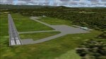
A collection of about 60 small airfields in Albania, Bosnia & Herzegovina, Kosovo, North Macedonia and Serbia & Montenegro, many of which aren't featured in FS2004, each enhanced with taxiways, parking spaces, buildings etc. and aprons as appropriate, to fill in a few gaps to the east of Italy. Most of these airfields are relatively "rural", often little more than a shed and a grass runway in a field, but they allow the generation of lightweight GA AI traffic in this area and into the adjacent countries.Again, there's no photo-realism here, just a selection of basic 'generic' buildings, more or less accurately sized and placed to reflect the airfield layout as seen on on-line satellite imagery and aerial photography. These buildings have minimal effect on frame-rates, so are ideal for this kind of job. The airfields are aligned as well as possible with the default roads etc. and the Genesis Europe mesh, but should mostly be fine in a default installation or other configuration.As before, the files for each airfield can be easily identified by the ICAO code, even if the airfield names vary slightly, so you can pick and choose and mix and match to suit any sceneries you already have, should you so wish. There is no requirement for any other download. Each airfield will exist as a stand-alone entity should you only want a few of them. A few default airfields have had new ICAO codes allocated, in these instances I've provided files to remove the default scenery from the landscape, though the original airfield will still appear on the maps and menu.
| Filename: | Airstrips_East_of_the_Adriatic.zip |
| License: | Freeware |
| Added: | 20th October 2025, 11:48:25 |
| Downloads: | 57 |
| Author: | Chris Eve |
| Size: | 525.71 KB |
| Category: Flight Simulator 2004 - Scenery | |
| Airstrips of North-West Europe |
|
Images related to this file:
File Description:
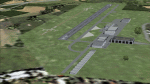
The sales blurb for FS2004 announced the inclusion of over 23,000 airfields ... unfortunately a significant number of those consisted of little or nothing more than a runway on a flatten with a rectangular background polygon.
To enable the addition of an amount of lightweight GA AI traffic, without overloading those airfields that were designed with parking spaces and taxi-ways, (and are probably already busy), I herewith include over 140 small sceneries, of mostly default airfields, from NW France, up the English Channel and the North Sea coast through Belgium, the Netherlands and NW Germany to Denmark, all with added taxiways and parking spots, aprons, generic buildings and background polygons as appropriate, to enable AI traffic to be generated without interrupting things at the more major airports.
A few of the French airfields are "new", not included originally with FS2004, and a couple have been updated to suit more recent developments :- for example, LFES "Scaer Guiscriff" is now LFES "Bretagne Atlantique", LFOR "Chartres Champhol" is now LFOR "Chartres Metropole", EHSE "Seppe" is now EHSE "Breda International" and EKVH "Vesthimmerlands" was previously EKVH "Aars".
There's no photo-realism here, just a selection of basic 'generic' buildings, more or less accurately sized and placed to reflect the airfield layout as seen on on-line satellite imagery and aerial photography. These buildings have minimal effect on frame-rates, so are ideal for this kind of job.
The airfields are aligned as well as possible with the roads etc. in UT Europe and the Genesis Europe mesh, but should mostly be fine in a default installation or other configuration.
Please read the rest of this "waffle" in the included text file ... it might save some confusion ;)
Enjoy :)
| Filename: | Airstrips_of_NorthWest_Europe.zip |
| License: | Freeware |
| Added: | 14th June 2024, 13:44:58 |
| Downloads: | 285 |
| Author: | Chris Eve |
| Size: | 9.95 MB |


© 2001-2026 AVSIM Online
All Rights Reserved
Privacy Policy |