
Where Flight Simulation Enthusiasts Gather from Around the World!
AVSIM Library - Search Results

| Category: Flight Simulator 2004 - Scenery | |
| Nursery Corner Farm Field CF13 near Ottawa in Ontario, Canada |

|
Images related to this file:
File Description:
Nursery Corner is a tree nursery around 12 miles southwest of Rideau Valley Airpark CPL3 (which did not appear in FS9, probably because it was then mainly used by gliders, but is a post of mine and downloadable) and 6 miles south of Hicks Farm, a recent post. CPL3 is 15 miles south of Ottawa Airport, tucked into a right angle bend of the Rideau River. Ultimate Terrain puts the river into place and I am not sure how CPL3 works without UT as the river is close by. Fly west from CPL3 along the river and Hicks Farm will be on the south side; fly south parallel to the roads, cross a small river, and in an area which has place names like Hutchins Corners and Pattersons Corners will be the farm field with two grass runways at right angles among the nursery rows of trees. The runways are 36/18 1,700 feet and 27/09 2,000 feet. The single T hangar houses what looked like a Citabria.
| Filename: | Nursery_Corner_Farm_Field_CF13_near_Ottawa_in_Onta.zip |
| License: | Freeware, limited distribution |
| Added: | 11th February 2010, 00:53:28 |
| Downloads: | 247 |
| Author: | Roger Wensley |
| Size: | 14.1 MB |
| Category: Flight Simulator X - AFCAD Files | |
| Fla-Net Airport (0NJ5), NJ |
|
File Description:
This another weird airport entry in the FSX database. The real 0NJ5 is the Meadowlands Sports Complex Heliport #2, and this just shows up as a random turf strip up near Netcong/Flanders in northern NJ. I could not find any specific information regarding the airport online, and while it does appear to once harbour the room and terrain for a grass strip, it's largely overgrown, even in the current MegaScenery Earth textures. So I've removed the strip entirely. There is still a start at the northwest end of where the strip used to be if you want to travel there, but that's it.
Scenery constructed with use of satellite images/streetview, the author has not been there in person.
This scenery is meant to be used in conjunction with MegaScenery Earth New York 005. It is not required, but apron use is minimized to allow satellite scenery to show through as much as possible, and objects are placed based on the MSE textures - lack of it may make scenery look out of place.
| Filename: | FlaNet_Airport_0NJ5_NJ.zip |
| License: | Freeware |
| Added: | 21st October 2010, 23:23:44 |
| Downloads: | 188 |
| Author: | Drew Sikora |
| Size: | 199.2 KB |
| Category: Flight Simulator X - Scenery | |
| TTCPx Patch Ver. 1.2 ( Rev. 8 ) |
|
Images related to this file:
File Description:
Unofficial LatinVFR Tobago TTCP for FSX Expansion Pack. This freeware patch contents: New photoreal scenery with seasons to airport area ( day and night for winter/fall and summer/spring seasons ); New ADE with correction of the NDB TAB 323 and park positions, activation of the RWY's 11 and 29, and other minor fixes; Addition of fuel-repair trigger points to the airport ( JetA to Gates 1-4 area, JetA1 to Gates 5-6 area, and AV100 to Gate 7 area ); New land and water classiffication in the entire island of Tobago; Correction of the entire island terrain including a better flatten around the airport area; More buildings, objects, vegetation and life around on the island of Tobago ( FSX default fictitious objects ); More road traffic over the photoreal area; Full set of the TTCP airport charts ( Use for Virtual Flight Only ); Other fixes. It's not a cumulative patch, so remove any previous version to install. System Requirements: LatinVFR Tobago TTCP v1.1 for FSX and Microsoft Flight Simulator X SP2 or Acceleration.
| Filename: | TTCPx_Patch_Ver_12__Rev_8_.zip |
| License: | Freeware |
| Added: | 22nd August 2010, 08:59:46 |
| Downloads: | 2,429 |
| Author: | Gladson Moreira |
| Size: | 32.76 MB |
| Category: Flight Simulator X - Panels | |
| General Dynamics F-111 PIG HUD PROJECT |
|
Images related to this file:
File Description:
FSX F-111 PIG HUD PROJECT - Navigation/Situation awareness cockpit.
REVISION 6.UPGRADE. MUST already have fxpiggb5.zip installed.
New features:In cockpit Pave Tack Display with full control allows views
in all directions, pitch,zoom and altitude, Terrain shading added to 2 GPS
displays, Virtual Cockpit layout improved, Flt Pln leg toggle SW,Precision
airspeed capable,Revised 56 pge Flight Manual includes new TFR procedures.
Adds to what is already an extreme capability panel and package packed
with custom instruments and concepts not available in other aircraft.
All instruments and text are sized to be clearly and easily readable.
Includes enhanced HUD, multiple radars,GPS units,MFDs,and effects,TFR,
autopilot/autothrottle, is Carrier and Air to Air capable,ICAO entry and
day/night/IFR/VFR navigation with constant current position awareness.
HUD available in all views including the 10 Camera views. This package sets
the benchmark for the amount, type of data provided and its presentation.
Possibly the best pilot friendly military aircraft available.
By Karol Chlebowski.
| Filename: | General_Dynamics_F111_PIG_HUD_PROJECT.zip |
| License: | Check within download |
| Added: | 17th September 2010, 23:53:26 |
| Downloads: | 409 |
| Author: | Karol Chlebowski |
| Size: | 14.7 MB |
| Category: Flight Simulator 2004 - Scenery | |
| VFR of Lario, Area B1 - Como lake, Italy |
|
Images related to this file:
File Description:

This is the second scenery of the "VFR of Lario" project that follows the previous LagoComo_A1, made with photorealistic terrain (multiseason & night) and with some 3D GMax realistic objects. With this scenery there are also enclosed the great realistic meshes that cover all the Como lake area.
Information: Como's lake (called Lario), is placed in the north of Italy, closed to the Helvetic border. This second scenery covers approximately an area of 7.5x6 kmt, from Bosco di Falmoira/Rondago (NW) to Nesso (NE), and from Balerna/Chiasso (SW) to monte Bolletto (SE), and includes some details of the towns around the lake as Cernobbio (pier, Villa Erba and Convention Center, Villa d'Este, Akzo Nobel buildings), Moltrasio (pier), Carate Urio (pier), Laglio (villa Oleandra), Brienno (buildings and pier), Nesso (pier), Careno (pier), Faggeto Lario (pier), Torno (building and Pier), Blevio (pier).
Contents: several piers and small docks, motor ships and boats, an animated hydrofoil; some other buildings (GenericBuilding system) and trees widespread all over the scenery. Review of Brunate's funicolar and Castel Baradello, due to updated meshes.
| Filename: | VFR_of_Lario_Area_B1__Como_lake_Italy.zip |
| License: | Freeware |
| Added: | 26th January 2012, 15:23:57 |
| Downloads: | 1,948 |
| Author: | Della Vedova Aldo, Daniele Lanfranchi, Diego Caligiuri, Gian Mario Verga |
| Size: | 36.15 MB |
| Category: Flight Simulator 2004 - AI Aircraft | |
| Aeronautica Militare Fiat/Aeritalia G.91 |
|
Images related to this file:
File Description:

Aeronautica Militare Fiat/Aeritalia G.91. I present a comprehensive AI traffic model package for this backbone of close air support in Europe during the Cold War years. The G.91 was built to suit a requirement for a NATO-compatible aircraft for close air support and light strike roles, able to operate from terrain as primitive as a flat grassy meadow (I found photos during research that support this). Going into production in 1961, this aircraft was manufactured for 19 years and served three European air forces for 35 years. The G.91 saw extensive combat service in Africa while operated by the Portuguese Air Force.
An original 7-LOD model brings this historic aircraft to the flightsim world. This package represents the G.91 in the service of the Italian Air Force and Frecce Tricolori Demonstration Team; with a total of 22 models and 74 repaints. Aircraft models covered are the G.91PAN, G.91R1, G.91R1A, G.91R1B, G.91T1, and G.91Y. Aircraft, textures, and flight dynamics by Michael Pearson.
| Filename: | Aeronautica_Militare_FiatAeritalia_G91.zip |
| License: | Freeware |
| Added: | 7th October 2013, 22:34:21 |
| Downloads: | 768 |
| Author: | Michael Pearson |
| Size: | 21.81 MB |
| Category: Flight Simulator X - Scenery | |
| CYXX (2012) Version 2 for FS9, FSX and Prepar3D |
|
Images related to this file:
File Description:

CYXX (2012) portrays the Abbotsford (British Columbia, Canada) Airport - home of the Abbotsford Air Show - and surrounding area as it appeared in late 2012. Abbotsford lies just east of Vancouver and only a short distance north of the US border. CYXX is home to Conair Aviation (a large operator of forest fire-fighting air-tankers), Cascade Aerospace (a major aircraft maintenance operation) and several helicopter training, service and operations facilities.) The recently completed major runway and taxiway extensions are reflected in CYXX (2012). This add-on includes a large selection of custom AI and static aircraft painted to represent airline and privately-owned aircraft based or often seen at CYXX, including every aircraft type currently operated by Conair. CYXX (2012) is compatible with BC Roads (FS9 only), Vancouver+, ORBX FTX USA Canada Pacific Northwest and both FS9 and FSX versions of Ultimate Terrain.
Generally, this new version is visually identical to its predecessor - even though quite different internally. As well, to the extent possible, it is compatible with Prepar3Dv2.
| Filename: | CYXX_2012_Version_2_for_FS9_FSX_and_Prepar3D.zip |
| License: | Freeware, limited distribution |
| Added: | 20th June 2014, 11:41:28 |
| Downloads: | 4,766 |
| Author: | Don Grovestine |
| Size: | 108.71 MB |
| Category: Flight Simulator X - Scenery | |
| CYBL (2011) Version 2 for FS9, FSX and Prepar3D |
|
Images related to this file:
File Description:
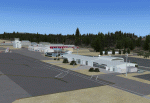
CYBL (2011) portrays the Campbell River (British Columbia, Canada) Airport and surrounding area, including the BC Forest Service tanker base, as it appeared in late 2011. (Campbell River, a small city mid-way up the eastern shore of Vancouver Island, is the "salmon capital" of North America and the gateway to Desolation Sound - summer cruising grounds for thousands of yachts from across the Pacific Northwest. Hence, CYBL is host to a lot of visiting GA.) This add-on includes a selection of Custom AI and static aircraft painted to represent aircraft based or often seen at CYBL. CYBL has recently completed a major runway extension and terminal upgrade - both of which are reflected in CYBL (2011). CYBL (2011) is compatible with BC Roads (FS9 only), ORBX FTX USA Canada Pacific Northwest and both FS9 and FSX versions of Ultimate Terrain.
Generally, this new version is visually identical to its predecessor - even though quite different internally. As well, to the extent possible, it is compatible with Prepar3Dv2. (v2.03 fixes a vehicle texture issue in 2.02)
| Filename: | CYBL_2011_Version_2_for_FS9_FSX_and_Prepar3D.zip |
| License: | Freeware, limited distribution |
| Added: | 22nd June 2014, 17:20:43 |
| Downloads: | 4,233 |
| Author: | Don Grovestine |
| Size: | 43.78 MB |
| Category: Flight Simulator 2004 - Scenery | |
| Minstrel Island CAX7 float base in British Columbia, Canada |
|
Images related to this file:
File Description:
This is the third in a series of new and renovated float bases in BC. Minstrel Island is on the south side of Knight Inlet and 25 miles west of Knight Inlet Lodge (the previous post in this series). There is a resort on the island, though it is hidden from the air by the trees. Fuel and oil are both available at the dock, and there is a 17 feet tidal range, which would be interesting of it could be replicated in FS. The AI is an adaptation of that for CF36 and involves a GA Cessna, and a Seair Beaver flying from Campbell River to Knight Inlet Lodge via Minstrel Island. Again, because of large hills the landing of the AI may or may not take place, depending on wind direction and whether or not they fly into solid rock before landing. Take off and departure will take place. Ultimate Terrain Alaska/Canada would be a definite plus to get the water in the right shape and place. This scenery will not work without it.
| Filename: | Minstrel_Island_CAX7_float_base_in_British_Columbi.zip |
| License: | Freeware, limited distribution |
| Added: | 3rd January 2017, 15:38:57 |
| Downloads: | 228 |
| Author: | Roger Wensley |
| Size: | 3.54 MB |
| Category: Flight Simulator 2004 - AFCAD Files | |
| China Airports |
|
File Description:
Afcads, Exclude files and grass skirtings to create 29 minor airports in China which Microsoft omitted from FS9.
Made primarily with Ultimate Traffic users in mind, and designed for use together with Curt Jardey's China_1.zip, China_2.zip and China_3.zip, and Jan "Uranusjay" Martin's tibet_95.zip, to activate all the Chinese airports in UT's database and provide full UT traffic in China. Airports built using official CAAC charts, so runway locations, dimensions, alignments, elevations, navaids, and apron dimensions are fairly accurate. Parking spots mostly fictional! And no airport buildings included!
Tested only with default FS9 scenery mesh.
Includes: DLU/ZPDL Dali, DIG/ZPDQ Diqing, DOY/ZSDY Dongying, DNH/ZLDH Dunhuang, GYS/ZUGU Guangyuan, HEK/ZYHE Heihe, HYN/ZSLQ Huangyan/Luqiao, JDZ/ZSJD Jingdezhen, JJN/ZSQZ Jinjiang, JUZ/ZSJU Quzhou (Juzhou), KRL/ZWKL Korla, KCA/ZWKC Kuqa, LYG/ZSLG Lianyungang, LNJ/ZPLC Lincang, LLF/ZGLG Ling Ling, LYI/ZSLY Linyi, LYA/ZHLY Luoyang, LUM/ZPMS Luxi/Mangshi, MXZ/ZGMX Meixian, NTG/ZSNT Nantong, SHP/ZBSH Qinhuangdao, TCG/ZWTC Tacheng, WXN/ZUWX Wanxian, WEF/ZSWF Weifang, WEH/ZSWH Weihai, WUS/ZSWY Wuyishan, YBP/ZUYB Yibin, YIH/ZHYC Yichang, HSN/ZSZS Zhoushan.
| Filename: | China_Airports.zip |
| License: | Freeware |
| Added: | 17th April 2005, 18:29:18 |
| Downloads: | 3,243 |
| Author: | Adrian Wright |
| Size: | 81.6 KB |


© 2001-2026 AVSIM Online
All Rights Reserved
Privacy Policy |