
Where Flight Simulation Enthusiasts Gather from Around the World!
AVSIM Library - Search Results

| Category: Flight Simulator 2004 - Scenery | |
| Moorea Airport, French Polynesia, NTTM |

|
File Description:
This version completely redoes the previous with a more accurate representation of the entire airport. It contains four distinct areas including the main terminal, a fictional sea plane pier and shelter, rudimentary hangars, and some Polynesian huts along with a pier and sail boats in the bay just down from the airport. This Island is the closest to Tahiti, and you can even see the Tahiti airport from it. The other outer Society Islands will be coming soon. It is suggested that you also download the file Fpsimesh.zip, which has been made for FS2004, and provides a very nice alternative to the boring terrain which FS has put in this most beautiful area of the world.
| Filename: | Moorea_Airport_French_Polynesia_NTTM.zip |
| License: | Freeware |
| Added: | 11th April 2004, 06:41:34 |
| Downloads: | 12,491 |
| Author: | Bill Melichar |
| Size: | 3.08 MB |
| Category: Flight Simulator X - Miscellaneous Files | |
| Drivable and Flyable Grey Van |
|
Images related to this file:
File Description:
The Drivable and Flyable Grey Van is derived from a stationary Euro Van model by the following modifications / additions:
-land-vehicle instrument panel
-sound files
-FSX effects and custom exhaust smoke effects files
-modified .CFG and .AIR files
The vehicle is powered by a single aircraft piston engine with modified flaps to serve as a gear-shift. High gear allows the vehicle to speed up to 70 Kt on wide highways, while the low gear restricts the speed to about 12 Kt, but enables the vehicle to ascend steep slopes for exploring terrain scenery.
At speeds around 65-70 Kt (in gear 4), pulling back on the yoke will allow the vehicle to take off and fly at level-flight speeds around 70 Kt. This is an interesting way to go island-hopping, overcome insurmountable terrain obstacles, or cover larger straight-line distances without using the slew mode.
An autopilot with hold altitude and hold heading options is operable during flight only.
All dashboard instruments are fully functional, including the Radio-Magnetic Indicator (RMI) during flight. Needles 1 and 2 are activated if correct frequencies are entered in the ADF and VOR radios.
The vehicle has lights which are toggled by pressing [L]. Lights are associated with a very thin exhaust smoke effect. Thick exhaust smoke is toggled by pressing [I].
Driving vehicles through FSX scenery in different seasons presents a whole new aspect to the simulation. It allows us to imagine discovering innumerable places on the planet which are in practice beyond our reach.
I hope you enjoy!
| Filename: | Drivable_and_Flyable_Grey_Van.zip |
| License: | Freeware |
| Added: | 29th January 2024, 15:24:50 |
| Downloads: | 37 |
| Author: | Rudy E. Kokich |
| Size: | 38.63 MB |
| Category: Flight Simulator 2004 - Scenery | |
| Ko Samui, Thailand (VTSM) v4.0 |
|
File Description:
Samui is a small, but busy airport on the island of Ko Samui. It is located in Southern Thailand, and is an exotic resort destination. In 1989 Bangkok Airways opened their own airport on the island, which decreased the travel time from Bangkok considerably. The airport is currently served by Bangkok Airways, although an occasional private aircraft will land here. This scenery is a detailed and accurate representation of this airport as it looks today. I consulted with several visitors to the airport, as well as the AIP for Thailand. Landsat imagery was used to modify the shoreline, and a custom landclass is included. Taxiway and parking areas were modified by using AFCAD2. This scenery is compatible with 3rd-party mesh scenery for Thailand.
| Filename: | Ko_Samui_Thailand_VTSM_v40.zip |
| License: | Freeware, limited distribution |
| Added: | 25th April 2004, 21:10:31 |
| Downloads: | 11,742 |
| Author: | Martin Strong |
| Size: | 5.34 MB |
| Category: Flight Simulator 2004 - Scenery | |
| San Francisco Int. (SFO) High Res Ground Scenery |
|
File Description:
This scenery contains high resolution ground scenery for the airport of San Francisco Intl. (SFO). It makes me kind of nostalgic, because that's the area where I first successfully tried my hi-res mesh technique for FS2004. The scenery has a resolution of 1.2m/pix (4.7m/pix is FS2004-standard). Coverage is the area around SFO containing the San Bruno Mountain Park and the San Adreas Res. So it's quiet a sight! And don't forget to bring some flowers :-) The scenery gives best results when combined with with my "San Francisco" standard resolution ground scenery, which covers a much larger area at 4.7m/pix and matches perfectly in color and everything...
Won't work in FSX. For FSX please wait for the upcoming FSX-version of this scenery.
| Filename: | San__Francisco_Int_SFO_High_Res_Ground_Scenery.zip |
| License: | Freeware, limited distribution |
| Added: | 27th November 2006, 10:58:19 |
| Downloads: | 16,818 |
| Author: | Gottfried Razek |
| Size: | 41.8 MB |
| Category: Flight Simulator 2004 - Scenery | |
| Bardenas Reales Firing Range Version 1.0 |
|
File Description:
Photorealistic scenery of the Firing Range of Bardenas Reales, in Navarra, Spain, close to LEZG ( N42º10.6',W1º28.0'). Created on 1951, this range was the practice area for air to surface weapons for the spanish air force pilots of EF18M, F1M, F5M and AV8 harriers. Usually is used for other allied forces like USAF F16. Actually the use of the firing range is decreasing @ 20% of the full capacity of 100 operations by day. Only textures 4.75 m/pixel, we recomend mesh EVA4,(http://www.airhispania.com/eva/eva.htm) or similar containing detailed topo of spain. Created By Jose Ramon Rodriguez ( this a present to all my friends of Virtual ZAragoza Airbase - www.basezaragozavirtual.tk -, specially to Diego Novillo by his support and illusion in this, and other projects, thx.
| Filename: | Bardenas_Reales_Firing_Range_Version_10.zip |
| License: | Freeware |
| Added: | 18th July 2006, 19:31:31 |
| Downloads: | 3,874 |
| Author: | Jose Ramon Rodriguez |
| Size: | 13.71 MB |
| Category: Flight Simulator 2004 - Scenery | |
| UK Hospitals (Vol 1) |
|
File Description:
This scenery collection contains airfield data for 54 Helipad landing sites in Wales, Lancashire, Merseyside, Cheshire and Cumbria based on the information provided by the Confederation of Helicopter Ambulance Services. Information here http://www.chasuk.co.uk/Documentation/HospitalLandingSites/tabid/69/Default.aspx.
The scenery is intended to be used in FS2004 Century of Flight with Just Flight's VFR photographic VFR scenery installed. The height data from CHASUK has been ignored in favour of that obtained from the Just Flight default mesh.
I have started to add autogen trees etc. around some of the landing sites - but this takes a lot longer and so I'm issuing vol 1 first with autogen only added to a few of the sites in the Chester/Merseyside area.
| Filename: | UK_Hospitals_Vol_1.zip |
| License: | Freeware |
| Added: | 2nd April 2009, 16:44:10 |
| Downloads: | 1,101 |
| Author: | Russ McGinn |
| Size: | 231.54 KB |
| Category: Flight Simulator 2004 - Scenery | |
| Exploring Our World - Part 3 - The Wine Country of Chile. |
|
Images related to this file:
File Description:

Exploring Our World - Part 3 - The Wine Country of Chile. Here is your opportunity to explore the Wine Country of Northern Chile with stopovers at four delightful GA airfields (SCAD-SCMI-SCOV-SCVN) enhanced by Cesar Carrasco. Along the way you will enjoy some very beautiful scenery. This package includes revised Afcads for the airports and a small Traffic file using default aircraft plus a challenge to find an observatory which I have added. Please read the documentation for further details. Designed to work with the default FS2004 scenery, no additional mesh is required. Please unzip (using folders option) to a temporary folder and follow the simple installation instructions which are in .doc and .pdf formats. Compiled for your flying enjoyment by David "Opa" Marshall.
| Filename: | Exploring_Our_World__Part_3__The_Wine_Country_of_C.zip |
| License: | Freeware |
| Added: | 3rd February 2010, 02:08:43 |
| Downloads: | 1,472 |
| Author: | David "Opa" Marshall |
| Size: | 1.19 MB |
| Category: Flight Simulator 2004 - Miscellaneous Files | |
| Tips and Tricks for FS2004 - Number 7. |
|
Images related to this file:
File Description:

Tips and Tricks - Number 7. This issue contains some VERY important information for anyone who "collects" scenery as well as an explanation of an error message we see from time to time. For anyone wanting to learn more about the use of "mesh", an excellent resource link is listed. An assortment of other tips, tricks and recommendations are included as usual - a little something for everyone. Some of these items have come from readers of this series and I thank them all. You will also find links to several unique sites that I believe you will find of value. Compiled in .doc and .pdf formats for your flying enjoyment by David "Opa" Marshall. --
This is a re-upload of the file which became "missing" after the hack.
| Filename: | Tips_and_Tricks_for_FS2004__Number_7.zip |
| License: | Freeware |
| Added: | 8th June 2010, 02:15:11 |
| Downloads: | 8,178 |
| Author: | David "Opa" Marshall |
| Size: | 940.44 KB |
| Category: Flight Simulator X - Scenery | |
| Locher/Sarentino Airfield scenery for MS FSX and LM Prepar3D |
|
Images related to this file:
File Description:
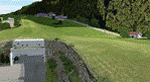
This scenery package is a representation of "Locher" airfield, a private grass field in the Trentino (or South Tyrol) area, close to the town of Sarentino (or Sarnthein, or Sarntal) in northern Italy. The town is very close to the border with Austria (hence the many versions of the town name). The field belongs to Locher Gebhard and shares the premises with Mr. Gebhard's factory, apparently producing metallic fire rated doors.
Features of the Locher airfield scenery include:
- Photoreal area with seasonal variations and watermask
- Custom mesh for a large area around the field
- Custom buildings and rock formations around the hangar, as well as sloped taxiway
- Custom landmarks on approach from the south, including power cables over the valley
| Filename: | LocherSarentino_Airfield_scenery_for_MS_FSX_and_LM.zip |
| License: | Freeware |
| Added: | 25th September 2017, 03:37:52 |
| Downloads: | 6,942 |
| Author: | Vassilios Dimoulas |
| Size: | 316.11 MB |
| Category: Flight Simulator X - Scenery | |
| Victoria, Canada including US Southern Gulf Islands and San Juan Islands - Part 2 of 2 |
|
Images related to this file:
File Description:
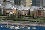
FSX-only version of Victoria, Canada area scenery including the Southern Gulf Islands and the San Juan Islands of the US. Includes automated installer and configurator by Scot Fraser.
Features:
-accurate shorelines, lakes and streams;
-landclass;
-FSX multi-LOD mesh with 10m maximum resolution;
-complete road network with moving traffic;
-railroads;
-utility corridors;
-marinas and ferry terminals;
-many static boats, including a custom model of the Canada Coast Guard ship Sir Wilfred Laurier;
-detailed models of major buildings and the Ogden Point Terminal;
-many bridges;
-nearly 300 marine lights; and corrected antennae locations.
Facilities include Don Grovestine's famous CYYJ (Victoria International Airport); 12 other Canadian land-based airports: Butler Field, Duncan (CAM3), Gaines, Hastings, Hudson Island, James Island, Thomas, Village Bay, Raven Field (CML2), Saltspring, Sidney Island, Whiskey Point; 20 US airports Blakely (38WA), Burden (61WA), Center Island (79WA), Clam Harbor (WA35), Crane Island, Decatur Shores (WN07), Decatur-Jones (WA18), Waldronaire (90WA), Orcas Island (KORS), Friday Harbour (KFHR), Lopez Island (S31), Pile Point, Roche Harbor (WA09), Shaw Island, Stuart Island Airpark (7WA5), Stuart Island West (2WA3), Wilding (6WA5), Windsock (4WA4); 12 floatplane facilities: Bedwell (CAB3), Fisherman's Bay (WA81), Friday Harbor (W33), Ganges (CAX6), Maple Bay, Mayne (CAW7), Port Washington (CAP8), Roche Harbor (W39), Rosario (W49), Shawnigan Lake (CAV8), Victoria Harbour (CYWH), Victoria International (CAP5) and Westsound, Orcas (WA83) - many with AI traffic; 9 heliports: Ganges (CAL7), Mayne (CBF5), Camel Point (CBF7), Jubilee (CBK8), Victoria General (CBW7) Madrona Bay (CBW9), Shoal Point (CBZ7), Mount Belcher (CMBH).
AI models include the DHC-2 floatplane in local liveries, a cruise ship model (by Mitsuya Hamaguchi) and two repaints, pilot boat, and small boats (by Larry Silsbee).
Ultimate Terrain X compatible (not required). Users of Vancouver+ for FSX will also get additional cruise ship traffic and additional floatplane and helicopter traffic. Full documentation. By Don Grovestine, Jon Patch and Holger Sandmann. Many other contributors: see documentation. Part 2 of 2 - you also need file vicenh7a.zip
| Filename: | Victoria_Canada_including_US_Southern_Gulf_Islands.zip |
| License: | Check within download |
| Added: | 29th January 2010, 21:21:49 |
| Downloads: | 23,166 |
| Author: | Don Grovestine, Jon Patch and Holger Sandmann |
| Size: | 59.08 MB |


© 2001-2026 AVSIM Online
All Rights Reserved
Privacy Policy |