
Where Flight Simulation Enthusiasts Gather from Around the World!
AVSIM Library - Search Results

| Category: Flight Simulator 2004 - Scenery | |
| Aasiaat BGAA on the west coast of Greenland |

|
Images related to this file:
File Description:
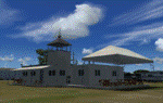
I wrote that Qikiqtarjuaq, on the east coast of Baffin Island, was the jumping off airfield for ferry flights for small planes from Canada to Europe via Greenland. Aasiaat is the airfield in Greenland that they jump to, 300 miles across the Davis Strait. The airfield is on the northern coast of Aasiaat Island, and the town of the same name is just two miles to the west. The runway is 2,600 feet of asphalt almost 100 feet wide and lit, at 74 feet ASL, aligned 12/30, with the apron and terminal building at the western end. Air Greenland run regular flights with a Dash-7 or 8, & Twin Otters, and the markings for the taxiway and parking spot in front of the terminal are exactly as they were six years ago. I have seen video since then that has further taxiway and parking spot markings added in, but I like the simplicity of the original. Unfortunately, given the limitations of FS and the single runway and simple taxiway routing there was no way to replicate both the parking facing away from the terminal AND the "through" taxiing to complete the circle back to the runway; after parking correctly the AI Air Greenland Dash-8 will reverse before heading out to take off. There is both JetA and 100LL fuel available. The surrounding area is rocky, and there is no grass around the runway; the airfield has compacted gravel instead.
| Filename: | Aasiaat_BGAA_on_the_west_coast_of_Greenland.zip |
| License: | Freeware, limited distribution |
| Added: | 26th March 2012, 11:01:16 |
| Downloads: | 691 |
| Author: | Roger Wensley |
| Size: | 2.73 MB |
| Category: Flight Simulator 2004 - Scenery | |
| RAF Wittering 1990 |
|
Images related to this file:
File Description:

Wittering was opened as an RAF station in 1924, but flying here started way back in 1916 with the Royal Flying Corps.
Initially the Central Flying School was based here from 1926 until 1935. During World War 2, Wittering was a part of 12 Group, which was responsible for the defence of the Midlands.
The station took on a nuclear responsibility in 1956 with the arrival of the V-Force Valiants, and later Victor bombers. Because of this, the runway was increased in length.
After the V-Bombers left, the station took on the mantle of Home of the Harrier, a title it carried with it from 1969, until the stations closure in 2010.
This scenery is made up of various library objects, using ScruffyDuck's ADE9X, to make a close representation of the base, as opposed to being factually accurate.
Brian has incorporated most of the extra runways and representations of deck landing areas that were used at Wittering for V/STOL training - these runways are not active, but may still obviously be used for taking off and landing yourself.
Also included are repaints of John Young's Harrier GR3/T4 AI model, available from flightsim.com. These represent the aircraft of No.1(F) Squadron and No.233 OCU, during 1989-90.
There are also a set of representative flightplans to allow the Harriers to fly "typical" missions and flights.
| Filename: | RAF_Wittering_1990.zip |
| License: | Freeware, limited distribution |
| Added: | 6th October 2013, 17:17:42 |
| Downloads: | 1,392 |
| Author: | Brian Clarke, Daryl Payne |
| Size: | 20.58 MB |
| Category: Flight Simulator X - Scenery | |
| Kopaida Airfield, Greece |
|
Images related to this file:
File Description:
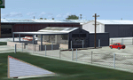
"Kopaida" airfield is a grass private strip, 105km NW of Athens located in the Kopaida drained lake plains between the towns of Aliartos, Kastro and Orchomenos and west of Yliki lake. It is a pure general aviation field and a hub of activity for numerous sport planes, gliders and motor gliders. The field includes a small tower and canteen and several owners of GA aircraft house them in the roomy hangar and also keep a mobile home or RV in the premises. The scenery includes a region and landclass bgl that will force a large area of the Kopaida plains around the airport to display US field textures. This was done because the US fields textures are rectangular and aligned N-E and W-E, in a similar way as the actual fields around the airport. A small photo background is used for the airfield itself. The photo background includes seasonal variations with slight colour variances as well as some autogen trees and shrubs. Custom GA traffic is also included. There is one trike doing circuits and TnGs and a Turbo Porter flying the circuit, simulating a skydiving sortie. The Turbo Porter used is the great freeware one created by Tim (Piglet) Conrad. I have also included a repaint for the F-GHVH, the Porter used by the GFFC, which sports a flashy "Alien" graffiti scheme.
*For FSX SP2 / Acceleration / P3D v1.00*
| Filename: | Kopaida_Airfield_Greece.zip |
| License: | Freeware |
| Added: | 3rd June 2014, 21:23:30 |
| Downloads: | 1,472 |
| Author: | Vassilios Dimoulas |
| Size: | 25.01 MB |
| Category: Flight Simulator X - Scenery | |
| 52F North West Regional Airport (DFW TX) |
|
Images related to this file:
File Description:
This airport scenery does not require any other software other than Microsoft Flight Sim X SP1 (minimum) - SP2 required for mission and display of some of the scenery items. However, it could help with performance on your PC if you install any accurate photo scenery for DFW. One such scenery is MEGASCENERY DFW photo scenery from http://www.megascenery.com/.
This is a custom developed scenery for airport, 52F - Northwest Regional, Roanoke, TX. 52F is next to Fort Worth Alliance in the Dallas Fort Worth Metroplex. It's a nice little airport.
This scenery package also includes a Mission called "52Foxtrot - Approach to Rwy 35 - Thermals". It is more of a free flight than the traditional FSX missions. The ones who fly for real at 52F-Northwest regional knows the quirks when coming into land at runway 35 on a hot day. The thermals at the cleared land and the sinking feeling when flying over the wooded area nearing the approach to 35. These thermal lifts and sinks have been modeled here. However, the only way to experience these thermals in FSX is via Missions. Once you select the mission "52Foxtrot - Approach to Rwy 35 - Thermals" and by selecting option "Enable changes in selected Mission", you could fly around like you would under "free flight". Except this time, you would have these thermal effects around 52F and get to experience what it's really like to fly and land at 52F.
| Filename: | 52F_North_West_Regional_Airport_DFW_TX.zip |
| License: | Freeware, limited distribution |
| Added: | 24th March 2010, 01:23:59 |
| Downloads: | 3,335 |
| Author: | Manny Mahadevan |
| Size: | 19.06 MB |
| Category: Orbiter - Orbital Stations | |
| Skylab 2 Mission |
|
File Description:
The Skylab space station was launched May 14, 1973, from the NASA
Kennedy Space Center by a huge Saturn V launch vehicle, the moon
rocket of the Apollo Space Program. Sixty-three seconds after liftoff,
the meteoroid shield--designed also to shade Skylab's workshop
--deployed inadvertently. It was torn from the space station by
atmospheric drag. This event and its effects started a ten-day period
in which Skylab was beset with problems that had to be conquered
before the space station would be safe and habitable for the three
manned periods of its planned eight-month mission.
skylab 2
25 May 1973 13:00 GMT. Duration: 28.03 days. Call Sign: Skylab. Backup
Crew: McCandless, Musgrave, Schweickart. Nation: USA. Agency: NASA.
Launch Site: Cape Canaveral . Launch Complex: LC39B. Launch Vehicle:
Saturn IB . LV Configuration: Saturn IB s/n SA-206. Program: Skylab.
Class: Manned. Type: Lunar spacecraft. Spacecraft: Apollo CSM. Payload
: Apollo CSM 116. Mass: 19,979 kg. Location of Spacecraft: Naval
Aviation Museum, Pensacola, FL. Perigee: 427 km. Apogee: 439 km.
Inclination: 50.0 deg. Period: 93.2 min.
Epic repair mission which brought Skylab into working order. Included
such great moments as Conrad being flung through space by the whiplash
after heaving on the solar wing just as the debris constraining it
gave way; deployment of a lightweight solar shield, developed in
Houston in one week, which brought the temperatures down to tolerable
levels. With this flight US again took manned spaceflight duration
record.
| Filename: | Skylab_2_Mission.zip |
| License: | Freeware |
| Added: | 7th January 2003, 04:31:25 |
| Downloads: | 907 |
| Author: | Ronald Dandurand |
| Size: | 3.76 KB |
| Category: Flight Simulator X - Flight Plans | |
| 3 in 1 Panama Fun |
|
File Description:
Three Flights in one Package!!!!.
Flight One......Stratosphere Pirates 1935---
Bill Barnes is called again by the Navy which has been bombarding the "Mystery Island" for 2 days, but
are sure Mordikay has been saved by "The Black Spider" and are now both on their way to Bomb the Panama Canal
in their Marvelous evil Dirigibles!!!!!!!...Bill and you will make a search to Find and Destroy the Derigibles--------Flight II....Lost in the Jungle---
The Motor Club of Talachoochi, Florida have driven from their home town to Panama. (long ride!!!)
Once there they, against the advise of many locals, desided to go to the Darien Jungle, to a place known as
"Blue Snake". This is deep in the jungle near the Colombian border. Roads here are really scarse and very dangerous.
You guessed it............the dudes are now totally lost!!!!!!..............
SAR authorities have been alerted and you must go in your DH to find them. The weather is poor during this time
of the year so the mission is dangerous.-------Flight III.....Holyday to Great Fishing Holes----
The Panama Jungle Yearly Fishing contest is about to start and you have been hired by a bunch of Fishermen from the States, actually 12 of them.
They are to be flown to 3 Hotels in the Jungle where the tournaments will be held. Beware, thunderstorms have been predicted for today!! Have
enough paper bags in the plane!!!..Oh!, one will return back with you.(?)
| Filename: | 3_in_1_Panama_Fun.zip |
| License: | Freeware, limited distribution |
| Added: | 16th February 2008, 09:37:29 |
| Downloads: | 1,290 |
| Author: | Gera Godoy C |
| Size: | 1.2 MB |
| Category: Flight Simulator 2004 - Scenery | |
| Sisimiut (BGSS) on the west coast of Greenland |
|
Images related to this file:
File Description:
Sisimiut is on the west coast of Greenland. It is around 125 miles south of Aasiaat, and 80 miles west of Kangerlussuaq airport, which is currently the largest commercial airfield in Greenland. Sisimiut has a population of 5,500 and the main occupations are fishing, tourism, education, and a growing industrial base. It has the northernmost year-round ice-free port in Greenland, though icebergs floating down from the north are commonplace. The airport is across a bridge and along a two mile road on the north side of an inlet, northwest of the town. The runway is 2,600+ feet of asphalt almost 100 feet wide and lit, aligned 20/02 and at 33 feet ASL, with the apron and terminal building at the eastern end. The building is identical to the one at Aasiaat. Air Greenland run regular flights with a Dash-8, Dash-7, or Twin Otters; within FS9 it is impossible to land an Ai Dash-7 on a runway less than 3,000 feet long, so I used a Dash-8. There was no way to replicate both the parking facing away from the terminal AND the "through" taxiing to complete the circle back to the runway; after parking correctly the AI Air Greenland plane will reverse before heading out to take off. The surrounding area is rock with some scruffy grass and low bushes, and there is no grass around the runway; the airfield has compacted gravel instead.
| Filename: | Sisimiut_BGSS_on_the_west_coast_of_Greenland.zip |
| License: | Freeware, limited distribution |
| Added: | 28th April 2012, 22:03:35 |
| Downloads: | 853 |
| Author: | Roger Wensley |
| Size: | 3.71 MB |
| Category: Flight Simulator 2004 - Miscellaneous Files | |
| Nick's LightFix |
|
File Description:
The concept and the base textures for this package are from Mark Poole and his original light replacement releases. Mark's original Nav Light package has a really good concept and uses light textures which create sharp lens flairs or bursts. I found the lens flair in his packages to be a bit too large and out of scale for my display and taste. Also, I wanted to have an easy way to replace all the FS9 lights in one shot with little or no configuration file editing. With that in mind, this package was created. This release will automatically replace ALL the Flight Simulator aircraft and airport lights with more realistic ones along with better distance visuals of slower flashing radio tower/smoke stack and ground beacons. It also includes replacement lights in scale for the PMDG 737, 747 and for all Project Opensky aircraft offered on their site. It works automatically with Ultimate Traffic and other AI add-ons which use the default Microsoft aircraft lights. I added a diffused halo effect to Mark's original airport_lighting_v2 texture which gives a more realistic look in cloudy or weather conditions and enhances the dynamic directional brightness of the lights. In addition to the navigation lights, I have also created aircraft beacons and strobes which will also install automatically . A restore package is included allowing to you to revert back to default FS9 texture and FX files.
ENJOY!
From Nick Needham
[email protected]
| Filename: | Nicks_LightFix.zip |
| License: | Freeware, limited distribution |
| Added: | 4th April 2006, 21:47:56 |
| Downloads: | 19,325 |
| Author: | Nick Needham |
| Size: | 1.55 MB |
| Category: Flight Simulator 2004 - Original Aircraft | |
| Avro Lancastrian II |
|
File Description:
A close derivative of the war-time Lancaster bomber, the Lancastrian was
fitted with streamlined nose and tail cones. Lancastrians were used as
long-range freighters, VIP transports, and jet engine test beds by the
RAF, as fast long-range airliners and mailplanes by Trans Canada Air
Lines, BOAC, BSAA, QUANTAS, and Alitalia, and as tankers by Flight
Refuelling Ltd. Charter operators were Skyways and Silver City.
Eighty-two aircraft were build, but most of them had vanished in
scrapyards by the early nineteen-fifties. In the immediate post-war
years, TCA offered twice-weekly Lancastrian flights from Dorval, Canada,
to Prestwick and London, while BOAC and BSAA (under chief pilot D.C.T.
Bennett) operated flights to Australia and South America, all based on a
rather uneconomical ratio of five crew to up to fourteen passengers. The
outbound leg from Hurn to Learmouth, Australia, took three days and well
over fifty hours flying time, with Lydda, Karachi, and Ceylon serving as
staging posts. BSAA's London to Buenos Aires flight took 56 hours.
Either way, one needs to have plenty of time on one's hands to recreate
these epic journeys. Gmax exterior model and textures by Manfred Jahn,
FDE and 2D panel by Paul Edwards (based on a panel by Phil Perrott of
Alphasim). The three texture sets included represent VM734 of 246
Squadron RAF, G-AGLY ("Norfolk") of BOAC, and G-AKFG of Flight
Refuelling Ltd.
| Filename: | Avro_Lancastrian_II.zip |
| License: | Freeware |
| Added: | 20th May 2007, 10:45:54 |
| Downloads: | 6,654 |
| Author: | Manfred Jahn and Paul Edwards |
| Size: | 5.23 MB |
| Category: Flight Simulator X - Scenery | |
| VTSM - Koh Samui |
|
File Description:
Today, after almost half a year of construction, I am presenting my new airport to
youVTSM- Samui Airport in front of .......
since I was already there myself and again no decent freeware scenerywas to be
found for the FSX,
so building it yourself was once again the trend
I tested the airport on another computer - everything works fine
Traffic works, Ai traffic as well as road traffic and ILS approach works. So
have fun in Koh Samui at the airport and the surrounding area .......
The best way to go on a voyage of discovery is with a small plane or helicopter so
that you can do the same
see many details .........
lands at the airport VTSM with an A319 or a Boing 737 larger planes are not there
then allowed to take a helicopter or a small plane and fly over the island
explores the many details ...............
Installation:
Put the folder VTSM - Samui in the folder FSX Addon Scenery and activate
Him......... !
The steps listed below only if you don't have these add-ons yet! !
to be able to see people unzip the supplied folder 3dpeoble_Lib and put
the unzipped folder in your FSX Addon Scenery and activate it
Support:
If you have any problems or questions, please send an email to
[email protected]
now have fun and good luck on your flight LG Jamaica
Demo video at https://youtu.be/dcIkSi03sfg?t=7
| Filename: | VTSM__Koh_Samui.zip |
| License: | Freeware |
| Added: | 5th February 2021, 19:28:51 |
| Downloads: | 785 |
| Author: | Ewald Wagner |
| Size: | 52.16 MB |


© 2001-2026 AVSIM Online
All Rights Reserved
Privacy Policy |