
Where Flight Simulation Enthusiasts Gather from Around the World!
AVSIM Library - Search Results

| Category: Flight Simulator 2004 - Scenery | |
| Alaska South Slope 3; Kiana PAIK |

|
Images related to this file:
File Description:
The town of Kotzebue is in the far northwest of Alaska, and served by Alaska Airlines. These are villages to the (mostly) east of Kotzebue on the South Slope of the Brooks Range of mountains, served by local flights from Kotzebue. There will be further additions. Kiana is a small village (population now around 360) on the bank of the Kobuk River, around 60 miles east of Kotzebue. The airfield, called Baker Memorial, is just north of the village, with 4,000 feet of lit gravel aligned 06-24 (as are several other runways in the area) with PAPI on 24. There are scheduled flights by Era (now renamed Ravn) and by Bering Air, both of them originating in Kotzebue and routing east to Noorvik, Kiana, Ambler, Shungnak, Kobuk, and then back again. The AI includes these flights along with Everts Air and Northern Air Cargo flights and GA. In real life the runway is around 200 yards closer to the village; this complicated the removal of roads and revised ground textures so I left it as is to make my life easier. The post includes missing night textures that were omitted from the post of Noatak PAWN. Noatak also has incorrectly installed original FS9 taxiway lights that were, as a result, impossible to remove. I had hoped to somehow manage it, but there is no way.
| Filename: | Alaska_South_Slope_3_Kiana_PAIK.zip |
| License: | Freeware, limited distribution |
| Added: | 7th September 2016, 22:00:17 |
| Downloads: | 213 |
| Author: | Roger Wensley |
| Size: | 4.5 MB |
| Category: Flight Simulator 2004 - AI Flight Plans | |
| Sorted default FS9 flight plans & GA flight plans sorted by ICAO/country |
|
File Description:
The Master_GA_sorted_country contains: some 20,436 flight plans that have been adopted from Reggie Fields' sorted aircraft registration collections. The following is from his readme file (included folder), "FS2004 General Aviation AI traffic with more correct registration numbers for the originating country. This file is a modification of the FS2004 default GA traffic designed to minimize the number of small single engine aircraft landing at the worlds major commercial airports. This will prevent a lot of go-around orders to commercial jets based on the length of time it takes a C172 to clear a 10,000 ft runway. This file makes commercial AI traffic flow much better than the MS default while retaining the GA aircraft in the airspace." Like Reggie Fields' files, all are free to use and redistribute but can not be sold. AC#defaultfp_sorted_ICAO folder contains all individual default aircraft in seperate files and their FS9 default flight plans are sorted by ICAO. A second folder contains a file for each country with the mentioned GA flight plans sorted by ICAO. This should be of an aide to those of us who wish to put more correct AI aircraft into a region or country. Copy/paste should be easier, this way, when building on each countries' aviation/flights. All files are text (.txt) files (ASCII.) They have no @ and TTOOLS by Lee Swordy is recommended.
| Filename: | Sorted_default_FS9_flight_plans__GA_flight_plans_s.zip |
| License: | Freeware |
| Added: | 10th May 2004, 14:48:30 |
| Downloads: | 2,983 |
| Author: | Rick Connolly |
| Size: | 5.57 MB |
| Category: Flight Simulator 2004 - Aircraft Repaints, Textures and Modifications | |
| FSP Airbus Paint Kits |
|
File Description:
This paint kit package contains all of the FSP Airbus paint kits in one easy-to-access pack. These are full kits - models, textures, aircraft.cfg, and *.air files. These kits are CLEAN; that is there is no dirt or shading. In addition to the normal DXT3 files, there are one or more PSP detail files in each aircraft folder. The detail files eliminate most of the requirement to use layered techniques when painting aircraft. Please see the instruction files for specific painting steps. You can now use full color washes on your work and you can stop worring about replacing windows and doors when you paint. I developed these CLEAN kits for two reasons - one, I like to add shading and details that reflect the way I paint aircraft as opposed to someone else who might add things like dirt where I might not want it - and two because with most aircraft designed with dynamic shine, you really don't need shading because it is built in. NOTE: The night textures in these kits have been heavily modified. I found two discrepancies in many of the kits on the Net today - incorrect window placement (especially on doors) and the use of an incorrect BLACK color on night textures which prevented the display of textures during night operations. Paint kits are by Frank Bass and night textures by Peter Leadbeater.
| Filename: | FSP_Airbus_Paint_Kits.zip |
| License: | Freeware |
| Added: | 4th June 2005, 16:04:31 |
| Downloads: | 1,457 |
| Author: | Frank Bass |
| Size: | 11.09 MB |
| Category: Flight Simulator 2004 - Scenery | |
| New Night Textures - Newark Liberty Intl (KEWR) |
|
Images related to this file:
File Description:
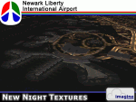
Some time ago, I purchased the Newark Liberty Intl (KEWR) by ImagineSim, but the night textures did not seem realistic. I set out to try to make them more so. This is the result of that work. Many of the scenery's night textures have been updated. The cargo areas for FedEx, UPS and UNITED Cargo now look much more realistic. The Marriott Hotel, the centerpiece of the airport and this scenery, looks considerably more realistic, as well as the terminals and the Continental Hanger and maintenance area. One of the nice unexpected results of this change is the light splash effect around the terminals; it definitely outlines the terminal area well. For those who own this scenery, I hope this enhances your flight experiences in and out of KEWR. For those who do not yet own this, but enjoy or would like to fly in and out of KEWR, it is now considered a legacy product by ImagineSim. As a result, the price was cut considerably and for a few shillings and this update, you'll have a nice addition to the airports in your FS2004 environment. I dedicate this work to all the controllers of VATSIM NYARTCC. I hope this brings more traffic your way. I want to thank ImagineSim for giving me permission to release these textures. See Readme.txt for installation instructions.
| Filename: | New_Night_Textures__Newark_Liberty_Intl_KEWR.zip |
| License: | Freeware, limited distribution |
| Added: | 27th October 2012, 03:48:59 |
| Downloads: | 2,292 |
| Author: | Jeffrey S. Bryner, Imagine Simulation |
| Size: | 1.97 MB |
| Category: Flight Simulator 2004 - AFCAD Files | |
| Airports used by MATVA |
|
File Description:
The MATVA Group offer you another package of Af2 files to replace the default ones for those airfields they visit, they do not have allocated gates. The 55 airfields in this package are in: Mongolia; (ZMUB) Ulaanbaatar, (ZMBN) Bulgan, (ZMMN) Moron, (ZMBH) Bayanhongor, (ZMAT) Altay, (ZMUL) Olgiy and (ZMCD) Choybalsan. Canada; (CYOA) Ekati, (CYHY) Hay River, (CYQT) Thunder Bay and (CYZF) Yellowknife. China; (ZHCC) Zhengzhou, (ZBHH) Hohhot and (ZHHH) Wuhan. Japan (RJNK) Komatsu and (RJOM) Matsuyama. S. Korea; (RKJJ) Gwangju, (RKNN) Gangneung , (RKNY) Yangyang, (RKPK) Pusan, (RKPU) Ulsan, (RKSS) Seoul/Gimpo and (RKTN) Daegu. Russia; (UIBB) Bratsk, (ULAA) Arkhangel'sk, (UMMS) Minsk2, (UNOO) Omsk, (URWA) Astrakhan, (URWW) Volgograd, (USSS) Yekaterinburg, (UUDD) Moscow/Domededovo, (UWGG) Nizhny Novgorod and (UWWW) Samara. (UKBB) Kiev, Ukraine. (ZKPY) Pyongyang, N. Korea. (ROAH) Naha, Okinawa. (RPVM) Cebu, Philippines. (EETN) Talinn, Estonia. (EGHH) Bournemouth, UK. (EVRA) Riga(LKPR) Prague. (OOMS) Muscat, Oman. (PTRO) Koror, Micronesia. (SLLP) La Paz, Bolivia. (VGZR) Dhaka, Bangladesh. (VYYY) Yangon, Myanmar. (WBSB) Brunei. (LIBD) Bari, Italy. (ESGG) Goteburg, Sweden. Also included are reworks of our previously released (EGPE) Inverness, (EIDW) Dublin, (OIII) Tehran, (ZSPD) Shanghai, (ULLI) St. Petersburg, and (SVMI) Maiquetia, Venezuela. These AFCADS are in no way intended to resemble their real world counterparts. They have been created to allow AI and flyable aircraft to do their thing, any problems get in touch at www.matva.org.uk :O) enjoy!!!!
| Filename: | Airports_used_by_MATVA.zip |
| License: | Freeware, limited distribution |
| Added: | 3rd January 2007, 00:59:49 |
| Downloads: | 8,582 |
| Author: | Louie Maclennan MATVA |
| Size: | 232.02 KB |
| Category: Flight Simulator X - Scenery | |
| LJLJ - Jozef Puchnik International Airport - Ljubljana, Slovenia |
|
Images related to this file:
File Description:
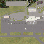
Decent representation of Slovenian airport named after Jozef Pucnik,
located near the village Spodnji Brnik, some 15 miles north of Slovenia's capital Ljubljana.
The scenery is packed with many features: custom landclass in the walley underlying the approach paths to both runways(12 and 30),
custom airport layout as found after last reconstruction of aprons and taxiways, corrected approaches (so IFR AI traffic in case of a missed approach to runway 30 is no longer turning right crashing into the 8000ft mountains just North of the airport). All airport buildings are placed into their correct
locations and shapes, even if only default generic buildings and library objects were used.
You will also notice airport has 3 runways(AFCAD on steroids),when there is actually
only one in reality and only one is also visible in the simulation.
This was done in order to enable different categories of AI aircraft using different intersections
for departure and the only way possible to recreate this was to use overlayed runways of different lenght.
There are also some surprises hidden in the scenery, but we will leave them for you to discover.
Music titles used in the scenery are published with kind permission of the author, Mr.Slavko Avsenik.
Released as freeware but with limited distribution.
LJLJ2012 by SST - Slovenia Scenery Team
| Filename: | LJLJ__Jozef_Puchnik_International_Airport__Ljublja.zip |
| License: | Freeware, limited distribution |
| Added: | 10th June 2012, 15:30:05 |
| Downloads: | 3,471 |
| Author: | SST - Slovenia Scenery Team |
| Size: | 11.35 MB |
| Category: Flight Simulator 2004 - AFCAD Files | |
| Presidente Nicolau Lobato International, Dili, East Timor (WPDL) v2 |
|
File Description:
"Euraka!" I cried in the middle of the night. My wife rolled over and mumbled "its not me, it must be the cat". But I was pleased with myself, for I had suddenly thought of a way to eliminate Microsoft's radiused corners where taxiway meets runway. They are a nifty arrangement, when you want them, but at this airport (clearly evidenced by Google Earth) they do not exist on the concrete connections. So here is a revised version of my Googlyafcad for WPDL Dili-Comoro-Komoro-Presidente Nicolau Lobato International or whatever it is called today. I considered calling this version 1.0062A so as to impress but I think you might prefer me to call it it version 2. Unfortunately, Microsoft's perception of this airport in Flight Simulator is a wee bit under scale and the ramp areas provided barely allow the parking of a flea, never mind the Boeing 737s that serve this airport. This A&F Data file allows you and "AI" traffic to land, park and take-off in the proper manner. But there is more . . . the Google Earth picture clearly shows three parked
helocopters, so to give the place a little atmosphere, I've provided an additional file which will place three static helicopters at the airport. They will only show if you have the Rwy12 libraries
installed, but the file won't bite if you don't. (replaces af2_wpdl.zip)
| Filename: | Presidente_Nicolau_Lobato_International_Dili_East_.zip |
| License: | Freeware |
| Added: | 12th February 2007, 13:07:25 |
| Downloads: | 753 |
| Author: | John Hinson |
| Size: | 44.33 KB |
| Category: Flight Simulator 2004 - Utilities | |
| FsPassengers (ver 05 september) |
|
File Description:
FsPassengers 2004 is an add-on for Flight Simulator 2004 that will completely revolutionize the way you fly in Fs2004. Here
are just some of the features of FsPassengers 2004: Add passengers to your flights! Finally, you're not alone in the sky.
Passengers react to how you fly your plane. Hear them scream if you make drastic mistakes, and get their opinion of your
flight in real time. Provide in-flight passenger services such as movies, music, and drinks. Make money for successful
flights; be fined if you do something wrong. Manage an airline (make money, manage aircraft fleets, etc). Maintain your
aircraft in good condition, otherwise you may experience unique and suprising failures. Create and maintain pilot careers.
Keep detailed logs and statistics for every flight you make (great for virtual airlines). Fly through dangerous parts of the
world, and risk the safety of your plane, crew, or passengers! Export your flight to your Virtual Airline. This add-on
includes more than 200 in-flight sounds to immerse you in the ambiance of flight. Hear feedback from your co-pilot, flight
attendants, passengers; listen to ATC chatter, music, GPWS, and more. All screens and reports work in full screen. No need to
quit FS. - This demo is fully functional apart that you can only start a flight from San-Francisco area (but you can land
anywhere)
| Filename: | FsPassengers_ver_05_september.zip |
| License: | Shareware, limited functionality |
| Added: | 5th September 2005, 17:01:18 |
| Downloads: | 9,753 |
| Author: | Daniel Polli |
| Size: | 26.19 MB |
| Category: Flight Simulator 2004 - Scenery | |
| FS9 Fort St John CYXJ in BC Canada |
|
File Description:
Fort St John is close to the border between British Columbia and Alberta, around 40 miles north-northwest of Dawson Creek. The airport was originally a Royal Canadian Air Force base, associated with the wartime construction of the Alaska Highway. The airfield was part of this construction effort and the wartime ferrying of planes to Russia. It is currently named "North Peace Regional Airport", or "North Peace Airport"; apparently there has been no final decision?
The date for this scenery is around 2006. I was given an old video tape cassette which was filmed on an uncertain date, but which had to be before the terminal building was renovated in 2007 and totally changed in appearance. The only way to view the video was to play it in the camera and watch it on a small screen. After I had completed everything except the buildings I started to view the video to establish the building appearances and within an hour or so the camera died. It was so old there was no way to repair it, so I then made some new buildings from memory of the video and what was available online. I also used some that I had already made for other scenery but which were similar. I may replace the terminal building that is in this version with a build of the new one, as I know this one is not a very accurate reproduction. The replacement, if I do it, will be towards the end of this year.
The AI included here is for GA, Air Canada Jazz, and two helicopter companies that were (and still are?) based there. One is at the western end of the apron and the other is at the eastern end but separated from the apron. To gain access to the taxiways and runways (so that all airport users follow the same procedures, for safety reasons) the eastern end helicopters just taxi across the grass. The helicopters are used for maintenance trips to the oil and gas fields in the surrounding area. My screenshots show Westjet at the terminal; this is because I have later Canadian AI installed, while the AI included here is only for the time around 2000 to 2010, when Westjet were not flying to Fort St John.
The airport is square in plan, with the apron running along the northern side and two runways forming diagonals. The two runways are 11-29 (6,882 feet long and 200 feet wide, with ILS at the 29 end and PAPI at the other) and 02-20 (6,684 feet long and 200 feet wide, and with PAPI at each end). The eastern side taxiway that runs north-south is not used. The western side taxiway is in use but only as a race track for cars.
Please email me if you find faults, such as a plane without textures.
| Filename: | FS9_Fort_St_John_CYXJ_in_BC_Canada.zip |
| License: | Freeware, limited distribution |
| Added: | 10th October 2022, 14:03:38 |
| Downloads: | 214 |
| Author: | Roger Wensley |
| Size: | 37.49 MB |
| Category: Flight Simulator X - Original Aircraft | |
| FedEx McDonnell Douglas MD-11F (N604FE) |
|
Images related to this file:
File Description:
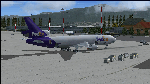
The Boeing MD-11F aircraft, N604FE, named "Hollis" is based out of Memphis, TN and can fly both Domestic and International Routes. The MD-11F (53 built) are the Freight transport aircraft version and were the second variant on offer at launch in 1986, and was the last and longest (1988-2000) manufactured version. 22 MD-11F's were delivered between 1991 and 2001 to FedEx. According to Flight Aware, she flies mainly domestic routes daily. The aircraft is almost identical to the DC-10F, although BOEING modernized their model with a longer fuselage and more powerful engines, giving her a longer range and higher service ceiling. Most flights are at full payload, and those disclude the center long-range fuel tanks, and involve flights ranging between 2,000 and 4,500 nm. I've been dealing with several versions of this aircraft for many years, actually since the first offered on CompuServe for FS98 in the '90s, and through time have found many aerodynamic details that were required in order to make her fly realistically. The Internet slowly added the details I needed, and then came the testing. Needless to say, I've flown many versions, including this one, for way too many hours, and added and corrected things along the way. This version is the best I've ever done, and I've worked on her for about a year before this upload. Everything is aerodynamically correct, and the engines (and their placement) are beyond anything ever presented by anyone with anything like this previously. I even fixed the gear to be 100% authentic in placement and use. I tried to fix the lights, but the textures are from FS2004, so I did the best I could. I chose this aircraft because it is actually in service today, and because the painter did a great job in making her look authentic. She now flies in FSX just as she does in reality, but you are better advised to study this on your own, rather than take my word. Aircraft ratings by manufacturers are based on simple standards, and very conservative. FSX is a virtual “WIND TUNNEL†when realistic aerodynamics are employed, so we can see what aircraft are capable of if we do it all right. Sorry to say, no one ever builds a free aircraft for upload with the correct engine/aerodynamics employed. In fact, I don't think anyone, other than myself, has ever put that much effort into it. So, keep this in mind. What you have now is real. It is Free. Now learn from it. READ THE MD11Readme.txt document before any operation after unzipping this. Tri-Engine Sound by B.G. Hany; Textures by Bradley McCoy; Panel by Marco Spada; Real World Engine/Aerodynamics by Douglas E. Trapp, [email protected], June 2018. This aircraft is designed for educational use protected under the Fair Use Doctrine: (http://www.expertlaw.com/library/intellectual_property/fair_use.html) ... It cannot be sold or bundled for sale, and such will never be approved by me or the original authors. FREEWARE DISTRIBUTION ONLY!!!
| Filename: | FedEx_McDonnell_Douglas_MD11F_N604FE.zip |
| License: | Freeware |
| Added: | 1st July 2018, 02:41:02 |
| Downloads: | 1,478 |
| Author: | Douglas E. Trapp |
| Size: | 121.26 MB |


© 2001-2026 AVSIM Online
All Rights Reserved
Privacy Policy |