
Where Flight Simulation Enthusiasts Gather from Around the World!
AVSIM Library - Search Results

| Category: Flight Simulator 2004 - Scenery | |
| PADL - Dillingham - Alaska, USA |

|
Images related to this file:
File Description:
Dillingham is a town with a population of around 2,300 at the southeast corner of the Bering Sea in Bristol Bay, 70 miles west of King Salmon. The town's economical well being is based on the commercial price of salmon and the numerous surrounding sport fishing lodges. FS9 shows the town as way more extensive than it is; the landclass textures correct this. The airport is a mile west of the town and has a single runway 6,400 feet long and orientated 01-19. There are scheduled passenger flights by Alaska Air (numerous in summer and non-existant in winter) and PenAir (year around) plus cargo flights by Everts and Northern Air Transport, and local scheduled flights by Grant Air; the AI includes these, plus GA. The GA gravel apron is behind the main apron and across a road, which is unusual. The parking on the asphalt apron is marked; in actuality there are no markings but landing at a field in FS9 that doesn't have a control tower leaves one wondering where to go; the six spots at the far northern end are unused by AI and free for visitors.
| Filename: | PADL__Dillingham__Alaska_USA.zip |
| License: | Freeware, limited distribution |
| Added: | 14th May 2015, 17:35:29 |
| Downloads: | 397 |
| Author: | Roger Wensley |
| Size: | 10.39 MB |
| Category: Flight Simulator X - AFCAD Files | |
| Active ILS - KATL (Hartsfield - Jackson Atlanta Intl Airport) |
|
File Description:
Many know that KATL was not updated in FSX do to the airport data cutoff date. KATL now has the new Runway 10/28 but there are many additions added which are to numerous for listing here. Several key changes are all 5 parallel runways are ATC controlled Arrival runways for both the User and AI Plane Traffic. All Gates and Parking Spots have been updated so AI Airline Planes including Cargo, Commuter, and Corporate GA park in the correct places. New Approach code including the 5 new STAR's, RNAV (gps overlay's), many new Transitions and correct Runway data as per current Jeppesen Charts (freeware charts included). Many features have also been fixed such as Jetways that moved the wrong way, recoding the ILS CAT II Runway 28 frequency, updating KLZU ILS Runway 25 frequency, many scenery GUID's to support KATL based on how it looks today and additional ground support tracks that go to many more places including all Cargo Stands. Read the included Whats New Readme txt file for all the enhancements and how I coded ATC to use all 5 parallel runways for arrival vectors to decrease the go around issues at large airports.
| Filename: | Active_ILS__KATL_Hartsfield__Jackson_Atlanta_Intl_.zip |
| License: | Freeware, limited distribution |
| Added: | 1st January 2007, 22:57:34 |
| Downloads: | 30,376 |
| Author: | Jim Vile |
| Size: | 10.84 MB |
| Category: Miscellaneous Files - Demos from Commercial Vendors | |
| QuickPlan for Windows |
|
Images related to this file:
File Description:

QuickPlan for Windows is a visual point and click flight planner that makes it easy to generate flight plans in native FSX, FS2004 or X-Plane formats.
The entire route is generated visually, by tapping the map to add the departure airport, intermediate waypoints and arrival airport in the same order that you intend flying the plan.
During plan creation and after adding the final arrival waypoint you also have the opportunity to remove any of the intermediate waypoints before saving the plan in your preferred format.
QuickPlan utilises a new mapping engine and includes 12 world-wide map styles and has support for FSWidgets Cloud Based Aero Charts (free Cuba/Puerto Rico WAC Cloud Based Chart included) and FSWidgets Cloud Based World Nav Data (Free KSFO - San Francisco Bay area Nav Data included).
QuickPlan can be used in Freeform Mode, Advanced Mode, or a combination of both.
FREEFORM MODE: Simply click anywhere on the map and QuickPlan will allow you to add it as a generic waypoint. VFR pilots often use towns, lakes and other unique geographic features and with QuickPlan you can add any geographical location shown on the base map. Plans created this way label the waypoints automatically with generic names (e.g. DEP, WP1, WP2, ARR).
If desired, the entire route from departure to arrival can be created without reference to any navigational aids or official airports. This is handy for bush pilots who often use unlicensed airfields and small landing strips (or seaplane landing areas). Helicopter pilots can also quickly create plans that depart from off-airport locations like building rooftops or land on a road.
ADVANCED MODE: If you own the FSWidgets Cloud Based World Nav Data product you can create more advanced flight plans by clicking on any of the icons displayed on the map to add them as waypoints - airports, VOR's, NDB's and intersections (data for the KSFO area is included free). Plans created this way label the waypoints automatically with airport and navigational aid identifiers taken from the Nav Data (e.g. KSFO, OSI, LV, FABLA). FEATURE LIST:
- Generates native FSX (.pln), FS2004 (.pln) and X-Plane (.fms) format flight plans
- Saves flight plans to any folder (preferred folder set in Preferences)
- Search for airport by ICAO identifier
- Map powered by CloudMade Leaflet API (using OpenStreetMap data)
- Includes 12 world-wide maps styles
- Supports FSWidgets Cloud Based AERO CHARTS
- Free Cuba/Puerto Rico WAC Cloud Based Chart included
- Supports FSWidgets Cloud Based WORLD NAV DATA
- Free KSFO (San Francisco Bay) area Nav Data included
- World-wide Metar and TAF Data icons
- US Nexrad (Next-Gen Radar) Data
| Filename: | QuickPlan_for_Windows.zip |
| License: | Commercial demo |
| Added: | 27th October 2012, 09:22:33 |
| Downloads: | 523 |
| Author: | Fermin Fernandez - FSWidgets |
| Size: | 1.95 MB |
| Category: Flight Simulator 2004 - Utilities | |
| F1 View Module |
|
File Description:
The F1_View module is a very basic tool that implements mouse-based zooming, panning, and eyepoint adjustments, including the ability to move your eyepoint beyond the limits imposed by Flight Simulator (this feature is good to stroll about virtual cabins of larger aircraft).
This module requires a wheel-mouse (a center wheel that also acts as a center mouse button).
/QUOTE
This application is provided for free by Flight1 and can even be placed on your own website for download providing you follow the guide lines set down in the agreement.
For those who are interested, you can find it HERE http://atr.flight1.net/ , look under:
Quick Links to our ATR Project Areas...
• Accessory Downloads
which can be found about half way down the page you are initially viewing.
and a bit more info from the readme:
Modes of Operation:
Rolling the mouse wheel forward means rolling the wheel away from the user.
Rolling the mouse wheel backward means rolling the wheel towards the user.
Virtual-cockpit:
Wheel forward moves you forward and wheel backward moves you back.
CTRL+forward moves right and CTRL+backward moves left.
SHIFT+forward moves up and SHIFT+backward moves down.
CTRL+SHIFT+forward zooms out and CTRL+SHIFT+backward zooms in.
While in Pan Mode (when mouse wheel is pressed and held down) inside the Virtual Cockpit:
Moving the mouse to the left rotates the view to the left.
Moving the mouse to the right rotates the view to the right.
Moving the mouse forward, away from the user, rotates the view up.
Moving the mouse backward, towards the user, rotates the view down.
Cockpit view:
CTRL+SHIFT+forward zooms the exterior view out and CTRL+SHIFT+backward zooms it in.
Tower view:
CTRL+SHIFT+forward zooms the view out and CTRL+SHIFT+backward zooms it in.
Spot view:
Wheel forward moves the view distance forward, and wheel backward moves the distance back.
CTRL+forward rotates the eyepoint right, and CTRL+backward rotates the eyepoint left.
SHIFT+forward moves the eyepoint down, and SHIFT+backward moves the eyepoint up.
CTRL+SHIFT+forward zooms out and CTRL+SHIFT+backward zooms in.
Note: View distance is different from view zoom.
While in Pan Mode (when mouse wheel is pressed and held down) in spot view:
Mouse left/right rotates the eyepoint right/left.
Mouse up/down moves the eyepoint up/down.
Top-down view:
CTRL+SHIFT+forward moves the view distance out and CTRL+SHIFT+backward moves it in.
Note: In this mode you can move your view all the way to outer space and back in.
| Filename: | F1_View_Module.zip |
| License: | Freeware |
| Added: | 8th May 2005, 04:27:45 |
| Downloads: | 15,464 |
| Author: | Flight1 |
| Size: | 725.3 KB |
| Category: Flight Simulator 2004 - Scenery | |
| Green Lake CBG2 in British Columbia Canada |
|
Images related to this file:
File Description:
Green Lake is on the eastern side of the Coast Mountains of British Columbia, around 40 miles north of Cache Creek and 15 miles south of 100 Miles House (a previous posting). The airfield is beside the lake shore and serves the Flying U holiday ranch with a grass runway 2,575 feet long and aligned 18-36. There is no lighting. There is also mooring on the lake for boats and float planes. I have posted it as Green Lake CBG2, but I suggest that you just add it to your previously created "BC airfields", if you followed my previous suggestion. You then avoid the inevitable doubling up of common textures etc. Plus that way you will have just one FS9 library post to do and new airfields will not need yet another posting. Up to you. It just occurred to me that probably only a few of you have a copy of the Nav Canada Airfields handbook, so won't know the airfield altitudes, which is useful to have amid mountains. So, Pemberton is 670 feet Above Sea Level, Cache Creek 2,034 feet ASL, and Green Lake 3,550 feet ASL. The others to follow as posted. If you find a defect, email me.
| Filename: | Green_Lake_CBG2_in_British_Columbia_Canada.zip |
| License: | Freeware, limited distribution |
| Added: | 18th November 2020, 19:44:00 |
| Downloads: | 88 |
| Author: | Roger Wensley |
| Size: | 10.05 MB |
| Category: Flight Simulator 2004 - Scenery | |
| Trail CAD4 in British Columbia, Canada |
|
Images related to this file:
File Description:
Trail is in the valley carved out by the Columbia River, around 7 miles north of the Canada-US border and on both banks of the river. The town has a population of just under 8,000 and the main industry is mining. The airport is around 3 miles south-east of the town and on the east bank, with the runway parallel to the river and aligned 16-34, 75 feet wide and asphalt. There are currently no runway or taxiway lights, though there is an overall improvement programme in place to cope with increasing passenger demand. A new terminal building was recently completed, along with alterations to road access and parking; as I have no information regarding these road changes I have left the original "terminal" building in place and in use by Pacific Coastal, the only airline to fly to Trail. There is a Youtube video which gives a very good idea of the basic facilities, and of the surrounding hilly terrain which is similar to that at Bella Cooola at the far side of Pacific Coastal's coverage area. The original position of the airport in FS9 before I corrected it was best described as "in a hole". The hole remains nearby as there is no easy way to deal with it.
| Filename: | Trail_CAD4_in_British_Columbia_Canada.zip |
| License: | Freeware, limited distribution |
| Added: | 23rd December 2018, 17:27:38 |
| Downloads: | 140 |
| Author: | Roger Wensley |
| Size: | 12.3 MB |
| Category: Flight Simulator 2004 - Scenery | |
| Frozen rivers and lakes (and sea) for Alaska's winter |
|
Images related to this file:
File Description:
This "freezes" all lakes and rivers (and some sea) for winter flying and means they can be landed on with skis or wheels; it is meant for low level flying rather than high level jet flights. This edition covers all of Alaska, except for the Aleutian Islands, as the worst area to do this for is a string of islands. Terrible. Fiddly. It is reversible with an "untick" in the FS scenery library. I have spent some time making sure that the sea and the larger inlets along the southern coast do not get frozen too as they stay ice-free in winter. Along the north shore I went for the peak of the winter with sea ice all the way to the permanent polar cap; this is not totally realistic as there is usually a partially open lead along the coast, but anything else would be ...... fiddly. This is really for use with Ultimate Terrain, though it will work without it. But as UT is what gets all the lakes and rivers there and in the right place it would be a shame not to be using UT. There is a blurry transition between southern Alaska and Canada so you may need the recent Canada post too.
| Filename: | Frozen_rivers_and_lakes_and_sea_for_Alaskas_winter.zip |
| License: | Freeware, limited distribution |
| Added: | 8th September 2011, 11:53:51 |
| Downloads: | 681 |
| Author: | Roger Wensley |
| Size: | 493.23 KB |
| Category: Flight Simulator 2004 - Scenery | |
| CYQU - Grande Prairie, Alberta, Canada |
|
Images related to this file:
File Description:
Grande Prairie is at 2,195 feet asl, 65 miles southeast of Dawsons Creek, 90 miles southwest of Peace River and around 60 miles east of the Rockies. The town has a population of 55,000 and growing. The airport is just to the west of the town and was originally a military base, built during WW2. The two runways are 07-25 and 11-29 and when one is the active runway then the other is used as a taxiway. AI in FS9 doesn't like this, and just stops at the first hold short without ever reaching the active runway. I have found a way to overcome this and AI will now use taxiway A and whichever runway is inactive to feed to and from both ends of the active runway. The vertical red tanks are for de-icing fluid; de-icing is carried out before take-off in the winter. The industrial area to the southeast is now larger than I have made it, but I kept it to this minimum size to keep frame rates down. All the buildings are modeled specifically for CYQU. The AI includes Westjet, Air Canada Jazz, and others as listed. The GA AI uses only FS9 standard aircraft.
| Filename: | CYQU__Grande_Prairie_Alberta_Canada.zip |
| License: | Freeware, limited distribution |
| Added: | 9th May 2014, 10:05:40 |
| Downloads: | 670 |
| Author: | Roger Wensley |
| Size: | 18.33 MB |
| Category: Flight Simulator X - Scenery | |
| PLAN Fleet |
|
Images related to this file:
File Description:

Here is a mighty PLAN fleet, capable of respectable force projection anywhere within the nine dash line and even beyond! I tried to find the Chinese Navy crest, similar to the one I used to represent my US Navy collection, but the only thing available anywhere is a depiction of the Peoples Liberation Army Navy flag.
These ships are currently assigned to the South Sea Fleet and so might be present at any of the events in the disputed South China Sea.
The LST YutingII/Type 072a Luhua Shan, pennant number 997, is the same type vessel that participated in the "near collision" with USS Cowpens recently. Now you can re-enact how a 18 knot transport was able to in any way interfere with the 32 knot Arleigh Burke class destroyer. Also in this fleet are two Houbei class missile boat catamarans, the Yuzhao class type 071 amphibious transport dock Changbai Shan, Luyang II/Lanzhou class type 052C destroyer DDG-171 Haikou and the Jiangkai II class type 054A frigate Hengshui.
All ships have landable decks, animated effects and night lights, Haikou has an animated Z-9 helicopter escort.
The ships are intended for placement with AICarriers, by Lamont Clark.
| Filename: | PLAN_Fleet.zip |
| License: | Freeware, limited distribution |
| Added: | 15th June 2014, 05:55:02 |
| Downloads: | 500 |
| Author: | Rick Keller |
| Size: | 31.7 MB |
| Category: Flight Simulator 2004 - Aircraft Repaints, Textures and Modifications | |
| PIA Boeing 747-367 FS2004/FSX |
|
Images related to this file:
File Description:
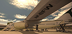
FS2004/FSX PIA Boeing 747-367, registatrion AP-BFW. Pakistan International Airlines B747-367 Megatop Jumbo, AP-BFW, displaying the newly designed livery by PIA. This livery has not officially been unveiled, and according to sources there will be some modifications to it. This aircraft now wears two stripes, one golden and one dark green extending all the way to the tail. The wavy flag style has been enlarged and placed accurately on the tail from real photos. The word 'PAKISTAN' is painted on the belly of the aircraft. Towards the rear, the word Pakistan is written in thin Urdu letters as well. Engines repainted to give a shiny metallic look. Repainted on the Project Open Sky 747v4 Advanced model with all updates for FS2004 and FSX. Contains ground service vehicles, stairs, tow truck, catering trucks, luggage loaders and containers painted in standard PIA colors. Luggage containers specially repainted to give a more realistic look. Registration of the aircraft painted on the bottom of the left wing, as on the real airplane. Panel updated to include utility gauge and tow truck gauge and gauges for FSX users. Updated model and fde. Complete pack, requires no external downloads. Textures in high quality 32 bit format to conserve quality. Repaint by Sabbir Khan, exclusively from Virtual PIA
| Filename: | PIA_Boeing_747367_FS2004FSX.zip |
| License: | Freeware |
| Added: | 4th April 2010, 19:09:07 |
| Downloads: | 2,463 |
| Author: | Sabir Khan |
| Size: | 18.65 MB |


© 2001-2026 AVSIM Online
All Rights Reserved
Privacy Policy |