
Where Flight Simulation Enthusiasts Gather from Around the World!
AVSIM Library - Search Results

| Category: Flight Simulator 2004 - Aircraft Repaints, Textures and Modifications | |
| American Airlines Boeing 747-123SF |

|
File Description:
This repaint is actually done on the NEW Boeing 747-200 PW made by Project Open Sky (POSKY) and I have paint it a way to look
like the old 747-123(SF) serries being used by American/American Freighter. N9675 (which I used as my model)is a
Boeing 747-123 (cn 20390/136), delivered on May 7, 1971, to American Airlines later becoming an all-freight plane flying
as "American Freighter". It temporarily had the registry OD-AGM for a lease flying for "TMA of Lebanon". When American Airlines
disposed of its 747 fleet, it was sold to UPS which now flies it as N675UP. This is also the aircraft featured in the movie
"Airport 1975" as Columbia 409.
The model which suits this aircraft (if you have downloaded the 742PW paintkit package with alot of .mdl's and are not sure to use which one) is
POSKY742SFJT9A123B2.mdl
| Filename: | American_Airlines_Boeing_747123SF.zip |
| License: | Freeware |
| Added: | 7th April 2004, 18:38:15 |
| Downloads: | 3,448 |
| Author: | Pantee Farhangi / Project Open Sky |
| Size: | 1.54 MB |
| Category: Flight Simulator 2004 - Aircraft Repaints, Textures and Modifications | |
| Boeing 767-300 and 767-400 v5 Antenna Updates |
|
Images related to this file:
File Description:

Combined Antenna Updates for SKYSPIRIT2010 BOEING 767-300 and 767-400ER v5 for FS2004 | Air Europa Boeing 767-3Q8/ER EC-HSV
- Air Seychelles Boeing 767-37D/ER S7-AHM
- S7 Airlines - Siberia Airlines Boeing 767-33A/ER VP-BVH
- Air Seychelles Boeing 767-306/ER S7-FCS
- Kenya Airways old and new colours Boeing 767-36N/ER 5Y-KQX
- LOT - Polish Airlines / Polskie Linie Lotnicze Boeing 767-306/ER SP-LPG
- Air Namibia Boeing 767-33A/ER V5-NMB
- El Al Israel Airlines Boeing 767-3Y0/ER 4X-EAP
- Nationwide Airlines Boeing 767-3Y0/ER ZS-PBI
- British Airways NC Boeing 767-336/ER G-BNWX
- British Airways OC Boeing 767-336/ER G-BNWX
- Boeing World Tour - 'Leading the Way' Boeing 767-432ER N76400
- Continental Airlines Boeing 767-424/ER N66051
- United Airlines (Continental Airlines) Boeing 767-424/ER N69059 |
Masters and Liveries by Philip Foglar.
| Filename: | Boeing_767300_and_767400_v5_Antenna_Updates.zip |
| License: | Freeware, limited distribution |
| Added: | 28th July 2011, 21:30:43 |
| Downloads: | 1,288 |
| Author: | Philip Foglar | SkySpirit2010 Team |
| Size: | 235.31 KB |
| Category: Flight Simulator X - Scenery | |
| FA44 - Willis / Boynton Beach - Miami, Florida - USA |
|
Images related to this file:
File Description:
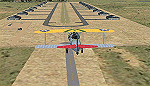
Neighbor to my 'Antiquers Aerodrome' here at avsim, Willis is another small grass strip just North of Antiquers Aerodrome in the Miami/Ft. Lauderdale area.
I gave it a light touch-up, changed concrete taxiways to oil-treated, added an avgas station, lit the runway, fenced it, an added a small parking lot.
This is a bee-utiful area to fly around in with many many airports. Some are nothing more than a a unmarked no bldg. grass strip all the way up to Miami International. Bahamas a short hop to the East, and Key West to the south. Best observed low & slow in an 'ol tail-dragger.
Three freeware beauties are included to get you started: A.F. Scrub's Fairey Fantome, Yak air7, and P. Clawson's Stinson Voyager.
They are written into the Traffic file along with the retro-paints MS Piper Cub and Mooney Bravo.
| Filename: | FA44__Willis__Boynton_Beach__Miami_Florida__USA.zip |
| License: | Freeware, limited distribution |
| Added: | 18th November 2014, 15:01:10 |
| Downloads: | 468 |
| Author: | Jeff Reed |
| Size: | 16.46 MB |
| Category: Flight Simulator X - AFCAD Files | |
| FSX "Mach Loop Tower Cameras" Addon Scenery Package |
|
Images related to this file:
File Description:
FSX "Mach Loop Tower Cameras" Addon Scenery Package.
Mach Loop fans Rejoice! I have created 7 independent "Tower Cameras" located around the Loop, including the ones famous on Youtube! I've spaced them so you can set your "Tower View" to "Nearest Tower" the view will transfer seamlessly from camera to camera as you fly all the way around!!! Strap into your Typhoon, Tornado, or Strike Eagle and experience it for yourself...GUARANTEED to make so smile! ;)
Installation is easy...Just copy all seven "EGMx_ADEX_DWG" files to your "FSX/Addon Scenery/Scenery" file.
(*note; they start at "EGM2" because EGM1 didn't "make the cut")
Thanks everyone for the YouTube vids! Now YOU get to fly and film the Mach Loop in FSX!
Tower Cams created using ADE "Aiport Design Editor".
OrbX Scenery and Dino Cattaneo's "Eurofighter 2000" shown in pics.
500ft at 500kts!
Daniel Gregory
[email protected]
| Filename: | FSX_Mach_Loop_Tower_Cameras_Addon_Scenery_Package.zip |
| License: | Freeware |
| Added: | 28th December 2020, 03:11:13 |
| Downloads: | 180 |
| Author: | Daniel Gregory |
| Size: | 2.7 MB |
| Category: Flight Simulator 2004 - Miscellaneous Files | |
| Active Approach - PHNL (Honolulu Intl Honolulu, Hawaii) |
|
File Description:
As most know the Approach and Final (VMC) for AI Traffic in FS9 is a straight in type landing and does not always consider high terrain at airports. This is do to the way that the coding is written in FS9 and it puts limits on IFR arriving aircraft. If you open runways at certain airports the AI Traffic will fly directly through a mountain once it is established on Final for a runway. What you will see with my file is a different type approach used for the way I control AI Traffic in FS9. No longer do the AI Planes use a straight in approach when landing to the west at PHNL. My new AI Aircraft Approach coding for FS9 now uses a base leg approach so AI Traffic does not fly through the mountains. The Honolulu Control Tower will clear all AI Traffic (IFR FP) landing either on 26L and 26R as a straight in landing even though the offset to final is 30 degrees from the runway center line. The Control Tower will instruct the AI Planes landing on either 22L or 22R to fly a left base leg which is greater then a 45 degree offset and then the AI Planes will turn on a short 1.5 mile final. The left base approach to 22L and 22R runways is a 65 degree offset from the runway center line. My testing shows excellent behavior of the FS9 default models, PAI models and the Aardvark planes of all sizes to execute this new type of visual approach that I am now writting code for which supersedes the FS9 default straight in ATC hard code approach. Read the text file for all the default scenery enhancements (plus Jetways) added to PHNL along with a full understanding of how the new Approaches work *** 3rd Party Scenery Designers Special APProach bgl and a FS2004 Default Scenery AFCAD included ***
| Filename: | Active_Approach__PHNL_Honolulu_Intl__Honolulu_Hawa.zip |
| License: | Freeware, limited distribution |
| Added: | 16th March 2005, 04:10:43 |
| Downloads: | 5,604 |
| Author: | Jim Vile |
| Size: | 134.3 KB |
| Category: Prepar3D V1-4 - Utilities | |
| MultiTool Prepar3D v3.2 |
|
Images related to this file:
File Description:
Multi-Tool Prepar3D v3.2 is a collection of tools, a number of them unique, extending the capabilities of P3D.
New features in v3.2 :
- Adjustable Horizon/Aircraft banking
- Bug fixes/Improvements on previous functions
Previous features include :
- Custom Flybys, user defined camera flyby paths.
- Roaming Flybys, computer generated camera flyby paths.
- Active Observers views placeable by clicking on a top-down view
- Find My Way Home random aircraft positioning.
- 3D Native Stereoscopic Output.
- Head tracking additions: Ordinals, Take off lock, View switching by head movement , Spot up/down tracking.
- Camera Shake + Vibration : Turbulence, G, ground roll, side slip, spoilers.
- Easy 2D & 3D custom cameras definitions.
- XYZ Position (Eyepoint) Mouse Move similar to the Mouse Look pan function, i.e. hold down a key and reposition your eyepoint with your mouse.
- POV conversion to multiple controller buttons.
- Keystroke macros to perform menu functions. - Landing lineup with runway camera.
- Multi screen VC setup. - Save/Recall view setup by aircraft.
- Recallable position autosaving. and more....
Youtube Channel https://www.youtube.com/channel/UCnFQCGMTB7eL-MFTHf8NFbA
| Filename: | MultiTool_Prepar3D_v32.zip |
| License: | Freeware |
| Added: | 22nd December 2016, 07:47:21 |
| Downloads: | 916 |
| Author: | Richard Barry |
| Size: | 3.74 MB |
| Category: Flight Simulator 2004 - Scenery | |
| Cache Creek CAZ5 in British Columbia Canada |
|
Images related to this file:
File Description:
Cache Creek is a small village of around 1,000 folks on the eastern side of the Coast Mountains of British Columbia, around 70 miles northeast of Pemberton and 40 miles west of Kamloops. The village is in a valley bottom and recently suffered from severe flooding due to the overflow of the river. The airfield is high above the town, with a runway aligned 15-33 and 3,280 feet of asphalt, without runway or taxiway lighting; hence "airfield" as opposed to "airport". I have posted it as Cache Creek CAZ5, but I suggest that you revise the name to perhaps "BC airfields" and just load my future airfield posts into the same scenery and texture folders to avoid the inevitable doubling up of common textures etc. Plus that way you will have just one FS9 library post to do and new airfields will not need yet another posting. Up to you. If you find a defect, email me.
| Filename: | Cache_Creek_CAZ5_in_British_Columbia_Canada.zip |
| License: | Freeware, limited distribution |
| Added: | 18th November 2020, 01:21:22 |
| Downloads: | 96 |
| Author: | Roger Wensley |
| Size: | 9.27 MB |
| Category: Prepar3D V1-4 - Aircraft Repaints, Textures and Modifications | |
| "JAARS" Pilatus PC-6 Porter |
|
Images related to this file:
File Description:
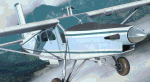
The repaint (textures only) for Milviz Pilatus PC-6 Porter B2-H4 model (payware addon for P3Dv4.4+). You need to have this great model of this legendary PC-6 plane. The repaint of Porter PK-UCF of JAARS organization. In aviation, JAARS helps its field partners start and run local aviation programs. This help comes in the form of training staff, setting standards, equipping aircraft, research, and more. In turn, these partners provide a range of transportation services to a variety of people, including translators, support personnel, consultants, trainers, linguists, Christian mission organizations, hospitals, local people and governments. These services can also include medical evacuations and disaster relief work. The real plane is used in JAARS Indonesia / West Papua - because airplanes are the only safe way to reach many isolated villages and communities in Indonesia. Textures set (outside and inside) was  tested in P3Dv4.5 HT2. The package contains external textures, many tweaks and improvements and interior modifications.
| Filename: | JAARS_Pilatus_PC6_Porter.zip |
| License: | Freeware, limited distribution |
| Added: | 4th April 2020, 16:53:12 |
| Downloads: | 264 |
| Author: | Rafal Stankiewicz / yoyosims |
| Size: | 76.61 MB |
| Category: Flight Simulator 2004 - AI Aircraft | |
| SKJ Antonov An-12 updated repaints in DXT3 format |
|
File Description:
SKJ Antonov An-12 updated repaints for AI traffic. Thanks to Valeriy Storozshko (aka "ALFER") for adapting his paintkit for me. These updates are from my earlier paints when I first started painting the SKJ An-12. The newer repaints as follows are all OK: AeroVis fleet, Kabul Air fleet, Meridian Airlines fleet and the TAPO-Avia fleet. The earlier paints are wrong in as much as I disliked the paintkit's main EXIT door on the port side of the aircraft, it was way to square looking at the bottom and all these have been changed to a more rounded look as they are in reality. I also amended a few of those 3 little 'objects' at the top of the tail as most (apart from British Gulf) are either painted white or a pale grey. This is not really an important update, but to me it is as I have thing about windows and exits, a bit sad eh! Billy. Re-upload.
| Filename: | SKJ_Antonov_An12_updated_repaints_in_DXT3_format.zip |
| License: | Freeware |
| Added: | 13th May 2010, 22:27:59 |
| Downloads: | 710 |
| Author: | Billy Rutherford |
| Size: | 3.05 MB |
| Category: Flight Simulator 2004 - Scenery | |
| Inukjuak CYPH - Northern Quebec, Canada |
|
Images related to this file:
File Description:
Inukjuak is a fairly large village on the east coast of Hudson Bay, in Quebec, around 115 miles south of Puvirnituq. The usual Hudson Bay Company post was established there in 1920, and with the opening of a school in 1951 the population grew as the nomadic way of life faded away; the population is now around 1350. Some of the population was forcibly relocated to Resolute and Grise Fiord in 1953 as "human flagpoles", a shameful act by the Canadian government that is hard to believe could ever happen. The airfield is a mile inland from the village and the 3,520 feet of gravel runway is aligned 07/25, and these are magnetic bearings as Inukjuak is not in the Northern Domestic Airspace zone. Both JETA-1 and 100LL fuel is available, though there may be only a limited quantity of 100LL, and probably in drums. The visiting AI airline is Air Inuit.
| Filename: | Inukjuak_CYPH__Northern_Quebec_Canada.zip |
| License: | Freeware, limited distribution |
| Added: | 12th December 2011, 14:44:32 |
| Downloads: | 539 |
| Author: | Roger Wensley |
| Size: | 1.81 MB |


© 2001-2026 AVSIM Online
All Rights Reserved
Privacy Policy |