
Where Flight Simulation Enthusiasts Gather from Around the World!
AVSIM Library - Search Results

| Category: Flight Simulator 2004 - Scenery | |
| Hawk Logging, for Holger Sandmann's scenery |

|
Images related to this file:
File Description:
This is a logging camp, on Admiral Island at the northern end of Chatham Strait in southern Alaska, around 30 miles south of Juneau. It is marked on the chart of the area; if you are chartless then there is a section of the chart included here. This scenery is designed specifically for use in the Tongass Fjord scenery (or Glacier, or Misty? I don't remember now which area it is in!) and probably does not work with just Ultimate Terrain; I haven't tried it. The camp has an identifying code so it will show up on a gps as PELC but there is no interaction with atc as there are no designated water runways; PELC on the GPS just acts as a waypoint. There will be further posts for use with Tongass Fjords, Misty Fjords, and Glacier Bay, and I still find these scenery areas by Holger and his crew the most satisfying in FS9.
| Filename: | Hawk_Logging_for_Holger_Sandmanns_scenery.zip |
| License: | Freeware, limited distribution |
| Added: | 8th November 2014, 22:42:24 |
| Downloads: | 319 |
| Author: | Roger Wensley |
| Size: | 12.37 MB |
| Category: Flight Simulator 2004 - AFCAD Files | |
| King County International (Boeing Field - KBFI) |
|
File Description:
King County International Airport is located 5 miles south of downtown Seattle and has the distinction of being the Boeing Company's final test site for the 737, 757, and 777 aircraft. Flight plans are included for 14 aircraft undergoing final tests prior to delivery to their respective airlines. Each aircraft will fly Monday through Friday for flights of approximately 3-1/2 hours. Since FS9 doesn't support flights that depart and arrive at the same airport, I've added a waypoint where the a/c can stop over for 15 minutes. The stopover is at Annette Island, Alaska, and I've included an AFCAD for an upgraded Annette Island "International" airport that, of course, doesn't really exist. If you wish to visit Annette Island International, there are runways equipped with the latest in ILS instrumentation. See the additional documentation I've included in the READ MEs. Commercial flights from Boeing Field are also provided by Helijet and San Juan Airlines.
| Filename: | King_County_International_Boeing_Field__KBFI.zip |
| License: | Freeware |
| Added: | 15th March 2004, 06:30:36 |
| Downloads: | 4,182 |
| Author: | Steve Lewis |
| Size: | 637.02 KB |
| Category: Flight Simulator X - Miscellaneous Files | |
| US & Canadian Coast Guard AI Boat Traffic V1 |
|
Images related to this file:
File Description:
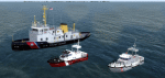
This is a paint and traffic file addition to go along with Henrik Nielsen's Global AI Ship Traffic.
These files have been tested to operate properly in FSX and P3Dv3. The textures are in .dds format for FSX and P3D.
The routes have been made with the consideration of using ORBX Vector, ORBX NA landclass and Pilots 2008 mesh products.
9 of the US Coast Guard's Bay Class icebreaker tugs are represented.
21 Canadian Coast Guard 47 foot motor life boats from the Quebec\Atlantic sectors and the British Columbia sector, along with 13 motor life boats of the US Coast Guard First District (New England) are represented.
4 ship traffic files allow all vessels to appear in the scenery.
Hendrik Nielsen's USCG Bay Class model and Jean-Pierre Fillion's Motor Life Boat model are included. Both Hendrik Nielsen and Jean-Pierre Fillion have given permission to include their ship/boat models with the project and I thank them greatly.
Four ship traffic files allow all vessels to appear in the scenery.
Please see the 'ReadMe' file first.
| Filename: | US__Canadian_Coast_Guard_AI__Boat_Traffic_V1.zip |
| License: | Freeware |
| Added: | 12th February 2019, 22:27:55 |
| Downloads: | 925 |
| Author: | Joe Bowers |
| Size: | 11.07 MB |
| Category: Flight Simulator X - Scenery | |
| NZOP- Opotiki Aerodrome (VectorLandClass, New Zealand) |
|
Images related to this file:
File Description:
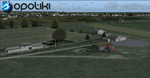
Opotiki aerodrome (ICAO: NZOP) is a small airstrip outside the township of of Opotiki, the gateway to the beautiful East coast of the North Island of New Zealand. Opotiki itself sits at the confluence of the Waioeka and Otara rivers and is surrounded by dairy farmland and Kiwifruit orchards with large areas of native bush to the south and east.
This scenery accompanies Tim Barnes'�� series of other small Bay of Plenty aerodromes (Whakatane,
Galatea, Waihi Beach) for use with VectorLandClass- It features custom modelled and textured buildings, large coverage of beautiful 0.5m aerial photography (fully auto-genned and including seasonal and night variations) and extensive use of high quality objects from the free VLC library. Installation of the library V1.1+ is required for this scenery to work properly and can be downloaded from the VectorLandClass website (www.vectorlandclass.co.nz)
This release, although not requiring it, works best with VectorLandClass topographic mesh and landclass addon covering all 268676 square kilometers of New Zealand. If you'��re not a VLC customer, you'��ll notice when the photoreal coverage runs out!
| Filename: | NZOP_Opotiki_Aerodrome_VectorLandClass_New_Zealand.zip |
| License: | Freeware, limited distribution |
| Added: | 21st February 2013, 13:52:47 |
| Downloads: | 969 |
| Author: | Tim Barnes |
| Size: | 146.68 MB |
| Category: Flight Simulator X - AFCAD Files | |
| Coombs Airport (7NJ7), NJ |
|
File Description:
Located 04 miles NE of Elmer, New Jersey, Coombs Airport is a private turf field 2000' in length wilth clear 20:1 approach and departure at each end of the runway. You'll find some surrounding buildings but they are all located several hundred yards from the runway. This is a good strip to keep in mind for emergencies if you're in the area. You will be landing on terrain so having your mesh complexity set as high as possible is recommended. This airport is not lit at night, daytime VFR operations only are suggested. There are no transient services offered.
Scenery constructed with use of satellite images/streetview/aerial photos - the author has not been there in person.
This scenery is meant to be used in conjunction with MegaScenery Earth New Jersey/Delaware 004. It is not required, but apron use is minimized to allow satellite scenery to show through as much as possible, and objects are placed based on the MSE textures - lack of it may make scenery look out of place.
| Filename: | Coombs_Airport_7NJ7_NJ.zip |
| License: | Freeware |
| Added: | 16th February 2011, 00:03:55 |
| Downloads: | 191 |
| Author: | Drew Sikora |
| Size: | 756.22 KB |
| Category: Flight Simulator X - AFCAD Files | |
| Rainbow's End Airport (JY39), NJ |
|
File Description:
Located 07 miles S of Salem, New Jersey on 20 acres of land, Rainbow's End Airport is a private turf strip 2200' in length. There are no services for transient aircraft and the airport is not lit at night, so daytime VFR operations only are recommended. If you have an aircraft with 40' or less of wingspan you can start at one of the parking spaces east or west of the runway by the hangars. Otherwise it is suggested you start on the runway. There is no hard surfaced runway so set your terrain mesh as high as possible.
Scenery constructed with use of satellite images/streetview/aerial photos - the author has not been there in person.
This scenery is meant to be used in conjunction with MegaScenery Earth New Jersey/Delaware 005 & New Jersey/Delaware 004. It is not required, but apron use is minimized to allow satellite scenery to show through as much as possible, and objects are placed based on the MSE textures - lack of it may make scenery look out of place.
| Filename: | Rainbows_End_Airport_JY39_NJ.zip |
| License: | Freeware |
| Added: | 12th May 2011, 00:58:29 |
| Downloads: | 173 |
| Author: | Drew Sikora |
| Size: | 626.46 KB |
| Category: Flight Simulator X - Scenery | |
| Hawaiian Airports Part 2 |
|
Images related to this file:
File Description:
Hawaiian Airports Part 2
This scenery features the airports at PHJR John Rodgers Field, PHBK Barking Sands, NPS Ford Island and PHNG Kaneohe Bay. All runways, aprons, taxiways and buildings have been repositioned to their correct locations, and include custom textures based on photographs of the real airports. The scenery features many animated objects including people, aircraft, animals, waves, cars, trucks and many more. Full night textures with light maps are included.
All the scenery files have been sub-divided so they can be switched on or off according to user preference. It has been designed for, and tested in DX9 and FSXA only. The airports include sloped flattens so they can also be used with high density mesh. These airports have long runways and can easily cater for the 'heavies', PHJR now acts as a backup to the main airort at PHNL Honolulu. Runway 04 at PHNG is a real challenge, and requires a 90 degree turn under the mountains.
Please enjoy, and I hope you like my scenery as much as I enjoyed building it.
| Filename: | Hawaiian_Airports_Part_2.zip |
| License: | Freeware, limited distribution |
| Added: | 27th January 2015, 09:03:22 |
| Downloads: | 8,351 |
| Author: | George Keogh |
| Size: | 152.19 MB |
| Category: Flight Simulator 2004 - Scenery | |
| Airstrips of Eastern France |
|
Images related to this file:
File Description:
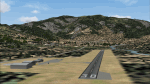
Next in my ongoing "Airstrips of Western Europe" project for FS2004, herewith about 100 sceneries of small, mostly default airfields in the eastern section of France, each enhanced with taxiways, parking spaces and aprons as appropriate, to further facilitate the generation of lightweight AI traffic in the area without overloading the more major airfields. When combined with the French airstrips from my previous uploads, the majority of the default small French airstrips in FS2004 will be able to generate AI traffic, should you so wish, as well as putting a little basic detail into the countryside.
Again, there's no photo-realism here, just a selection of basic 'generic' buildings, more or less accurately sized and placed to reflect the airfield layout as seen on on-line satellite imagery and aerial photography. These buildings have minimal effect on frame-rates, so are ideal for this kind of job. The airfields are aligned as well as possible with the roads etc. in UT Europe and the Genesis Europe mesh, but should mostly be fine in a default installation or other configuration.
| Filename: | Airstrips_of_Eastern_France.zip |
| License: | Freeware |
| Added: | 25th September 2024, 13:37:50 |
| Downloads: | 154 |
| Author: | Chris Eve |
| Size: | 2.83 MB |
| Category: Flight Simulator 2004 - Scenery | |
| CYYD - Smithers Regional Airport - Smithers, British Columbia, Canada |
|
Images related to this file:
File Description:
Smithers is in northwest BC, 60 miles east and a bit north of Terrace (my previous post) and directly east of the southern border of Alaska, 430 miles north of Vancouver on the Yellowhead highway. The town has a population of 5,500 and is set in a north-south valley between mountains, the most impressive of which is Hudson Bay Mountain to the west. The airport is to the north of the town and has a single runway of 7,544 feet, aligned 33-15. The main user is Central Mountain Air, who are headquartered in Smithers and have a large maintenance hangar there next to the terminal building. The airport has scheduled flights by Central Mountain Air, Jazz, and Hawk Air, which are in the AI along with a Lockheed Electra of Conair (who are the largest operator of fire fighting planes in BC and have re-fill tanks in Smithers) and also a HS 748 of Air North, which is actually for an upcoming post of Old Crow CYOC.
| Filename: | CYYD__Smithers_Regional_Airport__Smithers_British_.zip |
| License: | Freeware, limited distribution |
| Added: | 30th November 2014, 13:53:46 |
| Downloads: | 716 |
| Author: | Roger Wensley |
| Size: | 8.06 MB |
| Category: Flight Simulator 2004 - Scenery | |
| Minstrel Island CAX7 float base in British Columbia, Canada |
|
Images related to this file:
File Description:
This is the third in a series of new and renovated float bases in BC. Minstrel Island is on the south side of Knight Inlet and 25 miles west of Knight Inlet Lodge (the previous post in this series). There is a resort on the island, though it is hidden from the air by the trees. Fuel and oil are both available at the dock, and there is a 17 feet tidal range, which would be interesting of it could be replicated in FS. The AI is an adaptation of that for CF36 and involves a GA Cessna, and a Seair Beaver flying from Campbell River to Knight Inlet Lodge via Minstrel Island. Again, because of large hills the landing of the AI may or may not take place, depending on wind direction and whether or not they fly into solid rock before landing. Take off and departure will take place. Ultimate Terrain Alaska/Canada would be a definite plus to get the water in the right shape and place. This scenery will not work without it.
| Filename: | Minstrel_Island_CAX7_float_base_in_British_Columbi.zip |
| License: | Freeware, limited distribution |
| Added: | 3rd January 2017, 15:38:57 |
| Downloads: | 228 |
| Author: | Roger Wensley |
| Size: | 3.54 MB |


© 2001-2026 AVSIM Online
All Rights Reserved
Privacy Policy |