
Where Flight Simulation Enthusiasts Gather from Around the World!
AVSIM Library - Search Results

| Category: Flight Simulator X - Scenery | |
| Hawaiian Airports Part 2 |

|
Images related to this file:
File Description:
Hawaiian Airports Part 2
This scenery features the airports at PHJR John Rodgers Field, PHBK Barking Sands, NPS Ford Island and PHNG Kaneohe Bay. All runways, aprons, taxiways and buildings have been repositioned to their correct locations, and include custom textures based on photographs of the real airports. The scenery features many animated objects including people, aircraft, animals, waves, cars, trucks and many more. Full night textures with light maps are included.
All the scenery files have been sub-divided so they can be switched on or off according to user preference. It has been designed for, and tested in DX9 and FSXA only. The airports include sloped flattens so they can also be used with high density mesh. These airports have long runways and can easily cater for the 'heavies', PHJR now acts as a backup to the main airort at PHNL Honolulu. Runway 04 at PHNG is a real challenge, and requires a 90 degree turn under the mountains.
Please enjoy, and I hope you like my scenery as much as I enjoyed building it.
| Filename: | Hawaiian_Airports_Part_2.zip |
| License: | Freeware, limited distribution |
| Added: | 27th January 2015, 09:03:22 |
| Downloads: | 8,351 |
| Author: | George Keogh |
| Size: | 152.19 MB |
| Category: Flight Simulator 2004 - Original Aircraft | |
| North American B-45 and RB-45 Tornado FS2004 |
|
Images related to this file:
File Description:
The North American B-45 Tornado was one of the most important American aircraft of the early Cold War period, and one of the least remembered today. It was the first bomber-sized jet bomber in service anywhere in the world, first jet to drop a live atomic bomb, first jet to cross the North Pacific non-stop (Alaska to Japan,) first jet to fly the North Atlantic (with stops), NATO forces’ first and for some time only nuclear deterrent, first reconnaissance plane to fly deep penetration missions over North Korea, the People’s Republic of China, and the Soviet Union, and first aircraft to routinely use in-flight refueling on combat missions. The package includes twenty models and three dozen authentic skins depicting every major variant and numerous minor and sub-variants as they appeared throughout the type’s service life. A detailed manual explains some of the type’s unique operational procedures. Mostly by David Wooster with some help and skins painted by Mick.
| Filename: | North_American_B45_and_RB45_Tornado_FS2004.zip |
| License: | Freeware, limited distribution |
| Added: | 16th February 2023, 01:15:07 |
| Downloads: | 197 |
| Author: | David Wooster |
| Size: | 340.85 MB |
| Category: Flight Simulator X - Scenery | |
| FSX Portland International Airport KPDX |
|
Images related to this file:
File Description:
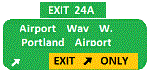
Welcome to Portland International Airport for FSX!
The City of Roses is in the process of revamping KPDX. Many of us have spent time on Concourse A
waiting for our Horizon flight. Many have utilized the ground level walkways on Concourse E to
get to their United Express flight. Both are things of the past.
KPDX is now a primary Alaska Airlines hub. This summer British Airways will start service to London
Heathrow.
The runways have been adjusted to their current length. The taxiways have been corrected (this is
particularly important at the juncture of 10L and 21 which used to overlap). A copy of the current
airport diagram is included.
All the buildings (with the exception of the tower) are custom. Airport vehicles use
the proper vehicle paths and do not use taxiways.To achieve this I had to add a vehicle path that crosses
10R and another that crosses 03.
Three scenery complexity levels are used (normal,dense, and very dense). More eye candy appears with each
increase.
| Filename: | FSX_Portland_International_Airport__KPDX.zip |
| License: | Freeware, limited distribution |
| Added: | 15th January 2020, 05:01:47 |
| Downloads: | 1,802 |
| Author: | Brett Delana |
| Size: | 12.18 MB |
| Category: Flight Simulator 2004 - Scenery | |
| Airstrips of Eastern France |
|
Images related to this file:
File Description:
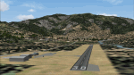
Next in my ongoing "Airstrips of Western Europe" project for FS2004, herewith about 100 sceneries of small, mostly default airfields in the eastern section of France, each enhanced with taxiways, parking spaces and aprons as appropriate, to further facilitate the generation of lightweight AI traffic in the area without overloading the more major airfields. When combined with the French airstrips from my previous uploads, the majority of the default small French airstrips in FS2004 will be able to generate AI traffic, should you so wish, as well as putting a little basic detail into the countryside.
Again, there's no photo-realism here, just a selection of basic 'generic' buildings, more or less accurately sized and placed to reflect the airfield layout as seen on on-line satellite imagery and aerial photography. These buildings have minimal effect on frame-rates, so are ideal for this kind of job. The airfields are aligned as well as possible with the roads etc. in UT Europe and the Genesis Europe mesh, but should mostly be fine in a default installation or other configuration.
| Filename: | Airstrips_of_Eastern_France.zip |
| License: | Freeware |
| Added: | 25th September 2024, 13:37:50 |
| Downloads: | 154 |
| Author: | Chris Eve |
| Size: | 2.83 MB |
| Category: Flight Simulator X - Scenery | |
| NZWV - Waihi Beach Airfield, New Zealand |
|
Images related to this file:
File Description:
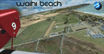
Waihi Beach (ICAO: NZWV) is a small airstrip north of Tauranga and near the small beach settlement of the same name, in the Bay of Plenty of New Zealand. It is a grass strip with offset thresholds giving usable landing lengths of 640m and 517m for RWY 13 and 31 respectively, a width of 55m and a group rating of 5. No night lighting or fuel is available. A very basic airstrip, there is only one recently built hanger and the airstrip is slowly being encroached on by
new housing developments. The airstrip itself is usually very sodden due to its low elevation but is a nice stop over for sightseeing from Tauranga and up the Coromandel peninsula.
The FSX model includes custom textures and models placed on a high resolution aerial image and a 15m mesh. It makes extensive use of items from the free VLC object libraries which are required to be installed (Available from www.vectorlandclass.co.nz Downloads menu). This scenery and
the VLC libraries have been funded by sales of VectorLandClass and although you do not need VLC to use it, your purchase helps further development.
| Filename: | NZWV__Waihi_Beach_Airfield_New_Zealand.zip |
| License: | Freeware, limited distribution |
| Added: | 1st November 2012, 10:01:38 |
| Downloads: | 1,006 |
| Author: | Tim Barnes / VectorLandClass |
| Size: | 11.13 MB |
| Category: Flight Simulator X - AFCAD Files | |
| Stoe Creek Farm Airport (7NJ2), NJ |
|
File Description:
Located 01 miles S of Canton, New Jersey, Stoe Creek Farm is a private turf field 1725' in length. The runway is largely clear of obstructions although on approach for Runway 05 you will deal with 20-30' trees a few hundred feet back from the threshold and there are transmission towers along the approach corridor to Runway 23 you should watch out for. The runway does have edge lighting, although the windsock is not lit at night and daytime VFR is still recommended. There are no services for transient craft at this airfield. Since you will be landing on terrain, it is recommended that your mesh complexity is set as high as possible.
Scenery constructed with use of satellite images/streetview/aerial photos - the author has not been there in person.
This scenery is meant to be used in conjunction with MegaScenery Earth New Jersey/Delaware 004. It is not required, but apron use is minimized to allow satellite scenery to show through as much as possible, and objects are placed based on the MSE textures - lack of it may make scenery look out of place.
| Filename: | Stoe_Creek_Farm_Airport_7NJ2_NJ.zip |
| License: | Freeware |
| Added: | 14th February 2011, 18:32:24 |
| Downloads: | 163 |
| Author: | Drew Sikora |
| Size: | 700.91 KB |
| Category: Flight Simulator X - AFCAD Files | |
| Winchelsea Airport (8NJ0), NJ |
|
File Description:
Located 01 miles W of Port Republic, New Jersey, Winchelsea Airport is a private turf strip. Pay very, very close attention to the published length of this grass runway: 980'. This is in addition to 50ft tree obstacles at either end of the runway. Double-check your aircraft's takeoff and landing distances before visiting this airfield!! A strong headwind is suggested for operations out of this location. Also take note the traffic patterns vary for each runway. There are no transient services offered and the airport is not lit at night so daytime VFR use only is suggested. There is no hard surface runway so set your terrain mesh slider as high as you can for the best effect of landing on terrain.
Scenery constructed with use of satellite images/streetview/aerial photos - the author has not been there in person.
This scenery is meant to be used in conjunction with MegaScenery Earth New Jersey/Delaware 003. It is not required, but apron use is minimized to allow satellite scenery to show through as much as possible, and objects are placed based on the MSE textures - lack of it may make scenery look out of place.
| Filename: | Winchelsea_Airport_8NJ0_NJ.zip |
| License: | Freeware |
| Added: | 24th March 2011, 19:28:46 |
| Downloads: | 162 |
| Author: | Drew Sikora |
| Size: | 396.23 KB |
| Category: Flight Simulator X - AFCAD Files | |
| High Meadow Farms Airport (9NJ8), NJ |
|
File Description:
Located 02 miles SW of Hope, New Jersey on 88 acres of land, High Meadow Farms Airport is a private turf strip 1850' in length. Take notice that the traffic pattern for Runway 13 is Right while the pattern for Runway 31 is Left. There is no hard surface runway so have your terrain mesh set as high as possible. There is tie down space available next to the paved area by the other parked aircraft however there are no official services offered for transient aircraft. This is a great airport to depart from to see some nice hilly terrain in northern NJ, it is just a few miles from the Delaware River Water Gap.
Scenery constructed with use of satellite images/streetview/aerial photos - the author has not been there in person.
This scenery is meant to be used in conjunction with MegaScenery Earth New York 007. It is not required, but apron use is minimized to allow satellite scenery to show through as much as possible, and objects are placed based on the MSE textures - lack of it may make scenery look out of place.
| Filename: | High_Meadow_Farms_Airport_9NJ8_NJ.zip |
| License: | Freeware |
| Added: | 7th April 2011, 00:16:49 |
| Downloads: | 200 |
| Author: | Drew Sikora |
| Size: | 641 KB |
| Category: Flight Simulator X - AFCAD Files | |
| Weiss Farm Airport (JY24), NJ |
|
File Description:
Located 02 miles W of Allamuchy, New Jersey on 264 acres of land, Weiss Farm Airport is a private turf strip 1800' in length. The published width is 50' but you really have closer to 100' to play with. There are no services offered to transient aircraft but you can start parked next to the barn if you wish to taxi out to the runway. No hard surfaced runway is used to have your terrain mesh set as high as possible the start of Runway 23 is a bit slanted and bumpy so you may want to aim long on your approach. The airport is unlit so daytime VFR operations only are recommended.
Scenery constructed with use of satellite images/streetview/aerial photos - the author has not been there in person. This scenery is meant to be used in conjunction with MegaScenery Earth New York 007. It is not required, but apron use is minimized to allow satellite scenery to show through as much as possible, and objects are placed based on the MSE textures - lack of it may make scenery look out of place.
| Filename: | Weiss_Farm_Airport_JY24_NJ.zip |
| License: | Freeware |
| Added: | 21st April 2011, 10:09:59 |
| Downloads: | 192 |
| Author: | Drew Sikora |
| Size: | 593.91 KB |
| Category: Flight Simulator X - Scenery | |
| HALA - Hawassa Intl. - Hawassa, Ethiopia |
|
Images related to this file:
File Description:
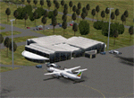
This project adds the booming city of Hawassa, Ethiopia, creates the new international airport (HALA), moves (and rebuilds) the downtown airport (recoded to HALX), and includes AI flight plans for the Ethiopian Airlines service that began April 2016. Tested in both the default FSX: Acceleration and with FTX Global/Vector, accurate coastlines, lakes, road data, and SRTMGL1 (30m) mesh, as well as corrected landclass are provided based on the latest available satellite imagery. The Hawassa International Airport was created using information from the current satellite footprint and the promotional video from Ethiopian Airports Enterprise (EAE). Although there is still very little published data on the airport, it is fully functional.
Updates were created or rebuilt in a manner which carefully aligns airport data with current satellite imagery. Scenery was created using Airport Design Editor X v1.70.6042, SBuilderX 3.13, and the FSX Object Placement Tool. Scenery objects were added and modified from stock FSX scenery to resemble as closely as possible the actual airports. The FSX apron lights included are from the set created by Jim Dhaenens. Thanks to Ron Blehm for bringing this part of the world to my attention.
| Filename: | HALA__Hawassa_Intl___Hawassa_Ethiopia.zip |
| License: | Freeware |
| Added: | 20th July 2016, 09:06:40 |
| Downloads: | 1,022 |
| Author: | Carlyle Sharpe |
| Size: | 10.41 MB |


© 2001-2026 AVSIM Online
All Rights Reserved
Privacy Policy |