
Where Flight Simulation Enthusiasts Gather from Around the World!
AVSIM Library - Search Results

| Category: Flight Simulator 2004 - Aircraft Repaints, Textures and Modifications | |
| Song (Delta Air Lines) Boeing 757-200 Pack |

|
Images related to this file:
File Description:

Presenting the new TDS Boeing 757-200! This model features, dynamic shine, opening passenger & cargo door, standard animations, realistic FDE, new detailed lighting effects, and much more. Model design by Hiroshi Igami. Flight dynamics design by Nate Rosenstrauch. Additional development, testing, and textures by TDS members Nick Wilkinson, Carlos Eduardo Salas, Yosuke Ube, Stian Svensen, David Biggar, and Luiz Antonio Perina. More information can be found at https://www.facebook.com/groups/214187952530554/
Song was a low-cost airline brand within Delta, operating from 2003 to 2006. It's main focus was leisure traffic between the northeast, Florida, and the west coast, to compete with growing LCCs. Its fleet of 45 757s featured a lime green livery and an all-economy seating configuration with seatback IFE. One aircraft however, N610DL, was painted in a special pink livery to raise awareness of the fight against breast cancer with partner, the Breast Cancer Research Foundation (BCRF). Also includes custom Delta ground crew and equipment. Enjoy!
| Filename: | Song_Delta_Air_Lines_Boeing_757200_Pack.zip |
| License: | Freeware |
| Added: | 28th October 2018, 02:05:33 |
| Downloads: | 398 |
| Author: | Joe Shimmel | Tenkuu Developers Studio |
| Size: | 30.6 MB |
| Category: Flight Simulator 2004 - AFCAD Files | |
| King Khalid AB, Khamis Mushait, Saudi Arabia (OEKM) |
|
File Description:
King Khalid AB, Khamis Mushait, Saudi Arabia (OEKM) for Microsoft default scenery only. This airport is located in mountainous terrain, in the southwest corner of the country, not far from both the Red Sea coast and the border with Yemen. No material changes were made to the stock airport layout as the ramps and taxiway network were already complete and free of errors. I have added 78 parking spaces:- 23 GA; 26 Mil_combat; 10 BBJ; 8 Gate Small; 3 Gate Medium; 2 Gate Heavy; 4 Mil_Cargo; 2 Civilian cargo. Parking code settings are for SVA, SVAV, BBJ, M000-M003. At the time of writing, scheduled airlines fly to nearby Abha airport. If you use Ed Kooymans' AI flightplans then you will see some AI activity at Khamis. Flights from OEKM direct to OETB overfly Jeddah en route but, when writing your own flightplans, note that the elevation of OEKM is 6778' and local terrain is higher still.
| Filename: | King_Khalid_AB_Khamis_Mushait_Saudi_Arabia_OEKM.zip |
| License: | Freeware, limited distribution |
| Added: | 1st September 2006, 20:08:31 |
| Downloads: | 990 |
| Author: | Mark S. Cherry |
| Size: | 9.38 KB |
| Category: Flight Simulator X - Scenery | |
| Cape_Verde_Mesh |
|
File Description:
To improve performance, FSX updated with SP1 loads DEM files in threads and only
the closer terrain (about 10 NM from the point of view) is rendered in high
detail, while at far distances FSX shows up its default low resolution mesh,
if it is not available a multi-resolution one. This terrain mesh file was multilod compiled from 90m SRTM2 source data, reprocessed with 3DEM to remove voids and spikes, providing a 76.4m (LOD9) horizontal resolution topography intended
for use only in FSX updated with SP1.
It covers the Cape Verde, a group of islands in the North Atlantic Ocean, that consist of two small archipelagos, about 400 miles off the western coast of Senegal (Africa), including: Boa Vista, Brava, Maio, Mosteiros, Paul, Praia, Porto Novo, Ribeira Grande, Sal, Santa Catarina, Santa Cruz, Sao Domingos, Sao Filipe, Sao Miguel, Sao Nicolau, Sao Vicente and Tarrafal (Geographic coordinates: 16ºN/24ºW).
Authors:
Hely Heck Junior - Magrao ( [email protected] ) and Jose Lobo (
[email protected] ) TerraBrasilis: www.terra-brasilis.org
| Filename: | Cape_Verde_Mesh.zip |
| License: | Freeware |
| Added: | 21st June 2007, 16:26:23 |
| Downloads: | 4,332 |
| Author: | Hely Heck Jr. and José Lôbo |
| Size: | 1.55 MB |
| Category: Flight Simulator X - Scenery | |
| Lost River ASU Observatories |
|
Images related to this file:
File Description:
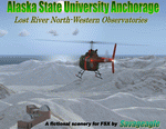
This is a fictitous scenery of the Alaska State University operated North-Western observatories.
It is located near LSR_Lost River and AK45_Lost River_2 on the Western coast of Alaska.
LSR, AK45 and KPC_Port Clarence have been upgraded with hangers and various objects.
LSR, AK45 and the (2) mountain top observatories have been upgraded with helipads along with various ground vehicles including snocats, aircraft, misc buildings and hangers. The main observatory complex has a main rooftop pad and a heli-tower. These helipads were designed for heli practice. some are on the ground and others are a bit more challenging.
There is a map included which shows the locations of the observatory complexes in relation to the airports. There is also a small research facility located to the east which is indicated on the map. This fictional scenery was design with default FSX 3D objects and (1) addon library, fa_ez-arctic_set by Finney Air, Robert Finnegan.
| Filename: | Lost_River_ASU_Observatories.zip |
| License: | Freeware |
| Added: | 11th November 2009, 19:11:39 |
| Downloads: | 557 |
| Author: | Tim Durham |
| Size: | 3.41 MB |
| Category: Flight Simulator 2004 - Scenery | |
| CWBH - Bernard Harbour - Nunavut, Canada |
|
Images related to this file:
File Description:
Bernard Harbour was a DEW line "iStation" (a small station with a staff of 5 or 7 people) on the nothern mainland coast 75 miles north of Kugluktuk, and 45 miles west of Lady Franklin Point. It closed in 1963. The slowly deteriorating buildings are still there, along with a fallen radio communications mast. The runway is also still there and has 3,040 feet of gravel, aligned 122T/302T. There is now no runway lighting, no signage, no windsock, and the bushes growing amid the gravel are winning, though slowly. In 1991 a North Warning System (NWS) automated station was established 3 miles to the southwest and there is a second smaller runway there (1,450 feet) along with a helicopter pad. A road joins the two sites for when diesel resupply is undertaken from a ship in the summer, and the zigzag route is (in reality) dictated by the numerous ponds that are too small to be picked up by Ultimate Terrain.
| Filename: | CWBH__Bernard_Harbour__Nunavut_Canada.zip |
| License: | Freeware, limited distribution |
| Added: | 11th November 2012, 01:24:20 |
| Downloads: | 256 |
| Author: | Roger Wensley |
| Size: | 1.49 MB |
| Category: Flight Simulator X - Scenery | |
| Victoria Inner Harbor Airport (CYWH) |
|
Images related to this file:
File Description:
This airport was made using Airport Facilitator X, and Instant Scenery 2. Victoria Inner Harbor Airport is a water airport located in southern Victoria, British Columbia, Canada. The airlines that fly there are Harbor Air, West Coast Air, Kenmore Air, and Whistler Air. This is an airport that flight simulator does not have. I put docks for seaplanes with two seaplanes. I even made it so that you can start off at the dock. I made the small terminal and a parking lot with cars and light poles. I also put the surrounding docks with many boats. There is also a small heliport 0.73 miles away from Victoria Inner Harbor called Shoal Point Heliport. I have made this heliport because it too is another one flight simulator forgot. This was all based on Google Earth and Bing Maps. Please read the read me for instructions on how to install. This is for Flight Simulator X only. By Tyler Lawrence.
| Filename: | Victoria_Inner_Harbor_Airport_CYWH.zip |
| License: | Freeware |
| Added: | 16th January 2012, 23:53:12 |
| Downloads: | 1,488 |
| Author: | Tyler Lawrence |
| Size: | 9.98 MB |
| Category: Flight Simulator X - Scenery | |
| Coffs Harbour V3, Australia |
|
File Description:
Coffs Harbour is on the east coast of Australia mid way between Brisbane (YBNE) and Sydney (YSSY). It is a busy regional airport taking a daily 737 from Virgin and numerous regional flights by Qantas and Brindabella Airlines. It handles 30,000 airport movements a year and is benefitting from a 4 million dollar expansion started in 1999.
This is a reworked version of Coffs Harbour for FS9. All models are GMAX and FSDS 3 and xml coded. Improvements have been made to Mutton Bird Island and southern headland, the harbour, Coffs shopping centre from photo textures taken recently, Sawtel shopping centre, the airport layout includes all but one of the real life hangars and are in as accurate position as the FSX airport layout will allow (pretty accurate in FSX). Additions include Opal Cove resort, coaslines changed to be accurate and include beaches!!, rivers more accurate and the main road with traffic realigned.
This is an ongoing project so any suggestions welcome.
| Filename: | Coffs_Harbour_V3_Australia.zip |
| License: | Freeware, limited distribution |
| Added: | 9th May 2007, 12:49:11 |
| Downloads: | 4,875 |
| Author: | John Ross |
| Size: | 11.98 MB |
| Category: Flight Simulator 2004 - Scenery | |
| CYEK - Arviat - Nunavut, Canada v 1.1 |
|
Images related to this file:
File Description:
This version of Arviat corrects the VASI position on the runway, and also updates the taxiway edge lights to a newer and smaller version which is more realistically sized. This is a complete version and does not require you to have installed the old version. You can just replace the existing .bgl's and the existing textures in the scenery and texture folders if you already have this scenery. Arviat is a small town on the west coast of Hudson Bay in Nunavut, around 90 miles south of Whale Cove, 130 miles south of Rankin Inlet, and 160 miles north of Churchill. The airfield is just south of the town, and the 4,000 feet of gravel runway is aligned 149T/329T, as these are true bearings and not magnetic, as Arviat is just inside the Northern Domestic Airspace zone. There is 100LL fuel available in drums, with 2 hours prior notice. The visiting AI airline is Calm Air, plus a cargo delivery by Buffalo Air.
| Filename: | CYEK__Arviat__Nunavut_Canada_v_11.zip |
| License: | Freeware, limited distribution |
| Added: | 23rd August 2014, 11:20:05 |
| Downloads: | 226 |
| Author: | Roger Wensley |
| Size: | 2.33 MB |
| Category: Flight Simulator 2004 - Scenery | |
| Inukjuak CYPH - Northern Quebec, Canada |
|
Images related to this file:
File Description:
Inukjuak is a fairly large village on the east coast of Hudson Bay, in Quebec, around 115 miles south of Puvirnituq. The usual Hudson Bay Company post was established there in 1920, and with the opening of a school in 1951 the population grew as the nomadic way of life faded away; the population is now around 1350. Some of the population was forcibly relocated to Resolute and Grise Fiord in 1953 as "human flagpoles", a shameful act by the Canadian government that is hard to believe could ever happen. The airfield is a mile inland from the village and the 3,520 feet of gravel runway is aligned 07/25, and these are magnetic bearings as Inukjuak is not in the Northern Domestic Airspace zone. Both JETA-1 and 100LL fuel is available, though there may be only a limited quantity of 100LL, and probably in drums. The visiting AI airline is Air Inuit.
| Filename: | Inukjuak_CYPH__Northern_Quebec_Canada.zip |
| License: | Freeware, limited distribution |
| Added: | 12th December 2011, 14:44:32 |
| Downloads: | 539 |
| Author: | Roger Wensley |
| Size: | 1.81 MB |
| Category: Flight Simulator 2004 - Scenery | |
| Wabush CYWK in Labrador Newfoundland Canada |
|
Images related to this file:
File Description:
Wabush is a small town close to Labrador City, 200 miles north of the Gulf of St Lawrence coast and close to the border with Quebec. The area is known for it's iron mining activity which started in the 1960's. The airport that serves the area is located close to Wabush and there is also a float base on the lake that abutts Labrador. This version is from around 2014. The single runway is aligned 01-19 and is 6,000 feet long, with PAPI on 19 and ILS on 01. Flights by Pascan Aviation, Air Inuit, and Provincial Airlines are included in the AI provided, along with GA flights. I also have WOA ai that provides Air Canada Jazz flights (not included here but worth downloading for Canada). There is also AI for the float base on the lake, which connects to River Deep Lodge for trout fishing on Atikonak Lake around 100 miles to the east and also included here.
| Filename: | Wabush_CYWK_in_Labrador_Newfoundland_Canada.zip |
| License: | Freeware, limited distribution |
| Added: | 24th August 2020, 23:15:16 |
| Downloads: | 215 |
| Author: | Roger Wensley |
| Size: | 16.1 MB |
© 2001-2026 AVSIM Online
All Rights Reserved
Privacy Policy |