
Where Flight Simulation Enthusiasts Gather from Around the World!
AVSIM Library - Search Results

| Category: Flight Simulator X - Scenery | |
| KDEN - Denver, Colorado International Airport |

|
Images related to this file:
File Description:
Denver Colorado International Airport For FSX. Several improvements have been made to the default airport, those being:
1. A United Airlines commuter terminal has been added to Concourse B along with custom made jetways complete with the United Airlines logo (these jetways are NOT animated).
2. All jetways and scenery objects will display as long as scenery complexity in FSX is set at normal or higher.
3. The vehicle paths have been redesigned so as not to allow airport vehicles to enter taxiways
4. Optionally, all runways may be opened for AI traffic.
5. The land class has been changed in places so as to prevent autogen objects from displaying on the airport grounds.
6. The tower view has been changed to display from the roof of the control tower.
7. Extra fuel trucks have been added throughout the airport.
8. All gates are accurately portrayed.
9. All taxiways are included and are accurately named, and taxiway signs are accurately placed.
Also, there is an option to place several static United Airlines and Southwest Airlines aircraft in designated spots.
This is an improved version of the airport which I first did in 2007.
Please refer to the README FIRST.txt file for important information
| Filename: | KDEN__Denver_Colorado_International_Airport.zip |
| License: | Freeware, limited distribution |
| Added: | 5th January 2014, 23:51:59 |
| Downloads: | 3,480 |
| Author: | Patrick Finch |
| Size: | 2.57 MB |
| Category: Flight Simulator 2004 - Scenery | |
| Portland KPDX 2010 scenery for FS9 |
|
Images related to this file:
File Description:
Portland KPDX 2010 is a highly detailed and accurate replacement for the default FS9 KPDX scenery. The airport has been completely rebuilt and includes:
* All new taxiways, aprons, roads, buildings and parking areas, covering the airport itself and extending east along Airport Way to the I205 bridge.
* Custom terminal with accurate placement of jetways, gate numbers, ramp lighting and other features, including the Horizon Air terminal extension.
* Custom versions of the old short-term and recently completed long-term parking structures.
* Custom version of the very cool Horizon Air engine runup structure.
* The I205 bridge has been moved to its correct location. If you are using Ultimate Terrain the bridge and roads will now line up.
* Photo textures used wherever feasible.
Peter Ham made the excruciatingly detailed AFCAD and placed the zillions of scenery objects. Sidney Schwartz made the stunningly attractive custom scenery objects. This project represents many hours of work on our part, and we hope you enjoy using it as much as we enjoyed making it. This scenery was designed to work in conjunction with Ultimate Terrain. If you do not have Ultimate Terrain, some of the roads will probably be misplaced, but everything else should work OK.
| Filename: | Portland_KPDX_2010_scenery_for_FS9.zip |
| License: | Freeware |
| Added: | 25th November 2010, 14:19:19 |
| Downloads: | 5,706 |
| Author: | Sidney Schwartz & Peter Ham |
| Size: | 4.33 MB |
| Category: Flight Simulator 2004 - Scenery | |
| Green Lake CBG2 in British Columbia Canada |
|
Images related to this file:
File Description:
Green Lake is on the eastern side of the Coast Mountains of British Columbia, around 40 miles north of Cache Creek and 15 miles south of 100 Miles House (a previous posting). The airfield is beside the lake shore and serves the Flying U holiday ranch with a grass runway 2,575 feet long and aligned 18-36. There is no lighting. There is also mooring on the lake for boats and float planes. I have posted it as Green Lake CBG2, but I suggest that you just add it to your previously created "BC airfields", if you followed my previous suggestion. You then avoid the inevitable doubling up of common textures etc. Plus that way you will have just one FS9 library post to do and new airfields will not need yet another posting. Up to you. It just occurred to me that probably only a few of you have a copy of the Nav Canada Airfields handbook, so won't know the airfield altitudes, which is useful to have amid mountains. So, Pemberton is 670 feet Above Sea Level, Cache Creek 2,034 feet ASL, and Green Lake 3,550 feet ASL. The others to follow as posted. If you find a defect, email me.
| Filename: | Green_Lake_CBG2_in_British_Columbia_Canada.zip |
| License: | Freeware, limited distribution |
| Added: | 18th November 2020, 19:44:00 |
| Downloads: | 87 |
| Author: | Roger Wensley |
| Size: | 10.05 MB |
| Category: Flight Simulator 2004 - Original Aircraft | |
| Lockheed L-749 Constellation Base Pack |
|
Images related to this file:
File Description:
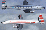
Dimensionally identical to the first-generation Constellation (L-049), the
post-war 749 had more powerful engines, additional fuel tanks, strengthened
landing gear, and much improved performance. Equally good for shuttle hops
and long-range flights, L-749 Connies entered service with major 1950s
carriers such as Eastern, TWA, B.O.A.C., Air France, KLM, Quantas, and many
others. Another customer was the Air Force, which placed an order for ten
aircraft (designated C-121A) in 1948.
Included in this sim package are seven
models and five textures, covering variants with and without "Speedpak"
cargo pannier, weather radar, and "jetstack" exhausts. KLM texture by Jaap
de Baare (representing "Flevoland", the last 749 in flying condition today).
TWA texture N6003C "Star of America" by Hans Herrmann. EAL, Air France, and
MATS textures by Manfred Jahn (including "8609", a frequent visitor to
airshows all over the world until 2005). Panel textures and additional
gauges by Diego S. Barreto, model and VC by Manfred Jahn, panels, gauges,
and animations by Hansjoerg Naegele, flight dynamics by Luis Pallas,
wingview angles, lights, and exhaust effects by Bill Tyne and Roland Berger,
checklist and documentation by Volker Boehme, flight test and handling
research by Stefan Werner. The 749 project has been hosted by Tom Gibson's
Calclassic forum at http://calclassic.proboards55.com.
| Filename: | Lockheed_L749_Constellation_Base_Pack.zip |
| License: | Freeware |
| Added: | 5th December 2009, 04:07:37 |
| Downloads: | 23,642 |
| Author: | Manfred Jahn and 749 Team |
| Size: | 36.17 MB |
| Category: X-Plane - Scenery | |
| WXPJ Susi Air Puncak Jaya Mining Airstrip v1.0.0 |
|
Images related to this file:
File Description:
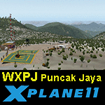
This is an X-Plane 11 scenery for Puncak Jaya Mining Airstrip (WXPJ) in the Puncak Jaya mountain region of Papua, Indonesia. This is a fictitious airfield, located in a high altitute mining location in Papua. At 4884 metres (16024 ft) above sea level, the Puncak Jaya peak, next to the mining location, is the highest mountain in Indonesia, on the island of New Guinea (which consists of the Indonesian West Papua region plus Papua New Guinea). This fictitious airfield may serve as a high altitute mining location challenge while flying the airstrips in Papua, as one of the destinations for "PT ASI Pujiastuti Aviation", operating as Susi Air, an Indonesia airlines established in late 2004 by Mrs. Susi Pudjiastuti. This scenery was tested and is operational (as of January 20, 2017) in "X-Plane 11 Public Beta #6 64 bit", Windows 10 Home. It was also tested and is partially operational (as of January 20, 2017) in "X-Plane 10.51 64 bit", Windows 10 Home. The issue with XP10 is the mesh again: there is no mine mesh, just a whole. The feel is very different from XP11, but it is still operational in XP10 to fly in and out.
| Filename: | WXPJ_Susi_Air_Puncak_Jaya_Mining_Airstrip_v100.zip |
| License: | Freeware |
| Added: | 21st January 2017, 18:42:35 |
| Downloads: | 58 |
| Author: | Rui Mesquita |
| Size: | 2.2 MB |
| Category: Flight Simulator 2004 - Scenery | |
| Iloilo Airport ,Iloilo City, Philippines |
|
File Description:
Iloilo Airport is located in Iloilo City, Panay Island, Philippines. This local visayan airport is served by the following major domestic airlines: Philippine Airlines, Cebu Pacific and Air Philippines. This scenery features the most realistic replica of buildings located in the airport area such as the Main Terminal buildings, Control Tower, Crash and Fire Rescue Station, Philippine Air Force building, private hangars, shops, and commercial buildings including the SM City-Iloilo right in front of the airport area. SM City's parking area is generally filled with vehicles everyday that they are very visible at the ramp area of the airport at daytime and most especially visible glittering at nighttime.
This scenery also features the different commercial vessels serving Iloilo City such as WG&A Superferry, Sulpicio Lines, Negros Navigation, and Philippine Fastferry Corporation's Supercat and SeaAngels. These vessels are visible when flying from Iloilo to Bacolod City passing through the Guimaras Channel.
This scenery is designed with the combined efforts of Ver Walter Gulfan of Cebu City, Philippines and Manny Aquino of Surabaya, Indonesia. For suggestions or comments, please visit our Philippine Flightsimmers Group website at www.philskies.net or you may join our forum at www.philskies.net/forum.
RPVI AFCAD file included with aircrafts taking off at the middle of the runway!
| Filename: | Iloilo_Airport_Iloilo_City_Philippines.zip |
| License: | Freeware |
| Added: | 29th August 2003, 21:38:49 |
| Downloads: | 5,813 |
| Author: | Ver Walter Gulfan/Manny Aquino,Jr. |
| Size: | 5.83 MB |
| Category: Flight Simulator 2002 - Scenery | |
| Victorian Airfields - Australia |
|
File Description:
This add-on scenery pack for FS 2002 adds 115 airfields to Victoria plus a few to NSW and South Australia,
totalling to over 120 in all. The 36 airfields listed below include full detail including accurately placed and sized
trees and buildings, static aircraft, fences, cars, roads with cars and streetlights and a variety of other
'eye candy'. The remaining airfields are mostly small minor/private strips and all include runway markers and
a windsock but you'll find a few buildings and other scenery at some of them. Rotorheads will also enjoy flying to the 10 included helipads scattered across the area around Melbourne. This scenery is a 'must have' for anyone who enjoys flying 'Downunder'!
The Following airfields are included in this package in full detail:
LILYDALE, COLDSTREAM, TOORADIN, PAKENHAM, TYABB, SUNBURY , WALLAN, MELTON, BACCHUS MARSH, GEELONG, TORQUAY, CORIO, BARWON HEADS, PORT FAIRY, LAKES ENTRANCE, APOLLO BAY, KYNETON, PHILIP ISLAND, LOCKSLEY, LETHBRIDGE, CERES, BENDIGO GLIDING CLUB, GRAMPIANS AIRFIELD, MILAWA, WENTWORTH, YARRAM, ORBOST, MALLACOOTA, MT BEAUTY, MOONGARA, WERRIBEE AIRSTRIP, BOORT, COBDEN, MEREDITH, WOODVALE, RIDDELLS CREEK
Using this scenery pack will make your flights around these airfields so much more exciting and enjoyable. No more boring old
unpopulated terrain around Victoria, you've got 115 new airfields available to fly from!
| Filename: | Victorian_Airfields__Australia.zip |
| License: | Freeware |
| Added: | 15th August 2003, 19:47:02 |
| Downloads: | 807 |
| Author: | Sebastian Szalai |
| Size: | 10.53 MB |
| Category: Prepar3D V1-4 - Scenery | |
| Arecibo Observatory, Puerto Rico N18.20.39 W66.45.09 |
|
Images related to this file:
File Description:
Arecibo Observatory, Puerto Rico N18.20.39 W66.45.09 also known as the National Astronomy and Ionosphere Center,
National Center for Astronomy and the Ionosphere), is located about 15 km south-southwest of Arecibo, island of Puerto Rico.
It operates through Cornell University under a cooperative agreement with the National Science Foundation (a US government agency). NAIC refers more specifically to the organization that directs both the observatory and the associated laboratories
and the offices of Cornell University. The observatory is equipped with a radio telescope consisting of a 305 meter diameter
single-aperture antenna, the largest in the world up to the entry into service, in September 2016, of the 500 meter FAST radio telescope, located in the province of Guizhou. in China (soon to be realized).
It is mainly used for three large research areas: radio astronomy, atmospheric physics (using both the radio telescope and the observatory Lidar function) and the radar observation of objects in the solar system.
The telescope received further international recognition in 1999, when it began collecting data for the SETI project.Important VFR point for approaching airport of Rafael Hernandez TJBQ and airport Eugenio Maria De Hostos TJMZ.
Within the downloaded package you will find readme files for scenery installation. Good fly VFR. Pasquale Marrulli.
| Filename: | Arecibo_Observatory_Puerto_Rico_N182039___W664509.zip |
| License: | Freeware |
| Added: | 19th December 2017, 00:35:59 |
| Downloads: | 278 |
| Author: | Pasquale Marrulli |
| Size: | 1.15 KB |
| Category: Flight Simulator 2004 - Sounds | |
| ATC Voices - Airline Call Signs set 24 |
|
File Description:
A collection of 13 new or corrected airline callsigns, for use with
Flight Simulator 2004 or 2002. Installation requires the
EditVoicepack software
(see http://bevelstone.xs4all.nl/FlightSimulator/EditVoicepack) by Lars
Møllebjerg which is also available free download from the usual Flight
Simulator download sites such as Avsim.
The callsigns included here represent a range of airlines around the
world for which flightplans and/or aircraft are available. They are:
ADRIA: Adria Airways (Slovenia) - improved,
AIRES: AIRES - Aerovias de Integracion Regional (Colombia) - improved,
CARZAM: Phoebus Apollo (Zambia),
CREOLE: Halcyon Air Cabo Verde (Cape Verde Islands),
CUTE: Island Aviation (Maldives),
EASTERN SKYJETS: Eastern Sky Jets (UAE),
E-WING East Wing (Kazakhstan),
FLYING OLIVE: Aerodynamics Malaga (Spain),
FLYLINK: Flylink Express (Spain),
STARSAWAY: Stars Away Aviation (South Africa),
TAT: Tat European Airlines (France) - improved,
TRANS MALDIVIAN: Trans Maldivian Airways (Maldives), and
VIP TAXI: VIP Air (Slovakia).
All of these callsigns have been cross-checked with reliable sources -
I do not create non-existent callsigns for badly compiled AI packages for
it is obviously more sensible to correct the mistakes in those packages.
If you are familiar with EditVoicePack to do not need to read the
readme.txt file very carefully, in block capitals or indeed at all,
just import these files like you usually do.
| Filename: | ATC_Voices__Airline_Call_Signs_set_24.zip |
| License: | Freeware |
| Added: | 10th December 2008, 08:11:06 |
| Downloads: | 2,605 |
| Author: | John Hinson |
| Size: | 11.2 KB |
| Category: Flight Simulator 2004 - AI Aircraft | |
| The 2006 Maine Military AI Aircraft and Airbases |
|
File Description:
The NorthEastern USA Military AI Aircraft and Airbase Collection Part 1: 2006 Maine Military AI Aircraft and Airbases package is the first in a series of complete Military AI packages that will cover all the currently active military aviation units in the New England states of Maine, New Hampshire, Vermont, Massachusetts, Connecticut and Rhode Island along with New York, New Jersey and Pennsylvania. This first package includes represenative AI fixed and rotary wing aircraft for all the military aviation units currently operating in the state of Maine, AFCADs for Bangor International Airport (KBGR) and Naval Air Station Brunswick (KNHZ) and novel and unique demonstration flightplans utilizing all of the above. Complete AI versions or conversions of such aircraft as the USN P-3C, USNR C-130T, USN SH-60B, USN HH-1N, ME ANG KC-135E, ME ARNG UH-60A, ME ARNG/CD RAID OH-58R, OSACOM C-12D and VT ANG F-16C (refueling flight conversion) are included. My thanks to John Young for the use of a modification of his excellent KBGR scenery version 3 and to Henry Tomkiewicz, Mike Stone, Jordan Moore, Owen Hewitt and Rok Dolonec for the use of their excellent aircraft models. This Military AI package created by Mike MacIntyre.
| Filename: | The_2006_Maine_Military_AI_Aircraft_and_Airbases.zip |
| License: | Freeware, limited distribution |
| Added: | 26th June 2006, 19:19:13 |
| Downloads: | 4,857 |
| Author: | Mike MacIntyre |
| Size: | 17.56 MB |
© 2001-2026 AVSIM Online
All Rights Reserved
Privacy Policy |