
Where Flight Simulation Enthusiasts Gather from Around the World!
AVSIM Library - Search Results

| Category: Dovetail Games Flight Sim World - Scenery | |
| EETN TALLINN X DEMO |

|
Images related to this file:
File Description:
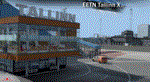
EETN TALLINN X DEMO features an extremely detailed scenery of EETN Lennart Meri Tallinn Airport in Tallinn, Estonia, fully compatible with FSX, FSX:SE, P3Dv1, P3Dv2, P3Dv3, P3Dv4 and FSW.
It's a fully functional DEMO version of the commercial payware product. It features same airport layout as in the full version but with limited 3D objects and low resolution textures. Using this free demo ensures no problems with online (VATSIM, IVAO, multiplayer etc.) flying in case some users use the payware scenery and some don't.
Lennart Meri Tallinn Airport (TLL / EETN) is the largest airport in Estonia and home base of the national airline Estonian Air. The airport has a single asphalt-concrete runway that is 3070 metres long and 45 metres wide (large enough to handle wide-bodied aircraft such as the Boeing 747).
It's equipped with an automatic installer, which means that the scenery will be automatically added to the Flight Simulator Scenery Library.
Please uninstall all previous versions of this airport you may have installed before. Please make also sure that no duplicated AFCAD files are installed.
Enjoy your virtual flying with Drzewiecki Design!
| Filename: | EETN_TALLINN_X_DEMO.zip |
| License: | Freeware, limited distribution |
| Added: | 4th February 2018, 05:52:26 |
| Downloads: | 87 |
| Author: | Drzewiecki Design |
| Size: | 10.36 MB |
| Category: Prepar3D V1-4 - Aircraft Repaints, Textures and Modifications | |
| Meridiana Air Italy "New Colors" Boeing 737-800 |
|
Images related to this file:
File Description:
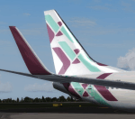
new livery for new company "Meridiana Air Italy" PMDG 737 800w p3d fsx uhd textures
4096x4096
Meridiana, Italy’s long established privately owned airline, has announced an
exciting new phase of growth and development with its new identity as Air Italy.
During a press conference in Milan, Mr. Marco Rigotti, Chairman of Alisarda and AQA
Holding; His Excellency Mr. Akbar Al Baker, Group Chief Executive of Qatar Airways;
Mr. Sultan Allana of Alisarda and AKFED and Mr. Francesco Violante, Chairman of
Meridiana, unveiled Air Italy’s fresh and modern brand identity and presented the
new airline business plan, focusing on excellent passenger experience and the next
generation of traveller, aimed at positioning itself as Italy’s leading airline.
Air Italy aims to have approximately 50 aircraft by 2022 and is already committed to
receiving 20 of the brand new Boeing 737 MAX aircraft type from April 2018, over the
next three years. Air Italy will also receive five Airbus A330-200 aircraft this
year from the Qatar Airways’ fleet, prior to these being further replaced by Boeing
787-8 Dreamliner aircraft, commencing in May 2019.
| Filename: | Meridiana_Air_Italy_New_Colors_Boeing_737800.zip |
| License: | Freeware |
| Added: | 3rd March 2018, 23:09:42 |
| Downloads: | 1,487 |
| Author: | massimo grassi |
| Size: | 78.68 MB |
| Category: Flight Simulator X - Original Aircraft | |
| USAF Boeing C-32B |
|
Images related to this file:
File Description:
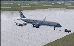
This version of the Boeing 757 is part of the U.S. Dignitary fleet of 5 aircraft of which only 2 are so modified as "B" models. All 5 can carry the Vice President, and when doing so the callsign is AIR FORCE TWO. Normally, this version is used for high altitude, long range missions without media attention. She is equipped for high altitude flights way beyond what a normal 757 can achieve due to higher cabin pressure and fortifications, as well as more powerful and efficient engines. Although the visual model presented is not so equipped in the real world, the engine/aerodynamic aspects for the C-32B have been fully employed within this model. In reality, this version is not painted with U.S. Colors, but is white.
Credits:
Model Designers (FS2004):
Lee Rosario
Albert Bouwman
C. Vincent Cho
Hiroshi Igami
Warren C. Daniel
Jaco du Preez
Ben Hewitt
Nick Peterson
Simon Ng
Repaint by Bobby Pitaya
Realistic Sound by Sanjay Blair
Aero/Engine Dynamics and Data Corrections for FSX:
Douglas E. Trapp
[email protected]
May 2018
This aircraft is designed for educational use protected under the Fair Use Doctrine:
http://www.expertlaw.com/library/intellectual_property/fair_use.html
| Filename: | USAF_Boeing_C32B.zip |
| License: | Freeware |
| Added: | 13th May 2018, 02:29:43 |
| Downloads: | 455 |
| Author: | Douglas E Trapp |
| Size: | 35.56 MB |
| Category: Flight Simulator 2004 - Scenery | |
| Colville Lake CEB3 in Northwest Territories Canada |
|
Images related to this file:
File Description:
Colville Lake is a small village of around 150 Dene, located to the northwest of the Great Bear Lake and east of the Mackenzie River, 120 miles north of Norman Wells. The village and the airfield are next to each other and to the lake shore. I recently discovered which of the standard terminal buildings had been used there and this, along with information I already had, enabled me to now make the scenery, which is based on an approximate 2010 date. The gravel runway is lit and around 2,800 feet long, aligned 10-28. North Wright Air serves the village from it's headquarters at Norman Wells with daily flights by de Havilland Twin Otters, or "twotters" as they were quickly named among the northern Canadian airline personnel when they were first produced. The approximate time of this scenery is 2010. While testing this scenery I discovered that Tulita (previously called Fort Norman) which is another Mackenzie River airfield to the south of Norman Wells, needs to be reposted due to a terrain fault. If you find an error here then email me please, and note that my email address has been changed to rogwens at Gmail dot com.
| Filename: | Colville_Lake_CEB3_in_Northwest_Territories_Canada.zip |
| License: | Freeware, limited distribution |
| Added: | 31st July 2021, 18:23:48 |
| Downloads: | 70 |
| Author: | Roger Wensley |
| Size: | 4.51 MB |
| Category: Flight Simulator 2002 - Aircraft Repaints, Textures and Modifications | |
| One-Two-Go Boeing 757-200 (by Orient Thai Airline) (2 liveries) |
|
File Description:
Ready to be used AI Aardvark Boeing 757-200RR in One-two-GO livery (model+texture+panel+sound)
This is primarily an AI aircraft, but is also quite flyable. Aircraft and base model and base textures by AI Aardvark, 1-2-go livery by Anuraka Siriwatra
One-two-GO (by Orient Thai airline) Starts the first Low cost airline in Thailand. They use 2 Boeing 757-200s in there Bangkok-Chiangmai service which costs only 999 baht(about22.5$) for one way trip which Thai airways sell 2200 baht. XU123 has been used in Kampuchea airline(I have heard that it's red-blue livery is it's old livery in Mytravel airline)
HS-OTA has just been dilivered few week ago from California.Both aircraft were painted "Tronge Pra Ja Roen" or " Long Live The King" to celebrate the king's 73rd anniversary. One-Two-Go is planing to provide full low cost service troughout Thailand in competition with Malaysian's AirAsia which will start it's service in Thailand next trimester.ANd Thai Airways International's Sky Asia low cost which will start in April. Next year will be the year of competition of 3 low cost no frill airlines in Thailand.
| Filename: | OneTwoGo_Boeing_757200_by_Orient_Thai_Airline_2_li.zip |
| License: | Freeware |
| Added: | 27th December 2003, 01:50:47 |
| Downloads: | 2,864 |
| Author: | Anuraka Siriwatra |
| Size: | 646.98 KB |
| Category: Flight Simulator 2004 - Panels | |
| F16 |
|
File Description:
FS2004 Panel, F16 Air Show Tour. The panel of this jet fighter has been designed for cross country flying to events worldwide. The 2D cockpit is packed with new gauges that complement this high performance, yet docile aircraft. All gauges, lights, etc. are functional, easy to read, and are panel installed except GPS 500. For long distance flights, the panel contains on-demand refueling capabilities for both ground and air operations. A few of the new gauges are; 180-degree scan navigational radar, triple mode interceptor-refueling-terrain radar, refueling gauge with command screen, fuel center with time/distance remaining computer, new Descentometer for Mach-plus aircraft, analog engine gauges including thrust and fuel efficiency, plus a hangar full of warning and indicator lights. The intercept mode of the ai-radar feeds info to the autopilot to assist in the rendezvous with tanker to allow all-weather, day or night air refueling. Digital data for AP, radio, altimeter, timer, and Descentometer is input via a central keypad. Acknowledge ATC instructions using joystick. Designed for use with Kirk Olsson's F16 Viper. Includes 15 page illustrated instructions plus Intercept and Refueling tutorial. By Glenn Copeland
| Filename: | F16.zip |
| License: | Freeware |
| Added: | 12th January 2007, 03:00:43 |
| Downloads: | 5,782 |
| Author: | Glenn Copeland |
| Size: | 1.83 MB |
| Category: Flight Simulator X - Scenery | |
| Goma Intl (FZNA) DRC and Gisenyi (HRYG) Rwanda |
|
Images related to this file:
File Description:
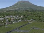
This project includes the neighboring Goma Intl (FZNA) and Gisenyi (HRYG) airports. After Goma's only runway was severely damaged by the eruption of Mount Nyiragongo in 2002, the runway, originally 3000m long, was reduced to 1800m of serviceable pavement after lava flowed onto the northern part runway and through the city center. In 2013, German NGO Welthungerhilfe ("World Hunger Aid") signed a contract to rehabilitate 500m of runway damaged by the lava flow. Goma resumed scheduled international flights in 2015, and this project reflects the airport as of March 2016, with runway 18/36 renumbered to 17/35. SRTMGL1 (30m) mesh brings the volcanoes in the area into much greater detail. This scenery is complimented by the Kigali Intl (HRYR) scenery (FSX_HRYR_Kigali_2016.zip).
Updates were created or rebuilt in a manner which carefully aligns airport data with current satellite imagery. Scenery was created using Airport Design Editor X v1.70.6042, SBuilderX 3.13, and the FSX Object Placement Tool. Scenery objects were added and modified from stock FSX scenery to resemble as closely as possible the actual airports. The FSX apron lights included are from the set created by Jim Dhaenens.
| Filename: | Goma_Intl_FZNA_DRC_and_Gisenyi_HRYG_Rwanda.zip |
| License: | Freeware |
| Added: | 4th August 2016, 21:11:20 |
| Downloads: | 2,284 |
| Author: | Carlyle Sharpe |
| Size: | 5.25 MB |
| Category: Prepar3D V1-4 - Scenery Design | |
| "Gerald R. Ford Intl "KGRR" P3Dv4/5" |
|
Images related to this file:
File Description:
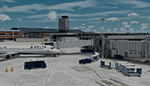
Prepar3D v4/5 Welcome to A "Fully Modeled" Gerald R. Ford International Airport (KGRR) for P3DV4/5,
With Dynamic Lighting.
All 3D Buildings including Runways, Taxiways and Photoreal, Even to the the smallest detail is custom hand made, through blender modeling tool.AI Traffic including Airport vehicles Work Perfectly. All Scenery is original work, This was a 3 year Long project, and was finally finished on 2021 of June.
Main Features to this scenery is Custom 3D Building, Custom Seasonal Photoreal, Dynamic Lights, Custom Fully modeled Airport, Custom Parked Static Vehicles throughout the airport, Custom Fences, Custom Runway and Taxiways, Custom taxi Edge lights, Working Ai Traffic, Custom small Detail and so much more...
Note to have it fully functional, GSX level 2 is Required to Power the Jetways, there's also a option to have static jetways, if you don't have GSX.
Please Don't Modify, Change, Re-upload, Reuse 3d objects or Textures. The airport is intended to be Freeware. This is a Cheer-Up Gift to all Simulation Aviation community Pilots. Please enjoy! Fly lots "Keep-Climbing "Please Share the news of this Airport being released Thankyou.
| Filename: | Gerald_R_Ford_Intl_KGRR_P3Dv45.zip |
| License: | Freeware, limited distribution |
| Added: | 4th July 2021, 05:46:03 |
| Downloads: | 1,455 |
| Author: | Dillon Rocque |
| Size: | 387.29 MB |
| Category: Flight Simulator 2004 - Scenery | |
| Alma CYTF in Quebec Canada |
|
Images related to this file:
File Description:
This is the second of five sceneries around Lac Saint-Jean in Quebec, Canada. Alma, the town, is 7 miles east of Lac Saint-Jean, on both the northern and southern banks of the Saguenay River. The airfield is at the southern edge of the town, with a single 13-31 runway 5,000 feet long and approach lighting at both ends. There is a visible ILS sytem but this was no longer in operation by 2010, the approximate date setting of this scenery. The largest operation on the field, by far, is Panorama Helicopters (actually Helicopteres Panorama) and this is reflected in the AI and a parked static helicopter. The ai includes helicopters that were originally posted as part of the payware Alaska Fjords series, with the permission of FSAddon. There are also other planes listed that will be required here or for the future posts in this series and are included here. The amphibious Beaver AI plane will only be available if you already have the payware Aerosoft Beaver installed, and I should have made it clear that the float Beaver included in the CTD3 AI was also an Aerosoft plane.
| Filename: | Alma_CYTF_in_Quebec_Canada.zip |
| License: | Freeware, limited distribution |
| Added: | 6th November 2017, 19:30:34 |
| Downloads: | 230 |
| Author: | Roger Wensley |
| Size: | 17.42 MB |
| Category: Flight Simulator 2004 - Scenery | |
| Buckland PABL in Alaska |
|
Images related to this file:
File Description:
Buckland is a village on a small river, around 45 miles east of Deering and 15 miles inland from the river mouth. Like Deering, the population of 420 live from fishing and the land. The airfield is close by and has a gravel runway aligned 10-24 and 3,300 feet long with VASI at both ends. Apart from the airfield itself, and it's buildings, this scenery modifies the local (mostly treeless) land class, adds village buildings while reducing the village size to reality, and creates a new airfield background. Bering Air flies into Buckland from Kotzebue and is included in the AI. A note here about my scenery making. This is post number 505 and there will not be many more to follow this as I am almost at the end of the photos I either took or found for scenery purposes. There is a limit to what can be located online and I have already been making use of the little there is; eg Unalakleet. So, if you are near an airport (preferably Canadian or Alaskan) and have a camera..... Let me know.
| Filename: | Buckland_PABL_in_Alaska.zip |
| License: | Freeware, limited distribution |
| Added: | 10th August 2019, 18:51:45 |
| Downloads: | 148 |
| Author: | Roger Wensley |
| Size: | 4.11 MB |


© 2001-2026 AVSIM Online
All Rights Reserved
Privacy Policy |