
Where Flight Simulation Enthusiasts Gather from Around the World!
AVSIM Library - Search Results

| Category: Flight Simulator 2004 - AI Aircraft | |
| North American F-100 Super Sabre (Part 3) |

|
Images related to this file:
File Description:

North American F-100 Super Sabre (Part 3). This aircraft, also known as the Hun, was the first of a long success of Century Series fighter aircraft during the 1950s and 1960s. I present a comprehensive 8-LOD AI traffic model for this cold warrior of military jet history, utilizing original source material from Jake Burrus. Going into production in 1953, 2,294 aircraft served thirty-five years in the USAF and the air forces of France, Turkey, Denmark, and Taiwan. The F-100 was originally designed as a daytime air superiority fighter (with all-cannon armament); but evolved into a capable light attack aircraft which served extensively in Vietnam. An original 8-LOD model brings this historic aircraft to the flightsim world. This package represents the F-100D in the Vietnam and post-Vietnam service of the USAF/ANG,with a total of 6 models and 64 repaints. Additionally, I am including the F-100C in late ANG service, with 18 additional repaints. Original aircraft model by Jake Burrus and Michael Pearson, textures by Michael Pearson, flight dynamics by Michael MacIntyre. Please read included documentation.
| Filename: | North_American_F100_Super_Sabre_Part_3.zip |
| License: | Freeware |
| Added: | 22nd April 2014, 20:36:58 |
| Downloads: | 517 |
| Author: | MIchael Pearson |
| Size: | 18.78 MB |
| Category: Flight Simulator 2004 - AI Aircraft | |
| North American F-100 Super Sabre - Part 5 |
|
Images related to this file:
File Description:

North American F-100 Super Sabre (Part 5). This aircraft, also known as the Hun, was the first of a long success of Century Series fighter aircraft during the 1950s and 1960s. I present a comprehensive 8-LOD AI traffic model for this cold warrior of military jet history, utilizing original source material from Jake Burrus. Going into production in 1953, 2,294 aircraft served thirty-five years in the USAF and the air forces of France, Turkey, Denmark, and Taiwan. The F-100 was originally designed as a daytime air superiority fighter (with all-cannon armament); but evolved into a capable light attack aircraft which served extensively in Vietnam. An original 8-LOD model brings this historic aircraft to the flightsim world. This package represents the F-100A/C/D/F in the entirety of its export service with the Armee d' la Air, Royal Danish Air Force, Republic of China Air Force, and the Turk Hava Kuvvetleri; with 14 models and 112 repaints. Original aircraft model by Jake Burrus and Michael Pearson, textures by Michael Pearson, flight dynamics by Michael MacIntyre. Please read included.
| Filename: | North_American_F100_Super_Sabre__Part_5.zip |
| License: | Freeware |
| Added: | 12th May 2014, 19:07:35 |
| Downloads: | 516 |
| Author: | Michael Pearson |
| Size: | 28.71 MB |
| Category: Flight Simulator X - Scenery | |
| NRAO - Karl G. Jansky Very Large Array |
|
Images related to this file:
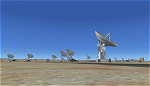
File Description: The VLA or "Jansky Array", managed by the National Radio Astronomy
Observatory (NRAO) consists of 27 independent radio telescope dishes, each with
a diameter of 82 feet and weight of over 200 tons. Each antenna is found along
the three arms of a track shaped in a Y configuration measuring 13 miles long.
Using the rail tracks that follow each of these arms the antennas can be
physically relocated to a number of prepared positions. At one point, the arms
intersect with U.S. Route 60 which passes right through the middle of the array.
It has been featured in numerous films, such as Armageddon, Independence Day,
Terminator Salvation, a Bon Jovi music video, and was featured most prominently
-and correctly- in the Carl Sagan novel Contact, as well as the film of the same
name. Also updated is the closest airport to the VLA - Magdalena, NM - N29. It's
a small dirt strip a few miles to the east, between Socorro and the VLA. It
serves as a nice staging area for flights to the VLA. Includes a helipad startup
location with NM99 ident. Scenery by Jason L. Terry. For FSX Acceleration.
| Filename: | NRAO__Karl_G_Jansky_Very_Large_Array.zip |
| License: | Freeware |
| Added: | 23rd August 2014, 11:18:02 |
| Downloads: | 409 |
| Author: | Jason L. Terry |
| Size: | 3.18 MB |
| Category: Flight Simulator 2004 - Scenery | |
| CYCS - Chesterfield Inlet - Nunavut, Canada Modified V1 |
|
Images related to this file:
File Description:
This version of Chesterfield Inlet corrects the VASI position on the runway, and also updates the taxiway edge lights to a newer and smaller version which is more realistically sized. This is a complete version and does not require you to have installed the old version. There is new AI, which is for Arviat, Whale Cove, and Chesterfield Inlet; this enlarges on and replaces the version posted with Whale Cove so use this one. The First Air and Calm Air flights also visit Rankin Inlet (made by Sid) and the GA flights originate in Rankin Inlet. There is a revised Rankin Inlet bgl so that the planes are allowed to use the gates. Chesterfield Inlet is a small village on the west coast of Hudson Bay, with a population of 340 or so. It is the oldest community in Nunavut and was established around a Hudson Bay Company post in 1911. It is 55 miles north of Rankin Inlet (Sid and Pete's post). The airfield is close to the village and has a gravel runway 3,600 feet long aligned 124T/304T (true, not magnetic).
| Filename: | CYCS__Chesterfield_Inlet__Nunavut_Canada_Modified_.zip |
| License: | Freeware, limited distribution |
| Added: | 23rd August 2014, 11:22:36 |
| Downloads: | 200 |
| Author: | Roger Wensley |
| Size: | 3.3 MB |
| Category: Flight Simulator 2004 - Gauges | |
| Reduced Braking Effectiveness in Rain and Snow |
|
File Description:
If you want more realism and are tired of having the same braking effectiveness in rain and snow as on a dry runway then this is for you.
There are two gauges, "BrakingAction" and "BrakingAction_AntiSkid".
Use the gauge "BrakingAction" for aircraft which do not have an AntiSkid system; do not use it on aircraft with antiskid (e.g. airliners) - for those use "BrakingAction_AntiSkid".
The gauges will reduce braking effectiveness during rain, snow, and freezing rain. In addition, the "BrakingAction" gauge simulates blocked wheels if you stay on the brake for too long; blocked wheels will further reduce the braking effectiveness; in addition, blocked wheels will put wear on the tires on dry and rainy runways; this may lead to a blown tire.
NOTE: The gauges are made for users who either use the keyboard or an assigned button (or two for differential brakes) on the joystick for braking. The gauges will most likely not work with devices that allow a progressive braking input, i.e. that allow you to apply brake pressure anywhere between 0 and 100% (I guess there are rudder pedals that allow you to do that).
| Filename: | Reduced_Braking_Effectiveness_in_Rain_and_Snow.zip |
| License: | Freeware |
| Added: | 27th February 2015, 18:09:43 |
| Downloads: | 309 |
| Author: | Detlev J. Rohmer |
| Size: | 132.84 KB |
| Category: Flight Simulator 2004 - Scenery | |
| EETN - Tallinn 2014 DEMO |
|
Images related to this file:
File Description:
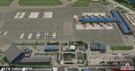
EETN TALLINN 2014 DEMO features an extremely detailed scenery of EETN Lennart Meri Tallinn Airport in Tallinn, Estonia, fully compatible with FS2004.
It's a fully functional DEMO version of the commercial payware product. It features same airport layout as in the full version but with limited 3D objects and low resolution textures. Using this free demo ensures no problems with online (VATSIM, IVAO, multiplayer etc.) flying in case some users use the payware scenery and some don't.
Lennart Meri Tallinn Airport (TLL / EETN) is the largest airport in Estonia and home base of the national airline Estonian Air. The airport has a single asphalt-concrete runway that is 3070 metres long and 45 metres wide (large enough to handle wide-bodied aircraft such as the Boeing 747).
It's equipped with an automatic installer, which means that the scenery will be automatically added to the Flight Simulator Scenery Library.
Please uninstall all previous versions of this airport you may have installed before. Please make also sure that no duplicated AFCAD files are installed. Enjoy your virtual flying with Drzewiecki Design!
| Filename: | EETN__Tallinn_2014_DEMO.zip |
| License: | Commercial demo |
| Added: | 2nd September 2015, 21:46:19 |
| Downloads: | 1,216 |
| Author: | Drzewiecki Design |
| Size: | 15.16 MB |
| Category: Flight Simulator 2004 - Scenery | |
| CYCQ - Chetwynd - British Columbia, Canada |
|
Images related to this file:
File Description:
The town of Chetwynd (population around 2,600) is on the east side of the Rocky Mountains, the first town to be encountered when descending from the Rockies on highway 97. Previously known as Little Prairie, the town name was changed in 1962. The main occupations of the town are linked to forestry, fossil fuels, and transportation; there are railway lines north to Fort St John, east to Dawson Creek, and south to Prince George. The airport is on the southern side of the town, with one runway aligned 05-23, asphalted in 1975 and just under 4,500 feet long. There are no scheduled services, although a new terminal building was constructed in 2008, and the helicopter operations by at least two companies (oil and gas and medical evacuation flights) are the primary operations from the field. These are included in the AI, incorporating helicopter modifications made by Holger Sandmann so that they function properly as AI at an airfield. As an aside, landing like a plane and using the runway and taxiways is in fact exactly what a helicopter does at a normal airfield in real life; everyone does the same thing so that guessing is unneccesary.
| Filename: | CYCQ__Chetwynd__British_Columbia_Canada.zip |
| License: | Freeware, limited distribution |
| Added: | 28th March 2016, 21:36:33 |
| Downloads: | 301 |
| Author: | Roger Wensley |
| Size: | 18.84 MB |
| Category: Flight Simulator 2004 - Scenery | |
| Alaska North Slope 5 - Nuiqsut PAQT |
|
Images related to this file:
File Description:
The town of Barrow is in the far north of Alaska, and these are coastal villages or radar installations to the west, south, and now east of Barrow. There will be further additions. Nuiqsut is a mainly Inuit community on the west side of the Colville River, around 20 miles south of the coast, and with a slowly declining population of around 420 or so. The airfield is just south of the town and has a gravel runway 5,000 feet long and aligned 04-22 in FS9. The airfield is the only year-round contact route to the rest of the world, though there are plans for a permanent road. The AI includes daily passenger flights early and late in the day, cargo deliveries, and some GA. It seems that the only photos I had of the airport were either of the old building or were not of Nuiqsut at all. The only pic I have seen (recently, which is why I now have doubts) of the new building is insufficient to model it, so I am sticking with the old or maybe incorrect version.
| Filename: | Alaska_North_Slope_5__Nuiqsut_PAQT.zip |
| License: | Freeware, limited distribution |
| Added: | 21st June 2016, 21:45:32 |
| Downloads: | 246 |
| Author: | Roger Wensley |
| Size: | 4.37 MB |
| Category: Flight Simulator 2004 - Scenery | |
| Johnson Creek 3U2 Forest Service airfield in Idaho USA |
|
Images related to this file:
File Description:
This airfield is in the mountains of Idaho, around 25 miles south of Big Creek U60, which was the second in the series to be posted. Johnson Creek is very regularly used for picnic fly-ins and overnight camping, as can be seen from the number of videos posted. Again, the creek does not appear in FS9 as it is only around 20 feet or so wide, plus within Ultimate Terrain I have streams turned off for the reasons given in the U60 post. The runway is at 4,933 feet ASL, 3,480 feet long, aligned 35-17, and in good condition. The shower facilities are south of the centre of the runway and on the eastern side; as a result planes mostly, but not all, park on the eastern side and towards the south. There are Forest Service workshop buildings on the east side of the runway near the centre. If you have a wind from the south then some AI planes will actually manage to land. I should have mentioned before that these are all made with only the default FS9 mesh, and that I will be reposting them again for use with the FSGenesis 19m mesh.
| Filename: | Johnson_Creek_3U2_Forest_Service_airfield_in_Idaho.zip |
| License: | Freeware, limited distribution |
| Added: | 25th May 2017, 17:54:06 |
| Downloads: | 172 |
| Author: | Roger Wensley |
| Size: | 4.81 MB |
| Category: Prepar3D V1-4 - Scenery | |
| EETN TALLINN X DEMO |
|
Images related to this file:
File Description:
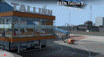
EETN TALLINN X DEMO features an extremely detailed scenery of EETN Lennart Meri Tallinn Airport in Tallinn, Estonia, fully compatible with FSX, FSX:SE, P3Dv1, P3Dv2, P3Dv3, P3Dv4 and FSW.
It's a fully functional DEMO version of the commercial payware product. It features same airport layout as in the full version but with limited 3D objects and low resolution textures. Using this free demo ensures no problems with online (VATSIM, IVAO, multiplayer etc.) flying in case some users use the payware scenery and some don't.
Lennart Meri Tallinn Airport (TLL / EETN) is the largest airport in Estonia and home base of the national airline Estonian Air. The airport has a single asphalt-concrete runway that is 3070 metres long and 45 metres wide (large enough to handle wide-bodied aircraft such as the Boeing 747).
It's equipped with an automatic installer, which means that the scenery will be automatically added to the Flight Simulator Scenery Library.
Please uninstall all previous versions of this airport you may have installed before. Please make also sure that no duplicated AFCAD files are installed.
Enjoy your virtual flying with Drzewiecki Design!
| Filename: | EETN_TALLINN_X_DEMO.zip |
| License: | Freeware, limited distribution |
| Added: | 4th February 2018, 05:50:41 |
| Downloads: | 957 |
| Author: | Drzewiecki Design |
| Size: | 10.36 MB |


© 2001-2026 AVSIM Online
All Rights Reserved
Privacy Policy |