
Where Flight Simulation Enthusiasts Gather from Around the World!
AVSIM Library - Search Results

| Category: Flight Simulator 2004 - Scenery | |
| Fortaleza City 2004 (BRAZIL) v5 |

|
Images related to this file:
File Description:
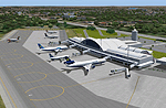
This version -- v5 -- adds new features of Fortaleza FiX BUG (Object invisible collision) observed in some system near GATE6 and 7 and add FINE TUNING in Night Textures in previous versions. Realistic FS2004 scenery Fortaleza City at northeast in Brazil (BR/Brasil) - Ceara. Full Scenery of the City includes a detailed International Airport Pinto Martins (SBFZ) with ANIMATED GATES CONTROLLED BY NAV1, NAV2 and AFCAD,the Air Base of Fortaleza, the detailed airfield SNFF (Feijo Aerodrome) with ANIMATED Hangars DOORS News landclasses, coastlines, lakes, buildings, Castelao Stadium ...ALL NIGHT TEXTURES! Development in great part in GMAX. (11th November 2004). Includes: fortalv5.zip + fortaleza_v5_update.zip
| Filename: | Fortaleza_City_2004_BRAZIL_v5.zip |
| License: | Freeware |
| Added: | 11th December 2009, 12:45:54 |
| Downloads: | 20,726 |
| Author: | Alvaro Volponi |
| Size: | 5.53 MB |
| Category: Flight Simulator 2004 - Scenery | |
| A Pilot's Home - Savage Island VT15 |
|
File Description:
A private island airstrip located in the state of Vermont. Features a very nice home and hangar created in detail with FSDSv2, Novasim, and digital photos. Hangar equipped with skylights and fully animated doors which open and close on pilot command with NAV1 frequency. Runway has been stretched to 3000 ft. and features pilot activated runway lights. Additionally, 7 different optional runway surface types are included allowing you to customize the airfield to your liking. Full seasonal textures and night lighting. Fictional. Optimized for FS2004. Includes full documentation. All required files and textures included. By Mark Smith.
| Filename: | A_Pilots_Home__Savage_Island_VT15.zip |
| License: | Freeware, limited distribution |
| Added: | 9th January 2004, 19:53:42 |
| Downloads: | 3,260 |
| Author: | Mark Smith |
| Size: | 2.83 MB |
| Category: Flight Simulator X - Scenery | |
| Tokol (LHTL) enhanced scenery and ADE file |
|
File Description:
Tokol (LHTL) is a former military airfield just south of Budapest Ferihegy.
This scenery replaces the default LHTL with an enhanced and "reactivated"
version of the military airbase. Parking for military aircraft is provided
on the ramps and in numerous hardened shelters. Parking is also provided
for general aviation aircraft. This design was accomplished using ADE,
SBuilderX, FSXPlanner and Whisplacer. Custom hardened shelters created
by Juri Masnik. Default FSX library objects, autogen and RWY12
objects were used for this creation, This scenery is for FSX only and
was tested in FSX-Acceleration\SP2 on WinXP Pro.
| Filename: | Tokol_LHTL_enhanced_scenery_and_ADE_file.zip |
| License: | Freeware |
| Added: | 3rd February 2008, 13:51:21 |
| Downloads: | 1,842 |
| Author: | Paul Strogen |
| Size: | 1.97 MB |
| Category: Flight Simulator 2004 - Original Aircraft | |
| FS2004, Horten H-Vc, experimental flying wing |
|
Images related to this file:
File Description:
This early 'flying wing' was converted from its two-seated predecessor, the H-Vb, into a single-seated aircraft. It was driven by two pusher propellers, each powered by a Hirth-HM60R aircooled engine of 80 hp. The aircraft could reach a max. speed of 260 km/hr.
The original paintings were in standard Luftwaffe camouflage, assigned to the code PE + HO.
The H-Vc made its first flight on May 26, 1942.
It was extensively tested at the military airfield in Goettingen as a experimental platform to study the aerodynamics of flying wings until it crashed in 1943.
| Filename: | FS2004_Horten_HVc_experimental_flying_wing.zip |
| License: | Freeware |
| Added: | 2nd January 2011, 01:22:45 |
| Downloads: | 490 |
| Author: | Andreas Becker |
| Size: | 4.33 MB |
| Category: Flight Simulator X - Scenery | |
| GB-0112 - RAF Bassingbourn - Cambridgeshire, England |
|
File Description:
RAF Bassingbourn is a former Royal Air Force station located in Cambridgeshire approximately 3 mi (5 km) north of Royston, Hertfordshire and 11 mi (18 km) south west of Cambridge, Cambridgeshire, England.
RAF Bassingbourn was constructed by John Laing & Son between 1937 and 1939 in the parishes of Wendy and Bassingbourn immediately to the west of the A14 (now the A1198) road. The site selected was low ground between several tributaries of the River Cam. The area had been long cleared of forest and tended to be swampy and unstable, and because the boggy ground produced a persistent mist over the large meadow the site was considered ideal for airfield camouflage.
During the Second World War it served first as an RAF station and then as a bomber airfield of the Eighth Air Force, of the United States Army Air Forces (USAAF). It remains the home of the Tower Museum Bassingbourn. From 19 August 1942 to 25 June 1945, Bassingbourn served as headquarters for the 1st Combat Bombardment Wing of the 1st Bomb Division. It was assigned USAAF designation Station 121.
The RAF resumed occupation of Bassingbourn on 26 June 1945, the airfield was officially returned on 10 July 1945. The station became one of the main airfields for long-range transport aircraft. In 1948 and 1949 Avro York, Avro Lancaster and Douglas Dakota aircraft from the base took part in the Berlin Airlift, a massive operation transporting essential commodities to the beleaguered city.
In February 1952, RAF Bassingbourn received its first allocation of English Electric Canberra bombers and became the first jet bomber operational conversion unit (OCU) in the world. Canberras operated from Bassingbourn for 17 years and one of the aircraft is on static display in the Barracks. From 1963 to 1969 the Joint School of Photographic Interpretation was also located there.
On 29 August 1969, the last RAF Commanding Officer, Sqn Ldr A.M. McGregor MBE, turned over the station to the British Army as Bassingbourn Barracks.
The barracks were established, on the site of the former RAF Bassingbourn airfield, in January 1970, as the new Depot for the Queen's Division. The depot was responsible for training recruits undergoing their 19-week basic training before joining a regular battalion; in 1993 the Barracks were re-designated the home of the "Army Training Regiment, Bassingbourn" and remained as such for nearly 20 years. Bassingbourn Barracks closed as an army training location in August 2012.
The site was reopened for training Libyan soldiers in 2014 but closed down the same year.
Since approximately 1970 the site has retained its RAF links by being the home of 2484 (Bassingbourn) Squadron Air Training Corps.
| Filename: | GB0112__RAF_Bassingbourn__Cambridgeshire_England.zip |
| License: | Freeware |
| Added: | 30th May 2016, 11:01:25 |
| Downloads: | 321 |
| Author: | Terry Boissel |
| Size: | 1.58 MB |
| Category: X-Plane - Scenery | |
| TMA Fortaleza XP11 Package SBFZ SJCM SJDS SNFF v1.0.0 |
|
Images related to this file:
File Description:

This is an X-Plane 11 scenery package for Fortaleza, Ceara, Brazil. It includes four airfields located in the metropolitan area of Fortaleza: (1) SBFZ FOR - Pinto Martins International Airport, (2) SJCM - Catuleve Aeronautical and Sports Airfield, (3) SJDS - Fabrica Fortaleza Private Airport, (4) SNFF - Feijo Flight School and Private Airfield. SBFZ/FOR scenery was tested and is operational (as of January 27, 2017) in "X-Plane 11 Public Beta #8 64 bit", Windows 10 Home. It was also tested but is NOT operational (as of January 27, 2017) in "X-Plane 10.51 64 bit", Windows 10 Home. This happens for two reasons: (a) preparation of a near future update release of this airport with ground traffic/services enabled for SBFZ/FOR ground, a feature compatible only with XP11, and (b) the use of some internal Laminar Research made libraries for XP11 only, not present in XP10 libraries. The new SBFZ version with XP11 ground traffic/services will be released after X-Plane's WED v1.6 is stable, outside of beta version for XP11. If you want a great SBFZ airport scenery compatible with XP10, please download it from here: "SBFZ - Pinto Martins International Airport - Fortaleza Ceará (Brazil) 1.6", By Rafasax, found at: http://forums.x-plane.org/index.php?/files/file/21401-sbfz-pinto-martins-international-airport-fortaleza-cear%C3%A1-brazil/
| Filename: | TMA_Fortaleza_XP11_Package_SBFZ_SJCM_SJDS_SNFF_v10.zip |
| License: | Freeware |
| Added: | 28th January 2017, 07:20:20 |
| Downloads: | 171 |
| Author: | Rui Mesquita |
| Size: | 16.99 MB |
| Category: Flight Simulator X - Scenery | |
| RAF Kirton in Lindsey - Lincolnshire, England |
|
File Description:
It appears to have been an RAF habit (inherited from the RFC to name its bases after the nearest railway station, possibly to simplify the process of issuing Rail Warrants to personnel posted there. By that token, the site should be RAF Kirton Lindsey, Kirton Lindsey being the name of the nearby railway station constructed in 1849. No.255 Squadron's Operations Record Book (ORB) consistently uses that version of the name. So does the airfield's separate ORB, from the date of the site's WWII creation (15 May 1940) through to May 1941. After mid-1941 and the departure of No.255 Squadron, use of RAF Kirton-in-Lindsey. Kirton in Lindsey begins to appear in the site's own records – eventually dominating.
On 25 March 2013 it was announced to dispose of the airfield and technical facilities with only accommodation remaining. The airfield used to host No. 1 Air Control Centre (1ACC), the RAF’s only deployable ground-based early warning and air control radar unit, which was parented by RAF Scampton
The Station has had a varied selection of personnel occupying it, the RFC, RAF, USAAF, and before becoming an RAF Station for the last time it was the home of the Royal Artillery Regiment responsible for operating the Rapier sam. The Station finally closed in 2013.
| Filename: | RAF_Kirton_in_Lindsey__Lincolnshire_England.zip |
| License: | Freeware |
| Added: | 29th October 2015, 23:44:17 |
| Downloads: | 161 |
| Author: | Terry Boissel |
| Size: | 19 KB |
| Category: Flight Simulator 2004 - Scenery | |
| Mackenzie CYZY in British Columbia, Canada |
|
Images related to this file:
File Description:
Mackenzie is around 120 miles west of Peace River and the BC/Alberta border, at the southern end of Williston Lake. The lake is 135 miles long and the population of the town is about 3,500; those figures illustrate typical Canada, a huge area enjoyed by the few. The main occupations relate to timber and mining in some form, plus tourism (in particular winter sports tourism). The airport is 2 miles southwest of the town, with no regular scheduled flights but it is not unusual to find Central Mountain Air there delivering either charter passengers or freight. The single runway is aligned 16-34 and 100 feet wide lit asphalt that is just over 5,000 feet long, with (in 2010 or so) an additional 1,500 feet of gravel. There is PAPI at both ends of the asphalt. The largest operation based at the airfield is a helicopter company, at the northern end of the apron. There is a "mandatory frequency" of 123.5 which is a Canadian invention; you MUST have a radio. There is no control tower at the actual airfield, and if or when there is no response from further afield then you announce your intentions etc. In FS9 there is no way to "switch off or on" the monitoring of a MF radio frequency so you will find that this one is always silent.
| Filename: | Mackenzie_CYZY_in_British_Columbia_Canada.zip |
| License: | Freeware, limited distribution |
| Added: | 27th December 2018, 20:19:05 |
| Downloads: | 131 |
| Author: | Roger Wensley |
| Size: | 19.81 MB |
| Category: Flight Simulator 2004 - Scenery | |
| Mountain View CPZ3 in Ontario, Canada |
|
Images related to this file:
File Description:
This is Mountain View, a small RCAF airfield at the eastern end of Lake Ontario on Prince Edward Island, some 40 miles west of Kingston. Mountain View is used for training during the summer months, and part of this training is for C-130 crews, who practice landing on rough or unprepared landing strips. The crews are based at Trenton, which is a large base 10 miles to the northwest on the mainland. There are (or were, I haven't seen it recently) numerous parked and ancient fighter planes such T-33's and Canadair Tutors; these could also have possibly been used for summer training or perhaps were just stored. Last summer there were only two hangars left standing; in 2002 there were five. In real life you would be on the lookout not only for C-130's but also (at certain times during the summer) for parachutists and also gliders. This airfield is one that you will fly over and not land on; I confess that I have cheated with the length of the 06L-24R gravel "practice" runway, so that it became possible for the FS version of a touch-n-go with a C-130 to be completed without using the grass. The aerial photograph shows the new "practice" gravel runway under construction.
| Filename: | Mountain_View_CPZ3_in_Ontario_Canada.zip |
| License: | Freeware, limited distribution |
| Added: | 9th March 2012, 15:05:57 |
| Downloads: | 350 |
| Author: | Roger Wensley |
| Size: | 7.26 MB |
| Category: Flight Simulator 2004 - Scenery | |
| RAF Chivenor 1979-1992 |
|
Images related to this file:
File Description:

Originally a civil airfield opened in the 1930s, the site was taken over by the Royal Air Force in May 1940 for use as a Coastal Command Station, and was known as RAF Chivenor. After the Second World War, the station was largely used for training, particularly weapons training. During the 1960s, one of the RAF's Tactical Weapons Units (TWU) used Hawker Hunter aircraft for training. In 1974 the station was left on "care and maintenance", though No. 624 Volunteer Gliding Squadron continued to fly from there. The TWU returned, flying BAE Hawks, in 1979 and 1981. In 1994, the TWU left Chivenor, merging with No. 4 Flying Training School at RAF Valley, and the airfield was handed over to the Royal Marines.
This scenery includes all the Hawk aircraft of 2 TWU in both camouflage and air defence grey schemes, depending on your preferred choice. There are flightplans included, which are representative only, but enables the aircraft to fly to bases and checkpoints around the country.
The scenery has been constructed using objects mainly from MAIW sceneries, which will need to be installed in order to gain the full visual experience. With BIG thanks to Nick Black for the use of his superb AI Hawk, and to Chris A. Brown for paintin' 'em!
| Filename: | RAF_Chivenor_19791992.zip |
| License: | Freeware, limited distribution |
| Added: | 21st June 2013, 21:28:56 |
| Downloads: | 1,173 |
| Author: | Brian Clarke, Stewart Pearson, Daryl Payne, Chris A. Brown |
| Size: | 22.67 MB |
© 2001-2026 AVSIM Online
All Rights Reserved
Privacy Policy |