
Where Flight Simulation Enthusiasts Gather from Around the World!
AVSIM Library - Search Results

| Category: Flight Simulator 2004 - Scenery | |
| Airstrips of the Falkland Islands |

|
Images related to this file:
File Description:
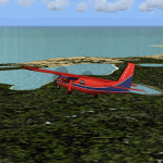
Inspired by Jim Keir's Falkland Islands mesh, coastlines and landclass, herewith a couple of dozen little strips from around the area, to give the opportunity to generate a bit of GA AI (and possibly a few scheduled flights) in an otherwise relatively ignored area in the South Atlantic. Please do note, other than Stanley, most of these airstrips are just that, a cleared strip of land in an otherwise empty landscape, (just as they are in real life), simply to provide a variety of destinations for the occasional aircraft to or from Stanley.
Most of the airfield locations are listed on WikiPedia and the layout confirmed using on-line satellite imagery. Other than the two main airports, none of these airstrips seem to have "official" ICAO codes, so I've generated a selection of alpha-numeric codes in the SF0* configuration, (as Stanley Airport has the ICAO code of SFAL), so the FS9 AI engine has some codes to work with and the airfields can be found on the map. Hopefully these pseudo-codes won't clash with anything else.
As with my other sceneries, the files for each airstrip can be easily identified by the ICAO code, even if the airfield names vary slightly, so you can pick and choose and mix and match to suit any sceneries you already have, should you so wish. There is no requirement for any other download. Each airstrip will exist as a stand-alone entity should you only want a few of them.
Having said that, Paul Denton's AFCAD and scenery for EGYP Mount Pleasant (available on AVSIM and possibly elsewhere) might be considered a worthwhile addition, especially if you want to see the twice-weekly scheduled RAF flights from Brize Norton (via Ascension Island), and the Saturday LATAM flight from Chile. Suitable AFCADs for EGVN Brize Norton and SCCI Punta Arenas may also be required. Appropriate traffic files and aircraft/texture suggestions are provided.
Please read the remainder of this "blurb" in the included text file, there may be a couple of details of interest.
| Filename: | Airstrips_of_the_Falkland_Islands.zip |
| License: | Freeware |
| Added: | 30th March 2025, 18:55:33 |
| Downloads: | 93 |
| Author: | Chris Eve |
| Size: | 295.87 KB |
| Category: Flight Simulator 2004 - Scenery | |
| Airstrips of North-East Germany |
|
Images related to this file:
File Description:
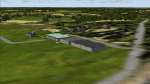
Moving towards completing my Airstrips of Western Europe project, herewith 50+ sceneries for smaller airfields in NE Germany, that I haven't included in my previous uploads, each enhanced with taxiways, parking spaces, buildings etc. and aprons as appropriate, to further facilitate the generation of lightweight AI traffic in the area, without overloading the more major airfields. If you have my "German Airstrips" folder from my previous uploads, these are in addition to that and the folders can be merged. Any apparent duplicates will be (minor) updates and can be over-written.
Again, there's no photo-realism here, just a selection of basic 'generic' buildings, more or less accurately sized and placed to reflect the airfield layout as seen on on-line satellite imagery and aerial photography. These buildings have minimal effect on frame-rates, so are ideal for this kind of job. The airfields are aligned as well as possible with the roads etc. in UT Europe and the Genesis Europe mesh, but should mostly be fine in a default installation or other configuration.
As before, the files for each airfield can be easily identified by the ICAO code, even if the airfield names vary slightly, so you can pick and choose and mix and match to suit any sceneries you already have, should you so wish. There is no requirement for any other download. Each airfield will exist as a stand-alone entity should you only want a few of them.
Very few basic library objects are used ... you can add "eye-candy" to suit your own taste should you wish, or just leave them as vague shapes in the scenery that can put a few more small aircraft into the air. As with other airfields in this series, now these are "ai-activated" you can expect to see the occasional little aircraft turn up at some of them if you've got any third-party traffic installed.
Please read the rest of this "blurb" in the enclosed text file ... there may be some details of interest.
| Filename: | Airstrips_of_NorthEast_Germany.zip |
| License: | Freeware |
| Added: | 14th April 2025, 19:55:20 |
| Downloads: | 83 |
| Author: | Chris Eve |
| Size: | 2.11 MB |
| Category: Flight Simulator X - Scenery | |
| Carnes Farm |
|
Images related to this file:
File Description:
These are the files that I talked about in the Prepar3d forums. I created these objects for Fs9, then upgraded them to the scenery SDK for FSX. They were created 10 years ago in GMAX, and I have used them successfully ever since in Prepared 1.4 as well.
For some reason the individual farmhouse and other objects that I created are not showing up in Prepar3d version 2.0.
That's where you guys come in! These files are free to use in anyway you want as long as proper attribution is given, but, I would like you guys who have both Prepar3d 1.4 and 2.0 to try them out in both and report back to me as to whether you have the same problems that I do. That's your only fee. And I'd like you guys to give it a shot in both, or all four( I am not sure that they will work in FS9 anymore, but try it out. Unfortunately I can't recompile my FSX SDK Files back to FS9 if it doesn't work).
What's included:
1. Photo real scenery of Barbourville, 10 miles to the north west of stinking Creek where we live, and;
2. Photo real scenery of the farm area and stinking Creek, upon which I have placed my GMAX objects;
A. The farm house.Carnes Farm From the Bridge at 500 AGL.jpg
B. The barn, shed and the RV in back of the farmhouse.
C. A two-story long structure the top of which is an apartment but the bottom of which is a re-creation of Mama Carne's store, along with all the real wood floors shelves and original contents.. It is also o n Google earth in 3-D as it is here with further description .
... A little note on Gmax.. Mama Carne's store was one the first structures that I built in Gmax. It was just a box. Later, I added the true architectural features that you see including the steps and rails which took about as long to create as it would have to Saw and fit and hammer the real rails, risers and steps.
D. K-6, my little 2300 foot strip for runways 03 and 21. It has VOR - (117.55), ILS(110.1), and NDB(222).
E. Gerald Bingham's house, 1/4 mile up Warriors Path North from us.( mostly dirt road with gravel topping).
F. Dewitt Baptist Church.
Off property Knox county
G.Escoe's Store and Post Office complete with great prices for gas at the included pumps.
Escoes.jpg
H. Rex allen's killer corner...sheds and farm equipment on the sharpest bend on Stinking Creek...my son went off it with a flat tire, unscathed, but more than several have lost their lives on that curve... there may be several iterations of the sheds...just delete or rename the wrong ones...I was experimenting with ModelConverterX, Arno Gerretsen's wonderful model and object scenery tool.
I. sitting on top of the Barbourville Photo real scenery Barbourville PhotoReal over the shopping center.jpg is the Barbourville P3D Shopping Center2.jpg shopping center all the stores and all the storefronts ... it's on 25 E. as you head into Barbourville.
Recreated, is the entire shopping center with the now outmoded Wal-Mart sign. Probably my magnum opus.
note on the Gmax scenes.
All of the scenery was either directly measured and if not practical for a such a long measuring device, walked off, as in the Stinking Creek Bridge and shopping center. All of the objects were then photographed, in 360° where possible and saved as texture for inclusion in the Gmax model.
Enjoy!
...oh... how do you get there? Wellllll.... situate yourself at Middlesboro (1a6), and tune your Nav radio to K-69's VOR, 117.55, take off and climb to 3500 feet...grinnnnn
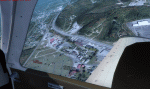
Welcome to Knox County Kentucky!
| Filename: | Carnes_Farm.zip |
| License: | Freeware |
| Added: | 2nd December 2013, 05:34:20 |
| Downloads: | 454 |
| Author: | Chas Honce |
| Size: | 91.13 MB |
| Category: X-Plane - Original Aircraft | |
| B25 Mitchell for X-Plane 6.40/6.51 |
|
File Description:
B25 Mitchell for X-Plane 6.40/6.51. Made famous by the Doolittle raid on Tokyo shortly after Pearl Harbour the B25 Mitchell bomber is the most famous medium bomber of WWII and perhaps of all time. The B25 was the most numerous twin engine aircraft built by the US during WWII; estimates of production vary from 9300 to 11000 built. On April 18, 1942 Doolittle led sixteen B-25 aircraft from the navy carrier, U.S.S. Hornet to bomb Japan in retaliation for that country's attack on Pearl Harbor on December 7, 1941. Although little damage was done and all planes were lost the raid proved to be one of the most famous missions of the war.
The B25 was powered by a pair of 1,700 hp Wright R-2600-29 "Cyclone" 14 cylinder, air-cooled engines. Maximum speed was 272 mph at 15,000 ft, with a ceiling of 24,000 ft and a range of 1350 miles with a full load of bombs. Armament varied considerably in the B25 depending on the type of mission the plane was designed for. Heavenly Body is a B25J designed as a bomber, so it carried eleven 0.50 caliber machine guns; two in the top turret, two in the tail, one in the nose, two in cheek packs on each side under the pilot and one in each waste window. The top, nose and cheek pack guns could also be used in strafing, if so desired. This version carried 3,000 lbs of bombs (usually six 500 pounders) in an interior bomb bay.
The X-Plane version is a fairly faithful rendition of the B25. The body consists of two sections consisting of the fuselage and a fuel tank. The main engine nacelles actually consist of two nacelles, one is the 1700 HP engine, the rear section is a 5 lb thrust rocket. Engine nacelles are also used for the two rudders in order to get the correct shape. Vertical stabilizers with rudders are buried within the nacelles. Decoration of the plane is complicated by the use of multiple nacelles but the resulting compromise is acceptable though not an authentic replica. As usual my panel leaves a lot to be desired but version 2 will correct this.
| Filename: | B25_Mitchell_for_XPlane_640651.zip |
| License: | Freeware, limited distribution |
| Added: | 25th February 2003, 00:15:23 |
| Downloads: | 495 |
| Author: | Robert App |
| Size: | 1.85 MB |
| Category: X-Plane - Original Aircraft | |
| B25 Mitchell v1.1 for x-plane 6.4/6.51 |
|
File Description:
B25 Mitchell v1.1 for X-Plane 6.4/6.51 upgrade from v1.0 includes better handling and improved non-custom panel. Made famous by the Doolittle raid on Tokyo shortly after Pearl Harbour the B25 Mitchell bomber is perhaps the most famous medium bomber of WWII and perhaps of all time. The B25 was the most numerous twin engine aircraft built by the US during WWII estimates of production vary from 9300 to 11000 built. On April 18, 1942 Doolittle led sixteen B-25 aircraft from the navy carrier, U.S.S. Hornet to bomb Japan in retaliation for that country's attack on Pearl Harbor on December 7, 1941. Although little damage was done and all planes were lost the raid proved to be one of the most famous missions of the war.
The B25 was powered by a pair of 1,700 hp Wright R-2600-29 "Cyclone" 14 cylinder, air-cooled engines. Maximum speed was 272 mph at 15,000 ft, with a ceiling of 24,000 ft and a range of 1350 miles with a full load of bombs. Armament varied considerably in the B25 depending on the type of mission the plane was designed for. Heavenly Body is a B25J designed as a bomber, so it carried eleven 0.50 caliber machine guns; two in the top turret, two in the tail, one in the nose, two in cheek packs on each side under the pilot and one in each waste window. The top, nose and cheek pack guns could also be used in strafing, if so desired. This version carried 3,000 lbs of bombs (usually six 500 pounders) in an interior bomb bay.
The X-Plane version is a fairly faithful rendition of the B25. The body consists of two sections consisting of the fuselage and a fuel tank. The main engine nacelles actually consist of two nacelles, one is the 1700 HP engine, the rear section is a 5 lb thrust rocket. Engine nacelles are also used for the two rudders in order to get the correct shape. Vertical stabilizers with rudders are buried within the nacelles. Decoration of the plane is complicated by the use of multiple engine nacelles but the resulting compromise is acceptable though not an authentic replica.
| Filename: | B25_Mitchell_v11_for_xplane_64651.zip |
| License: | Freeware |
| Added: | 2nd March 2003, 00:05:15 |
| Downloads: | 311 |
| Author: | Robert App |
| Size: | 1.41 MB |
| Category: X-Plane - Original Aircraft | |
| B25 Mitchell Bomber |
|
File Description:
B25 Mitchell for X-Plane 6.40-6.6 Made famous by the Doolittle raid on Tokyo shortly after Pearl Harbour the B25 Mitchell bomber is the most famous medium bomber of WWII and perhaps of all time. The B25 was the most numerous twin engine aircraft built by the US during WWII; estimates of production vary from 9300 to 11000 built. On April 18, 1942 Doolittle led sixteen B-25 aircraft from the navy carrier, U.S.S. Hornet to bomb Japan in retaliation for that country's attack on Pearl Harbor on December 7, 1941. Although little damage was done and all planes were lost the raid proved to be one of the most famous missions of the war. The B25 was powered by a pair of 1,700 hp Wright R-2600-29 "Cyclone" 14 cylinder, air-cooled engines. Maximum speed was 272 mph at 15,000 ft, with a ceiling of 24,000 ft and a range of 1350 miles with a full load of bombs. Armament varied considerably in the B25 depending on the type of mission the plane was designed for. Heavenly Body is a B25J designed as a bomber, so it carried eleven 0.50 caliber machine guns; two in the top turret, two in the tail, one in the nose, two in cheek packs on each side under the pilot and one in each waste window. The top, nose and cheek pack guns could also be used in strafing, if so desired. This version carried 3,000 lbs of bombs (usually six 500 pounders) in an interior bomb bay. The X-Plane version is a fairly faithful rendition of the B25. The body consists of two sections consisting of the fuselage and a fuel tank. The main engine nacelles actually consist of two nacelles, one is the 1700 HP engine, the rear section is a 5 lb thrust rocket. Engine nacelles are also used for the two rudders in order to get the correct shape. Vertical stabilizers with rudders are buried within the nacelles. Decoration of the plane is complicated by the use of multiple nacelles but the resulting compromise is acceptable though not an authentic replica.
| Filename: | B25_Mitchell_Bomber.zip |
| License: | Freeware, limited distribution |
| Added: | 27th March 2003, 01:20:45 |
| Downloads: | 1,670 |
| Author: | Robert App |
| Size: | 1.37 MB |
| Category: Flight Simulator 2004 - Panels | |
| Golovin N93 and Solomon AK26 in Alaska |
|
Images related to this file:
File Description:
Golovin is a coastal fishing village 70 miles east of Nome and around 20 miles west of Elim, with a population of under 200. The village is a check point on the Iditarod race and the name originates from a Russian admiral in the far distant past. The airfield has a gravel runway which is over 4,000 feet long; the older runway amid the village housing is still visible but not usable. The majority of flights to and from the airfield originate in Nome, but there are also others to and from nearby fields such as Elim, Unalakleet, Shaktoolik, and Koyuk. The AI includes a daily ERA flight. Most flights to villages of this size are in fact not "scheduled", but are "air taxi" being used by three or four villagers to go supermarket shopping in a larger neighbouring town, which in this case is Nome. In many cases the numbers of flights to and from a village in a year average out to one a day. There is a further scenery included here, which is Solomon AK26. Solomon is around 40 miles west of Golovin and from 1898 was suppporting a gold mining operation on the Fish and Niukluk rivers further inland at Council. Solomon, and the airfield which obviously came later, gradually faded from use in competition with Nome, leaving almost nothing behind at Solomon by the 1980's except a gravel runway and the nearby Solomon roadhouse. There are other buildings near the airfield which appear to be new and in good condition, but their function is unknown to me. The Solomon terrain modifications and grass deletion bgl's did not function until loaded in a "Top" folder; this is unusual, and may be required only in my FS9 setup or in all situations. I have no way of knowing as I can only design for my situation. A note here about my scenery making. This is post number 503 and there will not be many more to follow this as I am almost at the end of the photos I either took or found for scenery purposes. There is a limit to what can be located online and I have already been making use of the little there is; eg Unalakleet. Post 520 is unlikely. So, if you are near an airport (preferably Canadian or Alaskan) and have a camera..... Let me know.
| Filename: | Golovin_N93_and_Solomon_AK26_in_Alaska.zip |
| License: | Freeware, limited distribution |
| Added: | 5th August 2019, 16:19:07 |
| Downloads: | 83 |
| Author: | Roger Wensley |
| Size: | 4.23 MB |
| Category: X-Plane - Scenery | |
| XP11 German Scenery EDHK 2018+ Kiel-Holtenau |
|
File Description:
The small Zip-file will include a link for scenery download, because the scenery file size is above 500 Mbyte. Just follow the link and download EDHK 2018. This is an "install and fly" version, everything you need is already included (*see info below) and I will continously update the scenery. The story, in November 2012 the German MFG5 (Marineflieger-Geschwader) was relocated to Nordholz (ETMN). This was the end of the main military use in the southern and eastern part of the airport. Because the German harbor city Kiel needs living space for their citizens, opponents of the airport tried to convince citizens and politics to close the airport and to create there living space instead. In 2018 the citizen of Kiel voted with a citizen’s decision with the result that the majority voted for the preservation of the traditional airport. Personally, I am very happy with this decision. On the area of the airport some companies are settled, their employees should be able to sleep a little better now. In addition, there will certainly be future investments in the airport due to the election results. Since the airport has been financially in the red for years, the operator of the airport, the Port of Kiel Flughafen GmbH & Co. KG has converted large areas of the airport as parking area. These parked vehicles are part of the constantly increasing cruise ship operations within Kiel, making it possible for passengers to safely park their vehicles for extended periods of time. The taxiways “A†and “D†of EDHK are no longer in operation. This was of course taken into account in my scenery. The access to this taxiway was marked as in the original by yellow "X". The taxiway lighting was also turned off there. The on-site Luftsportverein (LSV) uses above the runway 08/26 an individually marked grass runway (not official), I called it 08S/26S and it is for the winch launch of their gliders only. The size of this provisional winch runway is about 820x20m. A glider takeoff by towing aircraft is usually handled by the Runway 08/26.(*) There is no copyright infringement, since I have received all the needed permissions to use the listed objects/libraries full or in parts within my scenery, the same for the single objects or non-Library bound objects/elements. I got all these permissions in writing from each individual author/rights holder. Take the time and read the full, included descritpion, please. If you have question, ask me first!
| Filename: | XP11_German_Scenery_EDHK_2018_KielHoltenau.zip |
| License: | Freeware |
| Added: | 28th November 2018, 22:46:11 |
| Downloads: | 70 |
| Author: | Marco Moschet |
| Size: | 1.3 KB |
| Category: X-Plane - Scenery | |
| XP11 German Scenery EDHK 2018+ Kiel-Holtenau |
|
Images related to this file:
File Description:
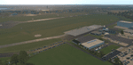
The small Zip-file will include a link for scenery download, because the scenery file size is above 500 Mbyte. Just follow the link and download EDHK 2018. This is an "install and fly" version, everything you need is already included (*see info below) and I will continously update the scenery. The story, in November 2012 the German MFG5 (Marineflieger-Geschwader) was relocated to Nordholz (ETMN). This was the end of the main military use in the southern and eastern part of the airport. Because the German harbor city Kiel needs living space for their citizens, opponents of the airport tried to convince citizens and politics to close the airport and to create there living space instead. In 2018 the citizen of Kiel voted with a citizen’s decision with the result that the majority voted for the preservation of the traditional airport. Personally, I am very happy with this decision. On the area of the airport some companies are settled, their employees should be able to sleep a little better now. In addition, there will certainly be future investments in the airport due to the election results. Since the airport has been financially in the red for years, the operator of the airport, the Port of Kiel Flughafen GmbH & Co. KG has converted large areas of the airport as parking area. These parked vehicles are part of the constantly increasing cruise ship operations within Kiel, making it possible for passengers to safely park their vehicles for extended periods of time. The taxiways “A†and “D†of EDHK are no longer in operation. This was of course taken into account in my scenery. The access to this taxiway was marked as in the original by yellow "X". The taxiway lighting was also turned off there. The on-site Luftsportverein (LSV) uses above the runway 08/26 an individually marked grass runway (not official), I called it 08S/26S and it is for the winch launch of their gliders only. The size of this provisional winch runway is about 820x20m. A glider takeoff by towing aircraft is usually handled by the Runway 08/26.(*) There is no copyright infringement, since I have received all the needed permissions to use the listed objects/libraries full or in parts within my scenery, the same for the single objects or non-Library bound objects/elements. I got all these permissions in writing from each individual author/rights holder. Take the time and read the full, included descritpion, please. If you have question, ask me first!
| Filename: | XP11_German_Scenery_EDHK_2018_KielHoltenau.zip |
| License: | Freeware |
| Added: | 29th November 2018, 19:24:38 |
| Downloads: | 66 |
| Author: | Marco Moschet |
| Size: | 1.3 KB |


© 2001-2026 AVSIM Online
All Rights Reserved
Privacy Policy |