
Where Flight Simulation Enthusiasts Gather from Around the World!
AVSIM Library - Search Results

| Category: Flight Simulator 2004 - Scenery | |
| VAKE Kandla/Gandhidham, India |

|
Images related to this file:
File Description:
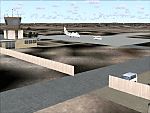
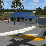
Googly scenery for VAKE Kandla/Gandhidham - a small domestic airport
in the state of Gujurat, India, for which little other than a runway is
provided in Flight Simulator 2004. These scenery files add taxiways, aprons,
buildings and other airport features, so that you and your "AI" traffic can
land, taxi, park and take off in a realistic manner.
Gandhidham is a small city about 5 miles from the seaport of Kandla, in the
Gulf of Kutch, and was developed in 1950 after the separation of Pakistan and
India left the key port of Karachi in Pakistan. The airport is served by daily
flights using turboprop aircraft of Air Deccan.
The scenery does not purport to be ultra-accurate. Based on high-detail satellite
imagery from Google Earth, the layout is proportionally correct but the added
airport features, such as buildings, are built from default Microsoft objects
and add-on libraries so will not look exactly like the real thing.
You are not obliged to download and install any additional scenery libraries,
but to enjoy this scenery in its entirety, you may wish to. It will work fine,
with or without.
[File re-uploaded at request of AVSIM]
| Filename: | VAKE_KandlaGandhidham_India.zip |
| License: | Freeware |
| Added: | 14th May 2010, 05:11:31 |
| Downloads: | 848 |
| Author: | John Hinson |
| Size: | 67.36 KB |
| Category: Flight Simulator 2004 - Scenery | |
| Dease Lake CYDL 2010 v1.1 |
|
Images related to this file:
File Description:
Version 1.1 adds the three hazard beacons that define the boundaries of the night circuit, as depicted in the included chart. Many thanks to Lane Street for creating the beacons and giving us permission to include them in the scenery. This scenery is complete and does not require the previous verion. Dease Lake CYDL airport is located about 2 miles south of Dease Lake in stunningly beautiful northwest British Columbia. (The lake directly to the east of the airport is Allan Lake.) Scheduled passenger service to Smithers and Bob Quinn Lake is provided by Northern Thunderbird Air (http://ntair.ca/). CYDL also serves as a base for Pacific Western Helicopters (http://www.pwh.ca/). This version moves the airport slightly to its correct location. All aprons & taxiways have been redone and all default buildings replaced. The little terminal building is photo real. The missing town of Dease Lake and the missing lake south of Allan lake have been added. This scenery was designed for use with Ultimate Terrain and was not tested in the default scenery. It may or may not work in FSX. Previous version had 307 downloads.
| Filename: | Dease_Lake_CYDL_2010_v11.zip |
| License: | Freeware |
| Added: | 6th November 2010, 22:30:24 |
| Downloads: | 793 |
| Author: | Sidney Schwartz & Peter Ham |
| Size: | 1.8 MB |
| Category: Flight Simulator 2004 - Scenery | |
| Driftwood Bay AK23 near Dutch Harbor Alaska |
|
Images related to this file:
File Description:
This is Driftwood Bay, an Air Force field that is just 13 miles northwest of Dutch Harbor, and was once part of a DEW line station with a road heading up the hill.
In FS9 the stock runway is concrete and if you have a mesh with the hills correctly positioned then the runway sits in a deep hole on the hillside. In fact the runway is gravel, 3,500 feet long and aligned 32/14 next to the beach, which is where I moved it to. The beach, as configured by Ultimate Terrain (and contrary to my previous doubts, UT does cover the Aleutians) is incorrect, in that a marshy area just behind the beach is shown as sea with large indentations in what should be a fairly straight line of sand. However, this does not squeeze AK23 in any way so I left it; consider it to be a spring high tide. There is very little at AK23 beyond a gravel runway and a windsock and the AI is an Alaska State Troopers Piper Super Cub from Dutch Harbor, presumably monitoring the numerous Alaska Maritime National Wildlife Refuge areas.
| Filename: | Driftwood_Bay_AK23_near_Dutch_Harbor_Alaska.zip |
| License: | Freeware, limited distribution |
| Added: | 14th August 2012, 20:32:14 |
| Downloads: | 354 |
| Author: | Roger Wensley, Sidney Schwartz |
| Size: | 3.35 MB |
| Category: Flight Simulator X - Gauges | |
| Flypad Gauge V2.0 |
|
Images related to this file:
File Description:
FSX, Flypad Gauge Version 2.0
This gauge has been developed on Win7 for FSX Flight Simulator SP2 or SP1.It should also work with Acceleration, but this is not guaranteed by the author. The gauge is a little extra addon based on the design of a smart phone and provides 9 different displays which are different from all of the standard gauge displays on a regular aircraft panel. It is mainly helpful for the user flying small propeller aircraft, and old timer aircraft.
However, the displays are as well attractive for sim pilots flying modern jet aircraft. Use it as if you just grabbed to your smart phone during a flight and check on the status of your aircraft, or how the terrain awareness situation looks like, how the AI traffic on the radar is, while you proceed with your flight plan. Enjoy the new design of a simple aircraft attitude display during an ILS approach. A new screen for LAT/LON coordination control and distance/bearing calculation has been added to this version in addition with a number of improvements.For credits look at the pdf documentation inside the zip file. By Dietmar Loleit
| Filename: | Flypad_Gauge_V20.zip |
| License: | Freeware |
| Added: | 2nd August 2014, 17:50:45 |
| Downloads: | 779 |
| Author: | Dietmar Loleit |
| Size: | 4 MB |
| Category: Flight Simulator X - Scenery Design | |
| Animated Flags |
|
Images related to this file:
File Description:
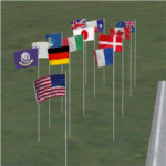
This scenery addon has been developed on Win 7 for FSX Flight Simulator SP1 or SP2. It has also been tested with Microsoft Acceleration, but compatibility is not guaranteed by the author.
The package provides a little collection of animated flags for scenery designers and FS users who do understand the handling of folders and files for FSX. The animated flag models have been developed with GMAX. Along with the textures the package includes the model (mdl) and bgl files. The XML files for the individual placement of a flag into a FSX scenery are included as well.
The documentation contains a step by step description on how to place the flag into the FSX scenery, on a position of your choice. In order to paint your own individual animated flag, the Appendix B of the documentation describes in detail on how to do it. However, a basic experience on how to work with graphical tools like Photoshop, GIMP, Paint Shop Pro etc. is required to paint the extures/colors for a new flag. For credits look at the pdf documentation inside the zip file. By Dietmar Loleit
| Filename: | Animated_Flags.zip |
| License: | Freeware |
| Added: | 17th October 2014, 22:59:25 |
| Downloads: | 662 |
| Author: | Dietmar Loleit |
| Size: | 5.98 MB |
| Category: Flight Simulator 2004 - Scenery | |
| CYCQ - Chetwynd - British Columbia, Canada |
|
Images related to this file:
File Description:
The town of Chetwynd (population around 2,600) is on the east side of the Rocky Mountains, the first town to be encountered when descending from the Rockies on highway 97. Previously known as Little Prairie, the town name was changed in 1962. The main occupations of the town are linked to forestry, fossil fuels, and transportation; there are railway lines north to Fort St John, east to Dawson Creek, and south to Prince George. The airport is on the southern side of the town, with one runway aligned 05-23, asphalted in 1975 and just under 4,500 feet long. There are no scheduled services, although a new terminal building was constructed in 2008, and the helicopter operations by at least two companies (oil and gas and medical evacuation flights) are the primary operations from the field. These are included in the AI, incorporating helicopter modifications made by Holger Sandmann so that they function properly as AI at an airfield. As an aside, landing like a plane and using the runway and taxiways is in fact exactly what a helicopter does at a normal airfield in real life; everyone does the same thing so that guessing is unneccesary.
| Filename: | CYCQ__Chetwynd__British_Columbia_Canada.zip |
| License: | Freeware, limited distribution |
| Added: | 28th March 2016, 21:36:33 |
| Downloads: | 301 |
| Author: | Roger Wensley |
| Size: | 18.84 MB |
| Category: Flight Simulator X - Scenery | |
| HALA - Hawassa Intl. - Hawassa, Ethiopia |
|
Images related to this file:
File Description:
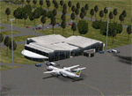
This project adds the booming city of Hawassa, Ethiopia, creates the new international airport (HALA), moves (and rebuilds) the downtown airport (recoded to HALX), and includes AI flight plans for the Ethiopian Airlines service that began April 2016. Tested in both the default FSX: Acceleration and with FTX Global/Vector, accurate coastlines, lakes, road data, and SRTMGL1 (30m) mesh, as well as corrected landclass are provided based on the latest available satellite imagery. The Hawassa International Airport was created using information from the current satellite footprint and the promotional video from Ethiopian Airports Enterprise (EAE). Although there is still very little published data on the airport, it is fully functional.
Updates were created or rebuilt in a manner which carefully aligns airport data with current satellite imagery. Scenery was created using Airport Design Editor X v1.70.6042, SBuilderX 3.13, and the FSX Object Placement Tool. Scenery objects were added and modified from stock FSX scenery to resemble as closely as possible the actual airports. The FSX apron lights included are from the set created by Jim Dhaenens. Thanks to Ron Blehm for bringing this part of the world to my attention.
| Filename: | HALA__Hawassa_Intl___Hawassa_Ethiopia.zip |
| License: | Freeware |
| Added: | 20th July 2016, 09:06:40 |
| Downloads: | 1,022 |
| Author: | Carlyle Sharpe |
| Size: | 10.41 MB |
| Category: Flight Simulator X - Aircraft Repaints, Textures and Modifications | |
| North American P-51D 4th FG WD-A, WD-B & WD-M |
|
Images related to this file:
File Description:

This folder contains three repaints for the Warbirdsim P-51D Little Friends package, in the colors of 3 P-51D's of the 335th FS, 4th FG, based in Debden, UK, in March 1945. Included are:
P-51D-20NA 44-63166 "Ridge Runner II", the second aircraft called Ridge Runner flown by Major Pierce W. McKennon. This was the aircraft in which he was shot down near Neubrandenburg on the 18th of March 1945. Captain George Green landed in a field and picked up his CO in his aircraft WD-M, and both flew back to the UK.;
P-51D-10NA 44-14557 "The Duchess", the aircraft of Major William O'Donnell
P-51D-20NA 44-6373 "Suzon", the aircraft of Captain George D. Green. He was flying this aircraft on 18 March 1945 when he saw his CO, Maj. McKennon bail out near Neubrandenburg and land in a field. He landed his aircraft in the field as well, threw out his parachute, and both pilots squeezed in the cockpit, took off and flew back to the UK.
Repaint by Jan Kees Blom, based on the paintkit by Warbirdsim.
| Filename: | North_American_P51D_4th_FG_WDA_WDB__WDM.zip |
| License: | Freeware |
| Added: | 27th July 2018, 16:02:45 |
| Downloads: | 77 |
| Author: | Jan Kees Blom |
| Size: | 42.21 MB |
| Category: Flight Simulator 2004 - Scenery | |
| Buckland PABL in Alaska |
|
Images related to this file:
File Description:
Buckland is a village on a small river, around 45 miles east of Deering and 15 miles inland from the river mouth. Like Deering, the population of 420 live from fishing and the land. The airfield is close by and has a gravel runway aligned 10-24 and 3,300 feet long with VASI at both ends. Apart from the airfield itself, and it's buildings, this scenery modifies the local (mostly treeless) land class, adds village buildings while reducing the village size to reality, and creates a new airfield background. Bering Air flies into Buckland from Kotzebue and is included in the AI. A note here about my scenery making. This is post number 505 and there will not be many more to follow this as I am almost at the end of the photos I either took or found for scenery purposes. There is a limit to what can be located online and I have already been making use of the little there is; eg Unalakleet. So, if you are near an airport (preferably Canadian or Alaskan) and have a camera..... Let me know.
| Filename: | Buckland_PABL_in_Alaska.zip |
| License: | Freeware, limited distribution |
| Added: | 10th August 2019, 18:51:45 |
| Downloads: | 147 |
| Author: | Roger Wensley |
| Size: | 4.11 MB |
| Category: Flight Simulator X - Scenery | |
| East Coast Victoria v2 for ORBX v2 YLKE Lakes Entrance YGRL Great Lakes Airport YORB Orbost YMCO Mallacoota |
|
Images related to this file:
File Description:
'East Coast Victoria v2' is made to match ORBX Australia v2 scenery. For ORBX v1 or no ORBX use 'East Coast Victoria'. There are 4 airports. YLKE Lakes Entrance YGRL Great Lakes Airport YORB Orbost YMCO Mallacoota. ORBX has done 2 of these (YORB, YMCO) as they have done every airport included with FSX in Australia to a reasonable standard. If I had not already done them for ORBX V1 I would not have bothered. However these are better than ORBX because the surroundings have been modified to match real life. Towns have been added or shifted. Forests cut down or added. There are also custom accurate versions of the terminal buildings. Included is an AI traffic files that covers the airports (little or no traffic from ORBX). In short a lot more time spent by me as I did not have to do every airport in Australia! These files are for Flight Simulator X. Made using Airport Design Editor using some objects borrowed from Robert Budd's excellent Baccus Marsh. REQUIRED The scenery is designed to interface with ORBX FTX_AU V2 scenery for Australia (payware).
| Filename: | East_Coast_Victoria_v2____for_ORBX_v2____YLKE_Lake.zip |
| License: | Freeware |
| Added: | 16th September 2019, 16:27:48 |
| Downloads: | 393 |
| Author: | Colin Jeffery |
| Size: | 6.32 MB |


© 2001-2026 AVSIM Online
All Rights Reserved
Privacy Policy |