
Where Flight Simulation Enthusiasts Gather from Around the World!
AVSIM Library - Search Results

| Category: Flight Simulator 2002 - Scenery | |
| Alaskan Commuter #9: North Alaskan Skies 2002 |

|
File Description:
Enhancements to 50 land-based airports in Northern Alaska. Includes static aircraft and additional airport structures as well as easy to install landclass files. These landclass files add small villages and stands of conifers that blanket the surrounding areas. The experience can be further enhanced with autogen tree replacements by either Ed Truthan or Gerrish Gray (download separately). This will greatly improve the look of autogen conifers, and multiply their numbers significantly. The results are realistic approaches over thickly forested areas into bush airports with small nearby communities, and it is fairly gentle on frame rates. If you download this scenery, and if you are not using these replacement trees, I recommend (no, I insist) that you download one of those utilities now. Look for "conifers.zip" by Ed Truthan or "MSTrees2.zip" by Gerrish Gray.
| Filename: | Alaskan_Commuter_9___North_Alaskan_Skies_2002.zip |
| License: | Freeware |
| Added: | 6th November 2002, 20:16:43 |
| Downloads: | 6,543 |
| Author: | Dave Erickson |
| Size: | 8.04 MB |
| Category: Flight Simulator X - Scenery | |
| EGHA Compton Abbas |
|
File Description:
All additional Buildings were placed using default objects.
AI traffic uses default aircraft which was scheduled by hand using the TrafficDatabaseBuilder from the SDK tools provided by FSX Deluxe.
Any additional roads and modified Landclass & water features were created using FSX-KML.
This package adds the apron , Hangars, clubhouse and the fueling station has been moved to the correct spot between the hangars.
Some of the local roads have been added to allow road access to the airfield.
The main wooded areas have been added to the North and south of the airfield and cropland defined surrounding the immediate area although FSX insists on putting trees on some steeper slopes.
I have also included 3 of the villages nearby , Compton Abbas, Ashmore and Fontmell Magna .
It also provides parking spots and ATC interaction along with some AI traffic.
Hope you like it :)
| Filename: | EGHA_Compton_Abbas.zip |
| License: | Freeware, limited distribution |
| Added: | 1st October 2007, 17:08:37 |
| Downloads: | 1,887 |
| Author: | Len Hickman |
| Size: | 17.45 KB |
| Category: Flight Simulator X - Scenery | |
| Catalunya Coast V1.0 |
|
File Description:
Catalonia is with Barcelona, the Costa Brava and many other places and sights
a popular tourist aim primarily for European.
The standard scenery of FSX in Spain and therefore also Catalonia has been improved strongly.
But there are areas which urgently required a revision, though.
So the shoreline was modelled by Catalonia only roughly (see the pictorial material).
In addition, many coastal places etc. are missing in the standard.
With this scenery expansion which will contain the whole Catalonia in the final construction stage,
the coast of Catalonia has been improved in a first step.
The following has been done:
- correction of the complete coastal line of Catalonia
- insert of 61 towns and villages along the coast
- insert of 123 beaches
- insert of 59 ports/marinas with landing stages and ships
- modification of offshore landscapes
- inking the offshore sea zones
| Filename: | Catalunya_Coast_V10.zip |
| License: | Freeware, limited distribution |
| Added: | 11th February 2007, 15:14:11 |
| Downloads: | 7,272 |
| Author: | Bodo Hesse |
| Size: | 1.68 MB |
| Category: Flight Simulator 2004 - Scenery | |
| Alaska North Slope 3: Atqasuk (PATQ) |
|
Images related to this file:
File Description:
The town of Barrow is in the far north of Alaska, and these are coastal villages or radar installations to the west and south of Barrow. There will be further additions. Atqasuk PATQ is 55 miles south of Barrow and is unusual in that it is one of the few settlements of the North Slope that is not on the coast. It is, however, on a narrow winding river that reaches the sea to the east of Barrow and seemingly provides fish in abundance. There could well be other good reasons for the village to be where it is, but they are unknown to me. The population is around 250. The airfield is to the south of the village and the runway is 4,900 feet of gravel aligned 06-24, lit, and with PAPI at each end.
| Filename: | Alaska_North_Slope_3_Atqasuk_PATQ.zip |
| License: | Freeware, limited distribution |
| Added: | 17th June 2016, 08:54:55 |
| Downloads: | 234 |
| Author: | Roger Wensley |
| Size: | 2.35 MB |
| Category: Flight Simulator 2004 - Scenery | |
| 8AK7 - Bullen Point - Alaska North Slope 7 |
|
Images related to this file:
File Description:
The town of Barrow is in the far north of Alaska, and these are coastal villages or radar installations to the west, south, and now east of Barrow. There will be further additions. Bullen Point is a DEW station Air Force base 240 miles east of Barrow and 75 miles east of Oliktok. The runway is just under 4,000 feet of gravel and aligned 05-23; this is approximately at right angles to the default FS9 alignment and how that came about is something I doubt Bill Gates could explain. Most of the DEW buildings have now been removed (including the large hangar, which is unusual) but as I had a layout I made the whole site as it was originally, way back in the days when the north slope was still a wilderness. The AI is one day a C-130, on another a Cessna, and on a third a DC3. When I started this North Slope series it was my intention to create the full monty and make all the oil and gas installations and Deadhorse airport etc. I have come to realise that the oil side is impossible to make. There is so much of it and each bit is as time consuming as Heathrow while the actual airfields are more like Rockcliffe CYRO, so a lot of effort for what is just background to an adjoining airfield. But at the same time, if I make the new airstrips it is impossible NOT to make the oil installations as they are the dominating feature. So no new airstrips, and this is going to be just the 1960's or 1970's, when the oil business was only exploratory and the airfields were for villages or DEW stations, and Harmon Helmerick had his dirt strip on the Colville River estuary and was guiding hunters and fishermen and had just started to help out Sinclair Oil with oil exploration in 1966. Read his book. Download my previous post of his field.
| Filename: | 8AK7__Bullen_Point__Alaska_North_Slope_7.zip |
| License: | Freeware, limited distribution |
| Added: | 15th July 2016, 17:46:54 |
| Downloads: | 278 |
| Author: | Roger Wensley |
| Size: | 2.5 MB |
| Category: Flight Simulator 2004 - Scenery | |
| Airports Northern Coast Alaska (PALU, PPIZ, PAWI, AK03) |
|
Images related to this file:
File Description:
The town of Barrow is in the far north of Alaska, and these are coastal villages or radar installations to the west of Barrow, and there will be additions. Cape Lisburne is a gravel runway right next to the coast with radar gear and accomodation buildings close by, and what was called "Top Camp" at the end of a long and steep road to the top of a nearby hill, or mountain. The runway is lit, as are most of them in this area of long dark winter nights. Barrow is 270 miles to the northeast. Point Lay PPIZ used to have a radar installation as well as a village, but the old buildings have now been removed and the gravel runway 05-23 has been lengthened to 5,000 feet to serve the village throughout the year. The population is around 270, living mostly traditionally and with an annual beluga whale hunt. Barrow is 180 miles to the northeast.
Wainwright PAWI, some 80 miles southwest of Barrow and on the coast, has a population of around 570. The PAWI runway is just under 5,000 feet long and like PPIZ is aligned 05-23, lit, and with PAPI on each end. The original runway of some 2,000 feet is still visible next to the apron. Three miles to the southeast there is a third runway, at AK03, serving the Wainwright DEW station. It was decided in 2007 to close the station and to remove the buildings both there and at Point Lay because of subsidence, but everything at Wainwright was still in place in 2009 and beyond. The villages have been "sketched" as opposed to replicated exactly. The texture folder includes the missing car textures for Barrow PABR, and the AI is modified PABR to include passenger flights by Ravn and cargo flights by Northern Air Cargo, plus limited GA. There are no flattened grassed areas at these airfields; they are runways and taxiways and aprons on a bed of gravel on permafrost.
| Filename: | Airports_Northern_Coast_Alaska_PALU_PPIZ_PAWI_AK03.zip |
| License: | Freeware, limited distribution |
| Added: | 16th June 2016, 15:59:24 |
| Downloads: | 360 |
| Author: | Roger Wensley |
| Size: | 10.84 MB |
| Category: Flight Simulator 2004 - Scenery | |
| Canlaon Volcano Eruption Scenery |
|
File Description:
Canlaon Volcano is located at the center of Negros Island,Philippines.The twin-peaked massif of Canlaon Volcano (aka Mt. Kanlaon) rises 2,465 meters above the island of Negros just 40-km southwest of the capital Bacolod.This file will add the crater to Canlaon Volcano and will enhance the Landclass surrounding the crater.The crater is real with water.This also adds Visual Effects such as steam,volcanic ashes and lava that will erupt every now and then.Ash falls will fall in the vulnerable surrounding villages of Pula, Malaiba, and Lumanao.The last volcanic activity of Canlaon Volcano recorded by Phivolcs was on June 1-18,2003.
Fly from Bacolod City(RPVB)to Tagbilaran City(RPVT)or Mactan(RPVM) and pass through the highest point of the Island of Negros and behold the beauty of the Canlaon Volcano eruption.
Special steam,ash,and lava effects are visible at daytime and at nighttime.The new Philippine Mesh by Jacques Marie is recommended for achieving realistic topography.You may find it here at avsim,too.
| Filename: | Canlaon_Volcano_Eruption_Scenery.zip |
| License: | Freeware |
| Added: | 10th December 2003, 22:41:38 |
| Downloads: | 3,877 |
| Author: | Ver Walter L. Gulfan |
| Size: | 5.04 KB |
| Category: Flight Simulator 2004 - Scenery | |
| Whale Cove CYXN in Hudson Bay, Nunavut, Canada |
|
Images related to this file:
File Description:
Whale Cove is a small village with 300 or so inhabitants at N62 W92 on the west shore of Hudson Bay, 40 miles south of the large airport at Rankin Inlet. The village does not feature in FS9, so the first thing to do was to add it; not all the smaller streets are in place but it is the right shape.
I also had to add the roads, delete the stock airfield background, and add a new background. Plus, although the village isn't near the airfield I thought that if the place is called Whale Cove then the least I could do was create the cove, so there is also "whaleWATER" and "whalecoastDELETE", plus of course the scenery file and the AFCAD and AI.
NOTE: If you have had a problem with textures not showing up in the villages in these northern sceneries there is a note on how to fix it.
| Filename: | Whale_Cove_CYXN_in_Hudson_Bay_Nunavut_Canada.zip |
| License: | Freeware, limited distribution |
| Added: | 15th October 2010, 20:48:12 |
| Downloads: | 419 |
| Author: | roger Wensley |
| Size: | 1.19 MB |
| Category: Prepar3D V1-4 - Aircraft Repaints, Textures and Modifications | |
| "JAARS" Pilatus PC-6 Porter |
|
Images related to this file:
File Description:
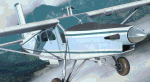
The repaint (textures only) for Milviz Pilatus PC-6 Porter B2-H4 model (payware addon for P3Dv4.4+). You need to have this great model of this legendary PC-6 plane. The repaint of Porter PK-UCF of JAARS organization. In aviation, JAARS helps its field partners start and run local aviation programs. This help comes in the form of training staff, setting standards, equipping aircraft, research, and more. In turn, these partners provide a range of transportation services to a variety of people, including translators, support personnel, consultants, trainers, linguists, Christian mission organizations, hospitals, local people and governments. These services can also include medical evacuations and disaster relief work. The real plane is used in JAARS Indonesia / West Papua - because airplanes are the only safe way to reach many isolated villages and communities in Indonesia. Textures set (outside and inside) was  tested in P3Dv4.5 HT2. The package contains external textures, many tweaks and improvements and interior modifications.
| Filename: | JAARS_Pilatus_PC6_Porter.zip |
| License: | Freeware, limited distribution |
| Added: | 4th April 2020, 16:53:12 |
| Downloads: | 264 |
| Author: | Rafal Stankiewicz / yoyosims |
| Size: | 76.61 MB |
| Category: Flight Simulator 2004 - Scenery | |
| Sioux Lookout CYXL in northwest Ontario Canada |
|
File Description:
Sioux Lookout is a small town of some 5,000 folks in northwest Ontario, towards the Manitoba border, and a regional centre for surrounding villages. The airfield is some two miles east of the town. It originally had two runways but the smaller was abandoned recently as part of a planned long term improvement of the field, leaving just 34/16 with its 5,300 feeet of asphalt. Both Wasaya and Bearskin fly to Sioux Lookout; on the field there are two maintenance companies, Eagle and Allen, and hangers for the Ministry of Health, Bearskin Airlines, Wasaya, and the Nishnawbe Aski Police Service (NAPS). I think there is now another company too, but I have no information on them so I pretended this was two years ago. As well as the airfield scenery there is also a landclass file an "AFCAD" file for your AI aircraft. You should also download and install Northwest Ontario Airports by Eric O'Link, and preferably also have Ultimate Terrain; I have not tested this without UT and there is a small lake nearby.
| Filename: | Sioux_Lookout_CYXL_in_northwest_Ontario_Canada.zip |
| License: | Freeware |
| Added: | 26th November 2008, 13:08:04 |
| Downloads: | 853 |
| Author: | Roger Wensley |
| Size: | 2.66 MB |


© 2001-2026 AVSIM Online
All Rights Reserved
Privacy Policy |