
Where Flight Simulation Enthusiasts Gather from Around the World!
AVSIM Library - Search Results

| Category: Flight Simulator 2004 - AFCAD Files | |
| King Khalid AB, Khamis Mushait, Saudi Arabia (OEKM) |

|
File Description:
King Khalid AB, Khamis Mushait, Saudi Arabia (OEKM) for Microsoft default scenery only. This airport is located in mountainous terrain, in the southwest corner of the country, not far from both the Red Sea coast and the border with Yemen. No material changes were made to the stock airport layout as the ramps and taxiway network were already complete and free of errors. I have added 78 parking spaces:- 23 GA; 26 Mil_combat; 10 BBJ; 8 Gate Small; 3 Gate Medium; 2 Gate Heavy; 4 Mil_Cargo; 2 Civilian cargo. Parking code settings are for SVA, SVAV, BBJ, M000-M003. At the time of writing, scheduled airlines fly to nearby Abha airport. If you use Ed Kooymans' AI flightplans then you will see some AI activity at Khamis. Flights from OEKM direct to OETB overfly Jeddah en route but, when writing your own flightplans, note that the elevation of OEKM is 6778' and local terrain is higher still.
| Filename: | King_Khalid_AB_Khamis_Mushait_Saudi_Arabia_OEKM.zip |
| License: | Freeware, limited distribution |
| Added: | 1st September 2006, 20:08:31 |
| Downloads: | 990 |
| Author: | Mark S. Cherry |
| Size: | 9.38 KB |
| Category: Civil Flight Simulators - Looking Glass Flight Unlimited 3 | |
| SanFran expansion Toolkit |
|
File Description:
Conversion of the SanFran Region from .cpd to .bin for FU3 This experimental toolkit is for region builders, its not a new full game ! If you want expand the region with new material to the north and the east then conversion to .bin is a must. Do not convert if you don't plan to expand or modify texture of the tiles. Then the only results are a larger game folder :-( The quality of the original tiles will not change ! The SanFran region is converted from 10x11 tiles area into a 16x16 tiles area but no new tiles are made north or east as sample, so a lot of tiles are then still missing and replaced by the blank tile (new full water tile). Elevation is not touched by this installation. After conversion you can use aireal pictures from map services to upgrade somes tiles of this area or even create new for the north-east.
| Filename: | SanFran_expansion_Toolkit.zip |
| License: | Freeware, limited distribution |
| Added: | 22nd February 2009, 02:13:43 |
| Downloads: | 58 |
| Author: | André Meystre |
| Size: | 540.28 KB |
| Category: Flight Simulator 2004 - Scenery | |
| Skysoft Simulation - ZUJZ_2011 |
|
Images related to this file:
File Description:
Jiuzhai Huanglong Airport (ICAO: ZUJZ, IATA: JZH) situated at the famous tourist
spot Jiuzhaigou in Sichuan Province, China, where is the home of pandas. With an
elevation of 3448m, it is one of the highest airports in China as well as in the world.
While enjoying the breathtaking landscape around you, you should always be cautious
about the severe turbulence and intense crosswind whenever departure or arriving the
airport. The airport was constructed in the year 2003 with a runway length 3400 meters
(11 056 ft.) and width 60 meters (147 ft.).
In the year 2007, the airport has been expanded. The runway was extended by 200
meters (650 ft.) and 7 parking gates were added. Now the airport is capable for
medium jets to takeoff and landing. Certification needed in both airplanes as well as the
crews before executing takeoff or landing on the airport. It is expected that in the year
2015, the average number of flights everyday could increased to about 100.
| Filename: | Skysoft_Simulation__ZUJZ_2011.zip |
| License: | Freeware, limited distribution |
| Added: | 1st April 2011, 15:36:44 |
| Downloads: | 2,907 |
| Author: | Skysoft Simulation DevelopTeam |
| Size: | 24.48 MB |
| Category: Flight Simulator 2004 - Scenery | |
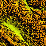
| "Himalayan Peaks" LOD10 Mesh, Volume 4 - Annapurna |
|
Images related to this file:
File Description:

Highly detailed terrain mesh of the Annapurna area, N28-30 E83-85. The files in this package are based on Shuttle Radar (SRTM) Version 2 data but with many of the void areas, especially the most significant sections, filled with elevation data generated from topographic maps by Jonathan de Ferranti. While Jonathan's work is unrelated to flight simulation he kindly gave me permission to compile his data for use in FS. The result is a wonderful improvement in detail and accuracy over any existing mesh file, freeware or commercial, based on SRTM or DTED data alone.
Due to the large area of the Himalayas I've compiled the source data as two separate series: the "Himalayan Peaks" series covers prominent mountains and ranges in higher detail and locally overrides any existing LOD9 terrain mesh. In addition, a LOD9 "base mesh" series covering the entire Himalayas will be available for those who do not yet have an add-on terrain mesh of these beautiful mountains.
| Filename: | Himalayan_Peaks_LOD10_Mesh_Volume_4__Annapurna.zip |
| License: | Freeware, limited distribution |
| Added: | 29th May 2010, 08:59:29 |
| Downloads: | 10,459 |
| Author: | Holger Sandmann, Jonathan de Ferranti |
| Size: | 15.07 MB |
| Category: Flight Simulator 2004 - Scenery | |
| "Himalayan Peaks" LOD10 Mesh, Volume 7 - K2 and Karakoram |
|
Images related to this file:
File Description:

Highly detailed terrain mesh of the Karakoram area, N35-37 E73-77. The files in this package are based on Shuttle Radar (SRTM) Version 2 data but with many of the void areas, especially the most significant sections, filled with elevation data generated from topographic maps by Jonathan de Ferranti. While Jonathan's work is unrelated to flight simulation he kindly gave me permission to compile his data for use in FS. The result is a wonderful improvement in detail and accuracy over any existing mesh file, freeware or commercial, based on SRTM or DTED data alone.
Due to the large area of the Himalayas I've compiled the source data as two separate series: the "Himalayan Peaks" series covers prominent mountains and ranges in higher detail and locally overrides any existing LOD9 terrain mesh. In addition, a LOD9 "base mesh" series covering the entire Himalayas will be available for those who do not yet have an add-on terrain mesh of these beautiful mountains.
| Filename: | Himalayan_Peaks_LOD10_Mesh_Volume_7__K2_and_Karako.zip |
| License: | Freeware, limited distribution |
| Added: | 30th May 2010, 09:56:27 |
| Downloads: | 9,473 |
| Author: | Holger Sandmann, Jonathan de Ferranti |
| Size: | 38.58 MB |
| Category: Flight Simulator 2004 - Scenery | |
| "Himalayan Peaks" LOD10 Mesh, Volume 6 - Jammu and Kashmir |
|
Images related to this file:
File Description:
Highly detailed terrain mesh of the Jammu and Kashmir areas, N31-36 E76-78. The files in this package are based on Shuttle Radar (SRTM) Version 2 data but with many of the void areas, especially the most significant sections, filled with elevation data generated from topographic maps by Jonathan de Ferranti. While Jonathan's work is unrelated to flight simulation he kindly gave me permission to compile his data for use in FS. The result is a wonderful improvement in detail and accuracy over any existing mesh file, freeware or commercial, based on SRTM or DTED data alone.
Due to the large area of the Himalayas I've compiled the source data as two separate series: the "Himalayan Peaks" series covers prominent mountains and ranges in higher detail and locally overrides any existing LOD9 terrain mesh. In addition, a LOD9 "base mesh" series covering the entire Himalayas will be available for those who do not yet have an add-on terrain mesh of these beautiful mountains.
| Filename: | Himalayan_Peaks_LOD10_Mesh_Volume_6__Jammu_and_Kas.zip |
| License: | Freeware, limited distribution |
| Added: | 29th May 2010, 08:55:43 |
| Downloads: | 9,661 |
| Author: | Holger Sandmann, Jonathan de Ferranti |
| Size: | 52.19 MB |
| Category: Flight Simulator 2004 - Scenery | |
| "Himalayan Peaks" LOD10 Mesh, Volume 5 - Garhwal |
|
File Description:
Highly detailed terrain mesh of the Garhwal area, N30°-32° E78°-81°. The files in this package are based on Shuttle Radar (SRTM) Version 2 data but with many of the void areas, especially the most significant sections, filled with elevation data generated from topographic maps by Jonathan de Ferranti. While Jonathan's work is unrelated to flight simulation he kindly gave me permission to compile his data for use in FS. The result is a wonderful improvement in detail and accuracy over any existing mesh file, freeware or commercial, based on SRTM or DTED data alone. Due to the large area of the Himalayas I've compiled the source data as two separate series: the "Himalayan Peaks" series covers prominent mountains and ranges in higher detail and locally overrides any existing LOD9 terrain mesh. In addition, a LOD9 "base mesh" series covering the entire Himalayas will be available for those who do not yet have an add-on terrain mesh of these beautiful mountains.
| Filename: | Himalayan_Peaks_LOD10_Mesh_Volume_5__Garhwal.zip |
| License: | Freeware, limited distribution |
| Added: | 18th February 2006, 23:16:47 |
| Downloads: | 10,130 |
| Author: | Holger Sandmann and Jonathan de Ferranti |
| Size: | 27.72 MB |
| Category: Flight Simulator 2004 - Scenery | |
| "Himalayan Peaks" LOD10 Mesh, Volume 3 - Namcha Barwa |
|
File Description:
Highly detailed terrain mesh of the Namcha Barwa area, N29°-31° E94°-96°. The files in this package are based on Shuttle Radar (SRTM) Version 2 data but with many of the void areas, especially the most significant sections, filled with elevation data generated from topographic maps by Jonathan de Ferranti. While Jonathan's work is unrelated to flight simulation he kindly gave me permission to compile his data for use in FS. The result is a wonderful improvement in detail and accuracy over any existing mesh file, freeware or commercial, based on SRTM or DTED data alone. Due to the large area of the Himalayas I've compiled the source data as two separate series: the "Himalayan Peaks" series covers prominent mountains and ranges in higher detail and locally overrides any existing LOD9 terrain mesh. In addition, a LOD9 "base mesh" series covering the entire Himalayas will be available for those who do not yet have an add-on terrain mesh of these beautiful mountains.
| Filename: | Himalayan_Peaks_LOD10_Mesh_Volume_3__Namcha_Barwa.zip |
| License: | Freeware, limited distribution |
| Added: | 18th February 2006, 23:15:17 |
| Downloads: | 12,184 |
| Author: | Holger Sandmann and Jonathan de Ferranti |
| Size: | 15.09 MB |
| Category: Flight Simulator 2004 - Scenery | |
| Himalayan Peaks LOD10 Mesh, Volume 1 - Mt. Everest and Kula Kangri |
|
File Description:
Highly detailed terrain mesh of the Mt. Everest and Kula Kangri areas, N26°-29° E85°-92°. The files in this package are based on Shuttle Radar (SRTM) Version 2 data but with many of the void areas, especially the most significant sections, filled with elevation data generated from topographic maps by Jonathan de Ferranti. While Jonathan's work is unrelated to flight simulation he kindly gave me permission to compile his data for use in FS. The result is a wonderful improvement in detail and accuracy over any existing mesh file, freeware or commercial, based on SRTM or DTED data alone. Due to the large area of the Himalayas I've compiled the source data as two separate series: the "Himalayan Peaks" series covers prominent mountains and ranges in higher detail and locally overrides any existing LOD9 terrain mesh. In addition, a LOD9 "base mesh" series covering the entire Himalayas will be available for those who do not yet have an add-on terrain mesh of these beautiful mountains.
| Filename: | Himalayan_Peaks_LOD10_Mesh_Volume_1__Mt_Everest_an.zip |
| License: | Freeware, limited distribution |
| Added: | 9th February 2006, 22:13:00 |
| Downloads: | 37,041 |
| Author: | Holger Sandmann and Jonathan de Ferranti |
| Size: | 52.01 MB |
| Category: Flight Simulator 2004 - Scenery | |
| CWCP - Cape Parry - Northwest Territories, Canada |
|
Images related to this file:
File Description:
This is a DEW line Main Station on the shore of the Canadian mainland at the far northern tip of Cape Parry. It is 60 miles north of Paulatuk, which is at the base of the Parry Peninsula, and 120 miles south of Sachs Harbour on Banks Island. The station ceased operations in 1989 and a North Warning System automated station was opened in the same year; the NWS station is not shown in this scenery as I have no information regarding it's location or layout. The runway is just over 5,000 feet of gravel 150 feet wide, aligned 037T at an elevation of 119 feet ASL. There is a large apron with a large hangar and a small shelter building for passengers. There are of course no lights, signage, or windsock. The station is up on the hill at 210 feet ASL. This is one of the more interesting stations in terms of size and complexity.
| Filename: | CWCP__Cape_Parry__Northwest_Territories_Canada.zip |
| License: | Freeware, limited distribution |
| Added: | 25th December 2012, 19:07:24 |
| Downloads: | 302 |
| Author: | Roger Wensley |
| Size: | 1.61 MB |
© 2001-2026 AVSIM Online
All Rights Reserved
Privacy Policy |