
Where Flight Simulation Enthusiasts Gather from Around the World!
AVSIM Library - Search Results

| Category: Flight Simulator 2004 - Scenery | |
| New Terrain Mesh of the Province of Quebec in LOD09 (2/4) |

|
File Description:
The files in this package contain terrain mesh files of the province of Quebec (N45 to N53) to be used with my Quebec enhanced sceneries for FS2004 (Scenes_du_Quebec_2k4.zip). The public data sources are the Shuttle Radar Topography Mission (SRTM-3, 90m) and the Canadian Digital Elevation Data (CDED - 0.75s/arc - 23m). (QC09_2k4a.zip to QC09_2k4d.zip - 4 parts)
***********************
Les fichiers de ces archives contiennent les donnees d'elevation de terrain (mesh files - lod09), pour FS2004, du territoire de la province de Quebec sous le 53ieme degre de latitude nord. Ils ont ete crees pour etre utilises avec mes nouvelles scenes du Quebec contenues dans Scenes_du_Quebec_2k4.zip. Les donnees sources sont du domaine public et proviennent de la Shuttle Radar Topography Mission (SRTM-3, 90m) et des donnees numerique d'elevation du Canada (DNEC - 0.75s/arc -23 m). (QC09_2k4a.zip to QC09_2k4d.zip - 4 parties)
| Filename: | New_Terrain_Mesh_of_the_Province_of_Quebec_in_LOD0.zip |
| License: | Freeware, limited distribution |
| Added: | 1st November 2009, 06:47:09 |
| Downloads: | 4,627 |
| Author: | Gilles Gauthier |
| Size: | 27.78 MB |
| Category: Flight Simulator 2004 - Scenery | |
| New Terrain Mesh of the Province of Quebec in LOD09 (3/4) |
|
File Description:
The files in this package contain terrain mesh files of the province of Quebec (N45 to N53) to be used with my Quebec enhanced sceneries for FS2004 (Scenes_du_Quebec_2k4.zip). The public data sources are the Shuttle Radar Topography Mission (SRTM-3, 90m) and the Canadian Digital Elevation Data (CDED - 0.75s/arc - 23m). (QC09_2k4a.zip to QC09_2k4d.zip - 4 parts)
***********************
Les fichiers de ces archives contiennent les donnees d'elevation de terrain (mesh files - lod09), pour FS2004, du territoire de la province de Quebec sous le 53ieme degre de latitude nord. Ils ont ete crees pour etre utilises avec mes nouvelles scenes du Quebec contenues dans Scenes_du_Quebec_2k4.zip. Les donnees sources sont du domaine public et proviennent de la Shuttle Radar Topography Mission (SRTM-3, 90m) et des donnees numerique d'elevation du Canada (DNEC - 0.75s/arc -23 m). (QC09_2k4a.zip to QC09_2k4d.zip - 4 parties)
| Filename: | New_Terrain_Mesh_of_the_Province_of_Quebec_in_LOD0.zip |
| License: | Freeware, limited distribution |
| Added: | 27th January 2010, 18:15:12 |
| Downloads: | 7,495 |
| Author: | Gilles Gauthier |
| Size: | 29.35 MB |
| Category: Flight Simulator 2004 - Scenery | |
| New Terrain Mesh of the Province of Quebec in LOD09 (4/4) |
|
File Description:
The files in this package contain terrain mesh files of the province of Quebec (N45 to N53) to be used with my Quebec enhanced sceneries for FS2004 (Scenes_du_Quebec_2k4.zip). The public data sources are the Shuttle Radar Topography Mission (SRTM-3, 90m) and the Canadian Digital Elevation Data (CDED - 0.75s/arc - 23m). (QC09_2k4a.zip to QC09_2k4d.zip - 4 parts)
***********************
Les fichiers de ces archives contiennent les donnees d'elevation de terrain (mesh files - lod09), pour FS2004, du territoire de la province de Quebec sous le 53ieme degre de latitude nord. Ils ont ete crees pour etre utilises avec mes nouvelles scenes du Quebec contenues dans Scenes_du_Quebec_2k4.zip. Les donnees sources sont du domaine public et proviennent de la Shuttle Radar Topography Mission (SRTM-3, 90m) et des donnees numerique d'elevation du Canada (DNEC - 0.75s/arc -23 m). (QC09_2k4a.zip to QC09_2k4d.zip - 4 parties)
| Filename: | New_Terrain_Mesh_of_the_Province_of_Quebec_in_LOD0.zip |
| License: | Freeware, limited distribution |
| Added: | 27th January 2010, 18:17:08 |
| Downloads: | 7,854 |
| Author: | Gilles Gauthier |
| Size: | 20.94 MB |
| Category: Flight Simulator 2004 - Scenery | |
| Modified SRTM Relief 76 m for Czech Republic |
|
File Description:
This Czech Republic terrain mesh 76 m (LOD9) is made from the 3arc-sec SRTM. Small voids in the source data were filled by the interpolation. Both the primary processing of the 3arc-sec data and the rendering of the terrain in the FS cause flattening and simplifying of the real shape of the terrain. This phenomenon was partially compensated by the sharpening of the source data. Made by the programs Surfer (Golden Software) and MS Terrain SDK 2000 and 2002. The relief covers the area N51.1523 E011.9531 to N48.5156 E018.9844 in the boundaries of the LOD9 quadrants. This scenery contains only the elevation data. The other elements of the basic terrain as the landclass, locally used airborne photos, vector roads, rivers and lakes are available in different sceneries by other authors and they are continuously developed.
| Filename: | Modified_SRTM_Relief_76_m_for_Czech_Republic.zip |
| License: | Freeware |
| Added: | 22nd December 2003, 21:25:07 |
| Downloads: | 6,720 |
| Author: | Vladimir Stoje |
| Size: | 20.81 MB |
| Category: Flight Simulator 2004 - Scenery | |
| EZ Scenery Cass Field (00CO) |
|
File Description:
FS2004 EZ Scenery CASS FIELD (00CO)
Briggsdale Colorado and surrounding parts of Eastern Co are well known for seeds. Seeds of almost any
kind imaginable like flowers, potatoes, bird seed and the list goes on and on. It is most always windy for there are no trees to slow the flow. Hot & windy in summer, cold and windy in winter and no natural enviromnent to harm plant growth. You can see the mountains to the west and more desolation to the east. A lonely place to drive through but rich in good people and seeds harvested for the world.
Area outside of airport's default flatten area require FS Global or Abasus extreme landscapes for elevation data. Download FREE library of RWY12 - EZ scenery objects (available on FlightSim.com or AVSIM) for objects. Ultimate Terrain USA for detailed landclass. FSX compatable.
Instructions inside.
jimmy R martin
| Filename: | EZ_Scenery_Cass_Field_00CO.zip |
| License: | Freeware |
| Added: | 6th June 2006, 01:54:47 |
| Downloads: | 619 |
| Author: | jimmy R martin |
| Size: | 255.55 KB |
| Category: Civil Flight Simulators - Looking Glass Flight Unlimited 3 | |
| Flight Unlimited III Seattle Region expansion up to Vancouver |
|
Images related to this file:
File Description:
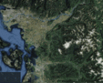
With this zip you get the opportunity to expand the Seattle region of your FU3 flight simulator up to Vancouver. The original region has 100 tiles (10x10) and the new region will hold 180 textured tiles (10x18). After all installation steps are done you will have a low resolution area from Coupeville Nolf up to Vancouver, but still better than OT texture. Everyone who's interested can obtain this set of megatiles with proper elevation and a basic scenery layout each one may take this to a more refined level later. Whether one elects to keep the basic textures or replace them with good orthophotos the terrain is there and new airports can be shared and used by everyone with an expanded high-res region. You will need 6 other files from the AVSIM library to prepare your game for this expansion, see readme file inside workfolder.
| Filename: | Flight_Unlimited_III_Seattle_Region_expansion_up_t.zip |
| License: | Freeware, limited distribution |
| Added: | 27th January 2011, 22:00:03 |
| Downloads: | 162 |
| Author: | Andre Meystre |
| Size: | 95.9 MB |
| Category: Flight Simulator X - Scenery | |
| FIMP - Sir Seewoosagur Ramgoolam Intl - Mauritius *New Terminal & Airport Layout* |
|
Images related to this file:
File Description:

This scenery adds the new terminal and taxiways, and rebuilds the aprons and runway to provide a fully functioning AI traffic extension for runway 14. The airport is assigned a mean elevation, allowing it to blend naturally with the surrounding terrain, and landclass is provided for the entire island. This scenery is most effective when used in combination with "mauritius_fsx.zip" by Max Kraus. This scenery is optimized to fit seamlessly with FTX Global/Vector and should also be fully functional in all FSX configurations. The airport is updated to reflect current satellite imagery and positioning. Scenery was created using Airport Design Editor X v1.61.5298, SBuilderX 3.13, and the FSX Object Placement Tool. Scenery objects were added and modified from stock FSX scenery to resemble as closely as possible the actual airport. The FSX apron lights included are from the set created by Jim Dhaenens.
| Filename: | FIMP__Sir_Seewoosagur_Ramgoolam_Intl__Mauritius_Ne.zip |
| License: | Freeware |
| Added: | 10th July 2015, 16:16:40 |
| Downloads: | 8,784 |
| Author: | Carlyle Sharpe |
| Size: | 5.06 MB |
| Category: Flight Simulator 2004 - Scenery | |
| Dragon Peaks AFB, South Africa |
|
Images related to this file:
File Description:
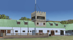
A Gmax representation of Dragon Peaks Air Force Base also referred to as CL van Wyngaard Airfield, South Africa with photoreal textures.
AFB Dragon Peaks is a small airfield nestled between the hills on the slopes of the Northern Drakensberg of South Africa. The airfield is situated only a few hundred meters from the Dragon Peaks Mountain resort as well as the home of the famous Drakensberg Boys Choir.
The grass runway is aligned 06/24 and 458m long and sits at an elevation of 3 986ft.
The scenery consists of 64 square kilometers of photoscenery with variants for all 4 seasons. Almost 1 100 hand placed autogen buildings and more than 32 000 (yes, thirty-two-thousand) hand placed autogen trees makes up the surrounding scenery. At the airfield itself you will find custom made Gmax models of the airfield buildings and structures with photoreal textures.
| Filename: | Dragon_Peaks_AFB_South_Africa.zip |
| License: | Freeware, limited distribution |
| Added: | 9th November 2017, 18:36:39 |
| Downloads: | 462 |
| Author: | kobus van wyk |
| Size: | 19.94 MB |
| Category: Flight Simulator X - Scenery | |
| FNLU Quatro de Fevereiro International Airport |
|
File Description:
Quatro de Fevereiro International Airport (Portuguese: Aeroporto Internacional 4 de Fevereiro), (IATA: LAD, ICAO: FNLU) is the main international airport of Angola. It is located in the southern part of the capital Luanda, situated in
the Luanda Province. Quatro de Fevereiro means 4th February, which is an important national holiday in Angola, marking the start of the armed struggle against the Portuguese colonial regime on 4 February 1961.
In 2009, about 1.8 million passengers were counted.
In the near future, the airport will be replaced by the new Angola International Airport. Construction work has already started, but its opening was postponed due to financial difficulties on the part of the Angolan government, to
later time.
Airport elevation and two runways were corrected also the aprons and buildinds. NOTE ILS in this aiport is not in service currently.
This work is dedicated to West Wind Airlines.
| Filename: | FNLU_Quatro_de_Fevereiro_International_Airport.zip |
| License: | Freeware |
| Added: | 11th June 2013, 15:46:51 |
| Downloads: | 3,270 |
| Author: | Anwar Gonzalez |
| Size: | 24.89 KB |
| Category: Flight Simulator 2004 - Scenery | |
| North Haledon |
|
File Description:
North Haledon is a small town in Northern New Jersey, USA. This is Chopper Friendly scenery, folks. It wasn't designed to be flown over at 10,000 feet - although, if you like to fly heavy iron into the major New York/New Jersey airports, you'll notice that it replaces the terrain elevation of Northern New Jersey with all the hills and valleys that the default scenery left out. No, this is interactive scenery. Built to be explored low and slow. Want to perfect your landing skills in a huge playground of rooftops, irregular terrain, and tight spaces? This is the place. You won't find any unlandable surfaces or false crashes here - just hundreds of places to touch down ranging from beginner, through expert, to downright sick! There's a police station with landable helipad, four schools, ballfields, an optional forest fire (with a scenic lake nearby for refilling), too many highly detailed houses and buildings to count, and much more.
| Filename: | North_Haledon.zip |
| License: | Freeware, limited distribution |
| Added: | 25th April 2006, 02:48:26 |
| Downloads: | 1,924 |
| Author: | Mick Posch |
| Size: | 13.14 MB |
© 2001-2026 AVSIM Online
All Rights Reserved
Privacy Policy |