
Where Flight Simulation Enthusiasts Gather from Around the World!
AVSIM Library - Search Results

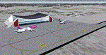
| Category: Flight Simulator X - AFCAD Files | |
| ORER - Erbil International airport - Erbil, Iraq |

|
Images related to this file:
File Description:
ORER - Erbil International Airport, Kurdistan, Iraq. The new airport and terminal building opened on March 3, 2010 and is as such not known in FSX. The airport is built next to the old airport, previously a military field. With its short 2,800 meter runway and temporary terminal buildings, there was a great need for a new airport, not just a new terminal. The new airport has one of the world's longest runways. 4,800 meters long, 75 meters wide and equipped for ILS CAT II operations.
Using ADEx 1.51, aeronautical maps all these changes have been built into the default FSX airport now making it on par with the present situation on paper. Right, on paper! Google Earth's images are too old (2004) to offer any help regarding buildings, vegetation and surrounding areas like offices, parkings and roads. With the help of blurry pictures found on the internet this is the best rendition for now. 99% correct.
For those interested a complete technical overview of the airport including approach plates is included in this package. Please read the readme carefully for proper installation!
| Filename: | ORER__Erbil_International_airport__Erbil_Iraq.zip |
| License: | Freeware |
| Added: | 7th August 2012, 20:51:42 |
| Downloads: | 3,912 |
| Author: | Menno C. Robert |
| Size: | 8.28 MB |
| Category: Flight Simulator 2004 - Scenery | |
| Schefferville CYKL & Squaw Lake CSZ9 in Quebec Canada |
|
Images related to this file:
File Description:
Schefferville is a town in an area of Quebec that is surrounded by Labrador, the border taking an unusual wriggly course instead of the normal Canadian straight line. One has to presume that there was a lot of political negotiation involved. Take a look at Google Earth to see what I mean. The town was established in 1954 (initially at a site a bit north of the present location, and with a different name) to support newly established iron ore mining. To assist with the exploration for further iron ore and the construction of the railway it seems that there was a forced relocation of native population. Although iron ore mining around Schefferville in its current location flourished through the late 1960's these relocated folk were neglected and suffered "destitute poverty". Through the 1970's iron ore mining declined and ceased in Schefferville in 1982, when most of the 4,000 or so non-native residents left. Since the year 2000 there have been moves to reopen mining in the area and production restarted in 2011, the approximate date of this scenery. The main reason why iron ore mining started again in Schefferville as opposed to any other area in Quebec or Labrador is the existing railway, used for ore transportation. There is no road connection and the airport is the only other means of access for the 250(?) town inhabitants. This population figure is somewhat of a guess, and the town inhabitants are largely company officers who change and move in and out as required by their work. Schefferville airport is to the east of the town. It has a single lit asphalt runway that is aligned 18-36 and is 4,975 feet long and 150 feet wide, with PAPI at both ends. Air Inuit flights connect with Kuujjuaq to the north and Sept-Isles to the south with onward connections to all parts of Canada. There are other charter flights for company personnel. The terminal building has been renovated and the photos show just how dilapidated it had become before this was done. I like it. This scenery also includes Squaw Lake, a float base that is used by Air Saguenay. Or was, as the company was closed in 2019 after an accident involving several deaths. The reason for Air Saguenay establishing a float base here was, once again, the railway, which allowed people to reach Schefferville for a reasonable cost. They could then use the float planes for a shorter distance and reasonable price to reach fishing lodges on the lakes to the north. If you find an error email me please, and note that my email address has been changed to rogwens at Gmail dot com.
| Filename: | Schefferville_CYKL__Squaw_Lake_CSZ9_in_Quebec_Cana.zip |
| License: | Freeware, limited distribution |
| Added: | 1st August 2021, 16:10:32 |
| Downloads: | 126 |
| Author: | Roger Wensley |
| Size: | 16.63 MB |
| Category: Prepar3D V1-4 - Scenery | |
| EDJA Allgäu Memmingen (DE) - V1 |
|
Images related to this file:
File Description:
Airport: Allgäu (DE) EDJA V1
Release: January 2018
Simulation: P3D v4.1
This scenery is an update of the stock Airport (ICAO code: EDJA).
"Memmingen Airport (IATA: FMM, ICAO: EDJA), also known as Allgäu-Airport Memmingen, is an international airport in the town of Memmingerberg near Memmingen, in the Swabia region of Germany. It is the smallest of the three commercial airports in Bavaria after Munich Airport and Nuremberg Airport and has the highest altitude of any commercial airport in Germany. It is operated by Allgäu Airport GmbH & Co. KG, a limited partnership of 71 mostly local, medium-sized companies with only minor public shares.
Located about 3.8 km (2.4 mi) from the centre of Memmingen and 110 km (68 mi) from the city centre of Munich, it serves Memmingen and the Allgäu area and also provides a low-cost alternative to Munich Airport and therefore is sometimes referred to as Memmingen/Munich-West Airport or similar by some low-cost airlines, despite the fact that it is 110 kilometres from the centre of Munich. It mostly features flights to European leisure and some metropolitan destinations and handled nearly 1,18 million passengers in 2017."
Source: Wikipedia, the free encyclopedia
Link: https://en.wikipedia.org/wiki/Memmingen_Airport
What to expect?
The entire airport has been updated with correct RWY, Taxiways, APRON's, COMM's (ATIS, GND, TWR), markings and some objects. RWY 24 got it's ILS and go arround information acc. to the charts. The main Terminal is a custom building with custom day and night textures. Also all ground textures are custom made. Other objects INCLUDING the tower are from stock ADE!
In time I will add more custom buildings to further releases of this airport. Currently I have already started to work on the Tower building.
Ground textures will not receive shadows unless you turn "Buildings" receieve shadows to ON!
General:
I'm not a proffessional scenery builder or texture artist but I did try to do my best to update the stock Airport and offer it as freeware to the simming community. I have tested the scenery and did not find any issues with it. GSX services work, AI traffic with Ultimate Traffic Live works, COMM's work, APPR on ILS24 does work, and so on.
Entire work and object placing has been done using a photo overlay image from Google Earth, yet don't expect a photoreal scenery. The used background image has been removed due to Google's copyright policy.
Big thanks to the guys from FS Developer (Don, Arno) who I have kept busy during the birth of the scenery and those who offered the tools to build it (ADE, MCX, Sketchup, Gimp,...).
| Filename: | EDJA_Allgu_Memmingen_DE__V1.zip |
| License: | Freeware |
| Added: | 21st January 2018, 17:07:14 |
| Downloads: | 1,620 |
| Author: | Gerald Krutsch |
| Size: | 19.08 MB |
| Category: Prepar3D V1-4 - Scenery | |
| KLVN - Airlake Airport - Lakeville, MN, USA |
|
File Description:
KLVN - Airlake Airport beta version .4 - by Jason Boche
This is an update of the default P3Dv4.5 KLVN airport. Aside from the original 12/30 runway, everything else at this airport has been completely ripped and replaced.
Enhancements include:
-Extended runway on each end to depict current configuration
-Accurate taxiways including Hamburg Ave. and buildings representing the current general aviation hangars
-Added navigational equipment on the field
-Added a few asphault and dirt service roads
-Added FBO and other buildings as close as I could match them
-Added some general aviation aircraft, civilians, vehicles at the FBO and hangars, and two fuel trucks
-Moved fuel station to where I believe it is currently according to Google maps with 100LL fuel trigger functional
-Moved the windsock to accurate location
-Moved the beacon to accurate location
-Moved GA parking spots
-Added trees around FBO and beacon
-Added utility poles
-Added a few square miles of Lakeville city, farm, and residential land class and autogen according to Google maps. This is probably the biggest improvement. It now looks like people live, work, and shop north/northwest of KLVN.
-Reworked the runway 12/30 blast pads to what I believe is the "proper" method. Instead of freehand polygon asphault, they are now actual runway extensions on both ends with yellow chevron markings
-Reworked the land class on the southwest end of the airport where I believe hangar expansion is intended. Prior to this, there was a sharp contrast between where the KLVN airport boundary ended and where generic farm landclass began which was right in the middle of the southwest taxiways and it looked bad. Now that whole region is grass and looks to be part of the airport parcel.
-Minor building adjustments west of the FBO to better match actual placement.
-Fixed a gap on the southeast end of Hamburg ave taxiway where it rounds the corner for the rwy 30 hold short line
-Randomized the directional facing of some of the cars parked at GA hangars
-Renumbered the parking spots 1-4 with #5 being the refueling spot
-Reversed the start direction of parking spots 1-3.
-Pulled the refueling parking "start" spot back because on start the engine cowling & prop were too far forward inside the fuel pump equipment
-Added an autogen exclusion to the rwy 12 short final due to trees popping up on short final path.
-KLVN tower viewpoint 25 meters above FBO.
-Removed the perimeter fence around the entire field
| Filename: | KLVN__Airlake_Airport__Lakeville_MN_USA.zip |
| License: | Freeware |
| Added: | 13th May 2020, 17:18:40 |
| Downloads: | 84 |
| Author: | Jason Boche |
| Size: | 14.81 KB |
| Category: Flight Simulator X - AFCAD Files | |
| KLVN - Airlake Airport - Lakeville, MN, USA |
|
File Description:
KLVN - Airlake Airport beta version .3 - by Jason Boche
This is an update of the default FSX KLVN airport. Aside from the original 12/30 runway, everything else at this airport has been completely ripped and replaced.
Enhancements include:
-Extended runway on each end to depict current configuration
-Accurate taxiways including Hamburg Ave. and buildings representing the current general aviation hangars
-Added navigational equipment on the field
-Added a few asphault and dirt service roads
-Added FBO and other buildings as close as I could match them
-Added some general aviation aircraft, civilians, vehicles at the FBO and hangars, and two fuel trucks
-Moved fuel station to where I believe it is currently according to Google maps with 100LL fuel trigger functional
-Moved the windsock to accurate location
-Moved the beacon to accurate location
-Moved GA parking spots
-Added trees around FBO and beacon
-Added utility poles
-Added a few square miles of Lakeville city, farm, and residential land class and autogen according to Google maps. This is probably the biggest improvement. It now looks like people live, work, and shop north/northwest of KLVN.
-Reworked the runway 12/30 blast pads to what I believe is the "proper" method. Instead of freehand polygon asphault, they are now actual runway extensions on both ends with yellow chevron markings
-Reworked the land class on the southwest end of the airport where I believe hangar expansion is intended. Prior to this, there was a sharp contrast between where the KLVN airport boundary ended and where generic farm landclass began which was right in the middle of the southwest taxiways and it looked bad. Now that whole region is grass and looks to be part of the airport parcel.
-Minor building adjustments west of the FBO to better match actual placement. Will only be shown on high scenery detail.
-Fixed a gap on the southeast end of Hamburg ave taxiway where it rounds the corner for the rwy 30 hold short line
-Randomized the directional facing of some of the cars parked at GA hangars
-Renumbered the parking spots 1-4 with #5 being the refueling spot
-Reversed the start direction of parking spots 1-3.
-Pulled the refueling parking "start" spot back because on start the engine cowling & prop were too far forward inside the fuel pump equipment
-Added an autogen exclusion to the rwy 12 short final due to trees popping up on short final path.
-KLVN tower viewpoint 25 meters above FBO.
-Removed the perimeter fence around the entire field
| Filename: | KLVN__Airlake_Airport__Lakeville_MN_USA.zip |
| License: | Freeware |
| Added: | 22nd November 2013, 23:26:10 |
| Downloads: | 225 |
| Author: | Jason Boche |
| Size: | 446.33 KB |
| Category: Prepar3D V1-4 - AI Flight Plans | |
| Nomads Travel Club 1998 |
|
File Description:
Nomads Travel Club may be one of the most storied travel clubs in aviation history. Founded in 1961 and based in Detroit(DTW), where the airline had it's own terminal, Nomads Travel Club gave up to 10,000 adventurous members the opportunity to hop on aircraft for elaborate tours across the earth. Initially flying a DC-7C, the airline upgraded to a L-188 Electra, CV-990, 727-100, and finally 727-200 N727M in 1993 which served the club until it's demise in 2011. N727M has traveled to dozens of countries and hundreds of airports, and I was able to find good information about 2 tours flown in 1998 and represented them in these plans. The aircraft spends at least half a day at each destination except for YHZ which is just a Westbound refueling stop. As far as I could find, the airline had no callsign or codes, so I am guessing they used the registration as a callsign. There is a paint for the AIA 727-200 on Avsim as "aib722nomads.zip".Flightplans by Chasen Richardson, based on real tours flown in 1998. Part of the 1998 Flight Simulator Project. Follow us on Facebook at facebook.com/flightsim98 and on instagram as @bayviationsim. For more Retro AI, check out the forums at: http://retroai.proboards.com/
| Filename: | Nomads_Travel_Club_1998.zip |
| License: | Freeware, limited distribution |
| Added: | 2nd December 2019, 14:26:43 |
| Downloads: | 60 |
| Author: | Chasen Richardson\Bayviation |
| Size: | 747.92 KB |
| Category: Flight Simulator X - AFCAD Files | |
| Alexandria Airport (N85), NJ |
|
File Description:
Located 02 miles W of Pittstown, New Jersey on 75 acres of land, Alexandria Airport handles small and medium GA craft as well as helicopters. The main parking area is at the southwest of the airport between the yellow lines - static aircraft are there to show you the parking arrangment. Collision with the three static aircraft in the parking area is disabled to make it easier to park next to them should you wish. AI will spawn in this area only. Craft with wingspans greater than 40 feet should not park here. There is additional space to park on the grass north of the airport and two open hangars are also available at the north tarmac. You can get fuel by stopping anywhere around the fuel tank on the east tarmac. Trees are summer ONLY.
Scenery constructed with use of satellite images/streetview, the author has not been there in person.
This scenery is meant to be used in conjunction with MegaScenery Earth New Jersey/Delaware 001. It is not required, but apron use is minimized to allow satellite scenery to show through as much as possible, and objects are placed based on the MSE textures - lack of it may make scenery look out of place.
| Filename: | Alexandria_Airport_N85_NJ.zip |
| License: | Freeware |
| Added: | 21st October 2010, 04:11:13 |
| Downloads: | 281 |
| Author: | Drew Sikora |
| Size: | 395.96 KB |
| Category: Flight Simulator X - AFCAD Files | |
| Flying W Airport (N14), NJ |
|
File Description:
Located 01 miles SW of Lumberton, New Jersey on 170 acres of land, Flying W Airport services small to medium GA aircraft as well as helicopters. Transient storage are tie downs only. There are plenty of places to park. The main parking area in on the west side of the airport on the south end of the north tarmac and can handle wingspans of up to 50 feet. You can also park slightly north among the static aircraft or east of the runway on the grass. Collisions are disabled with static craft in these areas to assist with parking. Both 100LL and Jet-A are available by stopping at the south tarmac next to the fuel tank or the north tarmac by the fuel trucks in front of the terminal. Trees are summertime ONLY.
Scenery constructed with use of satellite images/streetview, the author has not been there in person.
This scenery is meant to be used in conjunction with MegaScenery Earth New Jersey/Delaware 002. It is not required, but apron use is minimized to allow satellite scenery to show through as much as possible, and objects are placed based on the MSE textures - lack of it may make scenery look out of place.
| Filename: | Flying_W_Airport_N14_NJ.zip |
| License: | Freeware |
| Added: | 24th October 2010, 18:53:47 |
| Downloads: | 217 |
| Author: | Drew Sikora |
| Size: | 805.7 KB |
| Category: Flight Simulator X - AFCAD Files | |
| Herr Mountain Airport (5NJ2), NJ |
|
File Description:
Located 02 miles N of Stanton, New Jersey, Herr Mountain Airport is a private turf strip. No aircraft are based here, so don't expect much except for ample room to land and take off again. There is a residence on the property, but no hangar or storage facilities. The runway is 2800x100 feet so not too hard to arrive and depart from. Approaching Runway 25 can be a slight challenge given that you need to level off your descent to cross over a mountain top before diving in to land. There is no hard surface runway, so you will be landing on terrain - be gentle! It's recommended to have your mesh complexity set as high as possible to get the full effect. The runway is not lit so daytime VFR operations only are allowed at this airport.
Scenery constructed with use of satellite images/streetview/aerial photos - the author has not been there in person.
This scenery is meant to be used in conjunction with MegaScenery Earth New Jersey/Delaware 001. It is not required, but apron use is minimized to allow satellite scenery to show through as much as possible, and objects are placed based on the MSE textures - lack of it may make scenery look out of place.
| Filename: | Herr_Mountain_Airport_5NJ2_NJ.zip |
| License: | Freeware |
| Added: | 1st February 2011, 23:06:28 |
| Downloads: | 187 |
| Author: | Drew Sikora |
| Size: | 422.37 KB |
| Category: Flight Simulator X - AFCAD Files | |
| Thomas Browne Airpark Airport (61NJ), NJ |
|
File Description:
Located 02 miles W of Glassboro, New Jersey, Thomas Browne Airpark Airport is a private turf strip 2000��80 feet. There is no hard-surfaced runway, which means you will be landing on terrain so it is recommended you set your mesh resolution as high as possible. Watch out for trees and buildings alongside and at opposite ends of the runway. Crop fields are planted to the south of the runway and border the runway. You won't crash if you run into them but it certainly won't put you in good favor with the field owners! Take caution to avoid the transmission line towers as they are not lit at night! Neither is the runway, for that matter, so daytime VFR operations only are recommended for this airfield.
Scenery constructed with use of satellite images/streetview/aerial photos - the author has not been there in person.
This scenery is meant to be used in conjunction with MegaScenery Earth New Jersey/Delaware 004. It is not required, but apron use is minimized to allow satellite scenery to show through as much as possible, and objects are placed based on the MSE textures - lack of it may make scenery look out of place.
| Filename: | Thomas_Browne_Airpark_Airport_61NJ_NJ.zip |
| License: | Freeware |
| Added: | 4th February 2011, 02:47:24 |
| Downloads: | 166 |
| Author: | Drew Sikora |
| Size: | 1.41 MB |
© 2001-2026 AVSIM Online
All Rights Reserved
Privacy Policy |