
Where Flight Simulation Enthusiasts Gather from Around the World!
AVSIM Library - Search Results

| Category: Flight Simulator 2004 - Scenery | |
| Terrace CYXT Updated |

|
Images related to this file:
File Description:
This revises the previous versions by adding two missing buildings, corrects the apron markings and parking and adds a third gate, creates more GA parking, updates the AI to include, for instance, a Westjet flight, and most importantly of all adds the ILS to runway 33. It is complete in itself and can be installed as-is without first installing previous versions. Terrace is fifteen miles east and inland from Prince Rupert, which is 500 miles north of Vancouver up the BC coast. It is at the point in the mountains where two fjords meet, one coming from Prince Rupert and the other from Kitimat. The population of the town is around 12,500. The airport is called Terrace-Kitimat and is a couple of miles south of the town of Terrace, on the south side of the Skeena River. There are two runways, and the main one is a recently-extended 7,500 feet long and lit 33-15 with approach lighting to both ends and an ILS on 33. The second is 5,373 feet of unlit 03-21. The apron has been enlarged to be able to accommodate a Boeing 737, though there is at the moment no airline using a 737 for flights to Terrace. The pics and the video show the surrounding hilly terrain and the nearby river between the airport and the town.
| Filename: | Terrace_CYXT_Updated.zip |
| License: | Freeware, limited distribution |
| Added: | 13th January 2019, 18:38:12 |
| Downloads: | 178 |
| Author: | Roger Wensley |
| Size: | 15.64 MB |
| Category: Flight Simulator X - Scenery | |
| California Central Coast Scenery for FSX with Megascenery Earth (Default Mesh Terrain) |
|
Images related to this file:
File Description:
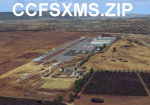
Revised 1/7/10 for upload to Avsim.COM. CCFSXMSFix is incorporated so not required.
This is an earlier version of CCC Megascenery Earth scenery that doesn't require FSGenesis Mesh Terrain. See CCFSXMSG.ZIP for the FSGenesis Mesh version.
This scenery covers the California coastal region from N36���°10' (Coalinga) to N34���°25' (Santa Barbara) and from the coast East to W119���°40'. It is a version of my previous California Central Coast scenery redesigned and expanded to work with MegaScenery Earth from PC Aviator Inc. Many airstrips in the area covered by this scenery have been added or enhanced for a total of 27 airports/airstrips in the area. Several areas of interest such as the Santa Barbara marina, Morro Bay, etc. are also included for a total of 41 points of interest. All airports/airstrips and related structures have been adjusted and realigned to conform to actual positions and dimensions as indicated by the MegaScenery satellite textures. In addition, there are 6 invisible water runways for use by AI floatplane traffic. MegaScenery California-13, -14 and -15 are required for this scenery to make sense. I also used California-12, -28 and -29 when constructing the scenery but they could be considered optional.
| Filename: | California_Central_Coast_Scenery_for_FSX_with_Mega.zip |
| License: | Freeware |
| Added: | 7th January 2010, 21:28:45 |
| Downloads: | 1,561 |
| Author: | Al Wheeler |
| Size: | 8.12 MB |
| Category: Flight Simulator X - Scenery | |
| RAF Dunholme Lodge - Lincolnshire, England **UPDATE** |
|
File Description:
This is an-update to correct the location of the Tower, if you have installed my version uploaded on the 15 or 23 Oct 15
RAF Dunholme Lodge was a Royal Air Force station located between the parishes of Welton and Dunholme in Lincolnshire, England.
The grass airfield was first used by the Royal Air Force during 1941 and 1942 for use by Handley Page Hampden aircraft from nearby RAF Scampton, and was officially opened as a RAF Station in September 1942 as part of RAF Bomber Command with the building of three hard runways.
The main occupier of the station was 44 Squadron, with the Avro Lancaster four-engined heavy bomber, which moved in from RAF Waddington in May 1943 and stayed until it moved to RAF Spilsby in September 1944.
In November 1944 flying operations ceased due the proximity of other stations which did not allow night flying. At the end of the war 120 Lancaster's had been lost on operations from Dunholme Lodge.
From 1948 the site was host to motorcycle and car racing until 1959 when the base was reopened as an active RAF station when it became an active Bloodhound surface-to-air missile station with 141 Squadron. The Squadron in 1964 and the station finally closed in 1964. Source: Wikipedia.
| Filename: | RAF_Dunholme_Lodge__Lincolnshire_England_UPDATE.zip |
| License: | Freeware |
| Added: | 28th October 2015, 18:41:50 |
| Downloads: | 263 |
| Author: | Terry Boissel |
| Size: | 335.14 KB |
| Category: Flight Simulator X - Scenery | |
| KEFD -Ellington 2025 Refresh FSX (Circa 2006-2010)- Johnson Space Center Houston |
|
Images related to this file:
File Description:
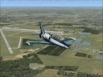
This is a complete refresh in 2025 for the entire Houston Bay Area and KEFD. This is a freeware update for KEFD, published 2025 for FSX, and includes CVX landclass and ADEX.bgl files for KEFD and surrounding greater area, circa 2006-2010. File includes very accurate landclass fixes for the surrounding Bay Area of Houston, and I added tons of VFR scenery objects, featuring Johnson Space Center Houston. Including:
-- Pasadena water treatment facility (Rwy 17)
-- NASA buoyancy lab
-- Pasadena shopping center off of Beltway 8
-- San Jacinto College
-- Pasadena convention center
-- Johnson Space Center Houston
-- Baybrook mall area
-- storage units across from Rwy 35Landclass fixes are extremely accurate, as I used satellite imagery from circa 2006-2010 era. This was both an era when the 147th FW was active, and there was a lot less buildings in the era. -- In addition:
-- I added NASA T38 and F16 parking with ramps
-- Straightened out the very crooked and inaccurate runways and taxis from the other freeware
-- added lighting to KEFD ramps and parking
-- added parking for coast guard MH 65 and helicopter parking for user.
-- Landclass fixes for the barren Spring-cypress greater area (KIAH-KDWH area).I hope you enjoy, north and southeast Houston no longer look like farms and fields with sparce patches of random houses. -DJN
| Filename: | KEFD_Ellington_2025_Refresh_FSX_Circa_20062010_Joh.zip |
| License: | Freeware |
| Added: | 26th May 2025, 23:25:14 |
| Downloads: | 64 |
| Author: | Dan Nelson |
| Size: | 23.49 MB |
| Category: Flight Simulator X - Scenery | |
| SKBO - El Dorado International Airport (2013) |
|
File Description:
El Dorado International Airport (IATA: BOG, ICAO: SKBO) is an international airport located in Bogota, Colombia. It is the largest Latin America airport in terms of cargo movements with 593,946 tons (2010) and the third in terms of
passenger traffic, only behind Sao Paulo-Guarulhos International Airport and Mexico City's Benito Juarez International Airport, transporting 18,934,203 passengers in 2010; as well as the largest airport in Colombia and the main
international and domestic air gateway in the country, serving as an important hub for Avianca, Copa Airlines Colombia, Aires, Satena, EasyFly and other cargo companies.
This file has the right coordinates, with the apron and characteristics of the airport with the new international terminal just builed in 2012. The runways were reoriented to the correct direction, runway were resized the gates placed on correct location and number, CATAM was placed
(Colombian Air force and Colombian National Army) and Colombia National Police and Colombian National Armada were assigned a correct apron. All the jet ways including the ones of the executive terminal are working. There is a copy
of all the airport charts required to navigate in and out of this airport which are courtesy of: Areonatica Civil de Colombia and the originals can be found at www.aerocivil.gov.co/ under Informacion Aeronautica click AIP; on AIP
click Aerodromos then click at SKBO.
This work is dedicated to West Wind Airlines.
| Filename: | SKBO__El_Dorado_International_Airport_2013.zip |
| License: | Freeware |
| Added: | 16th February 2013, 00:10:34 |
| Downloads: | 11,259 |
| Author: | Anwar Gonzalez |
| Size: | 19.16 MB |
| Category: Flight Simulator X - Utilities | |
| AI Aircraft SID and STAR Controller - Version 1.4B <b>for FSX, FSX Steam and P3D</b> |
|
Images related to this file:
File Description:
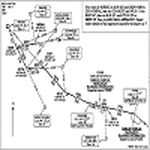
The AIController utility automatically vectors FSX, FSX-Steam or Prepar3D Artificial Intelligence (AI) aircraft through predefined Standard Instrument Departures (SIDs), jet routes, Standard Instrument Arrivals (STARs) (or alternatively generic traffic patterns), and/or final approaches. AIController automatically selects the most appropriate SID, jet route or STAR for each AI aircraft. AIController also lands arriving AI using published, custom or automatic final approach procedures, then provides taxi service to parking. The user can customize the procedures to fine tune AI arrival and departure patterns at each airport, such as specifying landing runways on-the-fly.
AIController optionally enforces spacing minimums between arriving AI aircraft by commanding speed changes and/or commanding the AI to hold at waypoints, thus reducing go-arounds. AIController can also enforce spacing minimums between the AI aircraft and the user's aircraft.
A stand-alone, windows based AI traffic monitoring program (AIMonitor.exe) is also included to provide the user with a graphical front-end. A converter (SIDSTARConverter) is included to automatically convert SID and STAR files from standard, aircraft format to the format used by AIController.
AIController requires an installed FSX or P3D SimConnect and can be run on a networked computer. The latest, registered version of FSUIPC ver. 4.9x (or later version) is also required.
| Filename: | AI_Aircraft_SID_and_STAR_Controller__Version_14B_b.zip |
| License: | Freeware |
| Added: | 18th July 2015, 00:11:26 |
| Downloads: | 14,195 |
| Author: | Roland Foster |
| Size: | 16.23 MB |
| Category: Flight Simulator 2004 - AFCAD Files | |
| RFS New improved and realistic Afcads for TNCM,TFFJ, and SABA/TNCS |
|
File Description:
Make the three FlyTampas airports even more realistic. These Files are for Flight simulator enthusiasts, who prefer realism. These Afcads are optimized for AI Traffic. FlyTampas FlyMarten is very realistic yet, but these files even optimize this very good scenery addon.
These files are improved afcads for the three FlyTampa FlyMarten airports St. Marten (TNCM), St. Barthélemy (TFFJ) and Saba (SABA/TNCS). They are on the basis of the three original afcads from Flytampa, but there are a few differences between the old and the new version: 1. AI Traffic does not make the u-turns in the grass, but they make the u-turns on the provided u-turn areas at the ends of the runways 9 in TNCM, 10 in TFFJ and 12 und 30 SABA. 2. Landing and Takeoff on runway 27 in TNCM and Takeoff on runway 28 in TFFJ is forbidden; it is not possible to prohibit landing, but allow takeoff. So I compound, that all flight movements in TNCM will be performed on RWY 9. 3. At all of the three airports tower frequencies replace AFT, e. g. "Saba Traffic". 4. In SABA and TFFJ I removed few gates, because the pushbacking aircrafts taxied into each other when using the old file. Important: These Files are functional only if FlyTampa-Marten is installed on your computer. There are also the original files in the backup folder.
RFS Real Flight Simulation
| Filename: | RFS_New_improved_and_realistic_Afcads_for_TNCMTFFJ.zip |
| License: | Freeware |
| Added: | 13th August 2008, 19:39:19 |
| Downloads: | 1,805 |
| Author: | Ernst Kamuschke |
| Size: | 1.8 MB |
| Category: Flight Simulator X - AFCAD Files | |
| Stallone Airport (9NJ5), NJ |
|
File Description:
Located 01 miles SE of Harrisonville, New Jersey, Stallone Airport is a private turf strip 1350' in length. However it should be noted that the actual length from the road to the trees on the opposite end of the runway is actually only around 900'. It is tightly hemmed in by trees so if you are landing on Runway 29 you may want to use Slew to turn your plane around to remove the risk of bumping into a tree instead. If you land on Runway 11 you can cross the road to turn around in the field opposite the runway. The windsock can be seen from both runways. Power lines run along the heights of the trees as well for the Runway 29 approach, on the same side as the trees though so not really any additional worry there. No transient services are available. There is no hard surface runway so make sure your terrain mesh slider is set as high as possible for a suitably bumpy ground experience.
Scenery constructed with use of satellite images/streetview/aerial photos - the author has not been there in person.
This scenery is meant to be used in conjunction with MegaScenery Earth New Jersey/Delaware 004. It is not required, but apron use is minimized to allow satellite scenery to show through as much as possible, and objects are placed based on the MSE textures - lack of it may make scenery look out of place.
| Filename: | Stallone_Airport_9NJ5_NJ.zip |
| License: | Freeware |
| Added: | 5th April 2011, 07:34:54 |
| Downloads: | 170 |
| Author: | Drew Sikora |
| Size: | 332.91 KB |
| Category: Flight Simulator 2004 - Scenery | |
| Ulukhaktok (Holman) CYHI in the Northwest Territories, Canada |
|
Images related to this file:
File Description:
Ulukhaktok (Holman) is an airfield on the west side of Victoria Island, off the northern coast of Canada. It is 320 miles west of Cambridge Bay (and you should download and install the recent post of CYCB by Sid and Pete, as I use it for the AI included in this post) and around 400 miles east of Inuvik (my post of a few months ago). It has been officially called Ulukhaktok since 2006, and before that it's name was Holman.
The village of Ulukhaktok has been placed around the bay and is approximately the right shape; it houses some 460 people who used to rely solely on hunting and fishing. The village is close to 71 degrees north, and there are only four months of the year when the average high is above zero centigrade. The photograph with snow (and of course a frozen sea) is typical; for the frozen sea download my Frozen Rivers & Lakes post which will provide this. The buildings on the field have been modelled specifically for this scenery, and as in real life there is only JetA available. The AI visiting aircraft are an Aklak Air DC3 (based in Inuvik and operated by Kenn Borek Air) and a Canadian North Dash 8-100. Note that the runways are signed as "true" headings instead of magnetic; in the Canadian Northern Domestic Airspace all headings are given as true. Unfortunately FS9 doesn't accommodate this in ATC.
| Filename: | Ulukhaktok_Holman_CYHI_in_the_Northwest_Territorie.zip |
| License: | Freeware, limited distribution |
| Added: | 24th May 2011, 20:05:47 |
| Downloads: | 454 |
| Author: | Roger Wensley |
| Size: | 2.3 MB |
| Category: Flight Simulator X - Scenery | |
| Ireland VFR Small Airports part 1 |
|
File Description:
Ireland VFR Small Airports Part 1.
This scenery includes 5 small airports in Ireland. EIDL Donegal is in the far North West, EIAB Abbeyshrule is located in the centre of Ireland. EIKL Kilkenny is located in the South East and Newcastle can be found on the East coast. EITM is a small grass strip to the north West of Dublin. Donegal and Abbeyshrule have paved runways whilst the others consist of small grass strips.
The scenery includes animals, vegetation and rural objects. It also includes sound effects, animations, some high definition people, and aircraft painted using real Irish aircraft photos. Many of the airports include open hangers and buildings modelled from real photographs. Although Donegal is the only one with ILS, full night textures are included for all the airports.
Many of the files are stand alone and can be switched on or off according to user preference. The scenery can be used as a standalone, however it also uses objects from my other scenery addons.
The scenery has been tested with FSXA only and is designed to complement vfr photographic scenery. It will also work with the FSX default terrain, however all objects have been placed using ordinance survey data and may therefore appear misplaced in the default.
Full installation instructions are included in the Readme file.
I hope you enjoy using the airports as much as I enjoyed making them.
| Filename: | Ireland_VFR_Small_Airports_part_1.zip |
| License: | Freeware |
| Added: | 21st December 2011, 00:18:25 |
| Downloads: | 4,985 |
| Author: | George Keogh |
| Size: | 51.33 MB |


© 2001-2026 AVSIM Online
All Rights Reserved
Privacy Policy |