
Where Flight Simulation Enthusiasts Gather from Around the World!
AVSIM Library - Search Results

| Category: Prepar3D V1-4 - Scenery | |
| TNCC - - Curaçao International Airport V 2.0 |

|
File Description:
This is an improved version of my previous senario for TNCC. This version has substantial improvements in the terminals and areas of the airport.
Curaçao International Airport (IATA: CUR, ICAO: TNCC), (Dutch: Hato Internationale luchthaven) also known as Hato International Airport (formerly Dr. Albert Plesman International Airport), is the only airport for the island of Curaçao.
The airport is located on the north coast of Curaçao, 12 kilometres (7.5 mi) from the capital Willemstad. Curaçao International Airport services flights from the Caribbean region, South America, North America and Europe and has the third longest commercial runway in the Caribbean region after Rafael Hernández Airport in Puerto Rico and Pointe-à -Pitre International Airport in Guadeloupe.
The airport serves as a main base for Divi Divi Air, Jetair Caribbean as well as EZAir; it formerly served as a main base for ALM, KLM, DCA, DAE and Insel Air.
| Filename: | TNCC___Curaao_International_Airport_V_20.zip |
| License: | Freeware |
| Added: | 25th June 2021, 18:19:49 |
| Downloads: | 450 |
| Author: | Eduardo Puelker |
| Size: | 37.41 MB |
| Category: Prepar3D V1-4 - Aircraft Repaints, Textures and Modifications | |
| AeroLyon 1998 AI Flightplans |
|
File Description:
From 1996-2000, AeroLyon operated a single DC-10-30(with a 2nd being added in 2001) mostly between secondary French cities and the French Caribbean, with the occasional intra-Europe charter. These plans will work for the whole era, but I kept the DC-10 rather busy to ensure that all French cities that saw AeroLyon get used at least once. The aircraft usually makes a stop in France on the way to TNCM/TNCC or TFFF/TFFR then does the same on the way back. The only day the aircraft visits LFPO is Sunday, on the way back from a real charter that took place to LOWW in 1998. Jason King has painted the DC-10 on avsim as: "aim_dc1030_aero_lyon.zip". Flightplans by Chasen Richardson. Part of the 1998 Flight Simulator Project. Follow us on Facebook at facebook.com/flightsim98 and on instagram as @bayviationsim. For more Retro AI, check out the forums at: http://retroai.proboards.com/
| Filename: | AeroLyon_1998_AI_Flightplans.zip |
| License: | Freeware, limited distribution |
| Added: | 1st December 2019, 20:56:04 |
| Downloads: | 110 |
| Author: | Chasen Richardson\Bayviation |
| Size: | 395.19 KB |
| Category: Flight Simulator 2004 - Flight Plans | |
| "Imperial 109" - The journey of Imperial Airways S.23 "Caterina" in 1939, from the novel by Richard Doyle. |
|
File Description:
In 1977 the novel "Imperial 109", by Richard Doyle, was published. The story is based on the flight of an Imperial Airways Short 'Empire' Class flying-boat, "Caterina", on its journey through Africa to Cairo and onwards through Europe to England and finally across the Atlantic to New York. When I read this novel just recently I couldn't help but think that it would make a wonderful Flight for Flight Simulator, and the fact that the characters and storyline was fiction was of no concern, because the airline, the aircraft and the route flown were real. I also considered that the best way to present this was to publish it as an unfolding story in blog format, in the same fashion as the Sir Alan Cobham flight around Africa which I had undertaken. Therefore I present you with "Imperial 109" for Microsoft Flight Simulator and you can take part by following and flying the updates as I present them online.
| Filename: | Imperial_109__The_journey_of_Imperial_Airways_S23_.zip |
| License: | Freeware |
| Added: | 27th September 2007, 12:59:21 |
| Downloads: | 951 |
| Author: | Bruce Kennewell |
| Size: | 51.57 KB |
| Category: X-Plane - Scenery | |
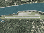
| US MI KBTL - WK Kellogg Airport Battle Creek v2.0.0 |
|
Images related to this file:
File Description:
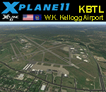
This is an X-Plane 11 and X-Plane 10 scenery package for the W.K. Kellogg Airport (IATA: BTL, ICAO: KBTL, FAA LID: BTL), which is a city owned, public use, joint civil-military airport located three nautical miles (6 km) west of the central business district of Battle Creek, a city in Calhoun County, Michigan, United States. v2.0.0 completely replaces the KBTL v1.0.2, with a brand new scenery, including orthophoto and city building for downtown Battle Creek. For better performance, only the default X-Plane libraries, by Laminar Research, are needed. No third party libraries are used. It includes corrected aprons, ramps, gates, taxiways, lighting system, city downtown buildings, ortho-photoscenery for the airfield area, and (XP11 only) airport ground services (like push back). This scenery was tested and is operational (as of March 20, 2017) in "X-Plane 11 Public Beta #15 64 bit", Windows 10 Home. It was also tested and is also operational (as of March 20, 2017) in "X-Plane 10.51 64 bit", Windows 10 Home. Only the default X-Plane libraries, by Laminar Research, are needed. No third party libraries are used.
| Filename: | US_MI_KBTL__WK_Kellogg_Airport_Battle_Creek_v200.zip |
| License: | Freeware |
| Added: | 22nd March 2017, 00:06:30 |
| Downloads: | 69 |
| Author: | Rui Mesquita |
| Size: | 22.38 MB |
| Category: Flight Simulator 2004 - Panels | |
| F16 |
|
File Description:
FS2004 Panel, F16 Air Show Tour. The panel of this jet fighter has been designed for cross country flying to events worldwide. The 2D cockpit is packed with new gauges that complement this high performance, yet docile aircraft. All gauges, lights, etc. are functional, easy to read, and are panel installed except GPS 500. For long distance flights, the panel contains on-demand refueling capabilities for both ground and air operations. A few of the new gauges are; 180-degree scan navigational radar, triple mode interceptor-refueling-terrain radar, refueling gauge with command screen, fuel center with time/distance remaining computer, new Descentometer for Mach-plus aircraft, analog engine gauges including thrust and fuel efficiency, plus a hangar full of warning and indicator lights. The intercept mode of the ai-radar feeds info to the autopilot to assist in the rendezvous with tanker to allow all-weather, day or night air refueling. Digital data for AP, radio, altimeter, timer, and Descentometer is input via a central keypad. Acknowledge ATC instructions using joystick. Designed for use with Kirk Olsson's F16 Viper. Includes 15 page illustrated instructions plus Intercept and Refueling tutorial. By Glenn Copeland
| Filename: | F16.zip |
| License: | Freeware |
| Added: | 12th January 2007, 03:00:43 |
| Downloads: | 5,780 |
| Author: | Glenn Copeland |
| Size: | 1.83 MB |
| Category: Flight Simulator 2004 - Scenery | |
| Colorado Lakes Project II |
|
File Description:
This project features the Blue Mesa Reservoir and the Black Canyon of the Gunnison and adds over 300 highly detailed lakes to the central portion of western Colorado. Three reservoirs, named for corresponding dams on the Gunnison River, form the heart of Curecanti National Recreation Area. Panoramic mesas, fjord-like reservoirs, and deep, steep and narrow canyons abound. Blue Mesa Reservoir is Colorado's largest body of water, and is the largest Kokanee Salmon fishery in the United States. Morrow Point Reservoir is the beginning of the Black Canyon of the Gunnison and below it is Crystal Reservoir.
These lakes are specifically designed to show off their photo realistic detail when used in combination with "FSGenesis-The Rockies 38.2m Terrain Mesh-Colorado" available as "fsg_dem38m_usrk_co.zip" at avsim.com, or comparable mesh. The free FSGenesis US National Landclass Project Beta 6 also adds beautifully to the landscape. These lakes work equally as well with the default mesh.
All lake information was projected from satellite imagery and compiled with a beta version of Jim Keir's "Slartibartfast" utility. Much thanks to Holger Sandmann and Jim Keir for their help and advice on interpreting the satellite data properly.
| Filename: | Colorado_Lakes_Project_II.zip |
| License: | Freeware |
| Added: | 1st June 2004, 02:34:42 |
| Downloads: | 6,050 |
| Author: | Carlyle Sharpe |
| Size: | 332.25 KB |
| Category: Flight Simulator X - Flight Plans | |
| Flight to the Mayan Curse "Hondo" |
|
File Description:
"AT 8:45 PM the land slided inward for more than 3 minutes. It felt like if everything was being sucked down to the bowels of the earth." Gonzalo Carnesco told the chief of police near the town of Pallasco in the central mountains of Honduras.---Dr. Giulio Ranzetti of the Roman-Mayan Institute of Mysterious Civilizations knew he had to go to "Hondo" for he was sure
he had read, many years ago while exploring the Honduran Jungles, the incredible Mayan Prediction of the "End" as they
called the fracture of the earth. This seemed pretty near to that prediction.
Now you come in......Dr. Ranzetti has hired you to fly him and his two women assistants to the emergency camp near the huge hole, now known as "Hondo". From there you will take the small one man helicopter and fly into the "hole" and take samples and photos of the incredible situation....If you get out of there alive, he is to be flown back to Tegucigalpa where he and his assistants
will fly back to Rome and maybe with the ported evidence...unriddle this riddle.
| Filename: | Flight_to_the_Mayan_Curse_Hondo.zip |
| License: | Freeware, limited distribution |
| Added: | 12th May 2008, 17:09:45 |
| Downloads: | 417 |
| Author: | Gera Godoy Canaova |
| Size: | 2.35 MB |
| Category: Flight Simulator 2004 - AFCAD Files | |
| PAKT Ketchikan International, Alaska, USA |
|
Images related to this file:
File Description:
Googlyafcad A&F Data file for Ketchikan International based on Google Earth satellite
data - a small but relatively busy airport located in one of the wettest parts of
Alaska, USA. Ketchikan is Alaska's fifth largest city, with its economy based on
salmon fishing.
For some curious reason the facilities provided in Flight Simulator 2004 omit a crucial
taxiway at the west end of the airport, causing all traffic to taxi from the opposite
end. These files redress this issue, and also provide realistic levels of parking for
commercial and general aviation traffic, allowing you and your "AI" traffic to land,
taxi, park and take off in a realistic manner. The layout has been cunningly designed
to fit both with the Flight Simulator default scenery and version 2 of Alan Wright's
enhanced scenery (paktv2.zip on AVSIM) and is compatible with both in every respect.
Apart from conventional and water-based general aviation aircraft Ketchikan International
is regularly served by commercial flights of Alaska Airlines and by smaller operators
such as Alaska Central Express, Everts Air Alaska and LAB Flying Service. [File re-uploaded at request of AVSIM]
| Filename: | PAKT_Ketchikan_International_Alaska_USA.zip |
| License: | Freeware |
| Added: | 29th May 2010, 09:28:41 |
| Downloads: | 1,266 |
| Author: | John Hinson |
| Size: | 206.01 KB |
| Category: Flight Simulator 2004 - Sounds | |
| AIG, Tower Package - Release 8 |
|
Images related to this file:
File Description: UPDATE FOUND HERE:

This is the eighth release package of 38 EditVoicepack files for FS2004/FSX by the Alpha India Tower Group. This package includes all previously released files since Package Release 7. Our goal is to provide accurate ATC calls in order to provide Microsoft Flight Simulator traffic with quality ATC. These sounds are the best that we have been able to compile and are accurate as of release date and to the extent that our data and the limitations of the EditVoicepack allow. Included in this package release are ABC AEROLINEAS, AIR HAMBURG, AIRKUFRA, ARABIA EGYPT, ASTERIX, BRILLIANT, CENTRAL CHARTER, CHALLENGE UKRAINE, DUTCH CORENDON, ENERJET AIR, EXPRESS FREIGHT, HAMBURG AIRWAYS, HOMAC, IMPERIAL, LAMIA, LARISA, MEDALS, MOUNTCOOK, NOVANILE, PEOPLES, PETRO AIR, PETROFF, PRAVI, RV7, SENEGAL AIR, SHELL CANADA, SKY SHUTTLE, SLOVAK GOVERNMENT, SLOVAKTRAVEL, TACOMA, TAG JET, TRANSNORTHERN, TRAVEL SERVICE, VAN'S, VOLARIS, WIZZAIR UKRAINE, ZAGROS, and ZIMEX. Visit us at www.alpha-india.net for more information.
| Filename: | AIG_Tower_Package__Release_8.zip |
| License: | Freeware, limited distribution |
| Added: | 17th December 2011, 16:18:17 |
| Downloads: | 4,216 |
| Author: | Alpha India Group |
| Size: | 31.23 KB |
| Category: Flight Simulator 2004 - Scenery | |
| Akulivik CYKO in northern Quebec Canada |
|
Images related to this file:
File Description:
This is another of the many airfields that are all around the coast of Hudson Bay, this one being on the eastern, Quebec side. Akulivik is around 110 miles south of Ivujivik, which is on the northeastern corner of the Bay, and some 60 miles north of Puvirnituq. The population is 630 or so and the village grew from a move back to the area by one family in 1973, followed by others in the following years; the closure of the Hudson Bay trading post post in 1952 had pushed all residents to move south to Puvirnituq. The village is unusual in that it has a built harbour instead of the usual beached storage of boats. The village is built on the central prong of a three pronged spear of headlands (from which the village name is derived) while the airfield is a mile or so further inland. I have no information regarding what I think may be a new terminal building, so this includes only the old original one. The runway is just under 3,500 feet of gravel aligned 09-27, and the ai includes the scheduled flight by an Air Inuit Dash 8-300, plus GA.
| Filename: | Akulivik_CYKO_in_northern_Quebec_Canada.zip |
| License: | Freeware, limited distribution |
| Added: | 9th September 2018, 03:43:25 |
| Downloads: | 162 |
| Author: | Roger Wensley |
| Size: | 4.69 MB |
© 2001-2026 AVSIM Online
All Rights Reserved
Privacy Policy |