
Where Flight Simulation Enthusiasts Gather from Around the World!
AVSIM Library - Search Results

| Category: Flight Simulator 2004 - Aircraft Repaints, Textures and Modifications | |
| Matsakoni Airlines Virtual Boeing 737-800 (MAV 2008 Livery) |

|
File Description:
Textures only for PMDG Boeing NG 737-800 in Matsakoni Airlines Virtual new colours for 2008, registration SX-KLM. Matsakoni Airlines was founded in early 2002 and its HQs is based on Ioannis Kapodistrias Int airport (LGKR), Corfu island. Affiliates and hubs on other major Greek and European cities are planned for the fiscal year 2008. Eletherios Venizelos Athinai Int airport (LGAV) is MAV's hub since Aug'07. London Stansted (EGSS) is our new Hub in the U.K. A classic virtual operator connecting the Greek islands to major European and other Atlantic cities on a daily base with scheduled and non-scheduled flights. Matsakoni Airlines is operating, by order, the following aircraft types: Airbus A340/330, A306, 319/2/1, Boeing B763, B747, B737, B727 and MD-11 for medium to long range flights. Matsakoni is servicing domestic flights and operates Fokker 100, ATR-72/500 and DH8C. We maintain a fly-on-demand fleet, ranging from business jets like the ERJ-145 for V.I.P. and corporate flights, down to the Beechcraft BE-58 and Cessna 206/172 for a low-cost transport that meets your needs. Matsakoni Airlines wishes you a pleasant flight, Enjoy!
| Filename: | Matsakoni_Airlines_Virtual_Boeing_737800_MAV_2008_.zip |
| License: | Freeware, limited distribution |
| Added: | 25th March 2008, 20:13:11 |
| Downloads: | 77 |
| Author: | Dimitris Pastarmatzis |
| Size: | 8 MB |
| Category: Flight Simulator 2004 - Aircraft Repaints, Textures and Modifications | |
| Matsakoni Airlines Virtual Boeing 737-800 with Winglets (MAV 2008 Livery) |
|
File Description:
Textures only for PMDG Boeing NG 737-800 (Winglets) in Matsakoni Airlines Virtual new colours for 2008, registration SX-KLM. Matsakoni Airlines was founded in early 2002 and its HQ's is based on Ioannis Kapodistrias Int airport (LGKR), Corfu island. Affiliates and hubs on other major Greek and European cities are planned for the fiscal year 2008. Eletherios Venizelos Athinai Int airport (LGAV) is MAV's hub since Aug'07. London Stansted (EGSS) is our new Hub in the U.K. A classic virtual operator connecting the Greek islands to major European and over Atlantic cities on a daily base with scheduled and non-scheduled flights. Matsakoni Airlines is operating, by order, the following aircraft types: Airbus A340/330, A306, Á319/2/1, Boeing B763, B747, B737, B727 and MD-11 for medium to long range flights. Matsakoni is servicing domestic flights and operates Fokker 100, ATR-72/500 and DH8C. We maintaining a fly-on-demand fleet, ranging from business jets like the ERJ-145 for V.I.P. and corporate flights, down to the Beechcraft BE-58 and Cessna 206/172 for a low-cost transport that meets your needs. Matsakoni Airlines wishes you a pleasant flight, Enjoy!
| Filename: | Matsakoni_Airlines_Virtual_Boeing_737800_with_Wing.zip |
| License: | Freeware, limited distribution |
| Added: | 25th March 2008, 20:55:10 |
| Downloads: | 109 |
| Author: | Dimitris Pastarmatzis |
| Size: | 8.28 MB |
| Category: Flight Simulator 2004 - Aircraft Repaints, Textures and Modifications | |
| Matsakoni Airlines Virtual Boeing 737-900 (MAV 2008 Livery) |
|
File Description:
Textures only for PMDG Boeing NG 737-900 in Matsakoni Airlines Virtual new colours for 2008, registration SX-BLN. Matsakoni Airlines was founded in early 2002 and its HQ's is based on Ioannis Kapodistrias Int airport (LGKR), Corfu island. Affiliates and hubs on other major Greek and European cities are planned for the fiscal year 2008. Eletherios Venizelos Athinai Int airport (LGAV) is MAV's hub since Aug'07. London Stansted (EGSS) is our new Hub in the U.K. A classic virtual operator connecting the Greek islands to major European and over Atlantic cities on a daily base with scheduled and non-scheduled flights. Matsakoni Airlines is operating, by order, the following aircraft types: Airbus A340/330, A306, Á319/2/1, Boeing B763, B747, B737, B727 and MD-11 for medium to long range flights. Matsakoni is servicing domestic flights and operates Fokker 100, ATR-72/500 and DH8C. We maintaining a fly-on-demand fleet, ranging from business jets like the ERJ-145 for V.I.P. and corporate flights, down to the Beechcraft BE-58 and Cessna 206/172 for a low-cost transport that meets your needs. Matsakoni Airlines wishes you a pleasant flight, Enjoy!
| Filename: | Matsakoni_Airlines_Virtual_Boeing_737900_MAV_2008_.zip |
| License: | Freeware, limited distribution |
| Added: | 25th March 2008, 20:55:59 |
| Downloads: | 108 |
| Author: | Dimitris Pastarmatzis |
| Size: | 8.06 MB |
| Category: Flight Simulator 2004 - Scenery | |
| CZFN - Tulita - Northwest Territories, Canada |
|
Images related to this file:
File Description:
Tulita (Fort Norman until 1996) is another in the series of airfields that follow (approximately) the Mackenzie River. At the far northern end of the river and on the eastern side of the delta there is Tuktoyaktuk, then Inuvik, Fort McPherson, Fort Good Hope, Deline, Wrigley, Fort Simpson Island and Fort Simpson, and then Fort Liard at the southern end of the list of those in the Northwest Territories. South of Fort Liard there are Peace River and Dawson Creek, both of which are already posted. Tulita is at the junction of the Mackenzie and Great Bear Rivers, on the east bank of the Mackenzie and the south bank of the Great Bear, around 40 miles southeast of Norman Wells. The town has a population of about 480 folks. The airport is above and to the east of the town, and has 3,000 feet of gravel runway. The scheduled flights are by North Wright and I have also added a Buffalo DC3 and GA. There is a mandatory radio frequency but in this case I have set the "tower" to "unmanned" so you will report position and intentions. There is no fuel available.
| Filename: | CZFN__Tulita__Northwest_Territories_Canada.zip |
| License: | Freeware, limited distribution |
| Added: | 12th July 2014, 08:05:54 |
| Downloads: | 273 |
| Author: | Roger Wensley |
| Size: | 2.66 MB |
| Category: Flight Simulator 2004 - Aircraft Repaints, Textures and Modifications | |
| CONVIASA Airbus A340-211 (YV1004) |
|
Images related to this file:
File Description:

Re-upload. CONVIASA is a Venezuelan state-owned airline based in Porlamar on Venezuela's Margarita Island. This Airbus A340-211, registration YV1004, is the sole A340 in CONVIASA's fleet. CONVIASA uses this aircraft for long-haul international flights and charter flights. This A342 was the 31st built and was originally delivered to Air France in October 1993. It went on to fly in the liveries of Air Tahiti Nui, Air Bourbon and most recently Air Europa. It was the first A340 for Air Europa as well. **PLEASE NOTE** This is a re-upload due to the AVSIM site compromise. However, I decided to update this repaint for the re-upload. So this release contains the following changes/enhancements; current registration (YV1004), the phrase "Simon Bolivar El Libertador" on the port side below the pilot's window, the Venezuela "Ahora es de todos" promotional logo on the aft part of both sides of the fuselage and improved fuselage and engine texture shading. Most of the textures in this repaint are 32-bit. This is a complete package; version 2004.8.5 of the Project Opensky A340-200 model is included.
| Filename: | CONVIASA_Airbus_A340211_YV1004.zip |
| License: | Freeware, limited distribution |
| Added: | 13th June 2010, 02:06:01 |
| Downloads: | 2,129 |
| Author: | Jeffrey S. Bryner, Project Opensky |
| Size: | 8.48 MB |
| Category: Flight Simulator 2004 - Scenery | |
| Alaska North Slope 6; Oliktok POLI |
|
Images related to this file:
File Description:
Oliktok is a DEW station Air Force base to the east of the Colville River delta, 160 miles east of Barrow and 12 miles from Harmon Helmericks house and dirt strip in the delta on Anachlik Island. (See my previous post, made after reading his book about northern Alaska flying). The runway is just over 4,000 feet of gravel and aligned 03-21. The large hangar is still there, and so are the majority of the DEW buildings closer to the beach. There are now also some oil production facilities and living quarters nearby on the point, but these are not included in this scenery as to make them convincingly (and there is no point in making them unconvincingly!) would be 100+ times as laborious as making the airstrip. And as Sid has memorably said, "If you can't taxi up to it, then xxxx it". So this scenery is dated way before the north slope was changed from a wilderness to an industrial complex. The AI is one day a C-130, on another a Cessna, and on a third a Reeve Aleutian DC-6B.
| Filename: | Alaska_North_Slope_6_Oliktok_POLI.zip |
| License: | Freeware, limited distribution |
| Added: | 30th June 2016, 20:36:34 |
| Downloads: | 282 |
| Author: | Roger Wensley |
| Size: | 2.42 MB |
| Category: Flight Simulator 2004 - AFCAD Files | |
| Biggest African Airports |
|
File Description:
Biggest african airports AFCAD files for FS2004. It contains files for; HECA, Cairo intl, Cairo, Egypt; FAJS, Johannesburg intl, Johannesburg, South Africa; FACT, Cape Town intl, Cape Town, South Africa; GMMN, Mohamed V, Casablanca, Morocco; GMMX, Menara, Marrakech, Morocco; DAAG, Houari Boumediene, Algiers, Algeria; DTTA, Carthage, Tunis, Tunisia; HLLT, Tripoli intl, Tripoli, Libya; HKJK, Jomo Kenyatta, Nairobi, Kenya; DNMM, Murtala Muhammed, Lagos, Nigeria; HAAB, Bole intl, Addis Abeba, Ethiopia; DIAP, Felix Houphouet-Boigny, Abidjan, Ivory Coast; DGAA, Kotoka intl, Accra, Ghana; DRRN, Diori Hamani, Niamey, Niger; FCBB, Maya-Maya, Brazzaville, Congo; FZAA, N'djili intl, Kinshasa, Congo (DRC); FEFF, Bangui intl, Bangui, République Centrafricaine; FKKD, Douala, Douala, Cameroon; FKYS, Nsimalen, Yaounde, Cameroon; FOOL, Leon M'ba, Libreville, Gabon; GABS, Senou, Bamako, Mali; GOOY, Leopold Senar Senghor, Dakar, Senegal; GQNN, Nouakchott, Nouakchott, Mauritania; HSSS, Khartoum, Khartoum, Sudan; HUEN, Entebbe intl, Entebbe, Uganda; FNLU, 4th of February, Luanda Angola; FMMI, Ivato, Antananarivo, Madagascar; FIMP, Mauritius intl, Maurtius Island; FSIA, Seychelles intl, Seychelles. A "must have" for your traffic AI. A lot of European and Asian airlines use its airports moreover than all african airlines, so if you have got a completed traffic AI, your african airports need a lot of gates.
| Filename: | Biggest_African_Airports.zip |
| License: | Freeware |
| Added: | 3rd December 2003, 00:41:35 |
| Downloads: | 17,301 |
| Author: | Bruno Hamza |
| Size: | 100.49 KB |
| Category: Flight Simulator X - Scenery | |
| LGSK - Skiathos Airport, Greece |
|
Images related to this file:
File Description:
LGSK Skiathos Airport Greece.
Skiathos Island lies off the east coast of mainland Greece and is often referred to as 'Europe's St. Maarten' with landing aircraft skimming the beach and the nearby harbour. At 5341feet the runway is short and narrow and usually only captains are allowed to perform landings. Seasonal taffic includes Munich, Gatwick, Rome, Oslo and Stockholm, with scheduled flights to Athens.
This scenery has been designed to sit on the excellent photoreal scenery by Angelo Tassoglou, available here on Avsim, just search for 'Skiathos.zip'. Please note, it will not work with the default terrain. It also uses many objects from my LGKF Kefallinia scenery, also available here at Avsim.
The scenery features added vegetation, detailed airport buildings based on real photographs, animated windsocks, flags, road traffic, people, trees, waves, birds and air traffic. All the scenery files have been divided so they can be switched on or off according to user preference. It has been designed for and tested in DX9 and FSXA only.
Please enjoy and I hope you like my scenery as much as I enjoyed building it.
Required files:
skiathos.zip by Angelo Tassoglou
LGKF Kefallinia by George Keogh
| Filename: | LGSK__Skiathos_Airport_Greece.zip |
| License: | Freeware, limited distribution |
| Added: | 28th January 2013, 00:13:54 |
| Downloads: | 16,022 |
| Author: | George Keogh |
| Size: | 20.47 MB |
| Category: Flight Simulator X - Scenery | |
| Odense Airport (EKOD), Funen, Denmark |
|
Images related to this file:
File Description:
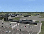
Odense Lufthavn (Odense Airport) is situated close the village of Beldringe, a few km north of Odense, the main city on the island of Funen, Denmark. Like several other Danish airports it was established as an airbase by the Germans during World War II. It was taken over by the Danish state after the war and owned by the state until 1998, at which time it was taken over by a consortium of local authorities, including the city of Odense.
Since the opening of the Great Belt Lin in 1997 there has been no regular passenger flights, apart from some charter traffic during the summer season. But there is a lot of traffic with one- and two-motor craft (including rotor craft) due to the many companies based in the airport.
The package is a complete scenery of the airport, including a few buildings around it. It includes approach lights, runway lights, taxiway lights and light on the apron, the car parking area and the surrounding roads. A traffic file with the (limited) charter traffic of the airport is also included.
| Filename: | Odense_Airport_EKOD_Funen_Denmark.zip |
| License: | Freeware, limited distribution |
| Added: | 31st October 2009, 10:29:34 |
| Downloads: | 3,732 |
| Author: | Peter H. Poulsen |
| Size: | 13.63 MB |
| Category: Prepar3D V1-4 - Scenery | |
| Arecibo Observatory, Puerto Rico N18.20.39 W66.45.09 |
|
Images related to this file:
File Description:
Arecibo Observatory, Puerto Rico N18.20.39 W66.45.09 also known as the National Astronomy and Ionosphere Center,
National Center for Astronomy and the Ionosphere), is located about 15 km south-southwest of Arecibo, island of Puerto Rico.
It operates through Cornell University under a cooperative agreement with the National Science Foundation (a US government agency). NAIC refers more specifically to the organization that directs both the observatory and the associated laboratories
and the offices of Cornell University. The observatory is equipped with a radio telescope consisting of a 305 meter diameter
single-aperture antenna, the largest in the world up to the entry into service, in September 2016, of the 500 meter FAST radio telescope, located in the province of Guizhou. in China (soon to be realized).
It is mainly used for three large research areas: radio astronomy, atmospheric physics (using both the radio telescope and the observatory Lidar function) and the radar observation of objects in the solar system.
The telescope received further international recognition in 1999, when it began collecting data for the SETI project.Important VFR point for approaching airport of Rafael Hernandez TJBQ and airport Eugenio Maria De Hostos TJMZ.
Within the downloaded package you will find readme files for scenery installation. Good fly VFR. Pasquale Marrulli.
| Filename: | Arecibo_Observatory_Puerto_Rico_N182039___W664509.zip |
| License: | Freeware |
| Added: | 19th December 2017, 00:35:59 |
| Downloads: | 278 |
| Author: | Pasquale Marrulli |
| Size: | 1.15 KB |


© 2001-2026 AVSIM Online
All Rights Reserved
Privacy Policy |