
Where Flight Simulation Enthusiasts Gather from Around the World!
AVSIM Library - Search Results

| Category: Flight Simulator 2004 - Scenery | |
| Clyde River CYCY & Cape Christian in Nunavut Canada |

|
Images related to this file:
File Description:
Clyde River is a village on the northeast coast of Baffin Island, 250 miles above the Arctic Circle and around 150 miles north of Cape Hooper. It is on the shore of Patricia Bay at the entrance to Cylde Inlet, a fjord which stretches over 60 miles inland. The population is around 880 folks, and it was named by the explorer John Ross in 1818. The airfield is just east of the village and the lighted runway is 3,501' of 100' wide gravel at 87' ASL, aligned 018 True 198 True; "True" as opposed to magnetic in the Northern Domestic Airspace. There are two aprons, one with the new terminal building and one with the old terminal and the garage. Five miles northeast of Clyde River is Cape Christian, where there is a gravel runway around 3,000' long and adjacent to the beach, built to serve what was started as a weather station and later became a LORAN navigation system station. The station is still there, though it was closed some time ago and is now the subject of decontamination work. The runway is usable, though only for light planes as it is a bit rough. First Air and Canadian North are the AI planes visting Clyde River.
| Filename: | Clyde_River_CYCY__Cape_Christian_in_Nunavut_Canada.zip |
| License: | Freeware |
| Added: | 14th July 2011, 20:26:14 |
| Downloads: | 457 |
| Author: | Roger Wensley |
| Size: | 3.33 MB |
| Category: Flight Simulator 2004 - Scenery | |
| Fort Liard CYJF in the Northwest Territories, Canada |
|
Images related to this file:
File Description:
Fort Liard is the seventh in a series of airfields that follow (approximately) the Mackenzie River. At the far northern end of the river there is Tuktoyaktuk, then Inuvik, Fort McPherson, Fort Good Hope, Deline, Wrigley, and then Fort Simpson Island and Fort Simpson, all posted. Fort Liard is at 708 feet asl and on the east bank of the the Liard River, around 130 miles south of Fort Simpson where the Liard and Mackenzie join, and about 25 miles from the borders with both British Columbia and the Yukon. The town has a population of about 560 folks.
The airport is next to the town, and has almost 3,000 feet of gravel runway. I have no information regarding when it was built but it may be from the WW2 time; the cleared and grassed area is long enough for a runway 0f 6,000 feet. There are no scheduled flights but North Cariboo Air have a base at the airport for local charters to support survey teams etc. and are almost an on-demand-scheduled airline. I have also added a Buffalo DC3 and GA. There is fuel available, but only by prior arrangement with North Cariboo. Right hand circuits for runway 20.
| Filename: | Fort_Liard_CYJF_in_the_Northwest_Territories_Canad.zip |
| License: | Freeware, limited distribution |
| Added: | 11th July 2014, 13:38:49 |
| Downloads: | 303 |
| Author: | Roger Wensley |
| Size: | 10.07 MB |
| Category: Flight Simulator 2004 - Scenery | |
| Helmericks 22AK on the North Slope, Alaska |
|
Images related to this file:
File Description:
Helmericks is on the northern coast of Alaska, 150 miles east of Barrow and 50 miles west of Prudhoe Bay. It is on the shore of Colville Island in the delta of the Colville River, and hasn't changed much from when Harmon Helmericks set up house there in the late 1950's. He lived there with his wife and two sons guiding hunting trips and running a fishing operation, and then in 1966 he was involved in the first north slope exploratory oil well drilling operation by Sinclair Oil, which was to lead to the opening up of the north slope in the 1970's. Read "The last of the Bush Pilots" if you want to know more about it. The dirt runway is around 2,400 feet long (long enough for the Wien DC3 to get in with supplies) and the house is still there along with storage sheds. To the southwest are the other houses (three of them) which make up the rest of Colville Village. If you want to have the frozen lakes and river and sea then look for my recent post which will freeze them until you get bored and want to put your floats back on.
| Filename: | Helmericks_22AK_on_the_North_Slope_Alaska.zip |
| License: | Freeware, limited distribution |
| Added: | 17th April 2010, 16:21:03 |
| Downloads: | 394 |
| Author: | Roger Wensley |
| Size: | 1.22 MB |
| Category: Flight Simulator 2004 - Scenery | |
| KQA Akutan, Alaska |
|
Images related to this file:
File Description:
This is Akutan, which comprises the water airport, the town, and the Trident crab and fish processing plant just to the west of the town. Akutan is in the Aleutians in an inlet on the island of the same name, around 35 miles ENE of Dutch Harbor, and is served by a Grumman Goose amphibian that flies from Dutch Harbor. The population is just over a thousand, though this can increase as more seasonal workers are employed at the plant. The church is not as big as it looks; the long part is a gymnasium. The Ai includes the Akutan end of a Grumman Goose flight from Dutch Harbour (the AI files are part of the Dutch Harbor scenery) which will take off from the Dutch Harbor runway and land on water at Akutan. It will then park at the bottom of the ramp up onto the apron, which is actually usable if you want to taxi up it. In reality it is a PenAir flight, here it is Reeve Aleutian for technical reasons. The Sea AI includes fishing boats from the Trident dock and a Coast Guard cutter from the town dock; the latter as explained in the updated version of Dutch Harbor, which you should already have installed.
| Filename: | KQA_Akutan_Alaska.zip |
| License: | Freeware, limited distribution |
| Added: | 10th August 2012, 16:54:02 |
| Downloads: | 492 |
| Author: | Roger Wensley + Sidney Schwartz |
| Size: | 3.17 MB |
| Category: X-Plane - Scenery | |
| WXPJ Susi Air Puncak Jaya Mining Airstrip v1.0.0 |
|
Images related to this file:
File Description:
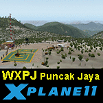
This is an X-Plane 11 scenery for Puncak Jaya Mining Airstrip (WXPJ) in the Puncak Jaya mountain region of Papua, Indonesia. This is a fictitious airfield, located in a high altitute mining location in Papua. At 4884 metres (16024 ft) above sea level, the Puncak Jaya peak, next to the mining location, is the highest mountain in Indonesia, on the island of New Guinea (which consists of the Indonesian West Papua region plus Papua New Guinea). This fictitious airfield may serve as a high altitute mining location challenge while flying the airstrips in Papua, as one of the destinations for "PT ASI Pujiastuti Aviation", operating as Susi Air, an Indonesia airlines established in late 2004 by Mrs. Susi Pudjiastuti. This scenery was tested and is operational (as of January 20, 2017) in "X-Plane 11 Public Beta #6 64 bit", Windows 10 Home. It was also tested and is partially operational (as of January 20, 2017) in "X-Plane 10.51 64 bit", Windows 10 Home. The issue with XP10 is the mesh again: there is no mine mesh, just a whole. The feel is very different from XP11, but it is still operational in XP10 to fly in and out.
| Filename: | WXPJ_Susi_Air_Puncak_Jaya_Mining_Airstrip_v100.zip |
| License: | Freeware |
| Added: | 21st January 2017, 18:42:35 |
| Downloads: | 58 |
| Author: | Rui Mesquita |
| Size: | 2.2 MB |
| Category: Flight Simulator 2002 - Scenery | |
| Victorian Airfields - Australia |
|
File Description:
This add-on scenery pack for FS 2002 adds 115 airfields to Victoria plus a few to NSW and South Australia,
totalling to over 120 in all. The 36 airfields listed below include full detail including accurately placed and sized
trees and buildings, static aircraft, fences, cars, roads with cars and streetlights and a variety of other
'eye candy'. The remaining airfields are mostly small minor/private strips and all include runway markers and
a windsock but you'll find a few buildings and other scenery at some of them. Rotorheads will also enjoy flying to the 10 included helipads scattered across the area around Melbourne. This scenery is a 'must have' for anyone who enjoys flying 'Downunder'!
The Following airfields are included in this package in full detail:
LILYDALE, COLDSTREAM, TOORADIN, PAKENHAM, TYABB, SUNBURY , WALLAN, MELTON, BACCHUS MARSH, GEELONG, TORQUAY, CORIO, BARWON HEADS, PORT FAIRY, LAKES ENTRANCE, APOLLO BAY, KYNETON, PHILIP ISLAND, LOCKSLEY, LETHBRIDGE, CERES, BENDIGO GLIDING CLUB, GRAMPIANS AIRFIELD, MILAWA, WENTWORTH, YARRAM, ORBOST, MALLACOOTA, MT BEAUTY, MOONGARA, WERRIBEE AIRSTRIP, BOORT, COBDEN, MEREDITH, WOODVALE, RIDDELLS CREEK
Using this scenery pack will make your flights around these airfields so much more exciting and enjoyable. No more boring old
unpopulated terrain around Victoria, you've got 115 new airfields available to fly from!
| Filename: | Victorian_Airfields__Australia.zip |
| License: | Freeware |
| Added: | 15th August 2003, 19:47:02 |
| Downloads: | 807 |
| Author: | Sebastian Szalai |
| Size: | 10.53 MB |
| Category: Flight Simulator 2004 - Scenery | |
| Iloilo Airport ,Iloilo City, Philippines |
|
File Description:
Iloilo Airport is located in Iloilo City, Panay Island, Philippines. This local visayan airport is served by the following major domestic airlines: Philippine Airlines, Cebu Pacific and Air Philippines. This scenery features the most realistic replica of buildings located in the airport area such as the Main Terminal buildings, Control Tower, Crash and Fire Rescue Station, Philippine Air Force building, private hangars, shops, and commercial buildings including the SM City-Iloilo right in front of the airport area. SM City's parking area is generally filled with vehicles everyday that they are very visible at the ramp area of the airport at daytime and most especially visible glittering at nighttime.
This scenery also features the different commercial vessels serving Iloilo City such as WG&A Superferry, Sulpicio Lines, Negros Navigation, and Philippine Fastferry Corporation's Supercat and SeaAngels. These vessels are visible when flying from Iloilo to Bacolod City passing through the Guimaras Channel.
This scenery is designed with the combined efforts of Ver Walter Gulfan of Cebu City, Philippines and Manny Aquino of Surabaya, Indonesia. For suggestions or comments, please visit our Philippine Flightsimmers Group website at www.philskies.net or you may join our forum at www.philskies.net/forum.
RPVI AFCAD file included with aircrafts taking off at the middle of the runway!
| Filename: | Iloilo_Airport_Iloilo_City_Philippines.zip |
| License: | Freeware |
| Added: | 29th August 2003, 21:38:49 |
| Downloads: | 5,813 |
| Author: | Ver Walter Gulfan/Manny Aquino,Jr. |
| Size: | 5.83 MB |
| Category: Flight Simulator 2002 - Aircraft Repaints, Textures and Modifications | |
| Matsakoni Airlines Virtual Bae 146-300 (Avro RJ100) |
|
File Description:
This is Matsakoni Airlines Virtual MAV(www.matsakoni.gr) fictional texture for the eurowings pro BAe146-300 addon. Based on standard colours of MAV aircrafts. Matsakoni Airlines was founded in early 2002 and its HQ¢s is based on Ioannis Kapodistrias Int airport (LGKR), Corfu island. Affiliates and hubs on other major Greek and European cities are planned for the fiscal year 2008. Eletherios Venizelos Athinai Int airport (LGAV) is MAV's hub since Aug'07. London Stansted (EGSS) is our new Hub in the U.K. A classic virtual operator connecting the Greek islands to major European and over Atlantic cities on a daily base with scheduled and non-scheduled flights. Matsakoni Airlines is operating, by order, the following aircraft types: Airbus A340/330, A306, Á319/2/1, Boeing B763, B747, B737, B727, BAe 146 and MD-11 for medium to long range flights. Matsakoni is servicing domestic flights and operates Fokker 100, ATR-72/500 and DH8C. We maintaining a fly-on-demand fleet, ranging from business jets like the ERJ-145 for V.I.P. and corporate flights, down to the Beechcraft BE-58 and Cessna 206/172 for a low-cost transport that meets your needs. Matsakoni Airlines wishes you a pleasant flight, Enjoy!
| Filename: | Matsakoni_Airlines_Virtual_Bae_146300_Avro_RJ100.zip |
| License: | Freeware |
| Added: | 13th February 2008, 02:02:49 |
| Downloads: | 95 |
| Author: | Andreas Mourtzoukos |
| Size: | 4.51 MB |
| Category: Flight Simulator 2004 - Aircraft Repaints, Textures and Modifications | |
| Matsakoni Airlines Virtual Bae 146-300 (Avro RJ100) |
|
File Description:
This is Matsakoni Airlines Virtual MAV(www.matsakoni.gr) fictional texture for the eurowings pro BAe146-300 addon. Based on standard colours of MAV aircrafts. Matsakoni Airlines was founded in early 2002 and its HQ¶s is based on Ioannis Kapodistrias Int airport (LGKR), Corfu island. Affiliates and hubs on other major Greek and European cities are planned for the fiscal year 2008. Eletherios Venizelos Athinai Int airport (LGAV) is MAV's hub since Aug'07. London Stansted (EGSS) is our new Hub in the U.K. A classic virtual operator connecting the Greek islands to major European and over Atlantic cities on a daily base with scheduled and non-scheduled flights. Matsakoni Airlines is operating, by order, the following aircraft types: Airbus A340/330, A306, Á319/2/1, Boeing B763, B747, B737, B727, BAe 146 and MD-11 for medium to long range flights. Matsakoni is servicing domestic flights and operates Fokker 100, ATR-72/500 and DH8C. We maintaining a fly-on-demand fleet, ranging from business jets like the ERJ-145 for V.I.P. and corporate flights, down to the Beechcraft BE-58 and Cessna 206/172 for a low-cost transport that meets your needs. Matsakoni Airlines wishes you a pleasant flight, Enjoy!
| Filename: | Matsakoni_Airlines_Virtual_Bae_146300_Avro_RJ100.zip |
| License: | Freeware |
| Added: | 13th February 2008, 22:46:00 |
| Downloads: | 232 |
| Author: | Andreas Mourtzoukos |
| Size: | 4.51 MB |
| Category: Flight Simulator 2004 - Aircraft Repaints, Textures and Modifications | |
| Matsakoni Airlines Virtual B737-700 (MAV 2008 Livery) |
|
File Description:
Textures only for PMDG Boeing NG 737-700 in Matsakoni Airlines Virtual new colours for 2008, registration SX-BKN.Matsakoni Airlines was founded in early 2002 and HQ¢s is based on Ioannis Kapodistrias Int airport (LGKR), Corfu island.
Affiliates and hubs on other major Greek and European cities are planned for the fiscal year 2008. Eletherios Venizelos Athinai Int airport (LGAV) is MAV's hub since Aug'07, London Stansted (EGSS) is our new Hub in the U.K and Makedonia int (LGTS) is the main hub for MAV Cargo flights.
A classic virtual operator connecting the Greek islands to major European and over worldwide cities on a daily base with scheduled and non-scheduled flights.
Matsakoni Airlines is operating aircraft types as follows:
Airbus A340/330, A306, Á318/9/2/1, Boeing B773, B763, B747, B737, B727 for medium to long range flights, also B747F, B73Q and B72Q for cargo flights.
Matsakoni is servicing domestic flights and operates BAE B463, Fokker 100, ATR-72/45, DH8C and Beechcraft B1900.
We maintaining a fly-on-demand fleet, ranging from business jets like the ERJ-145 for V.I.P. and corporate flights, down to the Beechcraft BE-58 and Cessna 206/172 for a low-cost transport that meets your needs.
Matsakoni Airlines wishes you a pleasant flight, Enjoy!
| Filename: | Matsakoni_Airlines_Virtual_B737700_MAV_2008_Livery.zip |
| License: | Freeware, limited distribution |
| Added: | 20th April 2008, 19:10:59 |
| Downloads: | 87 |
| Author: | Dimitris Pastarmatzis |
| Size: | 7.61 MB |


© 2001-2026 AVSIM Online
All Rights Reserved
Privacy Policy |