
Where Flight Simulation Enthusiasts Gather from Around the World!
AVSIM Library - Search Results

| Category: Flight Simulator 2002 - Scenery | |
| New 300-m (LOD7) Terrain Mesh of British Columbia and Southeast Alaska #2 |

|
File Description:
Mid-resolution (300-m) terrain mesh for the entire province of British Columbia (950,000 square km) and the Alaska panhandle southeast of N60 W139. Made from 250m-resolution source data without oversampling. Easy on frame rates and hard drive space. It transforms the rounded mountains of the default terrain mesh into a much more realistic representation of the diverse topography of this beautiful corner of the world. Experience the spectacular scenery between Vancouver and Atlin, Juneau and Fort St. John, and Mount Robson to Clayoquot Sound. Fourteen independent mesh tiles allow you to select the region(s) you like best. Several high-resolution add-on meshes will be uploaded separately. By Holger Sandmann. Part 2 of 4: All areas between 54 and 57 degrees North.
| Filename: | New_300m_LOD7_Terrain_Mesh_of_British_Columbia_and.zip |
| License: | Freeware, limited distribution |
| Added: | 17th January 2003, 20:23:55 |
| Downloads: | 3,487 |
| Author: | Holger Sandmann |
| Size: | 5.9 MB |
| Category: Flight Simulator 2002 - Scenery | |
| New 300-m (LOD7) Terrain Mesh of British Columbia and Southeast Alaska #1 |
|
File Description:
Mid-resolution (300-m) terrain mesh for the entire province of British Columbia (950,000 square km) and the Alaska panhandle southeast of N60 W139. Made from 250m-resolution source data without oversampling. Easy on frame rates and hard drive space. It transforms the rounded mountains of the default terrain mesh into a much more realistic representation of the diverse topography of this beautiful corner of the world. Experience the spectacular scenery between Vancouver and Atlin, Juneau and Fort St. John, and Mount Robson to Clayoquot Sound. Fourteen independent mesh tiles allow you to select the region(s) you like best. Several high-resolution add-on meshes will be uploaded separately. By Holger Sandmann. Part 1 of 4: All areas north of 57 degrees.
| Filename: | New_300m_LOD7_Terrain_Mesh_of_British_Columbia_and.zip |
| License: | Freeware, limited distribution |
| Added: | 17th January 2003, 20:24:26 |
| Downloads: | 4,101 |
| Author: | Holger Sandmann |
| Size: | 6.24 MB |
| Category: Flight Simulator 2004 - Scenery | |
| Bethel: St Mary's area airfields in southwest Alaska close to the Yukon River |
|
Images related to this file:
File Description:
This presumes you have already installed Bethel PABE and Bethel Local Airfields. In the Yukon River area of Alaska to the north of Bethel there are small villages, served by flights from both Bethel and the nearer St Mary's PASM. St Mary's has a gravel runway like the other villages, but has a larger population and airport services including maintenance and fuel. This, plus the saving of an average one hundred miles of flying by a Cessna 205 when compared with flights from Bethel, means it acts as a distribution centre fed from Bethel by larger aircraft. Go to "http://vfrmap.com/" for free vfr maps of the area (see the attached). The ten village airfields included here are all to the north and west of St Mary's: Hooper Bay PAHP, Chevak VAK, Cape Romanzof PACZ (closed air force field servicing a radar station), Scammon Bay SCM, Sheldon Point SXP, Alakanuk AUK, Emmonak PAEM, Kotlik 2A9, Mountain Village MOU, and of course St Mary's PASM itself. With these airfields not everything is as it appears to be. For instance, Hooper Bay is not a new and modernised airfield, despite the asphalt runway and apron; the current version has dispensed with the aging asphalt and gone back to gravel. I have tended to go for the 2005 or so versions, which sometimes means a small runway amid or close to the housing; Kotlik was an early renewal for reasons of safety as much as anything else and has had (since 2003?) a new and longer runway located outside of the town. The second batch of airfields will be to the east of St Mary's.
| Filename: | Bethel_St_Marys_area_airfields_in_southwest_Alaska.zip |
| License: | Freeware, limited distribution |
| Added: | 29th April 2019, 17:07:24 |
| Downloads: | 225 |
| Author: | Roger Wensley |
| Size: | 11.53 MB |
| Category: Prepar3D V1-4 - Miscellaneous Files | |
| RNP Approach Procedures for Southeast Alaska, for use with the PMDG 737 NGX |
|
File Description:
These are updated RNP procedures used in Southeast Alaska in conjunction with the PMDG 737.
While similar procedures exist else ware, the goal of these was not to code the exact procedure that is used in real world ops. The reason is because the PMDG 737 isn't capable of flying radius fix legs, which are used extensively in RNP procedures. If the approach and departures are coded as they are in the real aircraft, the flight path is not accurate. All other procedures I have located out there exhibit this limitation, which leads to unstabilized approaches.
The goal with these procedures is to have the PMDG 737 fly the same flight path as the real world procedures. Many of the fixes loaded into the FMS are sudo waypoints but as many of the true fixes are utilized to the extent possible. This means, when you arrive at minimums for the RNP 05 at Petersburg or the RNP 29 at Sitka, very little maneuvering will be required. Installation is a little tedious but will be well worth is.
Included airports and procedures:
Juneau - PAJN
CHLKT1
GLAZZ1
RODMN1
RNAV (RNP) M 08
RNAV (RNP) M 26
Ketchikan - PAKT
ANN3
DOOZI2
UDENE3
RNAV (RNP) M 11
RNAV (RNP) M 29
Petersburg - PAPG
GORBY4
HURAS2
RNAV (RNP) M 05
RNAV (RNP) M 23
Sitka - PASI
RNAV (RNP) M 11
RNAV (RNP) M 29
Wrangle - PAWG
KAJBU5
RNAV (RNP) M 10
RNAV (RNP) M 28
| Filename: | RNP_Approach_Procedures_for_Southeast_Alaska_for_u.zip |
| License: | Freeware |
| Added: | 31st March 2018, 03:31:12 |
| Downloads: | 837 |
| Author: | Trevor Lahey |
| Size: | 10.78 KB |
| Category: Flight Simulator X - Scenery | |
| RNAS Anthorn (HMS Nuthatch) - Cumbria, UK |
|
File Description:
This scenery is a representation of RNAS Anthorn (HMS Nuthatch) prior to runway and taxiway upgrades completed in 1948. It is not 100% accurate and no claim is being made that it is.
The scenery was made using ADE and is intended for use in FSX along with Horizon GenX VFR scenery but should work ok in Basic FSX.
Some History: Anthorn air field (also known as RAF Anthorn, RNAS Anthorn and HMS Nuthatch) was an airfield approximately 430 KM north-northwest of London
The airfield was built in february 1918 as a Fleet Air Arm (FAA) airfield. It was abandoned after World War I ended, however. The RAF reinstated the airfield at the beginning of World War II as an emergency landing ground for nearby RAF Silloth.
The site was taken over by the Royal Navy in December 1942, and renamed the site RNAS Anthorn. It was commissioned in September 1944 as 'HMS Nuthatch'.
The airfield served as No. ARDU (Aircraft Receipt and Dispatch Unit), a unit that accepts aircraft from their manufacturers and prepares them for operational use.
The last official flight took off from the airfield in November 1957. It was then put on Care and Maintenance, before it closed down in March 1958.
In 1961 the site was chosen to become a NATO VLF transmitting site for communicating with submarines. Construction of the site, by Continental Electronics of Dallas, U.S.A., began in 1962.
The station was accepted on behalf of the MoD in November 1964.
| Filename: | RNAS_Anthorn_HMS_Nuthatch__Cumbria_UK.zip |
| License: | Freeware |
| Added: | 1st March 2015, 23:11:58 |
| Downloads: | 435 |
| Author: | Mark Byers |
| Size: | 21.34 MB |
| Category: Flight Simulator X - Aircraft Repaints, Textures and Modifications | |
| BC Coastal Beaver Repaints |
|
Images related to this file:
File Description:

Textures for the default FSX DHC2 Beaver. 11 real world Beaver DHC2's. Repaints for: Nootka Air, Harbour Air, Pacific Eagle Air, Pacific Coastal Air, Pat Bay Air, Saltspring Air, Seair Seaplanes,
Tofino Air, Vancouver Island Air, Westcoast Air & Whistler Air. By Mike Mann
| Filename: | BC_Coastal_Beaver_Repaints.zip |
| License: | Freeware, limited distribution |
| Added: | 1st February 2011, 10:22:24 |
| Downloads: | 1,683 |
| Author: | Mike Mann |
| Size: | 26.09 MB |
| Category: Prepar3D V1-4 - Utilities | |
| MultiTool Prepar3D v3.2 |
|
Images related to this file:
File Description:
Multi-Tool Prepar3D v3.2 is a collection of tools, a number of them unique, extending the capabilities of P3D.
New features in v3.2 :
- Adjustable Horizon/Aircraft banking
- Bug fixes/Improvements on previous functions
Previous features include :
- Custom Flybys, user defined camera flyby paths.
- Roaming Flybys, computer generated camera flyby paths.
- Active Observers views placeable by clicking on a top-down view
- Find My Way Home random aircraft positioning.
- 3D Native Stereoscopic Output.
- Head tracking additions: Ordinals, Take off lock, View switching by head movement , Spot up/down tracking.
- Camera Shake + Vibration : Turbulence, G, ground roll, side slip, spoilers.
- Easy 2D & 3D custom cameras definitions.
- XYZ Position (Eyepoint) Mouse Move similar to the Mouse Look pan function, i.e. hold down a key and reposition your eyepoint with your mouse.
- POV conversion to multiple controller buttons.
- Keystroke macros to perform menu functions. - Landing lineup with runway camera.
- Multi screen VC setup. - Save/Recall view setup by aircraft.
- Recallable position autosaving. and more....
Youtube Channel https://www.youtube.com/channel/UCnFQCGMTB7eL-MFTHf8NFbA
| Filename: | MultiTool_Prepar3D_v32.zip |
| License: | Freeware |
| Added: | 22nd December 2016, 07:47:21 |
| Downloads: | 916 |
| Author: | Richard Barry |
| Size: | 3.74 MB |
| Category: Flight Simulator 2004 - Miscellaneous Files | |
| Supersky 2015 v1.0 |
|
Images related to this file:
File Description:
FS9 Supersky 2015 is an evolution of the preceding Supersky 2010.
FS9 Supersky is an environmental package composed of 5 set of sky textures + one module of SweetFX effects.
Sky textures have been adapted to better interact with SweetFX using the preset included in the package.
The result of this process is the generation of striking effects of the sky, included the Rayleigh effect on the horizon.
There are many combinations; I leave to you the joy of discovering them.
Before installing FS9 Supersky 2015 I suggest to make a backup copy of sky textures.
You can find them in the texture folder of your FS9.
Impact on framerate should be almost insignificant for owners of modern PCs.
Owners of old or weak PCs may have a loss of frame.
All the instructions to install and configure FS9 Superksy 2015 are already included into the package.
FS9 Supersky 2015 works with WinXP 32bit, Win7 32bit and 64bit.
| Filename: | Supersky_2015_v10.zip |
| License: | Freeware |
| Added: | 27th January 2015, 09:00:45 |
| Downloads: | 1,452 |
| Author: | Aldo Bulgheroni |
| Size: | 5.36 MB |
| Category: Flight Simulator X - Gauges | |
| PFD for Saitek FIP version 4 |
|
Images related to this file:
File Description:
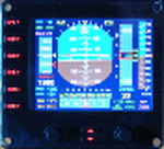
For Saitek Pro Flight Instrument Panel. This is version 4, some mistakes in tapes' numbers are fixed, a minus sign is added to the vertical speed tape when descending, instructions updated (unexpected spaces and words).
This is folder contains 4 PFDs. There are two sizes of numbers for radio height and for vertical speed. There are two positions for DME2, VOR2, Course and autopilot heading, lower left or lower right positions in the FIP. Codes have been reworked to be more FPS friendly.
PFDVGE4 provides horizon, speed, altitude and compass tapes. Localizer and glide slope. Flight director bars. Vertical speed with needle and numbers. Radio height, VOR1, DME1, VOR2, DME2, ADF, Course and autopilot heading in numbers. Autopilot bugs for speed, heading, altitude and vertical speed. Autopilot lights for functions: Master AP, Flight director, Altitude, heading, auto throttle, speed, Mach, approach, back course and NAV. TAT, QNH and Mach. Left knob moves course and right knob moves QNH.
| Filename: | PFD_for_Saitek_FIP_version_4.zip |
| License: | Freeware |
| Added: | 15th November 2011, 02:21:06 |
| Downloads: | 731 |
| Author: | Philippe Verhaege |
| Size: | 854.01 KB |
| Category: Microsoft Flight Simulator (2020) - Aircraft Repaints, Textures and Modifications | |
| Grumman G44A Widgeon N444M |
|
Images related to this file:
File Description:
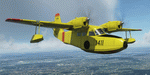
This folder contains a repaint for the Grumman G44A Widgeon by Flysimware. It shows Grumman G-44A Widgeon N444M, c/n 1411. It was Built in 1945 and went to fly in Alaska as NC41980. In 1960 it was re-registered as N444M and flew in the Eastern US. In 1981 it flew to the UK, where it sank after landing on a reservoir. It was repaired in 1985 and painted in the paintscheme of this repaint. It operated from Biggin Hill until 1997, when it was flown back to the US. It is currently based in Florida. Repaint by Jan Kees Blom.
| Filename: | Grumman_G44A_Widgeon_N444M.zip |
| License: | Freeware |
| Added: | 13th June 2021, 18:53:48 |
| Downloads: | 21 |
| Author: | Jan Kees Blom |
| Size: | 38.56 MB |
© 2001-2026 AVSIM Online
All Rights Reserved
Privacy Policy |