
Where Flight Simulation Enthusiasts Gather from Around the World!
AVSIM Library - Search Results

| Category: Flight Simulator 2004 - Scenery | |
| Kangiqsujuaq CYKF in northern Quebec, Canada |

|
Images related to this file:
File Description:
Kangiqsujuaq is on the north coast of Quebec, 85 miles west of Quaqtaq and 125 miles east of Salluit, while across the Hudson Strait and 100 miles away on Baffin Island is Kimmirut. The town grew around two trading posts, the first opened by Revillon Freres in 1910, and the second by the Hudson Bay Company in 1914. A school was opened in 1960, and a clinic in 1961. The town was known as Wakeham Bay until 1961, and now has a population of around 700. The airport is to the south of the town and up on the hill at 511 feet ASL (this has been remeasured since 2004 and is now known to be 501). The gravel runway is just over 3,500 feet long and aligned 15/33; there is no PAPI, but there is fuel available, both 100LL and JetA. There are flights by Air Inuit.
| Filename: | Kangiqsujuaq_CYKF_in_northern_Quebec_Canada.zip |
| License: | Freeware, limited distribution |
| Added: | 27th January 2013, 00:55:00 |
| Downloads: | 231 |
| Author: | Roger Wensley |
| Size: | 2.31 MB |
| Category: Flight Simulator 2004 - Scenery | |
| Kangiqsualujjuaq CYLU in northern Quebec, Canada |
|
Images related to this file:
File Description:
Kangiqsualujjuaq is in northern Quebec on the east side of Ungava Bay, which is to the east of Hudson Bay and around 150 miles wide and 120 miles deep. Kuujjuaq, the administrative capital of northern Quebec, is 100 miles to the southwest. The town is on the bank of the George River, and has also been known as Fort George River, George River, etc. There was a Hudson Bay trading post at the town's location as early as 1838, though it was closed and reopened more than once and the town did not grow because of the trading post; the Inuit lived on the coast during the summer but moved 30 miles inland in winter for trapping. A cooperative was formed in 1959 to market fish, and this was the creative force that brought about establishment of the town; a school was built in 1963.
The airport is to the north of the town in a valley between the surrounding hills at 215 feet ASL. The gravel runway is just over 3,500 feet long and aligned 16/34; there is no PAPI, but there is fuel available, both 100LL and JetA. There are flights by Air Inuit and a warning of caribou on the runway during October and November.
| Filename: | Kangiqsualujjuaq_CYLU_in_northern_Quebec_Canada.zip |
| License: | Freeware, limited distribution |
| Added: | 1st February 2013, 21:24:55 |
| Downloads: | 277 |
| Author: | Roger Wensley |
| Size: | 2.76 MB |
| Category: Flight Simulator 2004 - Scenery | |
| Kuujjuarapik CYGW in northern Quebec, Canada |
|
Images related to this file:
File Description:
Kuujjuarapik is in northern Quebec at the southern end of Hudson Bay, 90 miles east of James Bay and on the north shore of the Great Whale River; Kuujjuarapik means Small Great River in Inuktitut. Once again the Hudson Bay trading post that opened (in 1820) was the catalyst for the establishment of first a seasonal encampment and then the beginnings of a town in the late 1930's.
The two adjacent villages that now form the town have a total population (mainly Cree and Inuit) of around 1,500. When the Quebec hydo-electric project was under construction in the early 1980's a large portion of the Inuit population voted to move to a new settlement called Umiujaq (my post) 100 miles to the north.
The airport is to the west of the town, between the town and the sea. The gravel and sand runway (which I have made as gravel as there is no convincing way to mix the two) is 5,500 feet long, 150 feet wide, and aligned 17/35, which is approximately parallel to the coast. There is fuel available, both 100LL and JetA, delivered by truck. The AI included here is for Air Inuit and Wasaya, with Air Inuit making three flights per day plus a fourth flight by the Air Inuit Twotter C-GNDO that is based at the airport, and private flights by various aircraft. Yes, there really is a golf course to the south of the airport, and the last thing to note is that Kuujjuarapik has a mandatory radio frequency and that taking into consideration the scheduled flights I have included the tower radio frequency that makes this a controlled airport in FS9.
| Filename: | Kuujjuarapik_CYGW_in_northern_Quebec_Canada.zip |
| License: | Freeware, limited distribution |
| Added: | 16th February 2013, 00:33:20 |
| Downloads: | 306 |
| Author: | Roger Wensley |
| Size: | 2.8 MB |
| Category: Flight Simulator 2004 - Scenery | |
| CYSM - Fort Smith, Northwest Territories, Canada |
|
Images related to this file:
File Description:
Fort Smith is just north of the border between Alberta and Northwestern Territories, midway between Lake Athabasca to the southeast in (mostly) Saskatchewan (80 miles) and Great Slave Lake to the north west (90 miles). The runways all used to be larger, and while I don't know the history it looks as if it is ex-military and these are the remains of what were once 10,000 feet of asphalt. The main runway is now 11/29 and 6,000 feet long, and the secondary one is 1,800 feet of mostly gravel. There is an airline based at the field, Northwestern Air, and fuel (both 100LL and JA-1) is available at a self service point so long as you give it a credit card to read while you fill. The town of Fort Smith is two miles east of the airfield, on the bank of the Slave River and where there are some rapids that require a portage to get around them. Before aviation came along the river was a major route to the north and all those furry animals, which was why the Hudson's Bay Company established an outpost there in 1872. Today it has a population of 2,400 and the main activities are government administration of much of the Northwest Territories, education, and tourism.
| Filename: | CYSM__Fort_Smith_Northwest_Territories_Canada.zip |
| License: | Freeware, limited distribution |
| Added: | 28th January 2012, 17:11:47 |
| Downloads: | 592 |
| Author: | Roger Wensley |
| Size: | 4.29 MB |
| Category: Flight Simulator 2004 - Scenery | |
| Yellowknife Floats CEN9 - Northwest Territories, Canada |
|
Images related to this file:
File Description:
Yellowknife float base is on the shore of Yellowknife Bay, which is on the north side of Great Slave Lake. The float base is on two sides of Latham Island and the promontory that reaches out to it, which is where the town of Yellowknife was originally founded, and float planes land either in Back Bay (to the west) or in East Bay (guess where?). Where the south end of the island meets the promontory there are two inlets and two companies; Air Tindi in the eastern part and North Airways in the western. These two companies have bespoke buildings. I have used other buildings from other sceneries to model the "feel" of the original Yellowknife and the docks along the shore. One thing I could not do, and that was to recreate at its correct height "the rock", which is the raised centre of the promontory; FS9 resisted terrain readjustments beyond a certain point.
| Filename: | Yellowknife_Floats_CEN9__Northwest_Territories_Can.zip |
| License: | Freeware, limited distribution |
| Added: | 1st February 2012, 23:53:17 |
| Downloads: | 920 |
| Author: | Roger Wensley |
| Size: | 12.38 MB |
| Category: Flight Simulator 2004 - Scenery | |
| Rockcliffe CYRO update in Ontario, Canada |
|
Images related to this file:
File Description:
This is Rockcliffe in late 2011, on the day before the old clubhouse was demolished. It is based on the original scenery by Flight Ontario and follows on from my previous updates, but this is a new version rather than an update and REPLACES the previous versions. The difference is in the bespoke detail: runway and taxiway lighting (the taxiway lighting is limited, as in real life, to taxiway C); signage throughout including runways, taxiways, refuelling, and parking; refuelling tanks and pumps; fence visibility strips; updated ground markings for the Rockcliffe Flying Club apron and the runway; revised apron texture in front of the new hangar; smaller items such as trash cans and external electrical distribution box for heating cables. There are also, from previous updates, the new clubhouse, the new maintenance hangar, and from the original scenery the Museum complex.
| Filename: | Rockcliffe_CYRO_update_in_Ontario_Canada.zip |
| License: | Freeware, limited distribution |
| Added: | 28th February 2012, 13:13:33 |
| Downloads: | 564 |
| Author: | Roger Wensley |
| Size: | 5.01 MB |
| Category: Flight Simulator 2004 - Scenery | |
| Mountain View CPZ3 in Ontario, Canada |
|
Images related to this file:
File Description:
This is Mountain View, a small RCAF airfield at the eastern end of Lake Ontario on Prince Edward Island, some 40 miles west of Kingston. Mountain View is used for training during the summer months, and part of this training is for C-130 crews, who practice landing on rough or unprepared landing strips. The crews are based at Trenton, which is a large base 10 miles to the northwest on the mainland. There are (or were, I haven't seen it recently) numerous parked and ancient fighter planes such T-33's and Canadair Tutors; these could also have possibly been used for summer training or perhaps were just stored. Last summer there were only two hangars left standing; in 2002 there were five. In real life you would be on the lookout not only for C-130's but also (at certain times during the summer) for parachutists and also gliders. This airfield is one that you will fly over and not land on; I confess that I have cheated with the length of the 06L-24R gravel "practice" runway, so that it became possible for the FS version of a touch-n-go with a C-130 to be completed without using the grass. The aerial photograph shows the new "practice" gravel runway under construction.
| Filename: | Mountain_View_CPZ3_in_Ontario_Canada.zip |
| License: | Freeware, limited distribution |
| Added: | 9th March 2012, 15:05:57 |
| Downloads: | 350 |
| Author: | Roger Wensley |
| Size: | 7.26 MB |
| Category: Flight Simulator 2004 - Scenery | |
| Tuktoyaktuk CYUB in Northwest Territories, Canada |
|
Images related to this file:
File Description:
Tuktoyaktuk is on the northern coast of Canada, 70 miles north of Inuvik and to the east of the Mackenzie River delta. It has a population of around 900 and because of its natural harbour is a centre for oil exploration activity on the surrounding land and on the Beaufort Sea, with sizeable but now under-used yards dating back to the peak of activity in the late 1970's. On land work is restricted to the winter half of the year, as only the freeze-up makes it possible to move on land with heavy equipment, and during the winter further supples are driven over an ice road from Inuvik up to Tuk. The ice-free summer months are used for floating equipment from Yuk along the coast on barges and then up the rivers to inland sites in preparation for the winter activity. Before the oil there was a DEW line station here, and there is still an automated station on the same site and included here, as are the yards. The airfield is on the coast close to the town and the yards, at 15' ASL. The gravel runway 09/27 is 5,000' feet long and 150' wide; both thresholds are displaced by 200', but of course there are no markings on the gravel. The large apron is on the north side at the centre of the runway and is large enough to accomodate several large planes. Inuvik revised should be installed first, now Tuk, then last of the three Sachs Harbour which has AI for Aklak Airlines flights (operated by Kenn Borek) for all three airfields. There is a separate AI file included here, featuring freight delivery by Buffalo Airways and small planes.
| Filename: | Tuktoyaktuk_CYUB_in_Northwest_Territories_Canada.zip |
| License: | Freeware, limited distribution |
| Added: | 14th May 2012, 17:19:20 |
| Downloads: | 618 |
| Author: | Roger Wensley |
| Size: | 8.99 MB |
| Category: Flight Simulator 2004 - Scenery | |
| CYKY - Kindersley Regional Airport, Saskatchewan, Canada |
|
Images related to this file:
File Description:
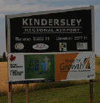
CYKY Kindersley Regional Airport is located in the west-central part of the province of Saskatchewan, Canada. The airport is located 4.6 km north of the town. The scenery consists of custom models of all the buildings at the airport, runway signs, runway and taxiway lighting, rotating beacon, static aircraft, vehicles, animated highway traffic and oil pump jacks, trees that properly change with the seasons, custom tarmac and runway textures, and seasonal ground textures for the airport and surrounding area.
| Filename: | CYKY__Kindersley_Regional_Airport_Saskatchewan_Can.zip |
| License: | Freeware |
| Added: | 14th June 2012, 13:44:10 |
| Downloads: | 1,288 |
| Author: | Gregory Putz |
| Size: | 84.58 MB |
| Category: Flight Simulator 2004 - Scenery | |
| CYPE - Peace River - Northwest Alberta, Canada |
|
Images related to this file:
File Description:
The Peace River flows east from the Rockies, joining up with the Slave River to empty into Great Slave Lake. The town is on both banks close to a bend, 245 miles northwest of Edmonton. The population is 7,000 and the surrounding area is either farmland or forest and used for winter sports; Peace River hosted the 2004 Alberta Winter Games. The airport is just over 3 miles west of the town. The runway is 5,000 feet of wide asphalt (150 feet) aligned 04/22, lit, and with PAPI. There is a second runway to the south of the main runway, 1,900 feet of grass and aligned 08/26. The apron is to the north of the runway at the eastern end and is large; there is a purpose-built terminal building, plus other hangar buildings along taxiway C that extends westward from the apron. The airport gives the impression that it is under-used; there are no long lines of parked planes waiting for the weekend and few scheduled flights. These are mainly (totally?) by Sunwest Home Aviation, but unfortunately nobody has made the textures for Sunwest and my talents do not run in that direction so I have made believable substitutions. There is also a small but obstinate AI difficulty, described in the notes.
| Filename: | CYPE__Peace_River__Northwest_Alberta_Canada.zip |
| License: | Freeware, limited distribution |
| Added: | 10th November 2013, 23:56:22 |
| Downloads: | 334 |
| Author: | Roger Wensley |
| Size: | 10.83 MB |


© 2001-2026 AVSIM Online
All Rights Reserved
Privacy Policy |