
Where Flight Simulation Enthusiasts Gather from Around the World!
AVSIM Library - Search Results

| Category: Flight Simulator X - AFCAD Files | |
| Greater Moncton International Airport / Canada (CYQM) |

|
Images related to this file:
File Description:
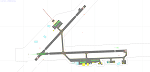
CYQM - Greater Moncton International Airport / Moncton, New Brunswick, Canada
This airport update was made with the latest version of ADE (Airport Design Editor) and made for FSX as a replacement for the stock (default) airport. I found that most stock airports in FSX lack a decent amount of character and realism and this area in particular was dreadful! The stock airport was rather inaccurate. I've made several additions to the airport which are listed below. All these enchancements are as close to the real airport as I can get with stock library objects. I've used satellite images, terminal photos and maps throughout the whole process so building locations are as accurate as possible. Happy landings in the beautiful Canada!
Features:
*Expanded parking apron
*Main terminal building with it's 2 jetways and additional parking for regional jets/turboprops
*Seperate parking aprons for GA traffic near the old terminal
*Hangar and other airport buildings added
*Airport vehicles and objects throughout the airport
*Main road in front of airport added with static vehicles
*Parking lots with static vehicles
*Airport fire station with fire trucks
*Static de-icing vehicles
| Filename: | Greater_Moncton_International_Airport__Canada_CYQM.zip |
| License: | Freeware |
| Added: | 21st July 2012, 02:41:58 |
| Downloads: | 816 |
| Author: | Jaison Diaz |
| Size: | 10.6 KB |
| Category: Flight Simulator 2004 - Scenery | |
| CYKY - Kindersley Regional Airport, Saskatchewan, Canada |
|
Images related to this file:
File Description:
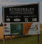
CYKY Kindersley Regional Airport is located in the west-central part of the province of Saskatchewan, Canada. The airport is located 4.6 km north of the town. The scenery consists of custom models of all the buildings at the airport, runway signs, runway and taxiway lighting, rotating beacon, static aircraft, vehicles, animated highway traffic and oil pump jacks, trees that properly change with the seasons, custom tarmac and runway textures, and seasonal ground textures for the airport and surrounding area.
| Filename: | CYKY__Kindersley_Regional_Airport_Saskatchewan_Can.zip |
| License: | Freeware |
| Added: | 14th June 2012, 13:44:10 |
| Downloads: | 1,288 |
| Author: | Gregory Putz |
| Size: | 84.58 MB |
| Category: Flight Simulator 2004 - Scenery | |
| Mountain View CPZ3 in Ontario, Canada |
|
Images related to this file:
File Description:
This is Mountain View, a small RCAF airfield at the eastern end of Lake Ontario on Prince Edward Island, some 40 miles west of Kingston. Mountain View is used for training during the summer months, and part of this training is for C-130 crews, who practice landing on rough or unprepared landing strips. The crews are based at Trenton, which is a large base 10 miles to the northwest on the mainland. There are (or were, I haven't seen it recently) numerous parked and ancient fighter planes such T-33's and Canadair Tutors; these could also have possibly been used for summer training or perhaps were just stored. Last summer there were only two hangars left standing; in 2002 there were five. In real life you would be on the lookout not only for C-130's but also (at certain times during the summer) for parachutists and also gliders. This airfield is one that you will fly over and not land on; I confess that I have cheated with the length of the 06L-24R gravel "practice" runway, so that it became possible for the FS version of a touch-n-go with a C-130 to be completed without using the grass. The aerial photograph shows the new "practice" gravel runway under construction.
| Filename: | Mountain_View_CPZ3_in_Ontario_Canada.zip |
| License: | Freeware, limited distribution |
| Added: | 9th March 2012, 15:05:57 |
| Downloads: | 350 |
| Author: | Roger Wensley |
| Size: | 7.26 MB |
| Category: Flight Simulator 2004 - Scenery | |
| Shea Field CSF7, Casselman Ontario Canada |
|
Images related to this file:
File Description:
Shea Field is a recently-licensed privately-owned grass airfield in Ontario, 25 miles southeast of ottawa, and south of Highway 417. When I visited I was greeeted by the horse, peering around the end of it's stable shed at the corner of apron and runway. I walked over to the house and rang the doorbell and the dog said hello and that exhausted all social contact. The hangar is large but I have no idea what is inside. There was one plane parked on the apron with a skirt of uncut grass so presumably it hasn't flown for a few months. It was a Citabria in what looked like good condition; I don't have a Citabria to park there so I put a Cub. My favourite building is the old barn, leaning to one side as if seeking support for an elbow. To the north there are some farm sheds and grain silos, and to the northwest a tall mast; avoid it. To find the field without a gps follow the 417 and look for the tall mast just west of a major highway wiggle.
| Filename: | Shea_Field_CSF7_Casselman_Ontario_Canada.zip |
| License: | Freeware, limited distribution |
| Added: | 5th August 2012, 13:35:12 |
| Downloads: | 215 |
| Author: | Roger Wensley |
| Size: | 2.62 MB |
| Category: Flight Simulator 2004 - Scenery | |
| Attawapiskat CYAT in northern Ontario, Canada |
|
Images related to this file:
File Description:
Attawapiskat is on the north bank of the river of the same name, around 7 miles upstream from where the river meets the west shore of James Bay at its mid point. The top end of the Bay is around 140 miles north, Moosonee is around the same to the south, and the east shore 140 miles to the east. The town has a population of around 1,600, although this varies with the seasons as hunting and the traditional way of life on the land is still important to the Cree-speaking inhabitants. The airport is just to the north of the town with a gravel runway almost 3,500 feet long, and I have included the recently installed PAPI. The Canada Flight Supplement does not say anything about fuel being available so I presume the tanks beside the apron are no longer in use. There is also no apron lighting, unless it has been installed recently. There are flights by Air Creebec and by several other smaller airlines and I have included both Air Creebec and Wasaya; their textures are available for download and the planes are as listed in the AI folder.
| Filename: | Attawapiskat_CYAT_in_northern_Ontario_Canada.zip |
| License: | Freeware, limited distribution |
| Added: | 3rd January 2013, 01:37:50 |
| Downloads: | 376 |
| Author: | Roger Wensley |
| Size: | 3.54 MB |
| Category: Flight Simulator 2004 - Scenery | |
| CYSK - Sanikiluaq - Southern Nunavut, Canada Revised |
|
Images related to this file:
File Description:
Sanikiluaq is on one of the Belcher Islands in Hudson Bay, near the northern end of James Bay, and this is a revised version. It corrects the terminal that I made with limited information and faded memories the first time, adds in signage, runway lights, taxiway lights, terminal night textures, and revised AI. The "spare" parking space is the one next to the 4 gas drums on a pallet; line up with the traffic cone. It presumes you have already installed my September 2010 Sanikiluaq post, and this version is not complete by itself.
| Filename: | CYSK__Sanikiluaq__Southern_Nunavut_Canada_Revised.zip |
| License: | Freeware, limited distribution |
| Added: | 15th January 2013, 17:35:52 |
| Downloads: | 248 |
| Author: | Roger Wensley |
| Size: | 2.78 MB |
| Category: Flight Simulator 2004 - Scenery | |
| Toronto Downtown Airport CYTZ Ontario, Canada |
|
Images related to this file:
File Description:
CYTZ is on an island in Lake Ontario and immediately adjacent to downtown Toronto. This updates the version made by Flight Ontario as there have been major changes since Porter Airlines purchased the airport. The obvious and main new item is the terminal, made with photo textures and with ten gates sized to accomodate the Dash 8-400 they currently use. The terminal has a passenger entrance and a vehicle setdown point as part of the link to the ferry terminal that wraps around the west side of the original and preserved terminal building. The ferry terminal is included here, along with a ferry. Also new are the car parking, road routing, gate and taxi markings, taxiways, taxiway signage, taxiway lighting, runway lighting, aprons, apron lighting (from Sid Schwartz and you will need to install his "lights_ss_v2"), fences, fuel tanks, tanker trucks, access roads to navigation equipment, ai parking, static parked planes, parked cars, apron equipment, and the useable floatplane ramp. The AI includes Porter, Jazz, several GA aircraft, and a helicopter. Only 3 of these require downloads. The Lake Ontario AI includes three large ships, typical of the traffic to be seen on all the Great Lakes. CYTZ has three runways and there is an airport diagram included. 08-26 has ILS and is the only runway actually long enough to be used by Porter; FS9 atc will ignore this. There is fuel available and it is dispensed from a truck. The longer projection from the front of the terminal building is a covered ramp that leads up from the terminal basement level, used by towed luggage trolleys. The gates are not powered in any way except for the weather cover that protects passengers as they cross the small area of asphalt between plane and gate. I did not try to reproduce this in FS9.
| Filename: | Toronto_Downtown_Airport_CYTZ_Ontario_Canada.zip |
| License: | Freeware, limited distribution |
| Added: | 23rd October 2012, 12:52:14 |
| Downloads: | 1,806 |
| Author: | Roger Wensley + Flight Ontario |
| Size: | 12.43 MB |
| Category: Flight Simulator 2004 - Scenery | |
| Matheson Point CWMP in Nunavut, Canada |
|
Images related to this file:
File Description:
This was a DEW line I Station on the southeast shore of King William Island; the island is around 70 miles square and Gjoa Haven is also on the southeast corner, 20 miles to the south. The station was closed in 1963 and has now been totally dismantled and removed except for a fallen 300 feet communications tower. The runway is still there (mostly) and is around 3,360 feet of gravel 120' wide, aligned 146T/326T. There are no lights, signage, or windsock, or any building remaining. All of these DEW line stations are not particularly impressive or even interesting. However, you can bet that any pilot flying regularly in the north along the coast knows where all these runways are, in case one of them suddenly becomes his favourite in the whole world just after the sudden silence.
| Filename: | Matheson_Point_CWMP_in_Nunavut_Canada.zip |
| License: | Freeware, limited distribution |
| Added: | 22nd November 2012, 16:28:19 |
| Downloads: | 179 |
| Author: | Roger Wensley |
| Size: | 785.57 KB |
| Category: Flight Simulator 2004 - Scenery | |
| Shepherd Bay CWSB in Nunavut, Canada |
|
Images related to this file:
File Description:
This was a DEW line Auxiliary Station on the western shore of the lower reaches of the Boothia Peninsula, 50 miles south of Taloyoak and 60 miles east of Gjoa Haven. The station was closed in 1989 but is almost intact except for a diesel tank or two. There are also other buildings nearby, and others on the beach landing area. A NWS automated station was opened in the same year as the Dew station was closed. The runway is also still there and is around 4,500 feet of gravel 100' wide, aligned 027T/207T. There are no lights, signage, or windsock, but the usual large hangar which was built at all Auxiliary Stations still survives. This is one of the more interesting DEW line stations to visit and walk around.
| Filename: | Shepherd_Bay_CWSB_in_Nunavut_Canada.zip |
| License: | Freeware, limited distribution |
| Added: | 22nd November 2012, 16:28:45 |
| Downloads: | 223 |
| Author: | Roger Wensley |
| Size: | 2 MB |
| Category: Flight Simulator 2004 - Scenery | |
| Simpson Lake CWSL in Nunavut, Canada |
|
Images related to this file:
File Description:
This was a DEW line I Station in the lower reaches of the Boothia Peninsula, 80 miles south of Taloyoak and 40 miles east of Shepherd Bay. The station was closed in 1963 and the buldings and other items have been removed apart from the garage and some diesel tanks. A NWS automated station was opened there in 1991. The runway is still there and is just over 3,500 feet of gravel 100' wide, aligned 044T/224T, and at 790 feet ASL. There are no lights, signage, or windsock. This is one of the less interesting DEW line stations to visit and walk around.
| Filename: | Simpson_Lake_CWSL_in_Nunavut_Canada.zip |
| License: | Freeware, limited distribution |
| Added: | 24th November 2012, 02:53:06 |
| Downloads: | 209 |
| Author: | Roger Wensley |
| Size: | 929.41 KB |


© 2001-2026 AVSIM Online
All Rights Reserved
Privacy Policy |