
Where Flight Simulation Enthusiasts Gather from Around the World!
AVSIM Library - Search Results

| Category: Flight Simulator 2004 - Aircraft Repaints, Textures and Modifications | |
| Royal Hellenic Air Force Supermarine Spitfire Collection |

|
File Description:
This package includes all the Hellenic Spitfires expect the Spitfire pr Mk.XI witch appeared in one unit and pr Mk.XIII in three units. You can fly the spitfire mk.Vb/c, Spitfire mk.IXe LF/HF and Spitfire Mk.XVIe LF. Greece in 9/23/1938 ordered 12 Spitfires and 12 Anson. During the June of 1939 it was signed the order of 24 Spitfires which cost 9335 pounds each. When Hitler attacked to Poland, England used all the aircrafts that were under construction and of course the Greek were some of them. On 10/12/1943, the 336th Olympus Squadron received the first Spitfire and followed the 335th Tiger Squadron. The Spitfire mk.Vb/c replaced the Hurricane mk.IIb/c. When the two greek Squadrons were at North Africa, their Spitfires wore the
| Filename: | Royal_Hellenic_Air_Force_Supermarine_Spitfire_Coll.zip |
| License: | Freeware, limited distribution |
| Added: | 2nd December 2005, 19:59:29 |
| Downloads: | 3,883 |
| Author: | Delizisis Thanasis, Delizisis Panagiotis, Ken Harrison (Merlin66) |
| Size: | 19.6 MB |
| Category: Microsoft Flight Simulator (2020) - Scenery | |
| UGAM Ambrolauri Airport, Georgia [MSFS] |
|
Images related to this file:
File Description:
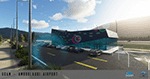
Ambrolauri Ambrolauri (Georgian: áƒáƒ›áƒ‘რáƒáƒšáƒáƒ£áƒ ი) is a city in Georgia, located in the western part of the country, on both banks of the Rioni river, at the elevation of 550 m above sea level. It is a self-governing city. At the same time, the city serves as the seat of the Racha-Lechkhumi and Kvemo Svaneti regional administration and the Ambrolauri Municipality. According to the 2014 census, the city had a population of 2,047. Its area is 1.6 km². Ambrolauri is first recorded in the 17th century as a place, where one of the palaces of the kings of Imereti was located. It acquired the city status in 1966 and became a self-governing city with its own municipal government in 2014. The Airport The airport is nestled into the Caucasus mountains right at the bank of the river Rioni. It has a single runway of 1100 m length and caters small propeller aeroplanes. The apron has space for two planes at a time and caters up to 50 passengers at one time. In the Simulator The virtual airport is very close to its real-world counterpart. All the buildings at and near the airport are modelled and the terminal even has an interior that can be seen from outside. The look and feel from a trip to the Racha region is definitely there. In real life, only small planes fly to the airport but that shouldn't stop you to bring planes from the size of the Dash 8.
| Filename: | UGAM_Ambrolauri_Airport_Georgia_MSFS.zip |
| License: | Freeware, limited distribution |
| Added: | 30th December 2020, 18:16:07 |
| Downloads: | 179 |
| Author: | David Hilker |
| Size: | 72.32 MB |
| Category: Flight Simulator 2004 - Panels | |
| New Vickers VC10 panel, Part 1 |
|
File Description:
This is part 1 of two downloads.
This project is based on David Maltby's panel for the Vickers VC10, model available here: www.dmflightsim.co.uk/vickers_vc10.htm.

The project's aim is to enhance the cockpit experience by re-activating numerous gauges, switches and lights that previously had no function. It also introduces some new gauges and windows that are not in the original model. And, to bring the cockpit procedures as close as possible to the real checklists. To this end it contains voicechecklist files, a cockpit briefing and interactions with the cabin crew including a safety briefing.
The cockpit instrumentation has also been brought up to date with modern requirements and practices. And, as well as a number of new additional windows there is also a new night cockpit. The checklists are taken from the original BOAC flight manual and are extremely detailed as they are designed for a three man crew! So, as a single "sim" pilot you will be very busy! I have made well over 100+ additions and changes making this a comprehensive update. The original model was very similar to how one drives a car. That is get in, turn on the ignition and drive off!! You will find this update very different as it intentionally brings you much much closer to the reality of handling a high performance heavy jet especially one as complex as the elegant VC10!
| Filename: | New_Vickers_VC10_panel_Part_1.zip |
| License: | Freeware |
| Added: | 31st August 2011, 09:45:19 |
| Downloads: | 3,325 |
| Author: | Nicholas Weber |
| Size: | 144.76 MB |
| Category: Flight Simulator X - AFCAD Files | |
| Greenwood Lake Airport (4N1), NJ |
|
File Description:
Located 01 miles E of West Milford, New Jersey on 150 acres of land, Greenwood Lake Airport is a public asphalt strip that services small to medium GA air traffic. The second runway that used to be there has been re-paved and now serves as extra aircraft parking. You can park anywhere on the closed runway, along the edge of the main tarmac where the terminal building is, or between any two white cones (50 foot max wingspan) that mark tie-down locations in the middle of the main tarmac. A helicopter start is provided as well. For parking, Small GA spaces are for craft with wingspans of less than 50 feet; Medium GA spaces are for craft with wingspans from 50-60 feet. The glide slope for Runway 24 has been adjusted up from 3.5 degrees to 4 degrees as in real life the runway sits higher than the ground the trees grow from so this will give you proper clearance on approach. Fuel is available by stopping near the tank on the main tarmac. Scenery constructed with use of satellite images/streetview/aerial photos - the author has not been there in person. This scenery is meant to be used in conjunction with MegaScenery Earth New York 005. It is not required, but apron use is minimized to allow satellite scenery to show through as much as possible, and objects are placed based on the MSE textures - lack of it may make scenery look out of place.
| Filename: | Greenwood_Lake_Airport_4N1_NJ.zip |
| License: | Freeware |
| Added: | 22nd July 2011, 03:59:26 |
| Downloads: | 479 |
| Author: | Drew Sikora |
| Size: | 1.98 MB |
| Category: Miscellaneous Files - Miscellaneous Files | |
| 79C - Brennand Airport - Neenah, Wisconsin - USA |
|
Images related to this file:
File Description:
Well this is my 1st attempt at creating/editing an airport so be gentle. I created all the models in sketchup and used ADE to compile the airport. All you should have to do is unzip it and place it with your other add-on scenery and activate it in P3D. This is for P3D V2 only at the moment. When I get a chance I'll get an FSX version done if anyone wants it.
Brennand Airport (79C) located about 4 miles southwest of Neenah WI. This airport is between KATW and KOSH. Brennand has had new ownership since 2013 and they have made many improvements in that time to 79C. So I went out there and took lots of pictures to create what I have for us now. They have built a new building and hangar which I have added along with all the other building on the airport grounds. The runway has been widened from 20 feet to 30 feet and they added PAPI lights on both runways 18 and 36 all of which I have included. I have changed the grass parking areas to reflect the way they are currently set up. (For fun parking area 8 is in the EAA Chapter 41 hangar (Hangar 11) with the door open so you can taxi out of the hangar. Now just need to figure out how to animate the hangar door).
Compatible with P3D v2 ONLY. FSX version may follow later.
| Filename: | 79C__Brennand_Airport__Neenah_Wisconsin__USA.zip |
| License: | Freeware |
| Added: | 4th November 2014, 00:05:41 |
| Downloads: | 99 |
| Author: | Jon Verrett |
| Size: | 32.63 MB |
| Category: Flight Simulator X - Scenery | |
| Whale Island (Hi Resolution Photo and mesh), New Zealand |
|
Images related to this file:
File Description:
Whale Island (Maori Name: Moutohora) is a small island located off the Bay of Plenty coast of New Zealand's North Island. It is located about 12 kilometers north of the town of Whakatane. A whaling station existed on the island during the 19th century. The 1.43 km island is a remnant of a complex volcano which has eroded, leaving two peaks. This is still an area of volcanic activity and there are hot springs on the island in Sulphur Valley, McEwans Bay, and Sulphur Bay.
This Hi Resolution scenery was created from a 0.25m pixel resolution Ortho-rectified Aerial mosaic owned by Environment Bay of Plenty (The Bay of Plenty Regional Council) and flown in 2007. The imagery has been slightly de-sampled for use in Flight Simulator X and utilizes the a custom hi resolution 5m Mesh derived from photogrammetry data off the photos. The textures are intended for summer daylight flying only, although due to the evergreen nature of New Zealand's native bush, the Islands appearance remains relatively constant throughout the year.
The island contains a small helicopter pad which is used for checking the various radio antennas on the Island. There is also a small Department of Conservation hut near the south western tip of the Island. These objects have been added from the FSX library of objects. Make sure to turn up your graphics sliders to make the most of this data! To find the Island fly north from Whakatane airport.
| Filename: | Whale_Island_Hi_Resolution_Photo_and_mesh_New_Zeal.zip |
| License: | Freeware, limited distribution |
| Added: | 20th January 2010, 10:12:14 |
| Downloads: | 4,650 |
| Author: | Tim Barnes |
| Size: | 9.94 MB |
| Category: Flight Simulator 2004 - Panels | |
| New Vickers VC10 panel, Part 2 |
|
File Description:
This is part 2 of a two part download.
This project is based on David Maltby's panel for the Vickers VC10, model available here: www.dmflightsim.co.uk/vickers_vc10.htm.
The project's aim is to enhance the cockpit experience by re-activating numerous gauges, switches and lights that previously had no function. It also introduces some new gauges and windows that are not in the original model. And, to bring the cockpit procedures as close as possible to the real checklists. To this end it contains voicechecklist files, a cockpit briefing and interactions with the cabin crew including a safety briefing.
The cockpit instrumentation has also been brought up to date with modern requirements and practices. And, as well as a number of new additional windows there is also a new night cockpit. The checklists are taken from the original BOAC flight manual and are extremely detailed as they are designed for a three man crew! So, as a single "sim" pilot you will be very busy! I have made well over 100+ additions and changes making this a comprehensive update. The original model was very similar to how one drives a car. That is get in, turn on the ignition and drive off!! You will find this update very different as it intentionally brings you much much closer to the reality of handling a high performance heavy jet especially one as complex as the elegant VC10!
| Filename: | New_Vickers_VC10_panel_Part_2.zip |
| License: | Freeware |
| Added: | 31st August 2011, 09:53:11 |
| Downloads: | 2,429 |
| Author: | Nicholas Weber |
| Size: | 172.82 MB |
| Category: Flight Simulator X - Miscellaneous Files | |
| Drivable and Flyable Grey Van |
|
Images related to this file:
File Description:
The Drivable and Flyable Grey Van is derived from a stationary Euro Van model by the following modifications / additions:
-land-vehicle instrument panel
-sound files
-FSX effects and custom exhaust smoke effects files
-modified .CFG and .AIR files
The vehicle is powered by a single aircraft piston engine with modified flaps to serve as a gear-shift. High gear allows the vehicle to speed up to 70 Kt on wide highways, while the low gear restricts the speed to about 12 Kt, but enables the vehicle to ascend steep slopes for exploring terrain scenery.
At speeds around 65-70 Kt (in gear 4), pulling back on the yoke will allow the vehicle to take off and fly at level-flight speeds around 70 Kt. This is an interesting way to go island-hopping, overcome insurmountable terrain obstacles, or cover larger straight-line distances without using the slew mode.
An autopilot with hold altitude and hold heading options is operable during flight only.
All dashboard instruments are fully functional, including the Radio-Magnetic Indicator (RMI) during flight. Needles 1 and 2 are activated if correct frequencies are entered in the ADF and VOR radios.
The vehicle has lights which are toggled by pressing [L]. Lights are associated with a very thin exhaust smoke effect. Thick exhaust smoke is toggled by pressing [I].
Driving vehicles through FSX scenery in different seasons presents a whole new aspect to the simulation. It allows us to imagine discovering innumerable places on the planet which are in practice beyond our reach.
I hope you enjoy!
| Filename: | Drivable_and_Flyable_Grey_Van.zip |
| License: | Freeware |
| Added: | 29th January 2024, 15:24:50 |
| Downloads: | 37 |
| Author: | Rudy E. Kokich |
| Size: | 38.63 MB |
| Category: Flight Simulator 2004 - Scenery | |
| Amundsen-Scott Station |
|
File Description:
The Amundsen-Scott South Pole Station is the American scientific research station on the high plateau of Antarctica. This station is located at the southernmost place on the Earth, the Geographic South Pole, at an elevation of 2,835 meters (9301 feet) above sea level.
Since the Amundsen-Scott Station is located at the South Pole, it is at the only place on the land surface of the Earth where the sun is continuously up for six months and then continuously down for six months. (The only other such place is at the North Pole, on the sea ice in the middle of the Arctic Ocean.) Thus, during each year, this station experiences one extremely long "day" and one extremely long "night". During the six-month "day", the angle of elevation of the Sun above the horizon varies continuously. The sun rises on the September equinox, reaches its maximum angle above the horizon on the summer solstice in the Southern Hemisphere, around 20 December, and sets onthe March equinox.
During the six-month "night", it gets extremely cold at the South Pole, with air temperatures sometimes dropping below -73 C (-100 F). This is also the time of the year when blizzards, sometimes with gale-force winds, strike the Amundsen-Scott Station. The continuous period of darkness and dry atmosphere make the station an excellent place from which to make astronomical observations.
This file has the apron and characteristics of the airport the coordenates are placed as far south FS allow it.
| Filename: | AmundsenScott_Station.zip |
| License: | Freeware |
| Added: | 17th October 2011, 22:02:39 |
| Downloads: | 668 |
| Author: | Anwar Gonzalez |
| Size: | 5.92 KB |
| Category: Flight Simulator 2004 - Scenery | |
| Zion National Park North, Cedar Breaks National Monument, Cedar City (KCDC), Utah, Photo-Scenery (FS9 & FSX) |
|
Images related to this file:
File Description:
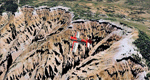
Cedar Breaks National Monument is a large amphitheater cliff in bright colors of red, orange and purple.
It lies east of Cedar City in the northern region of the scenery. The cliff was formed by erosion thru wind,
water and ice. Today erosion continues with a pace of about 2 inches every 5 years. Although it is called
Cedar Breaks, there are no cedars growing there but juniper trees. For a scenic flight to Cedar Breaks
National Monument best depart from Cedar City Regional Airport (KCDC) and head east. The scenery extends
south to Zion National Park and covers a large part of Zion Canyon and the Kolob Canyons area.
Zion National Park is another place where erosion of the Colorado Plateau formed the most beautiful colorful
stone formations of unique and wonderful shapes. There are nine different layers of stone visible in the park.
Most of them consist of sandstone. But there is also limestone, gypsum, siltstone, shale, clay and mudstone.
The Virgin River cut a spectacular and famous canyon thru Zion Park that is as narrow as 20ft and up to 2000ft tall.
High resolution versions of this scenery for FS9 and FSX (much sharper, but larger and multiple downloads)
are available at www.blueskyscenery.com/CNY_South2West5.html . The screenies are taken from the high-res versions,
so expect this version to be slightly more blurry.
Thanks to Joop Mak for providing a custom AFCADs that correct airport layouts so that they align with the photo-textures!
They are available here: www.blueskyscenery.com/AFCADs.html . YourDonation@Work: Dedicated to Richard, P.J. and Felix.
| Filename: | Zion_National_Park_North_Cedar_Breaks_National_Mon.zip |
| License: | Freeware, limited distribution |
| Added: | 14th March 2010, 00:30:28 |
| Downloads: | 1,564 |
| Author: | Gottfried Razek - blueskyscenery.com |
| Size: | 97.13 MB |


© 2001-2026 AVSIM Online
All Rights Reserved
Privacy Policy |