
Where Flight Simulation Enthusiasts Gather from Around the World!
AVSIM Library - Search Results

| Category: Prepar3D V1-4 - Original Aircraft | |
| FSX/FS2004 USAF C-133B Cargomaster 590524 |

|
Images related to this file:
File Description:

This is a repaint of the Douglas C-133B Cargomaster in the USAF scheme. The freeware Douglas C-133 Cargomaster by Tim Conrad is needed for this repaint - link provided. This repaint was tested on FSX-SE. It should work on FSX & FS2004. Textures for FS2004 users are included. Textures are 32bit DDS & DXT3 BMP. The C-133 was conceived as an air transport for the USA's large missiles, and was designed to meet the requirements for the USAF’s Logistic Carrier Support System. The Douglas designed C-133 Cargomaster first flew on 23 April 1956. In fact, Douglas built 50 of the turboprop powered C-133 Cargomasters from 1956 to 1961. It was the largest turboprop transport ever to be accepted by the U.S. Air Force. In 1958 the C-133s began flying MATS air routes throughout the world, and two Dover based C-133s established transatlantic speed records for transport aircraft on their first flights to Europe. The fleet of 50 aircraft proved itself invaluable during the Vietnam War, but fatigue problems led to their withdrawal from service in 1971. The aircraft was a marvel in its era, but it was soon under the microscope as the accidents started accunmulating. Throughout the 15 year service of the C-133 9 were destroyed in accidents and one was written off. Having said that, the C-133 was the first wave of turboprop and jet powered giants to come onto the scene in the post piston engine era, and was followed by the C-141, and the giant of them all the C-5 Galaxy. This aircraft, 590524, was with the 60th Military Airlift Wing MAC. It was retired on Jun 16, 1971, and scrapped by end of 1974.
| Filename: | FSXFS2004_USAF_C133B_Cargomaster_590524.zip |
| License: | Freeware |
| Added: | 11th December 2019, 18:45:50 |
| Downloads: | 79 |
| Author: | Ted Giana |
| Size: | 5.31 MB |
| Category: Flight Simulator X - AFCAD Files | |
| Ekdahl Airport (NJ59), NJ |
|
File Description:
Located 04 miles S of Freehold, New Jersey, Ekdahl Airport is a private turf strip 1300' in length bordered closely by trees. This makes for an interesting landing as the 90' width of the runway is all the room you have to play with. However because it can be difficult to gauge your distance to trees and also because even the slightest brush with a tree can cause a crash, all trees immediately adjacent to the runway have crash disabled - mainly so you can turn your plane around if you land on Runway 02. The hard surface runway was removed so make sure your terrain mesh complexity is set as high as possible to get that bumpy ground realism. A windsock is listed as being available on this field but I could not locate it in any imagery and so placed it by default near the hangar building. You can start on the runways or parked in front of the hangar. Make sure your plane is capable of these take off and landing distances! Tree height around the field was not listed so I again used my best judgement from studying aerial photos. There is no fuel or parking for transient aircraft available. The field is not lit - daytime VFR operations only are recommended.
Scenery constructed with use of satellite images/streetview/aerial photos - the author has not been there in person.
This scenery is meant to be used in conjunction with MegaScenery Earth New Jersey/Delaware 002. It is not required, but apron use is minimized to allow satellite scenery to show through as much as possible, and objects are placed based on the MSE textures - lack of it may make scenery look out of place.
| Filename: | Ekdahl_Airport_NJ59_NJ.zip |
| License: | Freeware |
| Added: | 13th August 2011, 16:53:55 |
| Downloads: | 172 |
| Author: | Drew Sikora |
| Size: | 550.03 KB |
| Category: Flight Simulator 2004 - Scenery | |
| Airstrips East of the Adriatic |
|
Images related to this file:
File Description:
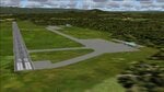
A collection of about 60 small airfields in Albania, Bosnia & Herzegovina, Kosovo, North Macedonia and Serbia & Montenegro, many of which aren't featured in FS2004, each enhanced with taxiways, parking spaces, buildings etc. and aprons as appropriate, to fill in a few gaps to the east of Italy. Most of these airfields are relatively "rural", often little more than a shed and a grass runway in a field, but they allow the generation of lightweight GA AI traffic in this area and into the adjacent countries.Again, there's no photo-realism here, just a selection of basic 'generic' buildings, more or less accurately sized and placed to reflect the airfield layout as seen on on-line satellite imagery and aerial photography. These buildings have minimal effect on frame-rates, so are ideal for this kind of job. The airfields are aligned as well as possible with the default roads etc. and the Genesis Europe mesh, but should mostly be fine in a default installation or other configuration.As before, the files for each airfield can be easily identified by the ICAO code, even if the airfield names vary slightly, so you can pick and choose and mix and match to suit any sceneries you already have, should you so wish. There is no requirement for any other download. Each airfield will exist as a stand-alone entity should you only want a few of them. A few default airfields have had new ICAO codes allocated, in these instances I've provided files to remove the default scenery from the landscape, though the original airfield will still appear on the maps and menu.
| Filename: | Airstrips_East_of_the_Adriatic.zip |
| License: | Freeware |
| Added: | 20th October 2025, 11:48:25 |
| Downloads: | 57 |
| Author: | Chris Eve |
| Size: | 525.71 KB |
| Category: Flight Simulator 2004 - Scenery | |
| Tuktoyaktuk CYUB in Northwest Territories, Canada |
|
Images related to this file:
File Description:
Tuktoyaktuk is on the northern coast of Canada, 70 miles north of Inuvik and to the east of the Mackenzie River delta. It has a population of around 900 and because of its natural harbour is a centre for oil exploration activity on the surrounding land and on the Beaufort Sea, with sizeable but now under-used yards dating back to the peak of activity in the late 1970's. On land work is restricted to the winter half of the year, as only the freeze-up makes it possible to move on land with heavy equipment, and during the winter further supples are driven over an ice road from Inuvik up to Tuk. The ice-free summer months are used for floating equipment from Yuk along the coast on barges and then up the rivers to inland sites in preparation for the winter activity. Before the oil there was a DEW line station here, and there is still an automated station on the same site and included here, as are the yards. The airfield is on the coast close to the town and the yards, at 15' ASL. The gravel runway 09/27 is 5,000' feet long and 150' wide; both thresholds are displaced by 200', but of course there are no markings on the gravel. The large apron is on the north side at the centre of the runway and is large enough to accomodate several large planes. Inuvik revised should be installed first, now Tuk, then last of the three Sachs Harbour which has AI for Aklak Airlines flights (operated by Kenn Borek) for all three airfields. There is a separate AI file included here, featuring freight delivery by Buffalo Airways and small planes.
| Filename: | Tuktoyaktuk_CYUB_in_Northwest_Territories_Canada.zip |
| License: | Freeware, limited distribution |
| Added: | 14th May 2012, 17:19:20 |
| Downloads: | 619 |
| Author: | Roger Wensley |
| Size: | 8.99 MB |
| Category: Flight Simulator 2004 - Scenery | |
| Alaska South Slope 12; Teller K54 |
|
Images related to this file:
File Description:
There are four main northwestern Alaska towns which are serviced by Alaska Airlines, and from which local flights spread out. The northernmost is Barrow. Southwest of Barrow is Kotzebue, then Nome, and the furthest south is Bethel (not yet made). This is the fifth in a series for local flights from Nome, and it is on the coast around 55 miles east of Wales and 55 miles northwest of Nome. There are two other airfields around a large lagoon that is almost totally enclosed from the sea, and Teller is on the easten shore, just 15 miles east of Port Clarence and 5 miles southeast of Brevig Mission, both already posted. Teller has a populaton of around 230, down from the 5,000 or so in the early 1900's after the Bluestone Placer Mine struck gold. Tollef Brevik was a Lutheran missionary who was both a pastor and teacher for the Inuit in the area from 1894 onward, travelling from community to community but based in Teller, where the Teller Mission Church was later renamed the Brevig Mission. The name was later appropriated and used for the curent village of that name; he was surely very well regarded by the local population. Unusually, it is possible to drive from Nome to Teller in summer, on a dirt road. Conversely, the road that shows in FS9 to the north towards Brevig Mission (courtesy of Ultimate Terrain) does not in fact exist except in winter, when it is estabished on the snow by the tyre tracks of users. The airstrip is southeast and 2 miles by road from the main part of the village on the spit, with a gravel runway 02-25 which is 3,500 feet of gravel. The AI is the usual for this area, Bering and ERA with some GA and cargo by Everts.
| Filename: | Alaska_South_Slope_12_Teller_K54.zip |
| License: | Freeware, limited distribution |
| Added: | 25th October 2016, 21:21:14 |
| Downloads: | 235 |
| Author: | Roger Wensley |
| Size: | 2.96 MB |
| Category: Flight Simulator 2004 - AFCAD Files | |
| Birmingham International Airport, Birmingham, Alabama (KBHM) |
|
File Description:
An extremely accurate rendition of the KBHM airport with appropriate gate, cargo and general aviation parkin. I've decided to make it a habit to do airports that one doesn't really see much on FS. Everyone does 300 AFCADs of KORD and there's nothing wrong with that it's a great airport but I figured I didn't need to add another KORD or KLAX to the pile unless I'd be providing something the others lack and I can't seem to find it. So, again, I'll be continuing to do AFCADs I feel are lacking or unavailable or not done well. The BHM airport is definetely not a bustling international port of call and it only receives mainline service from a few carriers but it has a decent amount of traffic and I thought it would be good to represent the airport. Thankfully this time MS did a reasonably good job with terminal space and I was able to include every gate in the two concourses. The great BHM website made my job a breeze by indicating which airlines park at which specific gate(s). Every airline is exactly where they should be as is cargo. A ramp for you VFR general aviation buffs is also available. The only time you might notice some craziness is if you start your flight super early in the morning and you have traffic at 95% +. It seems MS doesn't really "turn" planes in a realistic manner so you end up having more planes parked at the gate in the early morning hours then would be there in real life if they adheared to real world turn around times. Nothing I can do about that. Hope you enjoy your virtual trips in and out of the Birmingham International Airport.
| Filename: | Birmingham_International_Airport_Birmingham_Alabam.zip |
| License: | Freeware |
| Added: | 29th June 2004, 19:31:34 |
| Downloads: | 2,317 |
| Author: | Jason Diaz |
| Size: | 137.07 KB |
| Category: Flight Simulator 2004 - Aircraft Repaints, Textures and Modifications | |
| Pacific Western AI Aardvark Boeing 737-200 |
|
File Description:
Pacific Western, repaint for the AI_Aardvark 737-200. By RotorRick Deckard. Freeware, textures only, requires AI_Aardvark 737-200 basepack.
Pacific Western was a Canadian airline based in the western provinces, back when I was growing up, and I saw their planes all the time. They merged into CP Air, which turned into Canadian Airlines when they also took Wardair. And Canadian Airlines exists no longer either, having been absorbed by Air Canada, many of their staff were let go, and less desirable planes sold off to discount airlines.
Pacific Western, in parnership with Boeing, pionered a modification to the 737-200 that enabled it to land on gravel runways! Yes, no joke, with several of the destination runways up near the arctic circle, these runways wouldn't survive the ground temperature changes if they were more common paved or concrete runways. Anyway, I don't know many details, but I do know it involved a large beaver board attached to the rear of the nosegear wheels (which looks very much like that on the Antarctic mission C-130's the US uses to support missions down under), and vortex generators to blow in front of the engines on landing. This is all done to keep the low slung engines from ingesting any FOD. Since that time, such strips are more commonly visited by the Boeing 727, which has it's engines better protected and is generally more suited to such special purposes.
See here for more info:
http://airlines.afriqonline.com/airlines/205.htm
http://www.airtimes.com/cgat/ca/pwa.htm
This airline has operated the 707, Lockheed C-130 Hercules (actually L-100 variant), 767-200 and many other planes, but they were always primarily a 737-200 based airline.
| Filename: | Pacific_Western_AI_Aardvark_Boeing_737200.zip |
| License: | Freeware |
| Added: | 21st May 2005, 00:41:43 |
| Downloads: | 732 |
| Author: | Rick Deckard |
| Size: | 596.88 KB |
| Category: Combat Flight Simulator 1 and 2 - Aircraft | |
| B25-B Mitchell Doolitte's Raiders "Hari Carrier" A/C No. 40-2249 for The B24 Guy's OH |
|
File Description:
B25-B Mitchell Doolitte's Raiders "Hari Carrier" A/C No. 40-2249, April 18, 1942. Painted over The B24 Guy's B25 Mitchell Overhaul Model. This was mission plane #11, nicknamed The Hari Carrier. Pilot: Capt. C. Ross Greening, Co-Pilot: Lt. Kenneth E. Reddy, Navigator: Lt. Frank A. Kappeler, Bombardier: S/Sgt. William L. Birch, Flight Engineer/Gunner: Sgt. Melvin J. Gardner. The bomb group attacked targets in the Tokyo area. The North American B-25B was not designed or intended for aircraft carrier use, but there they were, sixteen highly modified bombers sitting on the deck of the USS Hornet (CV-8). They were modified to carry bombs to Tokyo. The B-25s are launched from their maximum range, and flew over Tokyo, bombing several installations. The bombs did little damage, but managed to damage the Japanese carrier Ryuho while it is in drydock. Many of the planes then head to wherever they can make it, since the fuel will be empty before they reach a friendly airbase. All of the B-25 bombers are forced to bail out or crash land except one. Eleven crews are forced to bail out over China, 3 crash land, and the last landed safely at Vladivostok. The crew that landed in Russia was interned, along with the plane, for a while. The crews were all volunteer, and had no carrier experience, yet all sixteen of the bombers were successful on take-off. Although little physical damage was inflicted on Japan, that day, the Japanese populace was demoralized, as suddenly, the war was brought to their homeland. Note the nose art. Texture, and Damage Files included. Note the three windows in both port and starboard bulkheads. By revev. Enjoy!
| Filename: | B25B_Mitchell_Doolittes_Raiders_Hari_Carrier_AC_No.zip |
| License: | Freeware |
| Added: | 1st August 2006, 20:02:12 |
| Downloads: | 416 |
| Author: | Evan G. Butterbrodt |
| Size: | 1.56 MB |
| Category: Flight Simulator 2004 - Scenery | |
| PABA - Barter Island (Kaktovik) - Alaska North Slope 8 |
|
Images related to this file:
File Description:
The town of Barrow is in the far north of Alaska, and these are coastal villages or radar installations to the west, south, and now east of Barrow. There will be further additions. Barter Island is a DEW station Air Force base 310 miles east of Barrow and 75 miles east of Bullen Point. The runway is just under 5,000 feet of gravel and aligned 06-24 on a spit of land at the northeast corner of the island. The big hangar is still there on the apron. Most of the DEW buildings have now been removed but this scenery is dated around 2005 when there were more of them still there. Between the DEW station and the airstrip is the village of Kaktovik, with a population of some 300 mainly traditional Inupiat. The village was first pioneered when the DEW station was built in the 1950's and grew as the years passed. The FS9 error discovered when making this scenery was that FS9 had mistakenly "placed" Kaktovik at Bullen Point (not physically, it was just wrongly stated as the local town); this is now only partly corrected as FS9 refused to accept my Bullen Point revision but allowed me to associate Kaktovik with Barter Island. Kaktovik is definitely on Barter Island. I could also mention that the runway was in the sea, but there isn't much point in that as Bill would say it was all the fault of Ultimate Terrain, so I won't bother. The next DEW station to the east is in Canada and called Komakuk; this has already been made and posted. The next in this series will be far to the west. The AI has daily flights by ERA, plus Northern Air Cargo, and some GA.
| Filename: | PABA__Barter_Island_Kaktovik__Alaska_North_Slope_8.zip |
| License: | Freeware, limited distribution |
| Added: | 19th July 2016, 17:49:16 |
| Downloads: | 209 |
| Author: | Roger Wensley |
| Size: | 3.42 MB |
| Category: Flight Simulator X - Aircraft Repaints, Textures and Modifications | |
| FSX/P3D TAI DC-3 1962 |
|
Images related to this file:
File Description:
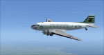
This is a repaint of the DC-3 in TAI (Transports Aeriens Intercontinentaux) colors. The freeware DC-3/C-47 v3 by Manfred Jahn is needed for this repaint. In 1946 the French government allowed the creation of some independent air carriers. On June 1 of that year TAI (Transports Aeriens Internationaux) was formed, and was based in Orly, France. Flights began on July 1, with a Junkers Ju-52. The following year they purchased 7 ex KLM DC-4s, along with 3 Bristol 170 freighters. In 1954 DC-6Bs started to replace the DC-4s. Their route network serviced mainly Africa, the Far East, the French Pacific territories, and Australasia. Prior to 1956 their network wa mainly in Africa, and Asia. On May 6, 1960, a partnership was formed with Air France, whereby TAI flew the South Pacific leg of the state carrier’s around the world service via New Caledonia and Tahiti. Later, on September 4 1960, TAI began a Douglas DC-8-32 service from Paris to Darwin via Athens, Teheran, Karachi, Bangkok, Phnom Penh, and Saigon, and on September 12, it inaugurated a route from Sydney to Los Angeles via Noumea, Nandi, Papeete, and Honolulu with the DC-8. On September 14 1961, TAI agreed, in principle, to a future merger with Union Aeromaritime de Transport (UAT). The two airlines integrated their schedules in 1962 and the amalgamation of TAI and UAT was completed on October 1, 1963, resulting in a new airline: UTA (Union de Transports Aeriens). This DC-3, F-BGXN, flew for TAI from 1956 to 1959. Textures are DXT5. This repaint was tested on FSX-SE and should work on FSX & P3D v1-3.
| Filename: | FSXP3D_TAI_DC3_1962.zip |
| License: | Freeware |
| Added: | 19th March 2019, 17:01:24 |
| Downloads: | 187 |
| Author: | Ted Giana |
| Size: | 8.29 MB |


© 2001-2026 AVSIM Online
All Rights Reserved
Privacy Policy |